
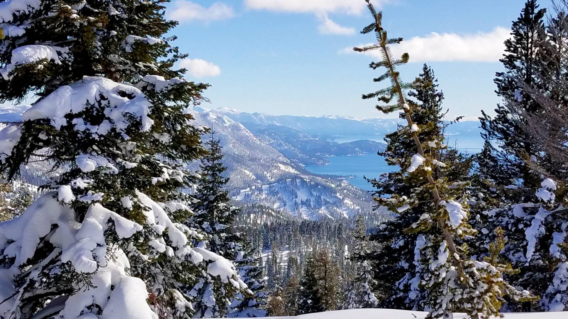
World Class Hiking, Backpacking, Fishing and Adventure found all around Lake Tahoe
Visitors to Lake Tahoe have many great options for entertainment and outdoor recreation. Most come to play on the shoreline or to get on the water of the Jewel of the Sierra. However once the snow melts, the Lake Tahoe region transforms into one of the nations best trail networks for day hikers and backpackers in the world. From easy family strolls that provide world class views of the lake to wilderness trips that will tax the most in shape. Lake Tahoe and the mountains surrounding hold unlimited adventures for locals and visitors alike.
Of course maybe it is cheating a bit since Lake Tahoe is home to both the Tahoe Rim Trail and a great section of the PCT which travels through Desolation Wilderness, Granite Chief Wilderness and Meiss Country on the South & West side of Lake Tahoe..
In this Guide we will feature our local favorites. The Best Day Hikes in and Around Lake Tahoe.
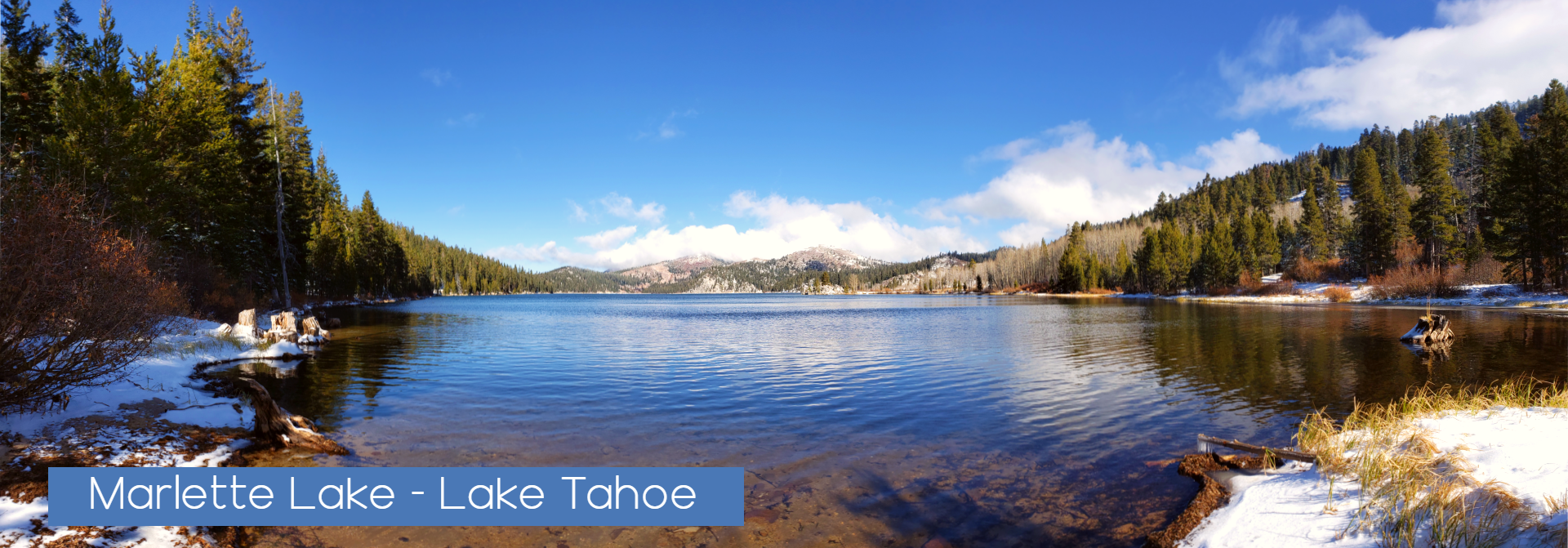
Marlette Lake / Flume trail
Marlette Lake / Flume trail – This moderate hike is commonly a huge bike route as well. Leaving from Spooner Lake recreation area at the junction of Hwy 50 at the Nevada State Park. Located in Nevada State Park, this popular trail is often crowded in the summer. Challenging even to the expert rider, the trail begins east of the picnic area near Spooner Lake. Turn left on the dirt road that heads toward the meadow and follow a sandy road for five miles to Marlette Lake. Turn left across the dam.
Access: The trail ends at Tunnel Creek Road. To make a loop, turn right and ride to the top of the ridge.
You will reach Twin Lakes in 1/2 mile, 7/10’s of a mile past the lake sign turn right or continue to the next main road and turn right. Turn right again on Forest Service Road 504, climb the ridge and where the road forks, continue straight to Marlette Lake. Take Highway 28 to the Spooner Lake parking lot at Nevada State Park. Attractions and Considerations: With magnificent views of Lake Tahoe, this single track trail lies 1,500 feet above the lake. Remember to wear your safety helmet.
Caution: Do not attempt this ride if you are afraid of heights or unfamiliar with your bike. A parking fee is charged. If you take two cars, limited parking is available at Tunnel Creek Road by the former Ponderosa Ranch.
Meek’s Bay Trail
Meek’s Bay Trail: This moderate hike takes you along the northernmost part of the Tahoe-Yosemite Trail. After hiking on a road for approximately 1.3 miles, the trail passes a small spring, parallels Meeks Creek and continues upward into a forested valley. A chain of alpine lakes can be seen before the trail ascends 1,000 feet up a series of switchbacks leading to Phipps Pass. Take Highway 89 to the Meeks Bay Resort. Parking is located across the highway from the resort at a small dirt parking lot. Wilderness permit required and may be self issued at the trailhead.
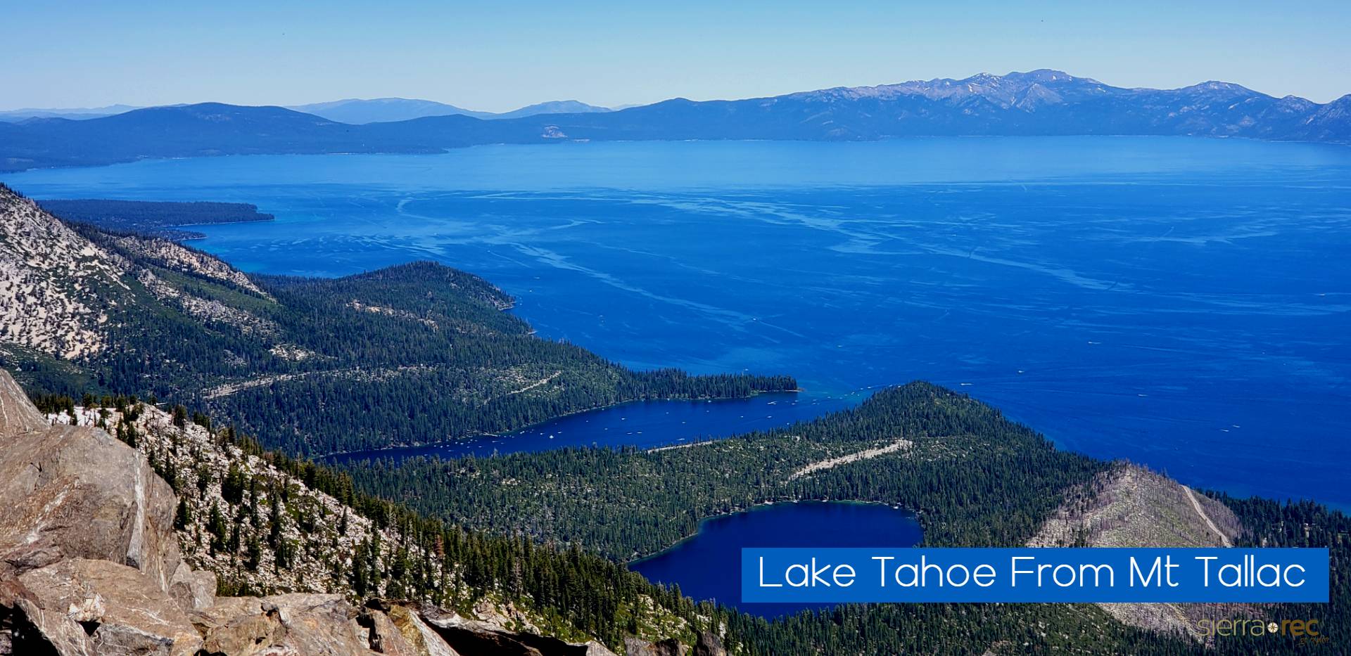
Mt. Tallac
Mt. Tallac: Providing a spectacular view of Fallen Leaf Lake, Lake Tahoe and Desolation Wilderness, this strenuous hike is well worth the effort. The first part of the trail to Floating Island and Cathedral lakes is moderate and can be enjoyed by the novice hiker. Beyond Cathedral Lake, the trail becomes steep and strenuous as it continues up the front face of Mt. Tallac. The trailhead is located approximately 3-1/2 miles north of South Lake Tahoe on Highway 89. Look for
the Mt. Tallac Trailhead sign directly across from the entrance to Baldwin Beach. Turn left drive to the trailhead parking. A wilderness permit is required.
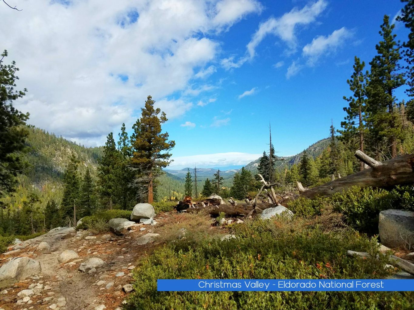
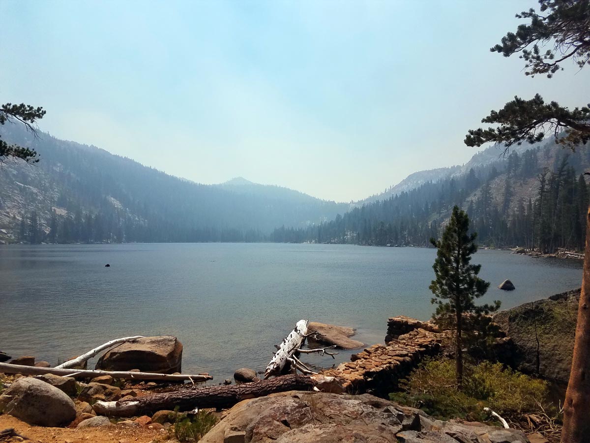
Christmas Valley to Dardanelles Lake
The Christmas Valley Trail to Dardanelles lake is a less traveled route that is Located off Hwy 89’s Luther Pass the Christmas valley trailhead is the less popular destination for the region as most people stop at the Big Meadow trailhead just up the hill. (Better Services and less climbing on that route). We discovered the Christmas Valley route a few years back when one of our Instagram follows suggested the route and though trail is a bit more strenuous than the Big Meadow trail (part of the Tahoe Rim Trail) I find that I enjoy this route very much and have done it a few times now instead of Big Meadow.
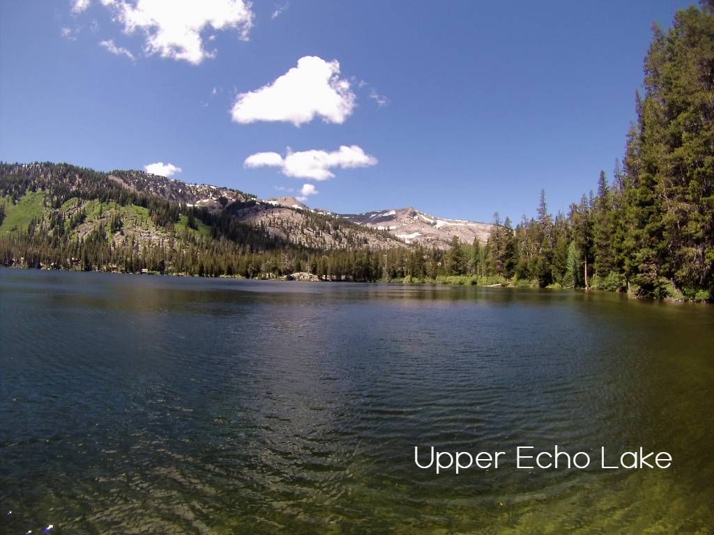
Echo Lake to Lake Aloha Lake / Lake of the Woods
Echo and Lake Aloha are no secrets for most visitors. Located off HWY 50 as you exit Lake Tahoe to the West, Echo Lake is one of the most popular destinations for entering the Desolation Wilderness. This hike includes access to Upper Echo, Tamarack lake, Ralston Lake, Lake of the Woods, Lake Aloha and more. We personally prefer Lake of the Woods over Aloha, but I believe most hikers really do love the crystal clear blue waters of Lake Aloha. It seems to be the icon water location for most Desolation Wilderness visitors. Lake Aloha is 7 miles from Lake Echo and all other lakes mentioned can be seen along the way with short diversion hikes.
Chickadee Ridge
Chickadee Ridge has become an Instagram famous hike in the region. With its location in North Lake Tahoe just west of Mt Rose, hikers lover the opportunity to hike into a great view of Lake Tahoe all while trying to locate trees of Chickadee birds that are more than willing to eat from the palm of your hand. This might be the best romantic hike in Lake Tahoe. As my wife puts it, nothing makes her feel like a Disney princess more than feeding birds from her hand.
Eagle Falls
Eagle Falls: Leading into the heart of Desolation Wilderness, this moderate trail offers
majestic views of the sierra high country. Just a 20-minute walk, Eagle Lake is a popular 1 mile each
way hike. A longer hike will lead you to the three Velmas, Dicks, and Fontanillis lakes. Take Highway
89 north approximately 9 miles from South Lake Tahoe to Eagle Falls Picnic Area on the left. This is a
very popular and congested area. Wilderness permit required.
D. L. Bliss-Rubicon Pt.
D. L. Bliss-Rubicon Pt. : Dipping up and down along the shoreline of Lake Tahoe, this moderate 3 mile each way trail offers some the most scenic views of the lake. Bring a swimsuit, towel and picnic lunch to enjoy a sunny day at one of the many quiet coves along the way. Or continue to the Vikingsholm trail, another 2.9 miles and ride the red trolley back to D.L. Bliss. Take Highway 89 north 10 miles from South Lake Tahoe to D.L. Bliss State Park. (There is a fee for day use parking). Pets are not allowed on State Park trails).
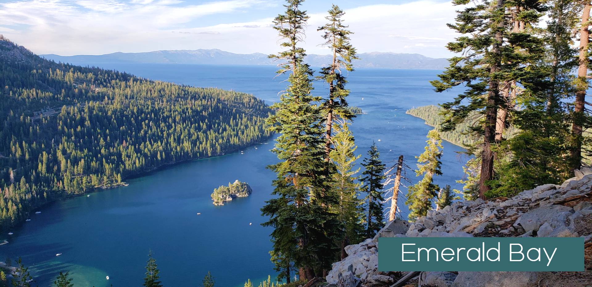
Vikingsholm Castle:
View a historic Scandinavian summer home now owned by California State Parks. Moderate 1 mile
each way to the castle. Daily tours are given from mid June through Labor Day. (A small fee is charged).
Bring a picnic lunch and enjoy the fabulous view of Emerald Bay and Fannette Island from the shoreline
of this state park. Hike the short trail to Lower Eagle Falls which begins directly across from the castle.
Or hike along the north shore of Emerald Bay which connects with the Rubicon Point trail 6.8 miles one
way. Take Highway 89 north from South lake Tahoe approximately 9 miles to the parking lot on the right.
The parking lot fills up quickly in the summer season, so arrive early.
BAYVIEW TRAIL
BAYVIEW TRAIL:
Offering magnificent views of Emerald Bay and Lake Tahoe, this steep trail leads you up the side of
Maggie’s Peak into Desolation Wilderness. Stop at Granite Lake for a short rest along the way. In 2.7
miles this trail intersects with the Eagle Falls Trail. Corral and watering facilities for horses are available at the trailhead. See “Cascade Creek Fall Trail” for directions. Wilderness permit required.

Moraine Trail
Moraine Trail: Stroll along a relatively flat trail through old growth forest, along the shore of picturesque Fallen Leaf Lake. Take Hwy 89 north approximately 3 miles from South Lake Tahoe. Turn left on Fallen Leaf Lake Road. Continue approximately 2/3 of a mile to Fallen Leaf Lake Campground. Drive through the campground and park
just before campsite #75 on the right. There is no fee for day use. Look for the trail head sign near the parking area.
Prey Meadows-Skunk Harbor
Prey Meadows-Skunk Harbor: Moderate 1.5 miles each way. Snow free in early spring,
this is a great walk through a mixed conifer forest with filtered views of Lake Tahoe along the
way. Look for the remains of an old railroad grade along the way, built in the 1870’s as part of
the network to supply timber to Virginia City. When you reach a fork in the road, you have two
options. The left fork leads to Prey Meadows which is blanketed with many varieties of wildflowers in the spring. The right fork leads you to Skunk Harbor, a small picturesque cove which offers great swimming and sunbathing in the summer. Take Hwy 28 south from Incline Village 7
miles. Look for a green forest service gate on the right. Parking is very limited. Do Not block
gate! (Additional parking just north of the gate is also available.)
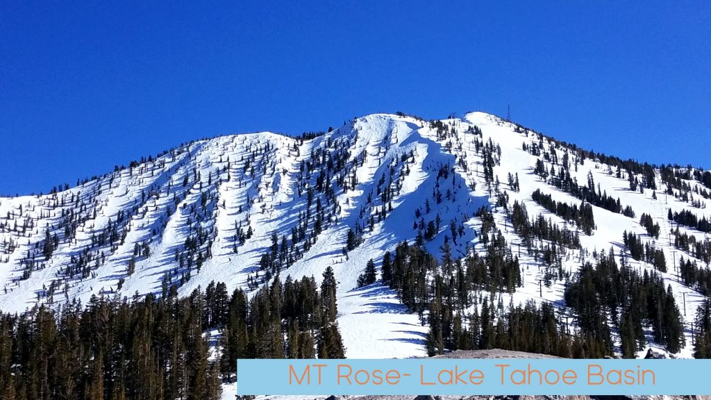
Mt. Rose Summit
Mt. Rose Summit: The highest peak on the north shore of Lake Tahoe Basin (10,778’), this strenuous 5.2 each way hike
offers excellent views of the lake, the city of Reno and the surrounding area. Take Hwy 431 from Incline Village to Mt. Rose summit. Look for the Tahoe Rim Trail (TRT) sign, park on the north side of the road. Hike through sub-alpine terrain, past a waterfall and spring wildflowers. Caution; the last 2 miles to the summit is steep and can be very windy and cold. Remember to bring water and layer clothing for warmth! Mountain bikes and horses are NOT permitted on this trail.
