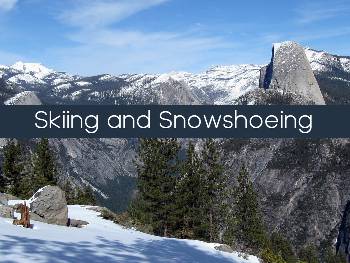
Ski or snowshoe touring in Yosemite can be a magnificent experience, or it can be a disaster if certain simple preparations are ignored. Park rangers have assembled a set of suggestions which, when observed, can help ensure a safe trip even if you encounter stormy weather or unforeseen problems.
Trail Options Fro Skiing or Snowshoeing Glacier Point Region
- Glacier Point Road: Because ski tracks are set by machine, this is the best trail for beginners or those wanting an easier ski. A skating lane is also provided. Go out as far as you like (Glacier Point itself is 10.5 miles, 16.9 km, one way), but remember, on the return trip the last few miles are uphill. Spectacular vistas of the Clark Range and large meadows for lunch stops make this trip even more enjoyable.
- Old Glacier Point Road (3.3 mi., 5.3 km, one way to Bridalveil Creek Campground): This trail follows the old road, traveling uphill approximately 1/3 mile (.5 km), then dropping down into the Bridalveil/ Peregoy Meadow area. Although the grade is not extremely steep, it can be a challenging run in icy
conditions. Connect with the “new” Glacier Point Road for a nice 6-mile (9.7 km) round trip. - Dewey Point via, Meadows #18 (3.5 mi., 5.6 km, one way from Badger): Follow the Glacier Point Road to the east end of Summit Meadow to start this trail. The trail winds through a series of meadows, continues on to some more difficult hills, and ends at a popular vista of Yosemite Valley. This trail is crowded on weekends and holidays, and can present quite difficult skiing in old snow or icy conditions. Not recommended for beginners after the first mile through the meadows.
- Dewey Point via Ridge #14 (4 mi., 6.4 km, one
the way from Badger): This trail starts off the Glacier Point Road to the west of Summit Meadow. This is a more challenging and difficult trail out to the valley vista mentioned above. It takes skiers along a winding up-anddown course among red fi r and lodgepole pine forests. - Ostrander Lake (9-10.3 mi., 14.5-16.6 km,
one way): Nestled in a bowl below Horse Ridge at 8,600 feet (2,621 m) elevation, Ostrander Lake is a popular overnight destination (see “Facilities” section).
Of the three main trails to the lake, Bridalveil Creek is the easiest (intermediate). Merced Crest is the hardest and very diffi cult to follow (expert skiers only!). Reservations are recommended for Ostrander Ski Hut
and a wilderness permit is required. - Ghost Forest Loop (11.5 mi., 18.5 km, round
trip from Badger): Follow the Glacier Point Road
to the Bridalveil Creek/Ostrander Lake trailhead (#21). Follow trail #21 across rolling terrain to the junction with the Ghost Forest Trail #19 (1.7 miles, 2.7 km). Two more miles of moderate skiing on trail #19 will bring you back
to Bridalveil Campground, where you can take either the old or new Glacier Point Road back to Badger Pass.
Related Articles
- Sierra Rec Now – Valentines in the Mountains – Episode 7
- Fischer Announces new Freestyle ski — Nightstick
- Alpacka Raft Releases Three New Models for 2024
- 33rd Annual Rocky Mountain Oyster Fry returns on Saturday, March 16
- Backpack Through The Wildest Corners Of The Sierra Nevada.
- Experience The Thrill Of Tubing At Woolly’s Tube Park In Mammoth Mountain, California
- A Valentines Treat at Virginia City’s Piper House
- Tahoe Regional Planning Agency Honored with Rosa Parks Award

Leave a Reply