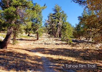
Segments to the Tahoe Rim Trail
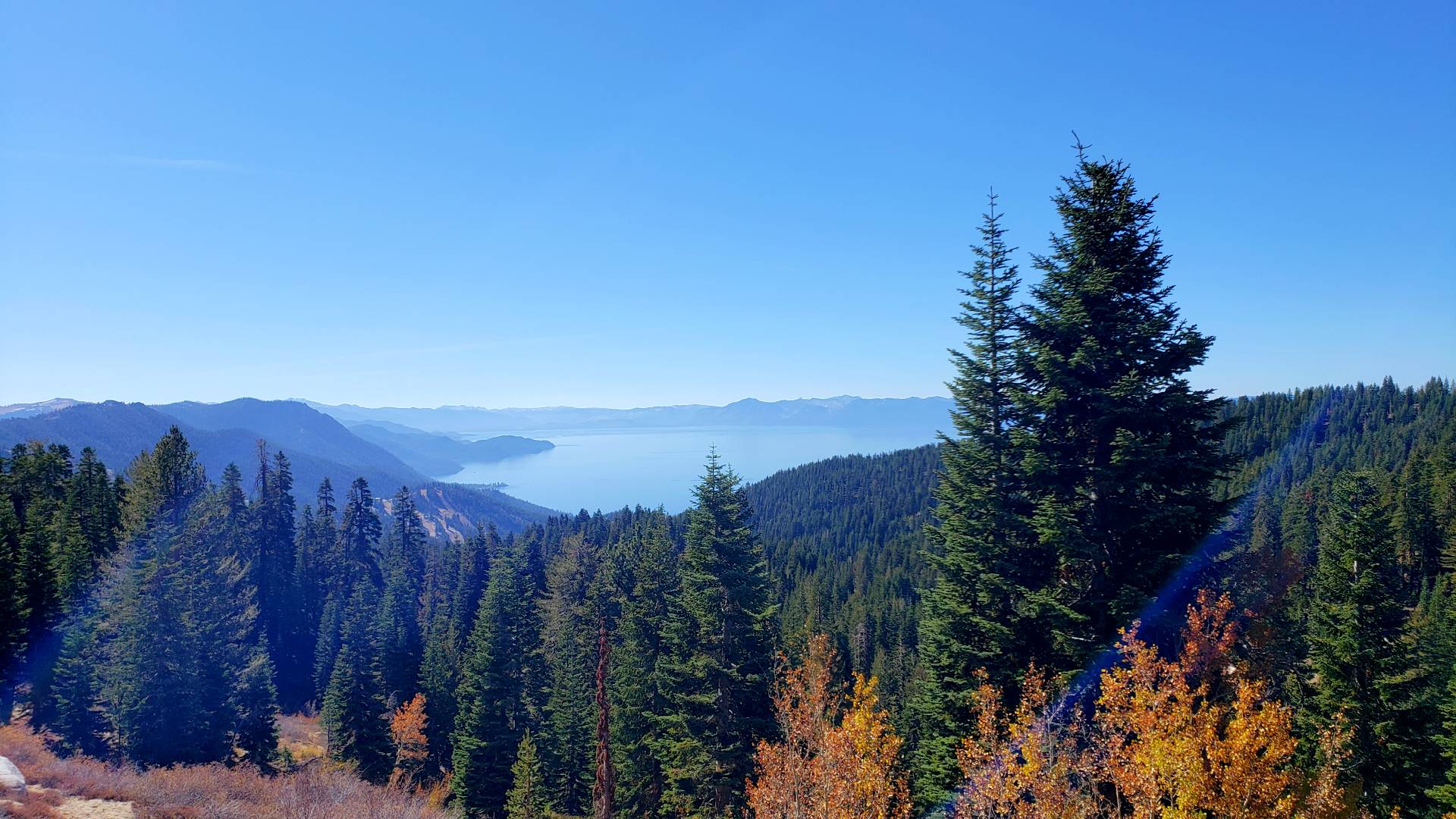
Tahoe City to Brockway Summit – 20.2 miles
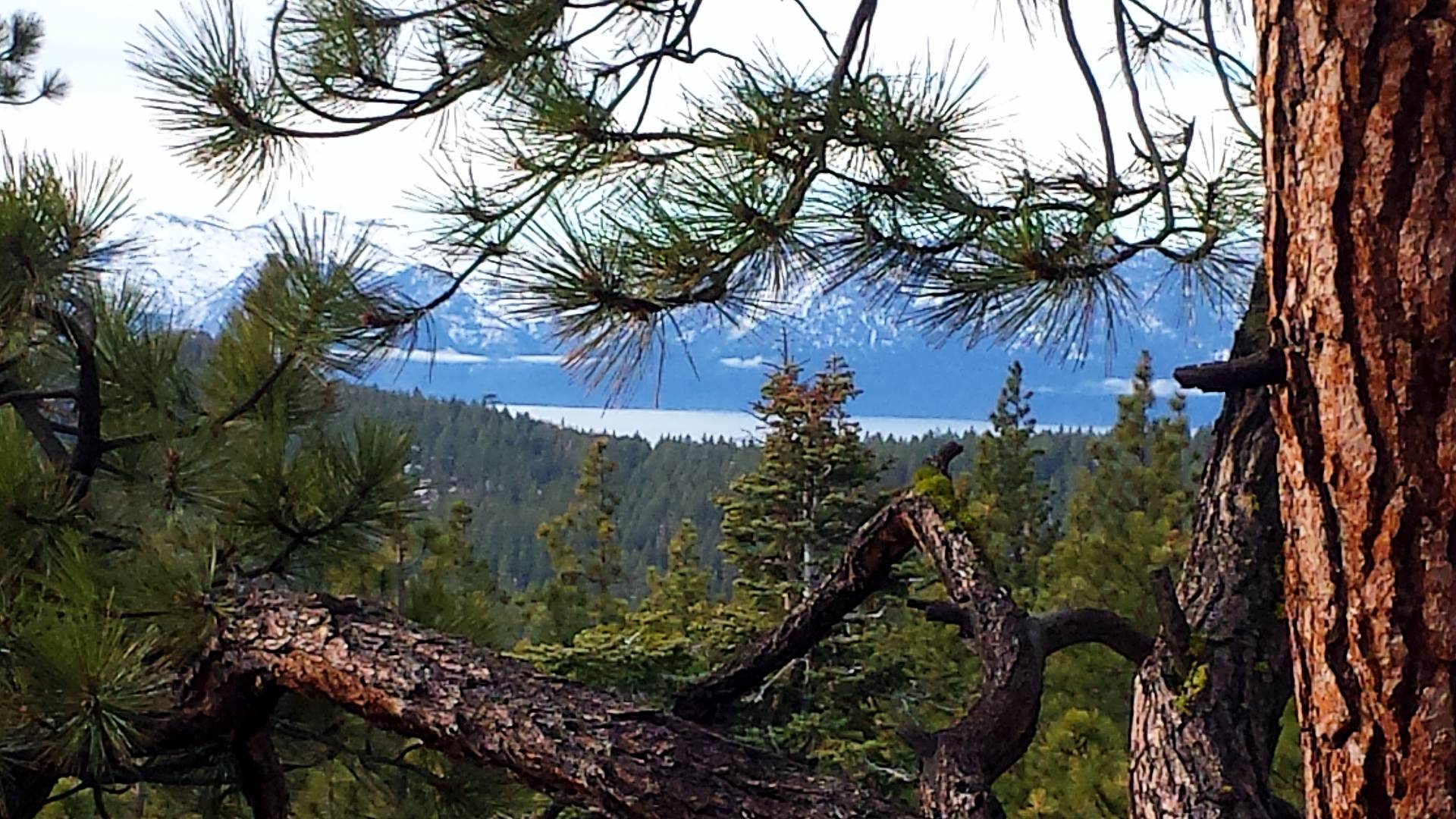
Between Tahoe City and Brockway Summit, the Tahoe Rim Trail meanders through groves of fir, cedar and aspen and across open hillsides covered with manzanita. The trail climbs steadily from Tahoe City into a mixed forest. Side trails and open slopes offer opportunities to explore cinder cones and ancient lava flows. Midway between the trailheads the terrain flattens and a denser forest provides cool, quiet shade. The trail continues past the Lava Cliffs, a lovely overlook of Lake Tahoe and the peaks lining its north shore, before dropping down to Watson Lake. More info on segment
Brockway Summit to Mt. Rose Summit / Tahoe Meadows – 20.2 miles
Between Brockway and Tahoe Meadows, the TRT winds through thick forests, open meadows, and across the feet of ancient volcanoes. In springtime fields of yellow mules ears sparkle against the backdrop of Lake Tahoe. This segment is prized for its spectacular windswept vistas of Lake Tahoe, the Sierra and the Carson Range. More info on segment
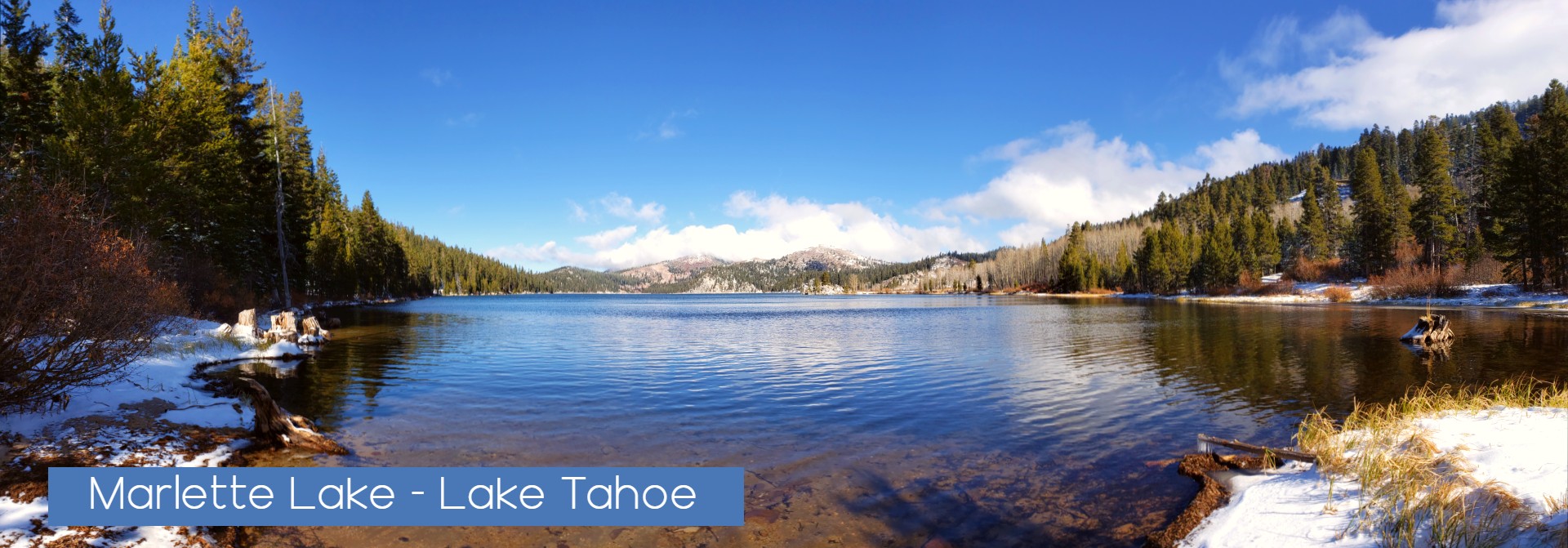
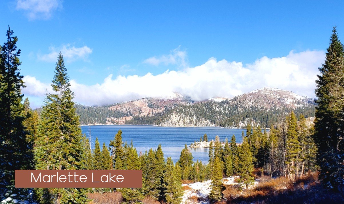
Mt. Rose Summit / Tahoe Meadows to Spooner Summit – 24.1 miles
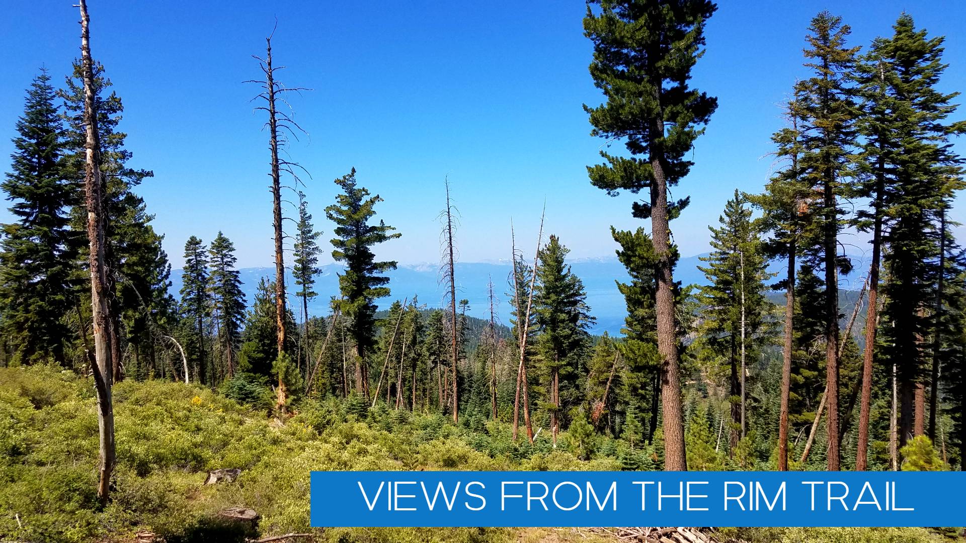
Between Tahoe Meadows (8740′) and Spooner Summit (7150′), the TRT roams high above sparkling Lake Tahoe and Marlette Lakes, through sun-warmed conifer stands, and across steep, flower-strewn slopes. This segment is celebrated for its magnificent views, stretching across Lake Tahoe and the high Sierra and past the jagged ranges of the Great Basin. The route is rich in historical reminders, skirting lakes and flumes built to supply water to distant miners on the Comstock. It traverses both dense forests that sprang up after clear-cutting a century ago, and ancient red fir stands spared the ax by their remoteness. More info on segment
Spooner Summit to Kingsbury South Connector 19 miles
Shadowing the rugged peaks of the Carson Range, this trail segment weaves between the huge trunks of ancient firs and over sun-splashed granite outcrops. Ridge top crossings showcase panoramic views of the Tahoe Basin and Carson Valley. Open stands of Jeffrey pine alternate with the cool stillness of red fir forests and the cheerful rustlings of aspen groves. A diverse array of birds and small animals inhabit the area and alert hikers may catch a glimpse of marmots frolicking across boulders or coyotes and mule deer slipping between the trees. More info on segment
Kingsbury South Connector to Big Meadow 22.9 miles
Between Kingsbury Grade South and Big Meadow, the trail follows the spine of the Carson Range from sun-drenched meadows to cool pine forests and windswept mountain passes. Starting at Kingsbury Grade the trail climbs through a dense forest of large red firs and white pines, majestic survivors of the Comstock logging era. Further south, open ridges and rocky outcrops showcase breathtaking views of the Carson Valley. Hemlock-ringed Star Lake offers inviting campsites and a nice fishing spot for brown trout. This secluded lake nestles at the feet of three of the highest mountain peaks in the Tahoe Basin, Freel Peak, Jobs Sister and Jobs Peak. The more rugged central portion of the segment weaves through monumental old growth junipers and across granite passes with stunning vistas of Lake Tahoe and the Sierra. More info on segment
Big Meadow to Echo Lakes – 18.3 Miles
Between Big Meadow and Echo Summit, the trail wanders from meadows to lakes to creeks, and through dense stands of pine, fir and aspen. The trail heads south from Big Meadow trailhead across a gently rolling landscape of grassy meadows and fragrant conifer stands. The shaded shores of Round Lake is nestled beneath high cliffs. Further on, the TRT merges with the Pacific Crest National Scenic Trail (PCT) and swings north through flower filled Meiss Meadows and alongside the cool head waters of the Upper Truckee River. More info on segment
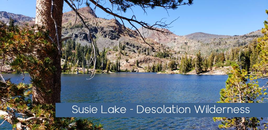
Echo Lakes to Barker Pass 32.5 miles – Desolation Wilderness
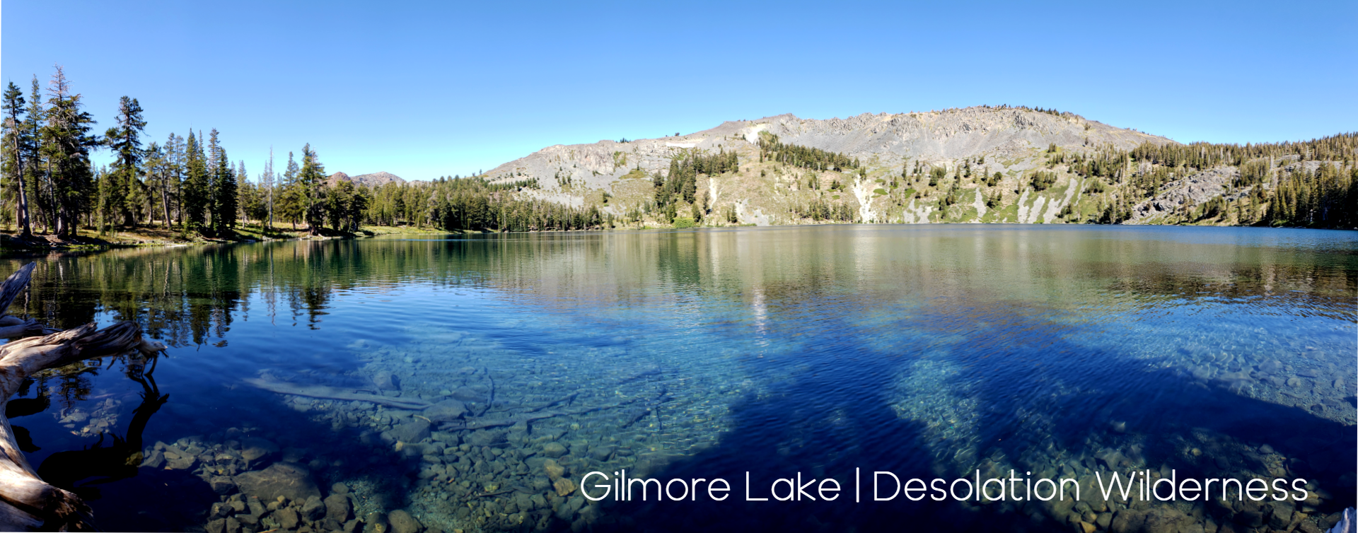
Between Echo Lake and Barker Pass, the trail leads deep into the granite heart of the Desolation Wilderness, where cool blue lakes lie cradled in ice-polished basins. The joint Tahoe Rim Trail/ Pacific Crest National Scenic Trail heads north from Echo Lakes across a rugged wilderness of glacial moraines and smooth granite ridges. Tumbling streams and serene lakes nourish pine groves and flower-filled meadows. The clear water and meandering shoreline of beautiful Lake Aloha offer delightful swimming and camping spots. The central portion of this segment is noted for its long steep approaches up and over Dicks Pass and for its equally breath-taking views. North of the pass, the Velma Lakes mark the trail’s entrance into a much drier and less open landscape, where thick conifer stands are interrupted by small meadows crowded with wildflowers. The gently rolling trail leads down out of Desolation Wilderness and eventually to shallow Richardson Lake. More info on segment
Barker Pass to Tahoe City 16.4 miles
Between Barker Pass and Tahoe City the trail dips in and out of flowery meadows and swoops around craggy volcanic peaks. The joint Tahoe Rim Trail / Pacific Crest National Scenic Trail north of Barker Pass rolls across open hillsides decorated with wildflowers. Near Twin Peaks, the TRT splits from the PCT and turns east toward Lake Tahoe. The trail soon drops steeply into thickly wooded Ward Canyon, where the scent of pine and the rustling of aspen leaves fill the air. It then meanders for a few miles past a small waterfall and alongside a gurgling creek before climbing back out of the canyon. More info on segment