Firefighters Gained Ground on Slower Moving Caldor Fire in south Lake Tahoe
South Lake Tahoe – September 2, 2021 – Today is a day of hope on the Caldor Fire in South Lake Tahoe. Yesterdays Winds and red flag warnings not as bad as expected. The Caldor fire stands at 207,931 acres today with 23% containment.
The Caldor Fire did have a run yesterday on the Northern Edge near Kyburz and ran out towards Wrights Lake aggressively. Firefighters also saw more aggressive behavior out at Kirkwood resort from winds.
In South Lake Tahoe the fire continues to head south East between Freel Peaks and Heavenly Resort. Heavenly is running its snow guns to help keep moisture in the area and Fire can be seen from the Mountain across the Southside ridges from the resort.
Weather Today is expected to be some of the best fire fighting days for over a week as humidity and wind will be favorable to prevent explosive growth. Of course that is only part of the equation as fuel pockets and fire spurs are still very real possibilities. Firefighters will continue with mission of structure protection, teams at Wrights lake, Kirkwood and South Lake Tahoe have hope of better conditions to make their jobs of protection successful.
President Biden did yesterday open way for additional resources yesterday for this fire as well.
Late Yesterday we did hear that the Pollock pines region had a downgrade in evacuation notices signaling that some homeowners on the West side of this fire may indeed get a chance to go back into their homes.
What to expect today
Calmer winds and return of moderate humidity to some areas of the fire reduced
activity overnight however spotting and fire spread still occurred along the
northern edge of the fire. Firefighters will work today to bolster lines where large
pockets of previously unburned fuel threaten existing control lines. Damage
inspection is in progress with approximately 60% of structures inspected to date.
To better provide public and firefighter safety due to extreme fire conditions
throughout Northern California, and strained firefighter resources throughout the
Country, the USDA Forest Service Pacific Southwest Region is announcing a
temporary closure of all National Forests in California. The closure order can be
found at https://tinyurl.com/USFSClosure.
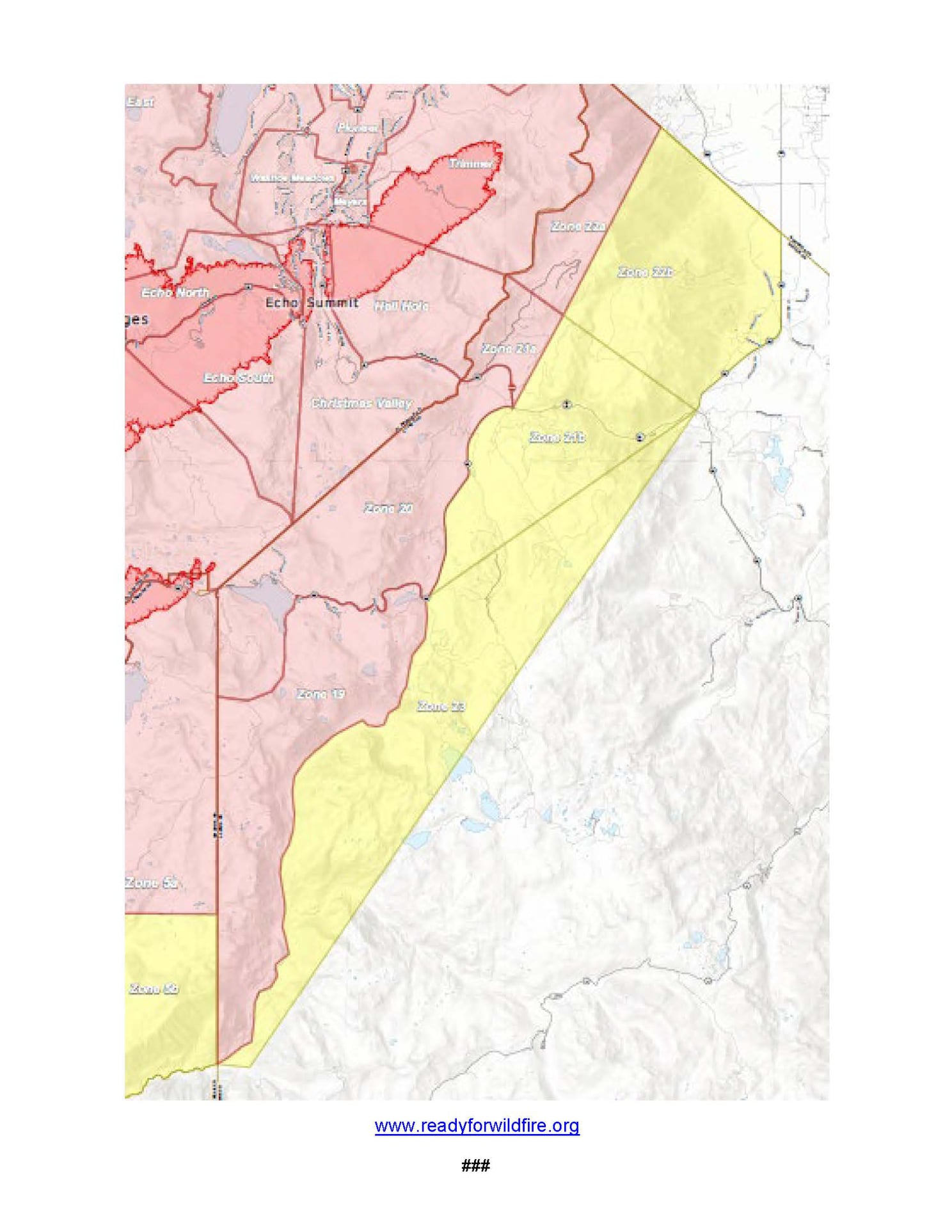
AMADOR COUNTY – ORDERS
• South of Highway 88 along the Amador/El Dorado County line from Dufrene
Road, due east to the Amador/Alpine County line and from the
Amador/Alpine County line north to Highway 88. This includes the area of
Kirkwood Lake.
AMADOR COUNTY – WARNINGS
• South of the Amador/El Dorado County line along Highway 88 from Dufrene
Road west to Omo Ranch Road.
• North of Tiger Creek Road East to Salt Springs Reservoir Road to the East
end of the Salt Springs Reservoir.
• West of the Amador/Alpine County line to Highway 88.
• East of Highway 88 to the Amador/Alpine County line
.
AMADOR – ROAD CLOSURES
• Highway 88 is closed between Peddlers Ridge and the Highway 88/89
interchange.
El Dorado County
Evacuations:
EL DORADO COUNTY – ORDERS
• Grizzly Flat: The areas on Grizzly Flats Road East of Kendra Way into Grizzly
• Flats Proper. The areas of Diamond Railroad Grade, Old School House,
Sweeney Road, Caldor Road, and steely Ridge.
• Grizzly Flats Road East of four corners in somerset into Grizzly Flats Proper.
• The areas of Myers Lane, Varmet Ridge Road, Rodwell Canyon Road,
Snowbird Lane, & Mehwald Lane.
• East of Sly Park Road between Highway 50 & Mormon Emigrant Trail to Ice
House Road. This includes the communities of Pacific House & Fresh Pond.
• North of Highway 50, East of Forebay Road to Ice House Road.
• Intersection of Perry Creek & Hawk Haven, the East side of Fairplay Road
from Perry Creek South to Cedarville Road. This includes Slug Gulch, & all
roads off of Slug Gulch.
• All roads north of Omo Ranch from Cedarville Road to Hwy 88.
• The area between Highway 88 & Mormon Emigrant Trail
• The area between Highway 88 & Mormon Emigrant Trail
• North of Hwy 50 from Sly Park Road East to Ice House Road.
• South of Highway 50 from Snows Road to Ice House Road.
• Between Highway 50 and Slab Creek from Snows Road to Ice House Road.
• South of Highway 50 from Ice House Road to Silver Fork Road. This includes
the community of Kyburz.
• North of Highway 50 from Ice House Road to Silver Fork Road to include Ice
House Reservoir, Union Valley Reservoir, & Loon Lake.
• Silver Fork Road in Kyburz East to Twin Bridges.
• North & South in a line extending from Twin Bridges to the Placer County
line & South to the Amador County line.
From Twin Bridges east to Echo Summit.
• From Highway 50 South to Amador/ Alpine County Line.
• From Highway 50 North to Flag Pole Peak.
• Pleasant Valley Road & all intersecting roads extending South from
Newtown Road to the intersection of E-16 (Mt Aukum Road).
• All roads accessed from E-16 (Mt Aukum Road) between Pleasant Valley
Road and Bucks Bar Road.
• This includes all roads & residences accessed from Moon-Shadow and
Gopher Hole Road off Bucks Bar Road.
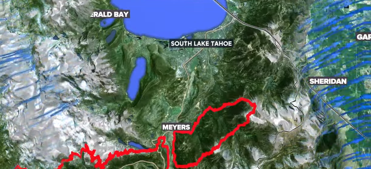
• Christmas Valley from Highway 89 West to Echo Summit
• Highway 89 due West to Watershed Ridge/Echo Summit and South to the
Amador/El Dorado County line.
• The area from Luther Pass Road, North along the El Dorado/Alpine County
line to Armstrong Pass. West from Armstrong Pass to Upper Apache at
Meyers. West on Upper Apache to Highway 50. West on Highway 50 to
Highway 89. South on Highway 89 to the El Dorado/Alpine County line. This
includes all homes on both sides of Highway 89.
• The area from Upper Apache at Meyers, North along Highway 50, to Elks
Club Drive. East on Elks Club Drive to Pioneer Trail, extending due south to
Upper Apache at Meyers. (This includes all homes off of Oneidas, Mandan,
Apache, Ottawa and Player).
• The area North on Highway 50 from Highway 89 to Saw Mill Road. West on
Saw Mill Road to Angora Ridge, extending to the Echo Summit.
• Desolation Wilderness from the watershed ridge to the CA ENF/CA TMU
wilderness boundary. From the El Dorado/Placer County line to Echo Lakes.
• The section from Emerald Bay north to the Placer County line in Tahoma,
extending West to the border of Desolation Wilderness.
• The area from Sawmill Road at Lake Tahoe Blvd. extending north to Pope
Beach. Along the water’s edge to Eagle Point. From Eagle Point west, to
Desolation Wilderness, across Emerald Bay.
This is the area North of Elks Club along Highway 50 and the West side of
Pioneer Trail, also including the streets of Hekpa, excluding the residences
west of the airport, this segment includes all residences accessed from
Jicarilla, Washoan, & Glen Eagles. This also includes the Golden Bear
neighborhood, & the neighborhoods of Cold Creek Trail, High Meadows, &
Marshall Trail.
• Northwest of the South Lake Tahoe Airport & West of the Highway 50 /
Lake Tahoe Blvd & Highway 89 intersection to include the South Lake Tahoe
High School, Tahoe Verde & the streets accessed from 5th through 15th
street South of Highway 89
• The area East of Pioneer Trail to the Alpine County Line stopping South of
Heavenly Ski Resort, excluding all residence off of Pioneer Trail.
• All residences with the Tahoe Keys community & all residents accessed from
Page 4 of 8
the streets connected to Tahoe Keys Blvd, staying East of 3rd Street.
• East of Highway 50/ Highway 89 at the at the Lake Tahoe Blvd and Highway
89 Highway 50 intersection. This includes the area of Barton Hospital & the
area of Winnemucca to the “Y”. Also North of Highway 50 west of Tahoe
Keys Blvd following along the north side of Highway 89 through the end of
town prior to Pope Beach.
• From the evacuation order line in Twin Bridges east to the Echo Summit and
from Highway 50 South to the Amador & Alpine County lines & North to the
Placer County line.
• Dry Lakes Section: This section is North of Wentworth Springs Road up to
the Placer County line and the remaining section of El Dorado County South
of Placer County to Loon Lake.
• The area from Sawmill Road at Lake Tahoe Blvd. extend
Dry Lakes Section: This section is North of Wentworth Springs Road up to
the Placer County line and the remaining section of El Dorado County South
of Placer County to Loon Lake.
• The area from Sawmill Road at Lake Tahoe Blvd. extending North to Pope
Beach. Along the water’s edge to Eagle Point. From Eagle Point West to
Desolation Wilderness, across Emerald Bay.
• The remaining area of the Lake Tahoe Basin. From the Alpine/El Dorado
County line, North along the California/Nevada state line to Lake Tahoe.
North along the water’s edge to the El Dorado/Placer County line. West
along the El Dorado/Placer County line to McKinney Lake.
• All residences off of Lakeview which is west of Highway 50 North of Blue
Lakes Road & East of Tahoe Keys Neighborhood.
• All residences on both sides of Highway 50 for the streets connected to
O’Malley, Lodi, Silver Dollar & Rubicon Trail.
• The residences between Al Tahoe on the East side of Johnson Blvd to
include the streets of Treehaven & Fremont & extending to the East to all
residences West of Ski Run & East of Pioneer Trail.
EL DORADO COUNTY – WARNINGS:
• North of Slab Creek to Wentworth Springs Road between Sand Mountain
and Loon Lake.
• Mosquito Road from the bridge North to include the Community of
Swansboro.
• North of Highway 50 to Slab Creek between Smith Flat and Snows Road.
• South of Highway 50 to Pleasant Valley between Smith Flat and Snows
Road, and North of Pleasant Valley between Holm and Newtown.
• South of Pleasant Valley between Bucks Bar Road and Newtown Road, East
of Bucks Bar Road to Kingsbury Drive.
• Southwest of Bucks Bar Road to Ladies Valley Road including the community
of Outingdale, Ant Hill Road, Perry Creek Road and Sand Ridge between
Ladies Valley Road and Bucks Bar Road.
• East of Mt Aukum Road (E16) from Bucks Bar Road to Omo Ranch Road.
North of Omo Ranch Road to the intersection of Omo Ranch Road and
Fairplay Road
North of Highway 50, West of Sly Park, South of Slab Creek, and East of
Larsen Drive / Snows Road.
EL DORADO COUNTY – ROAD CLOSURES:
• Highway 50 is closed in both directions from the Sly Park Road exit to the
California/Nevada stateline.
• Highway 89 at the Placer County/ El Dorado County line in Tahoma.
Alpine County EVACUATION ORDERS ALPINE COUNTY:
• The area from Pickett’s Junction, north on Highway 89 to the Alpine/El
Dorado County line. Northeast along the Alpine/El Dorado County line to
the California/Nevada state line. Southeast along the Alpine County line to
Fay-Luther Canyon. Southwest along Fay-Luther Canyon to Horse Thief
Canyon to Pickett’s Junction.
EVACUATION WARNINGS ALPINE COUNTY:
• North of Highway 89 from Woodfords due north to Luther Creek at the
Nevada State line.
• East of Forestdale Road and south to the Pacific Crest Trail Crossing.
• East of the Pacific Crest Trail to the Summit City Canyon Trail.
• East of Summit City Canyon Trail and south to the El Dorado / Stanislaus
National Forest Line.
• El Dorado / Stanislaus National Forest Line east to the northern lake edge of
Upper Blue Lakes.
• North of the North-west Lake edge of Upper Blue Lake to the southern
aspect of Hawkins Peak and to Woodfords junction.
• South of Highway 88 at Woodfords Junction to Forestdale Road.
• The area from Picketts Junction south on Highway 88 to Forestdale Road.
Northeast to Hawkins Peak to the Highway 88/Highway 89 junction at
Woodfords. East on Highway 88 to the California/Nevada state line.
Northwest along the Alpine County line to Fay-Luther Canyon. Southwest
along Fay-Luther Canyon to Horse Thief Canyon to Picketts Junction.
Douglas County
Nevada:
DOUGLAS COUNTY EVACUATION ORDER:
• Upper Kingsbury (South)
• Upper Kingsbury (North)
• Central Kingsbury
• Lower Kingsbury
• Round Hill region and roads including Lower Elks Point
• Lake Village
• Lower Olivers, Kahle Drive region and roads
These Evacuation Order will include areas from Highway 50 at Lake Parkway,
East to Elks Point Road (excluding Stateline Casinos) and State Route 207
Page 6 of 8
(Kingsbury Grade) from Highway 50 to Tramway Drive, including all area roads
North and South of Kingsbury Grade.
DOUGLAS COUNTY EVACUATION WARNING:
• Zone 2
• Any homes or property located on Foothill Road from Centerville Lane north
to Muller. Included in this zone is the valley side of Kingsbury Grade and
any homes that are accessed by Foothill Road between Centerville Lane and
Muller Lane.
• These communities are asked to be on the alert and start preparing for
potential evacuations. Evacuations have not been ordered at this time,
however there is potential for evacuation orders in the near future and road
closures are imminent. Please stay vigilant, pay attention to emergency
phone alerts, and have a plan in place.


