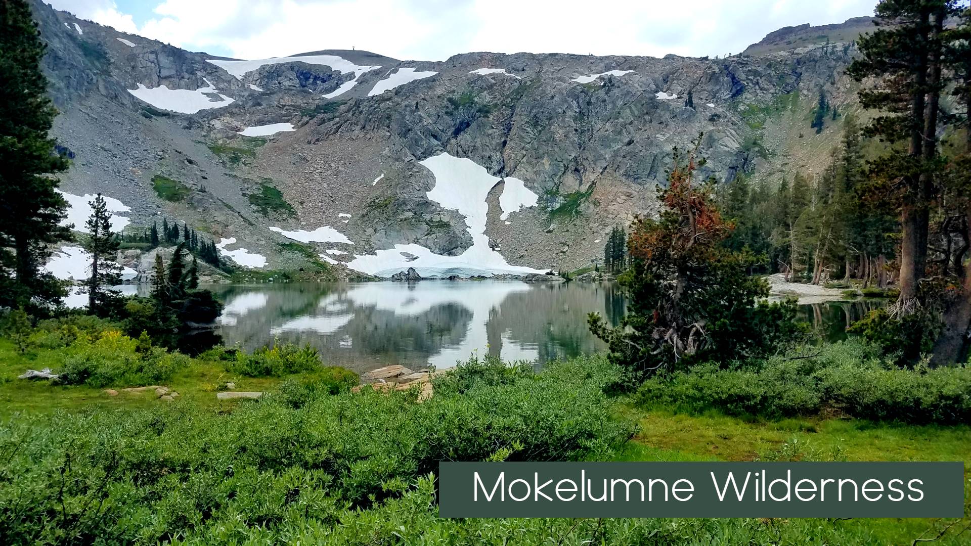

Mokelumne Wilderness
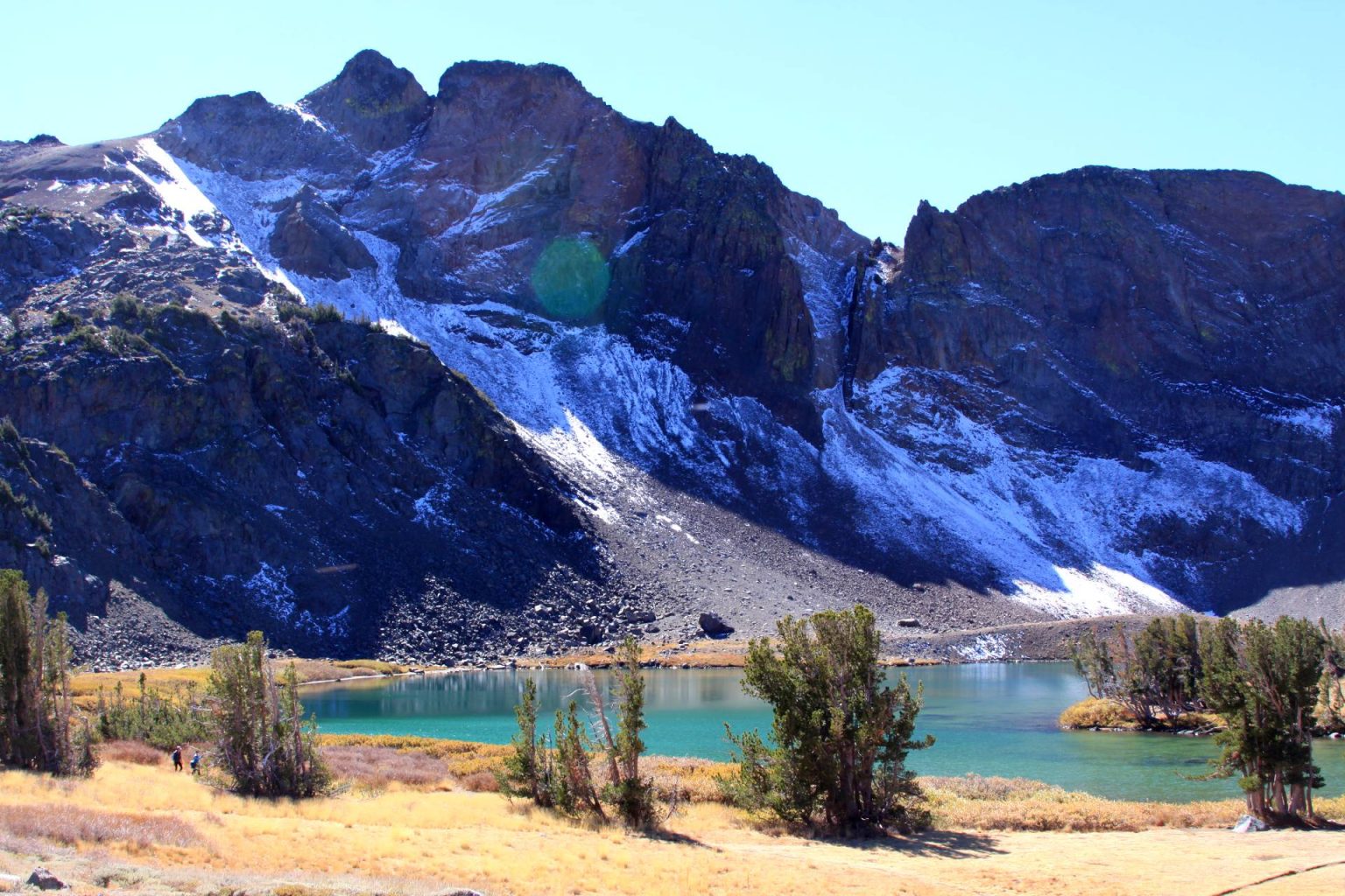
Rugged dry beauty that stands apart from surrounding Sierra Wilderness areas. The Mokelumne (pronounced moo-ka-la-mi), located at the junction of northern, southern and eastern Sierra botanic provinces, is renowned for its incredible diversity. Elevations range from 4,000 feet near Salt Springs reservoir to over 10,380 ft at Round Top Peak in the north.
Visitors will immediately notice the variety of rock comprising its mountains and canyons. An important example of “crest zone” geology, the metamorphic rock capping Mokelumne Peak once covered most of the Sierra’s granite. This layer of volcanic rock, sand, and mud can be found here alongside weathered granite as old as the dinosaurs.
Straddling the Sierra Nevada crest between Carson and Ebbett’s Passes, the Mokelumne Wilderness is an exceptional tract of rugged mountains, lakes, plunging canyons, and explosively wildflower-strewn meadows. In short, it is everything that one expects from a Sierra wilderness. To most people the Sierra Nevada is associated with the stark granite landscape of the High Sierra, the soaring granite cliffs of the valleys and canyons, as well as domes, waterfalls, jagged summits and lakes. However, while the Mokelumne does feature many of these aesthetic hallmarks of the Sierra, its composition differs from the typical granite landscape that is archetypal of the range. Nonetheless, the Mokelumne is a sublime slice of mountain wilderness.
The 105,165 acre Mokelumne Wilderness straddles the crest of the central Sierra Nevada, within the Stanislaus, Eldorado, and Toiyabe National Forests. This area lies within portions of Calaveras, Alpine, and Amador Counties and is bordered by State Highway 4 on the south and State Highway 88 on the north. Watersheds drain to the Mokelumne River on the west slope and the Carson River on the east slope. New Management Guidelines were recently adopted for the Mokelumne Wilderness.
The prominent feature is disputably the rugged Mokelumne River Canyon. There are many smaller streams flowing through deep granitic canyons but only a few lakes concentrated in the northern portion of this spectacular area.

Featured Stories and trip experiences in Mokelumne Wilderness
Backpacking trails Mokelumne Wilderness – Our Guide to Backpacking the Mokelumne Wilderness
Lake Winnemucca – Carson Pass – A local and regional favorite the Carson Pass to Winnemucca Lake trail might be the most visited location in this unique wilderness
Fourth of July Lake – Just beyond the popular Winnemucca and Round top Lakes fourth of July lake is a beacon for backpackers and adventure seekers looking for a little trail elevation.
Woods Lake – This highly underrated campground and lake location is sits at the entry way into the Mokelumne wilderness and provides great day fishing experience for kids.
A Weekend of Discovery in The Blue Lakes Basin – come discover the hidden gems located behind the Blue lakes in Mokelumne Wilderness
General Information and Regulations
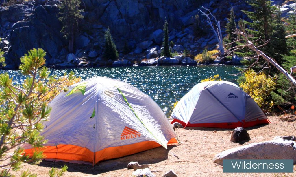
- Campfires – Campfires are allowed below 8,000 feet in elevation. Camp stoves are allowed in the entire wilderness. Campfire permits are required for all woodfires, charcoal fires and gas stoves. This permit does not allow you to have a campfire in the prohibited areas. It only allows you to use your gas stoves in those areas.
- Campfires are prohibited in the following locations:
- Above 8,000 feet.
- Carson Pass Management Area
- North Fork Mokelumne River Canyon along Salt Springs Reservoir and the Blue Hole Trail
- Campfires are prohibited to reduce human-caused fires, impacts to vegetation from firewood collection, and to reduce the visual impacts of fire rings and surface scarring.
- Method of Travel – Travel is restricted to horseback or foot only. Trails in the Mokelumne Canyon are maintained in a primitive and challenging condition and are not recommended for stock use. All means of mechanical transportation, including bicycles, are prohibited in wilderness. Wheelchairs are allowed. Stay on trails and do not shortcut switchbacks or create parallel ruts by walking alongside the trail.
- Waste – Visitors are required to bury human waste 6 to 8 inches deep and at least 200 feet away from water, trails, and campsites. Toilet paper must be buried or packed out. Garbage must be packed out.
- Group Size – Maximum group size: 12 people for day-use, and 8 people for overnight use.
- Pets – Domestic pets are allowed in the Mokelumne Wilderness at this time. You are responsible for their actions as well as their welfare. In the Carson Pass Management Area pets should be leashed or physically restrained at all times. Elsewhere within the Wilderness, dogs should be either leashed or under direct voice control. Dogs can disturb other campers, get in fights with other dogs along the trail, and scare wildlife away. The Amador and Alpine County leash laws will be enforced inside the Wilderness boundary where dogs off leash are an impediment or hazard to the safety of any person, or where dogs are harassing or molesting wildlife.
BEARS
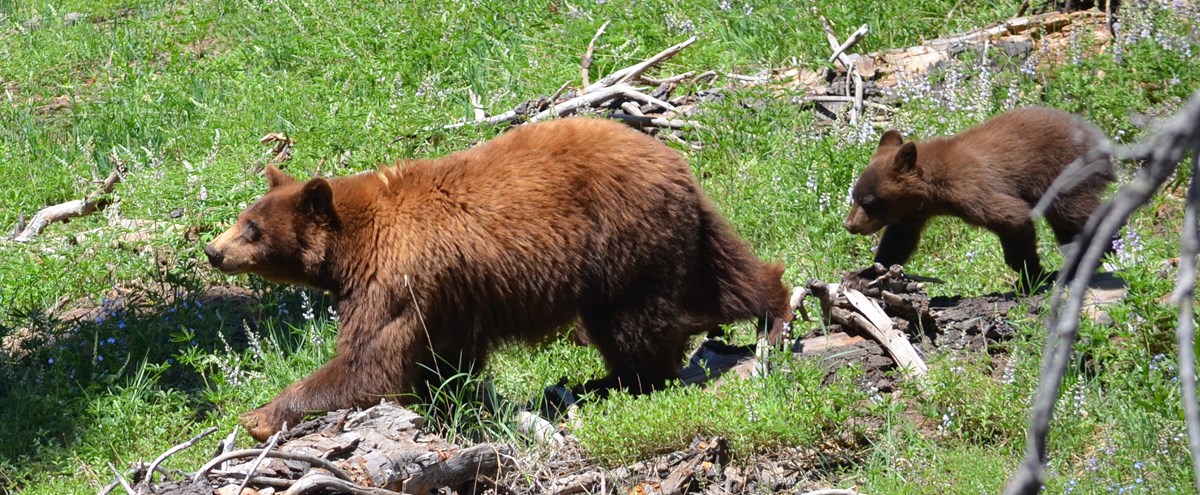
Black bears are increasingly common in the Mokelumne Wilderness, with individuals being displaced from the lower elevation western slopes into the higher country. Food must be stored properly at all times. Bear resistant food canisters are recommended.
Carson Pass Management Area
Due to the popularity of the Carson Pass Area, restrictions are now in effect to ensure your opportunities for solitude, a primitive recreational experience, and to protect popular camping destinations from overcrowding and heavy impacts.
Mokelumne Wilderness Permits
Permits are mandatory for entry into the Mokelumne Wilderness year round for overnight use.
Recreational Stock Use
In the Mokelumne Wilderness, visitors using Pack Stock in the Wilderness are subject to the same regulations and guidelines as other wilderness visitors. There are further guidelines and regulations that are intended to protect the wilderness from the more severe impacts pack stock can have on resources.

Peaks of Mokelumne Wilderness
Round Top (10,382 ft.):
Dominating the Carson Pass skyline, Round Top is the monarch of the Mokelumne Wilderness. In terms of scenic qualities, height and bulk, Round Top reigns in solitary isolation over the northern reaches of the wilderness. Its summit is reached with relative ease from the Carson Pass area.
The Sisters (10,153 & 10,045 ft.):
The Sisters are twin peaks protruding from the ridgeline that extends westward from Round Top. They are particularly attractive from Round Top Lake, where they loom above the lake and numerous possible campsites.
Raymond Peak (10,014 ft.):
The highest summit in the eastern section of the Mokelumne Wilderness, Raymond Peak is volcanic in nature. Lying beneath the summit, Raymond Lake is a popular destination for hikers. The Pacific Crest Trail is routed near the summit.
Deadwood Peak (9,846 ft.):
The third highest peak in the wilderness, Deadwood Peak receives less visitation than the rest of the high peaks in the Mokelumne. It is visible from the Blue Lakes area and the trail to Grouse Lake passes south of it, but it remains fairly obscure. Three subordinate peaks above 9,000 ft. surround Deadwood.
Melissa Coray Peak(9,763 ft.):
This summit is situated on the western boundary of the Mokelumne wilderness. It rises above the 4th of July Lake area. It is just outside the Carson Pass Management Area.
Reynolds Peak(9, 679 ft.):
Reynolds Peak is the second highest peak in the eastern Mokelumne. Like Raymond Peak, its neighbor to the north, Reynolds Peak is associated with the Ebbetts Pass area. The quickest way to the summit is to catch the Pacific Crest Trail at Ebbetts Pass and head north.
Elephants Back(9,585 Ft.)
The Elephants Back is a high peak composed of volcanic rock a short distance northeast from Round Top. Its summit forms the eastern boundary of the Carson Pass Management Area.
Markleeville Peak(9,415 ft.):
Sharing its name with the community to the northeast, Markleeville Peak lies is the northeastern region of the Mokelumne Wilderness. It is volcanic in origin like all the other peaks in the eastern Mokelumne.
Mokelumne Peak(9,334 ft.):
Towering in isolation above the western stretch of the Wilderness, Mokelumne Peak is the highest summit along the Mokelumne River canyon. The enticingly named Mokelumne Tetons rise out of the canyon south of the peak.
Jeff Davis Peak(9,065 ft.):
A volcanic spire located in the eastern stretch of the wilderness. It is the highpoint between Markleeville and Raymond Peaks.
