
AllTrails Peak Membership Launches June 11
Sierra Rec Magazine is excited to announce the arrival of AllTrails Peak, a new premium membership tier launching June 11 from the world’s most trusted outdoor trail platform. For Sierra Nevada adventurers, this means a new level of control and insight—both while planning your trip and once you’re on the trail.
We’ll be testing these advanced features throughout summer 2025 in the heart of the Sierra—customizing new backpacking routes through Yosemite National Park, Desolation Wilderness, and the remote, off-trail regions of the southern Emigrant Wilderness. We’re also preparing a custom route project this September: a new off-trail loop from Tuolumne Meadows to Yosemite Valley, featuring lesser-known lakes and intertwined trail segments—all built using the new AllTrails Peak tools.
What is AllTrails Peak?
AllTrails Peak is the platform’s most advanced membership tier to date. Priced at $79.99 annually, it includes everything in AllTrails Plus—such as offline maps, 3D previews, wrong turn alerts, and live location sharing—plus four powerful upgrades designed for serious outdoor enthusiasts.
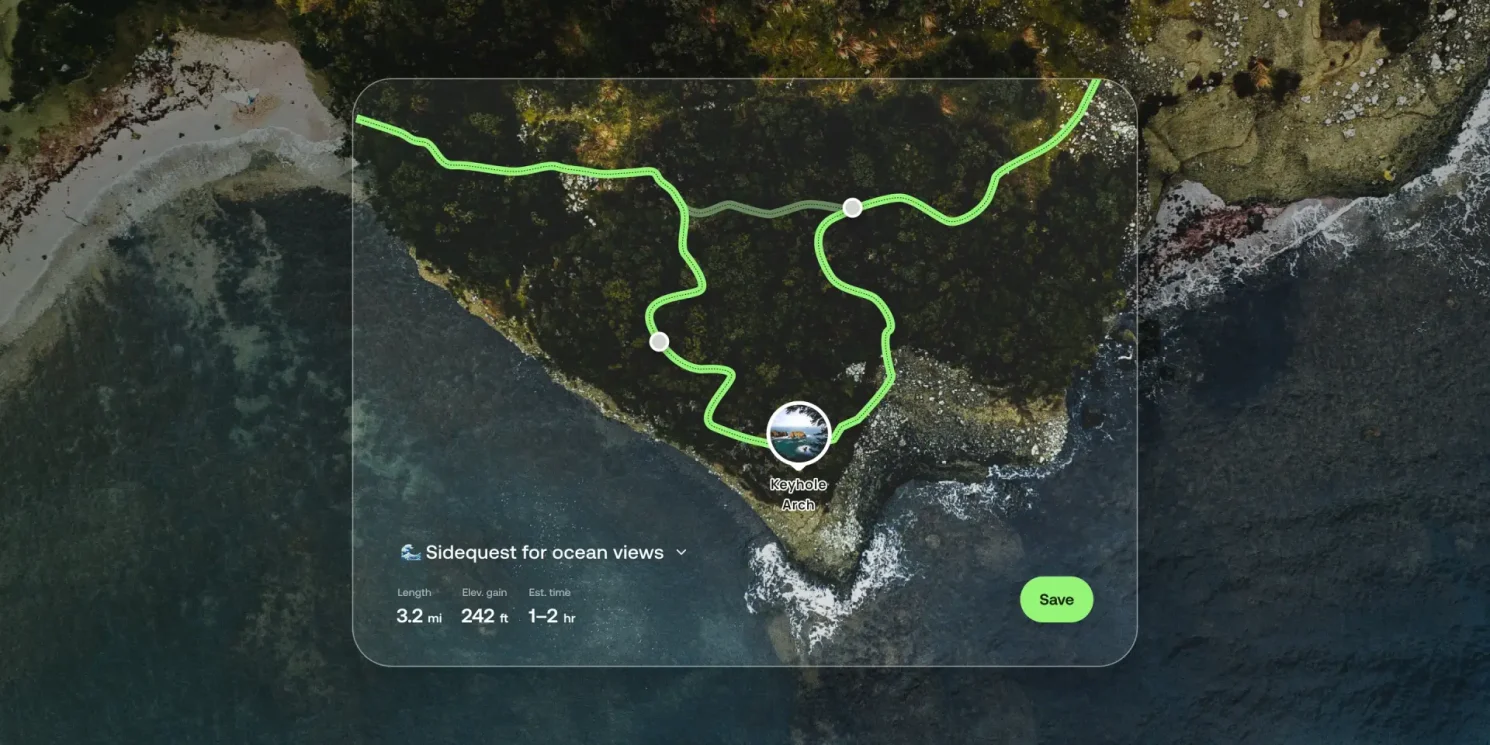
1. Custom Routes
Build your own adventure by customizing trails from scratch or adjusting existing routes to better fit your needs. AllTrails’ smart-routing tools help you create routes that are shorter, less steep, or more scenic with just a tap. Ideal for off-trail exploration in areas like the Emigrant Wilderness or making family-friendly loops in Desolation.
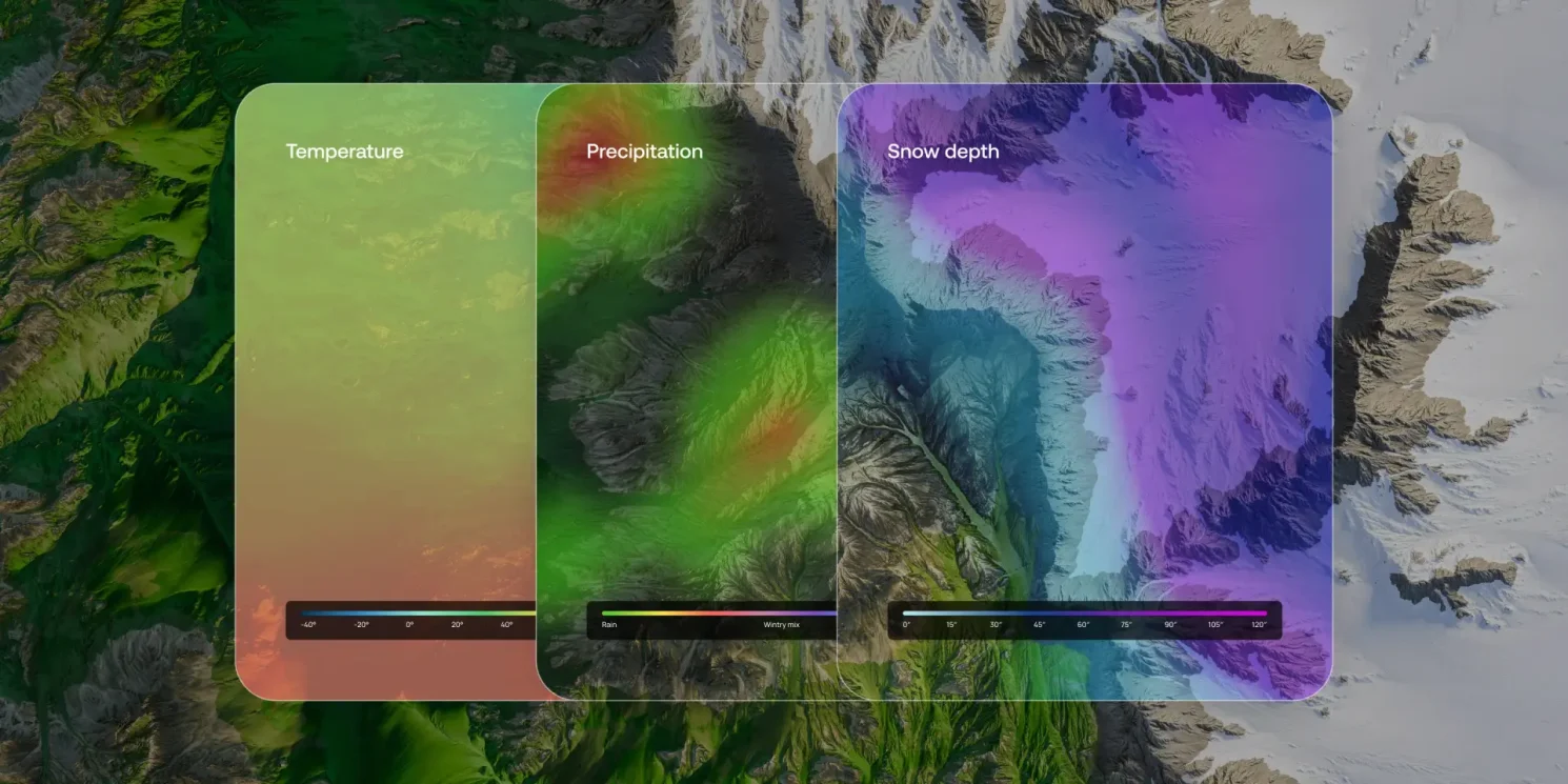
2. Trail Conditions
Stay updated with on-trail weather intelligence. This feature layers together 15 different weather factors, user reviews, and real-time geospatial data to predict temperature, precipitation, snow depth, air quality, and even mosquito activity along your route.
3. Community Heatmap
Find popular trails or avoid the crowds. The heatmap uses millions of data points to show which trails are currently trending—and which are still hidden gems. This is perfect for those hoping to dodge peak-season congestion at Lake Tahoe, Yosemite Valley, or Mammoth.
4. Outdoor Lens (Coming Soon)
Turn your smartphone into a nature ID tool. Use your in-app camera to identify trees, flowers, and natural features instantly. Every identification is logged so you can revisit your discoveries and build a digital field journal over time.
Why This Matters for Sierra Nevada Travelers
From high-elevation wilderness loops to trailhead-to-valley connections, AllTrails Peak gives you the tools to explore with more confidence and customization. With remote terrain, changing weather, and limited cellular access in the Sierra, having reliable offline data, route-building options, and real-time trail insights can elevate every trip.
At Sierra Rec Magazine, we’ll be using AllTrails Peak this summer to:
- Build multi-day off-trail routes in Southern Emigrant Wilderness
- Optimize route elevation and mileage in Desolation and Mokelumne Wilderness areas
- Navigate snowmelt crossings and mosquito season conditions in June and July
- Capture fall backpacking loops in Yosemite’s Cathedral Range and Grand Canyon of the Tuolumne
We’ll share our results through field-tested stories, trail reports, and podcast recaps.
Ready to Upgrade?
If you want to explore the Sierra with the same tools we’re using this season, consider upgrading to AllTrails Peak through our affiliate link below. Your support helps fuel our field reporting, gear reviews, and on-the-ground storytelling from across the range.
Get AllTrails Peak Now – Start Your Upgrade
Want to see how AllTrails Peak performs in real-time? Subscribe to the Sierra Rec Now Podcast and follow along on YouTube and our summer adventure series as we put these tools to the test across the Sierra Nevada.


