Go Off Trail And Explore This Stunning Chain of Lakes Near Lake Tahoe
Desolation Wilderness, Ca – Desolation Wilderness whispers with hidden wonders, and Pyramid Creek stands as its vibrant artery. While Horsetail Falls’ fiery cascade steals the show from Highway 50, a chain of pristine lakes awaits those willing to delve deeper. This revised article, tailored for Sierra Rec Magazine, unveils the magic of Pyramid Creek and equips you for an unforgettable off-trail adventure.
Beyond the Thundering Veil: A Journey Upstream
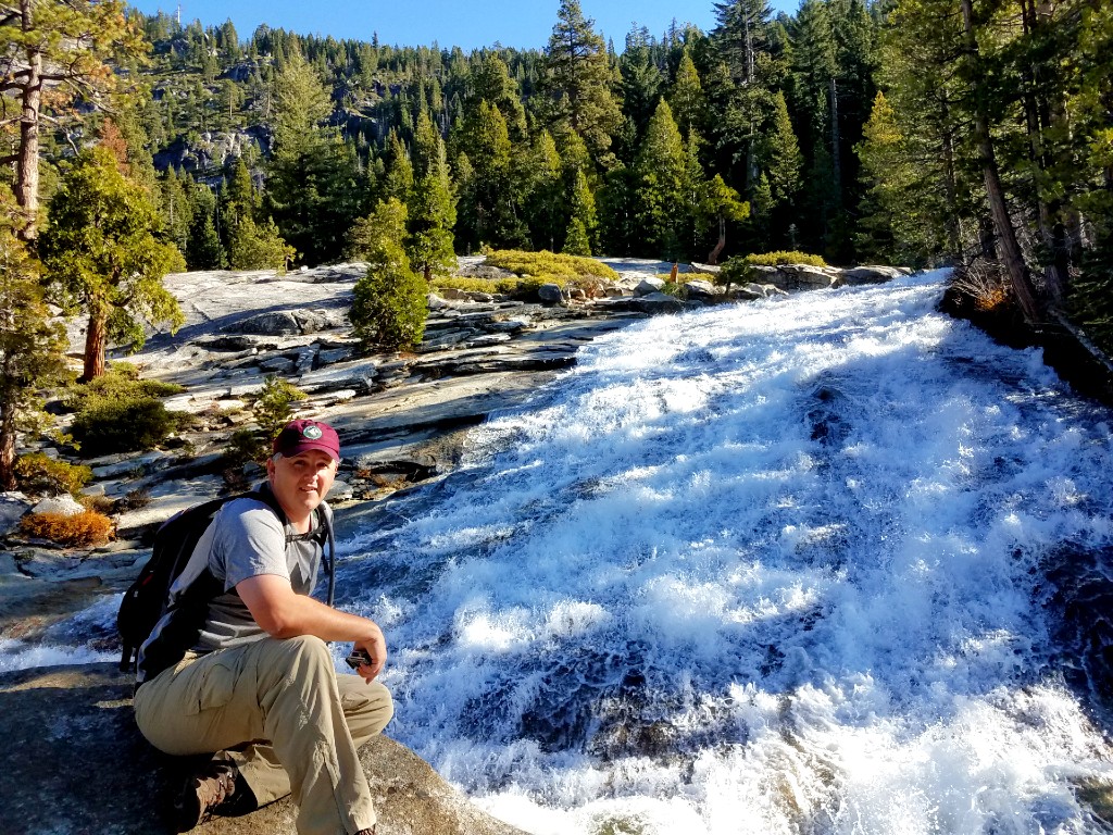
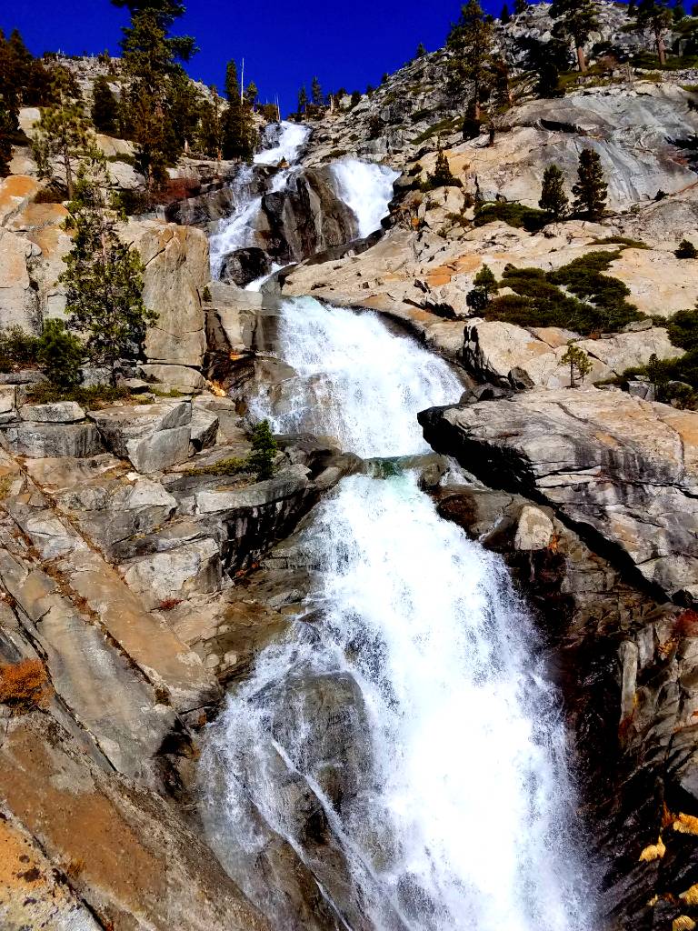
Horsetail Falls, a 500-foot giant, is Pyramid Creek’s grand entrance. But true wilderness explorers crave what lies beyond. A network of interconnected lakes, each a crystal jewel reflecting the granite cathedral that is Desolation, beckons the adventurous. These alpine gems, fed by winter’s bounty, ultimately contribute to California’s water system, feeding the south fork of the American river, a testament to the creek’s vital role. One of the largest waterfalls in the state of California, Horsetail Falls is a popular destination for day hikers looking to experience Desolation Wilderness up close, without a long distance hike into the wilderness. A moderate to easy 3 mile loop hike from the parking lot will put you at the base of one of the waterfalls last big plunges.
On multiple summer visits, we explored the bulk of lakes on two long day hikes going off trail in the Wilderness to follow this wild and beautiful stream. A recommended wilderness adventure for your next visit to Desolation Wilderness.
Planning Your Expedition: Two Epic Routes
Unveiling Pyramid Creek’s secrets requires careful planning. Two primary access points offer distinct experiences:
- Twin Bridges: This heavily trafficked area near Lake Tahoe serves as the trailhead for the lower section. While the initial 2 miles up the canyon are moderate, tackling the challenging terrain towards the first series of lakes (Avalanche, Pitt, and Ropi) demands experience and a strong sense of direction.
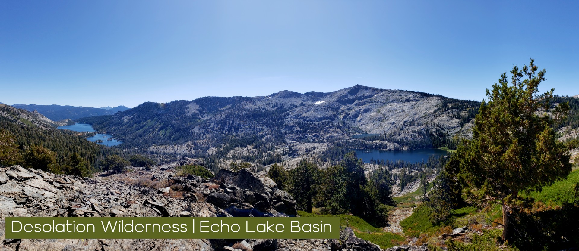
- Echo Lakes: Hike the PCT/Tahoe Rim Trail from Echo Lakes to access the upper chain. Two routes unravel from Lake Aloha:
- Route 1: Follow the stream south, passing American Lake, Channel Lakes, and Desolation Lake before cascading down to Ropi Lake.
- Route 2: Head south to Lake of the Woods, descend to Ropi Lake (including Avalanche and Pitt with some map skills), and then explore upstream towards Desolation, Channel, American, and Aloha Lakes before returning via the PCT.
A Day Trip or a Backpacker’s Paradise?
The entire chain can be a challenging day trip, with mileage varying depending on navigation. Be prepared for route-finding and potential off-trail scrambling. The distance from Highway 50 to Ropi Lake might be a mere 3 miles, but expect it to feel like seven! For a more relaxed exploration, consider backpacking. This designated Section 44 into Section 39 on the Zone map requires permits, obtainable online or by phone at Recreation.gov (1-877-444-6777).
This off trail route after the base of horsetail Falls is easy to add distance to your trip. traversing granite slopes, navigating around water and picking your way across the open granite adds miles. Between Desolation Lake and Channel Lakes you will need to choose a route that might include going around a high point in the granite as following the creek at times leads you to a places that are hard to traverse.
Know Before You Go:
- Navigation Skills are Crucial: Off-trail exploration demands excellent map and compass proficiency. Be prepared for route-finding challenges.
- Respect the Wilderness: Desolation Wilderness thrives on responsible recreation. Pack it in, pack it out, and leave no trace.
- Embrace the Challenge: The terrain is rugged, with steep climbs and granite scrambles. This adventure is best suited for experienced hikers in good physical condition.
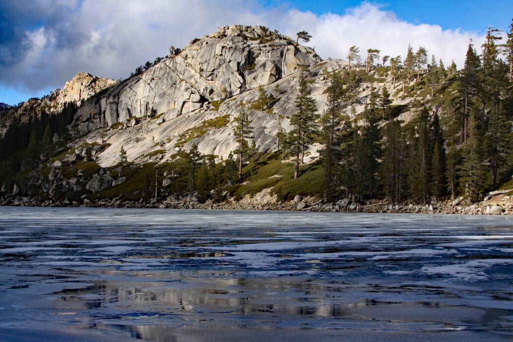
A Glimpse of the Treasures: The Lakes of Pyramid Creek
Lake Aloha
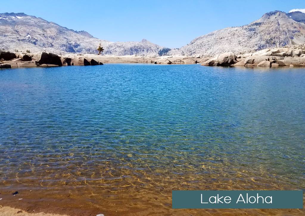
Lake Aloha is a large shallow back country reservoir located at an elevation of 8,116 feet in the Sierra Nevada Range, west of Lake Tahoe. It is one of the most visited lakes in Desolation Wilderness and very popular backpacking destination. A sprawling gem, popular for backpackers, offering stunning reflections of the surrounding peaks.
The shortest and easiest approach is from Echo Lake by the Pacific Crest Trail. Alternately, it can be reached by the Glen Alpine Springs Trailhead, near the city of South Lake Tahoe. From the south, Lake Aloha can be reached by the Ralston Peak Trail or cross country through Horsetail Falls and Desolation Valley. The primary outflow from Lake Aloha is Pyramid Creek, which flows south for roughly four miles before it empties into the South Fork American River near Twin Bridges
Channel Lakes and Desolation Lake: A series of interconnected lakes, perfect for a refreshing dip. These smaller clear water gems are secluded and away from the crowds of Desolation.
Channel Lakes
This small series of Lakes is possibly on of the most secluded locations in desolation. It sits between Lake Aloha, and desolation Lake directly below American Lake. and features many different locations that would make a great camp spot in the summer.
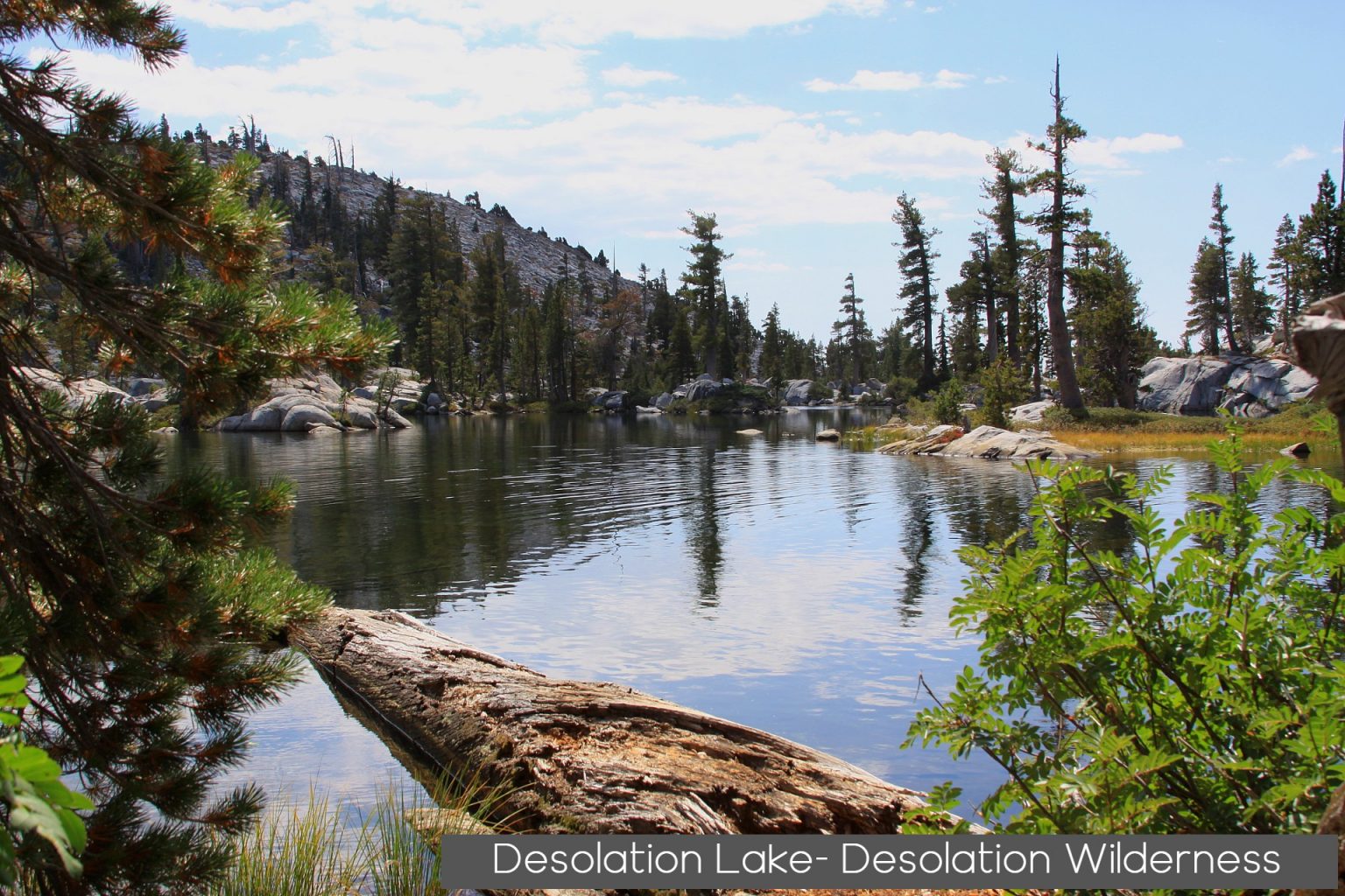
Desolation Lake
Located directly above Ropi Lake and at top of a sprawling Cascade that pours into Ropi Lake to the East, Desolation Lake is a wilderness treasure that few people ever venture out to see. This is Sierra Rec Magazines Top Pick for Backpacking experience inside Desolation.

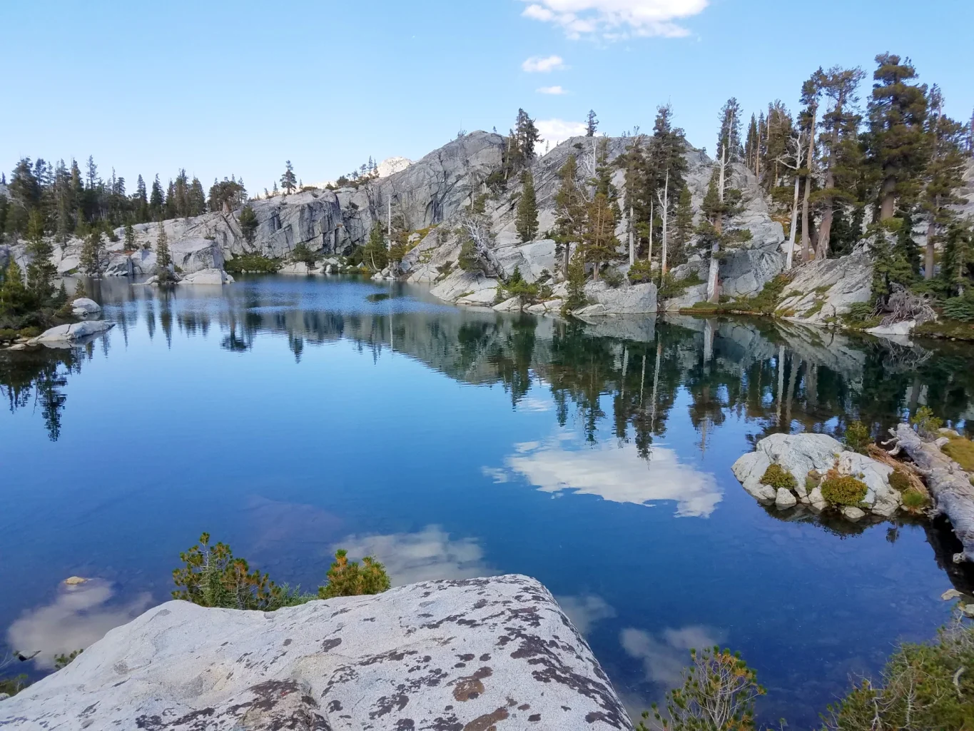
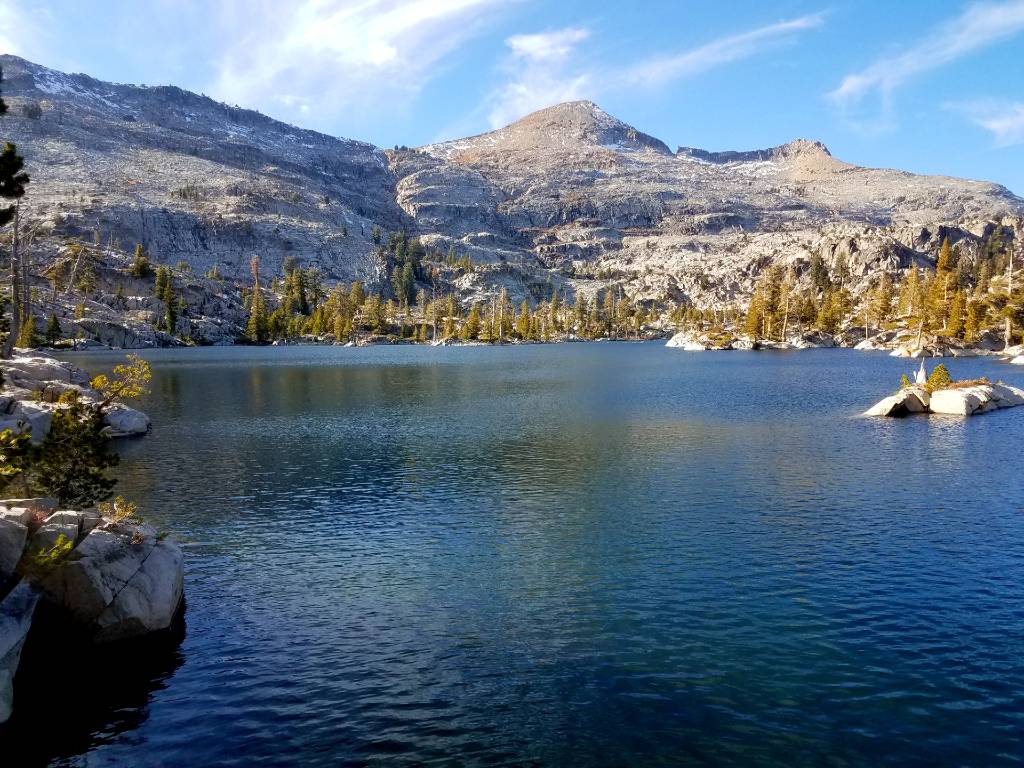
Ropi Lake
Cascading waters lead to this serene lake, nestled amidst towering granite giants. Explore the network of smaller lakes feeding into Ropi for an even more secluded experience. Ropi is our personal favorite lake of desolation wilderness. Its deep blue pool of water perfectly reflects Pyramid Peak above and an open canvas plateau makes for a spectacular night sky.
Ropi Lake
Not Photographed here is small set of lakes to the West of Ropi Lake that feed into the lake as well through direct channels. (Toem Lake, Gefa Lake, Pyramid Lake and Waca) These lakes sit at the base of Pyramid Peak and South of Lake Aloha.
Avalanche and Pitt Lakes:
These lie at the headwaters of Pyramid Creek directly above Horsetail falls, offering a taste of wilderness right off Highway 50 (though reaching them requires some off-trail navigation).
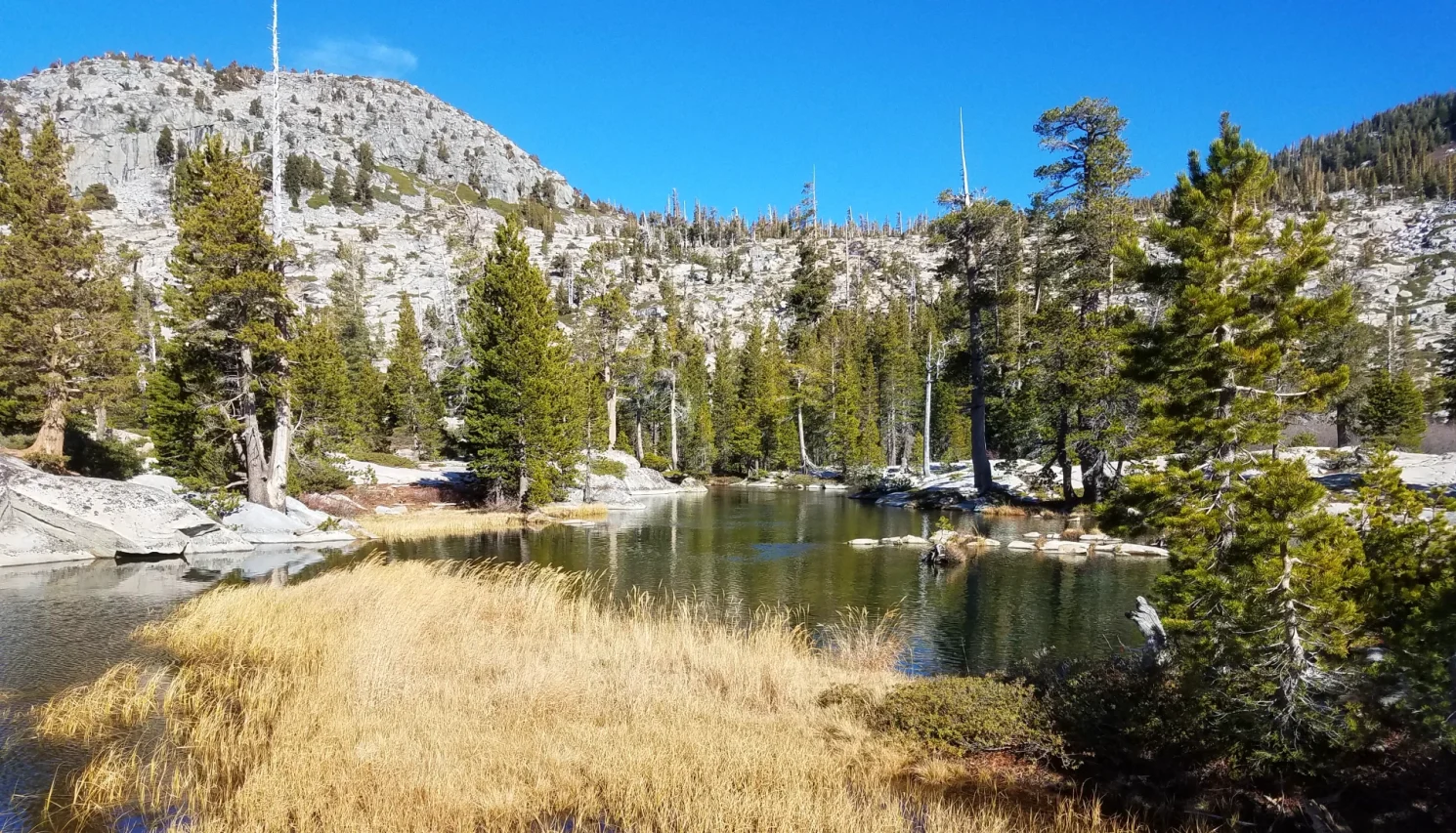
Pitt Lake
The second of these small lakes at the top of Horsetail, Pitt features a stunning pool of water collected from the cascades coming out of Ropi Lake. it then braids its way through a stand of trees that filter the water down to Avalanche Lake. Braving the creek crossings and wandering in the forest between these two lakes is magical but you are almost certain to leave with wet feet.
Avalanche Lake
This stunning oasis is directly above Horsetail Falls and makes the perfect place for a nap after a grueling climb up the Falls Tallas. On the North end of Avalanche lake where the creeks from Pitt Lake flow into avalanche you can find a delightful location to escape reality and immerse your self in wilderness.

Embrace the Challenge, Reap the Rewards
Pyramid Creek’s off-trail adventure isn’t for the faint of heart. But for those who dare to venture beyond the well-trodden path, a string of breathtaking lakes awaits. With careful planning, honed skills, and a reverence for the wilderness, you’ll unlock a secret chapter in the story of Desolation Wilderness. So lace up your boots, grab your map and compass, and get ready to discover Pyramid Creek’s hidden gems.
Horsetail Falls
Backpacking Fee Schedule:
- Reservation Fee: $6 per party/permit (nonrefundable). Permit fees are paid at time of reservation. Plan carefully before making your reservation.
- Overnight Wilderness Permit Fee: $5/person for one night, $10/person for 2 to 14 nights. The cost of a single permit will not exceed $100. Children 12 and under are free. Permit fees may be refunded if changes or cancellation is done more that 14 days in advance of date of entry. All fees are non-refundable within 14 days or less of date of entry.
- Pre-Paid Fee Card: $20 for an annual pre-paid fee card. The card covers only the overnight permit fee for cardholder and is valid for one year from date of purchase. You still must obtain a permit, subject to quota limits, and pay any reservation fee. Because a wilderness permit is a special use authorization, Interagency Passes do not apply.
- Service Charge: $5.00 for a change to the date or for adding people. Additional permit fees may apply. No fee for cancellations. Changes to reserved permits can be made online, through the call center, or in person.
- Trailhead Day Use Fee: Currently applies to Eagle Falls and Pyramid Creek parking areas only. A daily Trailhead Day Use pass is $5 per vehicle per day. (This fee is waived for overnight permit holders. Be sure to obtain or print your parking pass and properly display in your vehicle. The Pass does not guarantee parking will be available.)
- A $20.00 Annual Day Use Pass is available, valid at the facilities listed below where a parking fee is required. This Pass is valid for one year from date of purchase. Facilities include: Eagle Falls, Pyramid Creek, Carson Pass, Meiss, and Woods Lake Trailheads. Also covers day use fees at the Dru Barner Campground. (Parking at the Carson Pass and Meiss Parking areas is limited to June 1 to October 1st due to their operation as a State SnoPark during the winter months.)
- Interagency Annual, Senior, and Access passes allow the holder to park at the above listed facilities for free. Interagency Passes do not apply to the Wilderness permit or purchase of the Fee Card or Parking Pass.


Comments 4