Markleeville Ca – Grover Hot Spring is locals favorite for day trips in the Central Sierra and Alpine County. Grover Hot Springs State Park is located on the east side of the Sierra at the edge of the Great Basin Province, characterized by open pine forest, meadows and natural beauty of the surrounding mountain peaks. The park has a pool complex with a hot pool and a swimming pool hot springs, a campground, picnic area and hiking trails.
On my recent visit to Grover Hot Spring I choose to park outside of the park at the Burnside Lake Trailhead and hike into the park as part of the adventure. If you are a fan of large Ponderosa trees and the mixture of sagebrush and boulders this is a great place to start your adventure. The Burnside Lake Trailhead gives you mileage points Charity Valley, Charity Valley Trailhead and to Burnside lake. The outer trail is not as used as the park entrance so pine needles cover the trail and provide a soft step, but can at times make the trail seem to disappear a bit. The hillside runs down to the Hot Springs Creek which in mid January is flowing but is iced over in spots. A short hike leads you into the eastside of the park right behind the campgrounds and joins up with a utility road for a few hundred yards before peeling off along the meadow that is a major feature for the grove Hot spring park.
The meadow provides a great place for not only pictures of the mountain ranges above but wildlife viewing at various times of the year for the park guest and hikers. The Park as stationed a couple of benches on the backside of the meadow for your enjoyment and relaxation. Once you hit the road the trail turns to a well-traveled crushed granite path for the next mile as you follow the Hot Spring / Buck creek to the westside of the park.
As you pass the meadow thoughts of abandoning the trail and heading straight to the Hot  spring pool that is managed by the park are very tempting, however int he winter season the poll is not open till 11 am so a good morning hike is in store.
Hiking at Grover Hot Spring gives you ample opportunity to see deer, squirrels, birds and occasionally a bear. A morning hike is very interesting as you move from a quite forest to one that comes to life with birds and squirrel chatter in the morning sun. On this particular day I found my self drawn in by several woodpeckers. Along the creek you can often scare out a few animals enjoying a quite sip along the creek. Not sure what I scared out this morning, but I scared it about as much as it startled me as I approached the shore for a peek. Nothing like the rush of adrenaline you feel when you scare a creature out in the forest. The often quite stealth like animals tend to make such loud crashing noises as they make sure you don’t catch them in the act. And I for one always find my heart pounding and my senses in high alert for a few minutes after.
About halfway from the meadow to the waterfall you will find a trail split. to the left the Waterfall and path that most people take in the park, to the right a five-mile trail up to Burnside Lake and The Charity Valley. On todays trip I started with the mission of getting a good climb in and wanted to get above the valley floor so I went right to start and will come back to see the falls later in the day.
The Trail up to Burnside is not as well-traveled but there is an impression in the earth where people have walked for years. Friends tell me that they have taken this hike down from Burnside Lake in the evenings while camping, because the moon provides enough light and the sky is spectacular in the summer up here. The trail during this season is covered by a thick layer of pine needles and at the early stages is an easy gradual climb along the edge of the mountain. If you are like me and enjoy climbing up on a rock and just taking in nature while on the trail, there are many places along this route to find solitude on a rock.
The trail gradually gets steeper as you climb and will cross a creek region where your feet might get a little wet, it will travel through an old growth fir stand that is really pretty special to walk through in this part of the country, and then it will open up into fields of manzanita and rock as it starts to climb out of the forest and above the valley.
Signs posted on this section remind us to stay on the path for both our safety and erosion control as the soil is a very soft pumice and will fall away from your step easily. The view from above the tree line will make you stop a moment and take in the view. You will be able to see the meadow below, and the outer reaches of the mountains that surround Markleeville area. By time you reach the top of the tree line you will know if you are in shape enough to make it to Burnside lake or not. this section of the hike climbs quickly and will test your endurance.
For me on this day I made it another half mile or so until I found a nice outcropping of rock to climb up on and take in nature for the day. I brought my bible today and enjoyed a nice read through the book of James while filling up on some snacks for the afternoon hike. I didn’t make it to Burnside today but got a peak into the Charity Valley before heading back down to the waterfall for the afternoon. The trip down was quite peaceful and I finally saw my first fellow hiker on the way down.
The Waterfall at Grover’s was surprisingly still covered with Ice which confirms that I’m glad I wore my layers today because even without snow in the mountains it is still cold enough to freeze. 
Grover Waterfall can be a bit tricky for some to find as the trail just before reaching the fall seems to just vanish at a pile of rocks and the river. Tip: at this point look tot he right and you will se a natural stair step feature to the rocks. Most people go up here and once you start climbing the rock you will start to see paths that have been developed by many people finding their way to the waterfall. I recommend exploring around a bit and keep climbing. At the very top of the waterfall there is a little cove that has developed behind a large boulder in the creek. The kind of place most people miss without exploring the hidden features of a place like this.

Once I have explored the waterfall it is time to head back towards the meadow and the car. Once again after a long hike the thoughts of the hot spring fill my mind. Grover Hot Spring is a locals favorite for enjoying a Hot Spring Pool. It has locker rooms, bathrooms a cool down pol which the kids will love in the summer.
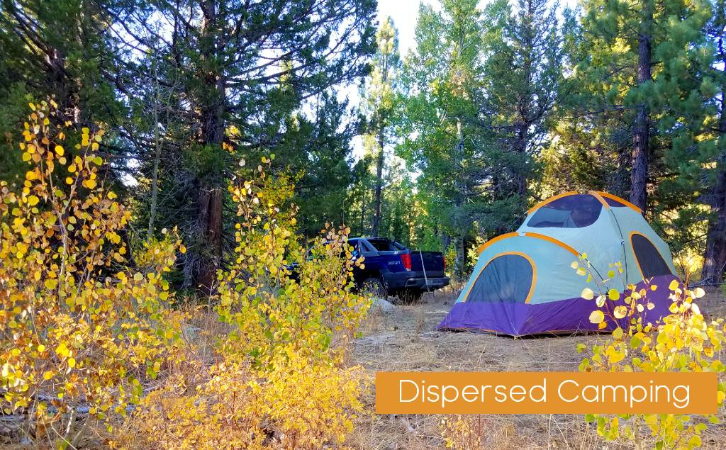
Special note also that Grover Hot Spring State Park is open in the winter for camping also. On this visit I counted at least 6 tent campers in the park.
We hope you enjoy your visit to Grover Hot Spring State Park. or many of the other trails and camping areas in the Alpine County Area. If you are camping at Grover’s and looking for other places to explore while you stay, stop in to the tourism offices in Markleeville for maps of many trails in the area. Turtle Rock, Indian Reservoir, the East Fork of the Carson River are all with in a couple of miles. In the spring through fall if you like to explore we recommend the Carson Iceberg Wilderness area, accessed through the PCT up top or down below in the Wolf Creek Trailhead area.
Sierra REC Magazine is dedicated to not only sharing the news and events in the Sierra Mountains but reviews and tips of local recreational experiences. If you have a tip or story you would like to share please send us a line at sierrarecinfo@gmail.com or find us on Facebook & twitter (recsierra). Enjoy your trips and #goexplore