Caples Lake is located just off Highway 88 In Alpine County. EID Operates the lake as part of the hydroelectric Project 184. and in cooperation with the Eldorado National Forest also manages a boat launch, day-use areas, restrooms, and limited lake access.
This high-elevation reservoir (7,800 feet) offers an excellent high alpine getaway. The predominate activity is trout fishing. The area also offers scenic picnicking areas, boating, and access to trails entering the Mokelumne Wilderness. Afternoon winds are common here which makes it a great location for sailing.
Weather permitting, the boat launch and day use facility is open May through October.
The auxiliary dam features a small area for day-use parking and restrooms.
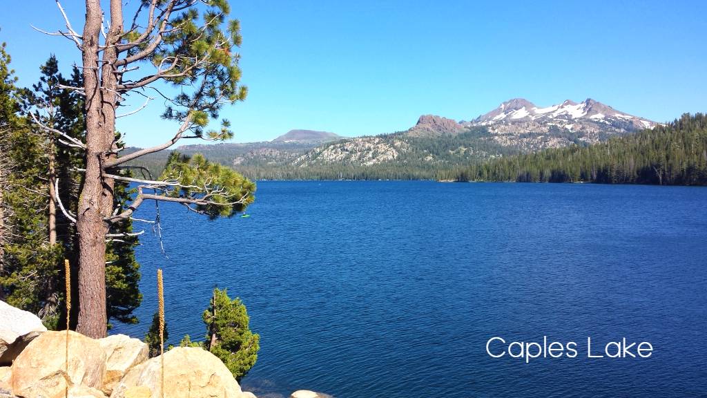
Boating / Fishing on Caples Lake
The speed limit on Caples Lake is 10 MPH.
Seasonal Operations (dependent on weather conditions)
Memorial Day to Labor Day (dependent on weather conditions): 6:00 a.m. to 8:00 p.m.
Outside of the Normal High Season (dependent on weather conditions): 7:00 a.m. to 7:00 p.m.
Day-Use Fees
Launch Fee: $10.00
Picnic/General Parking: $5.00
Full List of Highway 88 Recreation Fees
Annual Day-Use Permits (Note: Permits are valid at all three of our recreation lakes; Caples, Silver, and Jenkinson at Sly Park Recreation Area)
Popular trails and day hikes near Caples Lake.
- Emigrant Lake trail into Mokelumne Wilderness. Trailhead location and parking is located on the West side of the lake just past the dam. trail is 8 miles out and back and includes a scenic two mile stretch the climbs the mountain next to the Emigrant Creek.
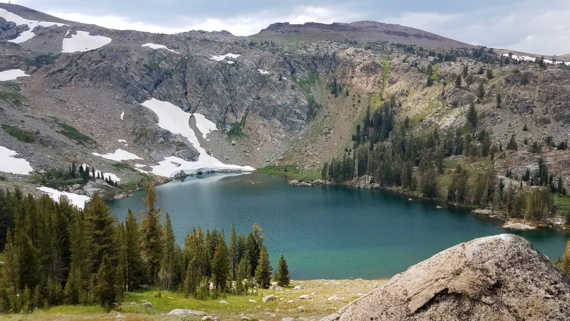
- Round Top / Winnemucca Lake Loop out of Woods Lake. Woods Lake recreation are ais located just East of Caples Lake Boat Launch area and provides day recreational and hiking opportunities up to Round top Lake, Winnemucca Lake and Fourth of July lake.
- Shealor Lake trailhead is on the north side of Highway 88, about half way between Kay’s Resort and Plasse’s turnoff.
- Granite Lake heads toward and past Kit Carson Lodge; the trailhead is on the east side of Silver Lake at the end of road 10N20.
- Lake Margaret trailhead is on the north side of Highway 88 between Kirkwood Inn and Caples Lake.
- Thunder Mountain trailhead is located on the south side of Highway 88, just west of the Carson Spur.
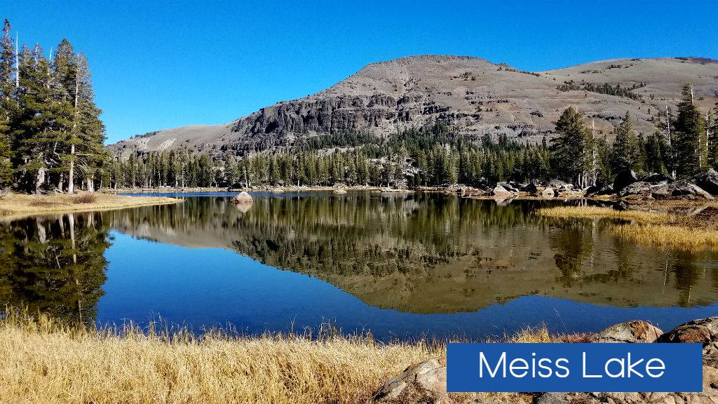
- Meiss Lake trailhead is a parking lot on the north side of Highway 88 just west of the Carson Pass Information Center.
- Frog Lake/Round Top trailhead is at the Carson Pass Information Center.
Horseback Trails Near Caples Lake.
Carons Pass to Echo Summit
This 13-mile ride takes you over gentle country from near Carson Pass via the Pacific Crest Trail to Echo Summit . Most of the route is through forested country with elevation changes of no more than 500 hundred feet at a time until the final descent to Echo Summit. Five miles out on the trail you pass Showers Lake.
A wonderful alternative route is to take the Meiss Country turnoff after 3 miles and follow the gradually descending trail past Round Lake and out through Big Meadow to the trailhead on Luther Pass (Highway 89). It is only an 8-mile ride. There are a couple of short uphill sections, but overall the trail drops from a high of 8,800 feet to 7,300 feet.
Parking at the trailhead is one mile west of Carson Pass at the Woods Lake sign.
Source: http://www.carsonpass.com/activities/horseback_riding.html
Lake Margaret
Hiking to Lake Margaret is a moderate 2.5 mile walk that includes traversing granite slabs, forest, meadows, and crossing several streams (which may be high in springtime; use caution). The wildflowers in mid-summer and changing color of aspens in autumn are beautiful. This trail is also open for Equestrian use.
Lost Cabin Mine Trail (Round Top Lake) 17E47
This popular 2.5 mile trail begins at the parking area along the Woods Lake road, and climbs through forested terrain, crossing a creek (with high spring flows), meadows, and passing Lost Cabin Mine before reaching Round Top Lake. This trail tends to hold springtime snow longer than other trails in the area.
Continue on to Fourth of July lake with options to drop down in to the Blue Lake Region as well.

Leave a Reply