
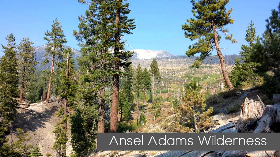
Day Hiking Near Reds Meadow / Devils Postpile National Monument or Backpacking Ansel Adams and John Muir Wilderness
- Agnew Meadow Wildflower Trailhead – This short nature trail through meadow habitat gives the opportunity to see many plant species.
- Beck Lake Trail – This trail goes to some little know places, like Lost Dog and Noname Lake, as well as going to Beck Lakes. From Shuttle stop #6 in front of the Devils Postpile Visitor Center it is less that a mile to the junction with the John Muir Trail. A bridge across the river leads to several trail junctions. Above Minaret Falls the Beck Lake trail separates from Minaret Lake and John Muir trails with the Beck Lake trail staying south of Red Top Mountain. This trail also gives access to Superior and Holcomb Lakes. Beck Lake trail does not continue onto the John Muir or Pacific Crest trails. Common Destinations: Superior Lake, Beck Lakes, loop to Fern Lake and Snow Canyon.
- Fern Lake Trail – The Fern Lake trail follows Snow Canyon toward King’s Creek and Summit Meadow on the way to Fern and Anona Lakes. Start from Shuttle stop #6 in front of the Devils Postpile Visitor Center it’s less that a mile to the junction with a bridge across the river where you leave the John Muir Trail. Trips going to Beck Lake or Minaret Falls have different trail designations and quotas. Fern Lake trail does not include trips that will continue on the John Muir Trail. Common Destinations: Fern Lake, Anona Lake, loop to Beck Lake trail or go west via Summit Meadow and Granite Stairway into Sierra National Forest to Bench Canyon or Isberg Pass.
- Fish Creek Trail– Following the general route of an old wagon trail, the Fish Creek Trail starts near Reds Meadow Resort, shuttle stop # 10 or the Rainbow Falls trailhead shuttle stop #8. The trail passes multiple junctions with the John Muir, Devils Postpile and Rainbow Falls trails. The Fish Creek trail follows Crater Creek to the Fish Creek Valley. Eleven miles down the trail is the popular Iva Belle hot springs. Beyond Iva Bell, the trail continues to Cascade Valley and eventually connects to the John Muir and Pacific Crest Trails near Purple Lake or Tully Hole. Common Destinations: Iva Bell, Island Crossing, Fish Creek Valley and points beyond.
- High Trail – The High Trail starts from the Agnew Meadows (shuttle bus stop #1). Instead of crossing Agnew Meadow, the trail climbs partway up the east side of the canyon. There are magnificent views across the valley of the Minarets, Mount Ritter and Banner Peak as the trail contours along the slope to the headwaters of the San Joaquin River. Several trail junctions give options to travel to Summit Lake, Agnew Pass, Clark Lakes, or Badger Lakes. The High Trail is also part of the Pacific Crest Trail. If you continue on the Pacific Crest Trail you will connect with the John Muir Trail near Thousand Island Lake. Common Destinations: Pacific Crest Trail (northbound), John Muir Trail (northbound), Thousand Island Lake loop.
- John Muir Trail – North of Devils Postpile– Journeying the length of the Sierra, the John Muir Trail extends from Mount Whitney to Yosemite National Park. This entry point is starting at Devils Postpile National Monument going north (toward Yosemite). From the Devils Postpile Visitor Center (shuttle stop #6) it is less than a mile to the junction with the John Muir Trail. As you follow the John Muir Trail above Minaret Falls and goes past Johnston Lake, Trinity Lakes and Gladys Lake. It is possible to go all the way to Happy Isles in Yosemite.
- John Muir Trail – South of Devils Postpile – Journeying the length of the Sierra, the John Muir Trail extends from Mount Whitney to Yosemite National Park. This entry point is for the section of John Muir trail is South of Devils Postpile. Start from the Devils Postpile Visitor Center (shuttle stop #6) if you want to see the stone columns of Devils Postpile. Or you can start your trip from the Rainbow Falls trailhead (shuttle stop #8) or Reds Meadow Resort (shuttle stop #10) if you want to visit the market or other resort services. When requesting a permit, indicate if you are going to Mt. Whitney as there is a secondary quota for exit at Mt. Whitney.
- Minaret Lake Trail – Glacier-fed Minaret Lakes are at the foot of the Minaret Pinnacles in the Ritter Range. From the Devils Postpile Visitor Center (shuttle stop #6) it is less than a mile to the bridge across the river and several trail junctions. Above Minaret Falls near Johnston Meadow the Minaret Lake trail seperates from the John Muir trail to follow Minaret Creek. Common Destinations: Johnston Meadow, Minaret Creek, Minaret Lake and points beyond
- Rainbow Falls Trailhead – This sunny and open, moderate hike leads to spectacular views of Rainbow Falls. The waterfall often has a rainbow in the mist from the falls and is a popular day hike or destination for horseback rides. Backpackers with permits for Fish Creek trail may choose to start their trip from Rainbow Falls Trailhead.
- River Trail – Explore the headwaters of the Middle Fork of the San Joaquin River by following the River Trail to Thousand Island Lake. Starting from Agnew Meadows, shuttle bus stop #1, the River Trail and Shadow Creek Trail are combined for the first 3 miles, where the Shadow Creek trail splits off to go past Shadow Lake. The River Trail stays in the valley to follow the San Joaquin River to its headwaters. Before Thousand Island Lake several trail junctions give the option to join the Pacific Crest and John Muir Trails.
- Shadow Creek Trail – The Shadow Creek trail travels past glacier-fed lakes and icy streams at the base of the Minarets and Mount Ritter. The trail starts at Agnew Meadows (shuttle bus stop #1). For the first three miles to Olaine Lake, the Shadow and River Trails are combined. At the trail junction where River Trail follows the San Joaquin River, the Shadow Creek Trail turns up Shadow Creek to climb past Shadow Lake and connect with the John Muir Trail. Hikers can go north or south on the John Muir Trail or continue up Shadow Creek to Ediza and Iceberg Lakes. Common Destinations: Ediza Lake, Iceberg Lake, John Muir Trail, Thousand Island Lake loop.
- Sotcher Lake Trailhead – Sotcher Lake trail gives access to this day use area and Reds Meadow. Camping in this area is limited to campgrounds. If you are beginning a backpacking trip, check the area map for trail names.
Wilderness Permits – Planning Your Trip
While planning your wilderness trip, please note that activities like backpacking, hiking, skiing, mountaineering, and horse camping are allowed. Motorized or mechanical activities like drones or bicycles are not allowed in wilderness.
There are maintained trails through the area to hike on, but no developed campground facilities. Campsites are not assigned. Follow Leave No Trace principles when selecting a wilderness campsite. Groups are limited to 15 people or less, in order to preserve the solitude and tranquility of the backcountry. If you will travel into the neighboring national parks, you may be limited to a smaller group.
When you sign a permit as group leader you are agreeing to abide by all laws, rules and regulations that apply to the area and accept responsibility for your group to do likewise.
The first principle of Leave No Trace is to plan ahead and prepare. Learn the rules & regulations for the area you’ll visit.
Quotas
Various quota or limitations may apply depending on your trip scenario. Quota that limit the number of visitors are intended to allow for recreation use at levels that are ecologically sustainable by limiting the number of people that can start on a trail the same day.
For example, a trail with a quota of 20 would allow several groups to start throughout the day with a cap of 20 people total. Specific quota are listed in Trail Names & Quotas. Refer to the rules page for more quota details.
How to Reserve a Permit
Our permits are reserved on the website www.recreation.gov. On their home page search “Inyo National Forest – Wilderness Permits” to explore available permits or search “Mt Whitney” to find Mt Whitney day-use and Mt Whitney Trail* overnight permits.
*Note that Mt. Whitney Trail does not include overnight trips on the Mountaineers route or East Face climbing routes. Reserve the North Fork of Lone Pine Creek overnight permit found under Inyo National Forest – Wilderness Permits. The Wizard “Which Permit Do I Need” may help you identify the correct permit for trips that include Mt Whitney.
When selecting quota you are reserving a specific date and location to start your trip. Your reservation will only be valid to start on that date and trail. For a description of where a trail goes click on the trail name. To book a permit select quota from the grid by clicking on the number corresponding to your desired trail and entry date. Our quota is based on the entry date alone, you do not need to select quota for every day of the trip.

Leave a Reply