Plumas National Forest – In the Feather River Basin of Northern California, water and natural resources rule the landscape. Ans as one travels along Highway 70 towards the Scenic river canyon 70 will converge with HWY 89 again with a route north to Lake Almanor and Lassen Volcanic scenic Byway. the early part of this route is referred to as the Indian Valley.
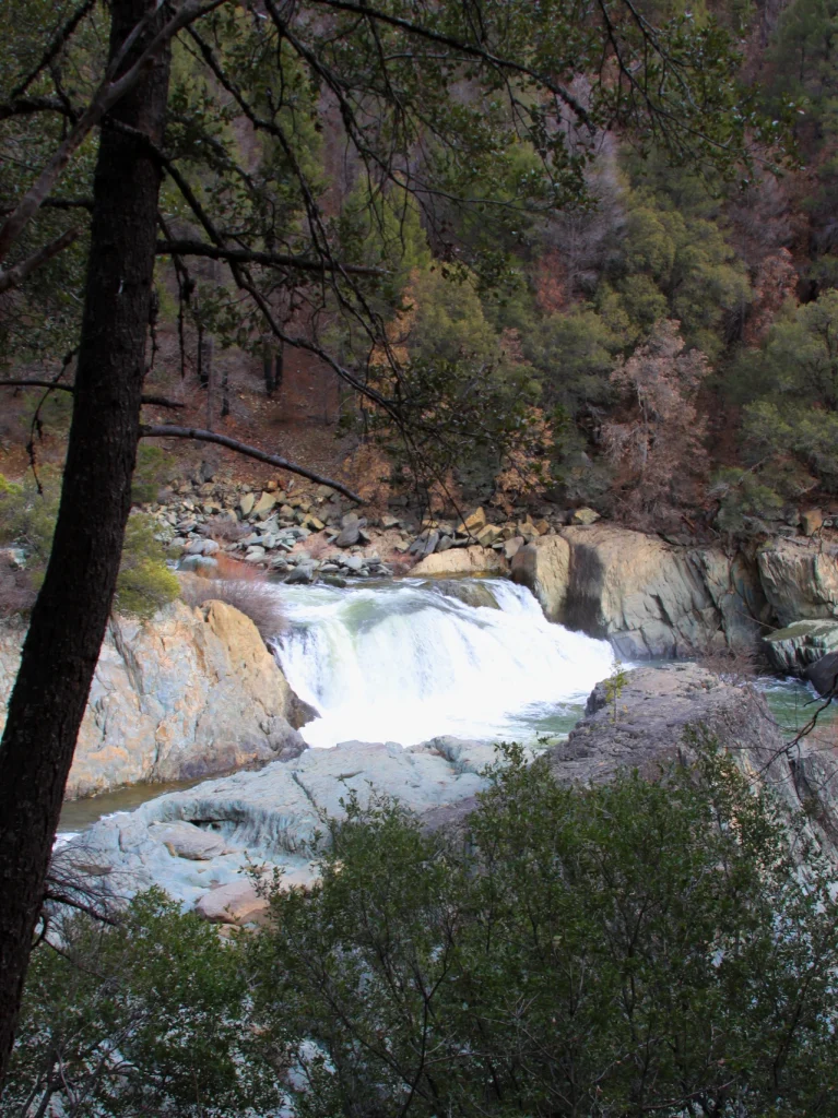
The Indian Valley high alpine meadow is the headwaters of Indian Creek. A scenic and vital part of the community and all that it offers. Between Highway 70 and Indian Valley there is a little hidden Waterfall worth your time on your next visit. Indian falls will not impress you with its massive drop or girth. But the character of this water fall and the landscape that shapes it is quite beautiful and relaxing.
In 2023 the forest surrounding the fall is much more embattled then I first visited this location in 2014. The Dixie fire claimed a large portion of the Black oak and Fir forest that blanketed the hillside. however I was please to discover on my stop the short (.3 mile) scenic path down the waterfall was not only saved but is flourishing still after the fire.
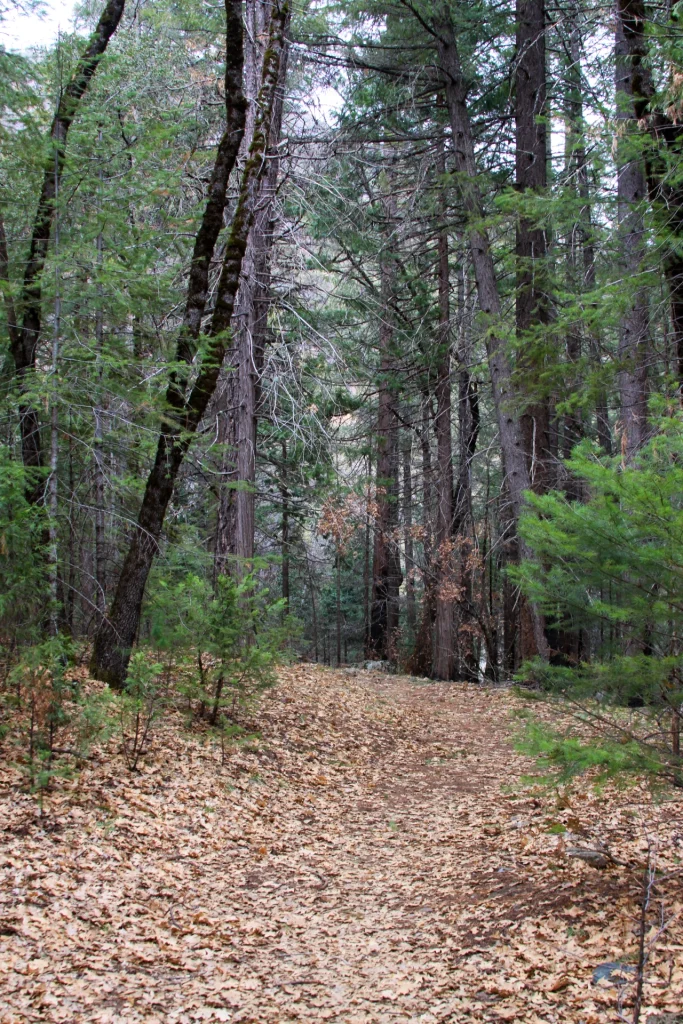
First time visitors to the falls will find a small dirt lot on the East side of the highway tuck away under a short down ramp driveway. The trail sign pays homage tot the Indian heritage of the area and acts as a beacon to the trails beginning. The fir and oak lined trail is often covered in oak leaves and a large Douglas Fir planted over 100 years ago after deforestation in the area stands as a monument of this areas past history and determination of survival.
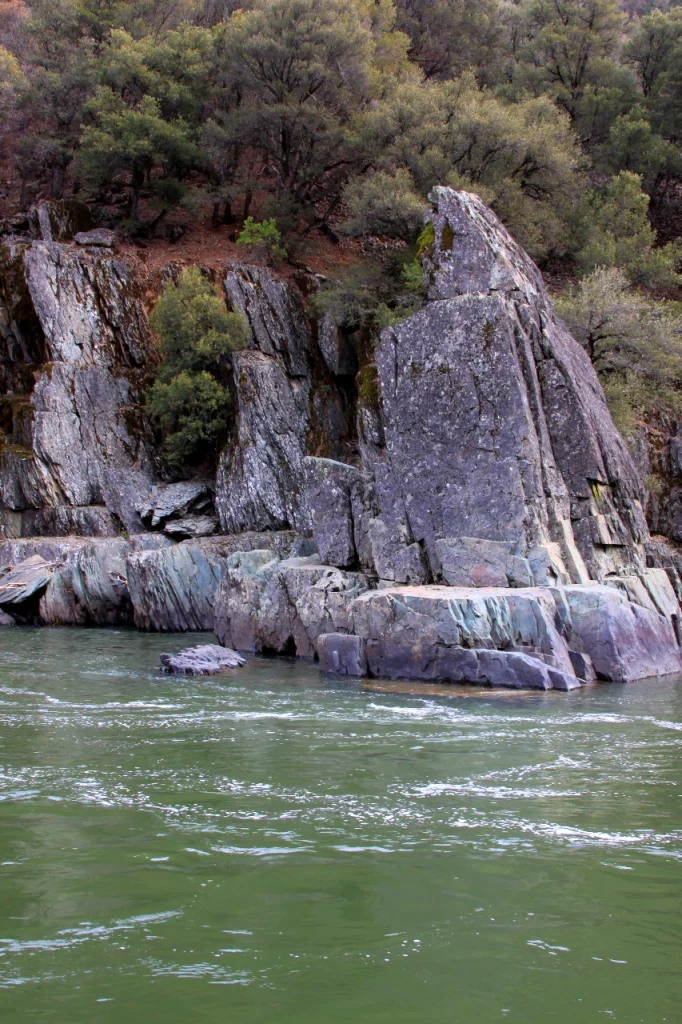
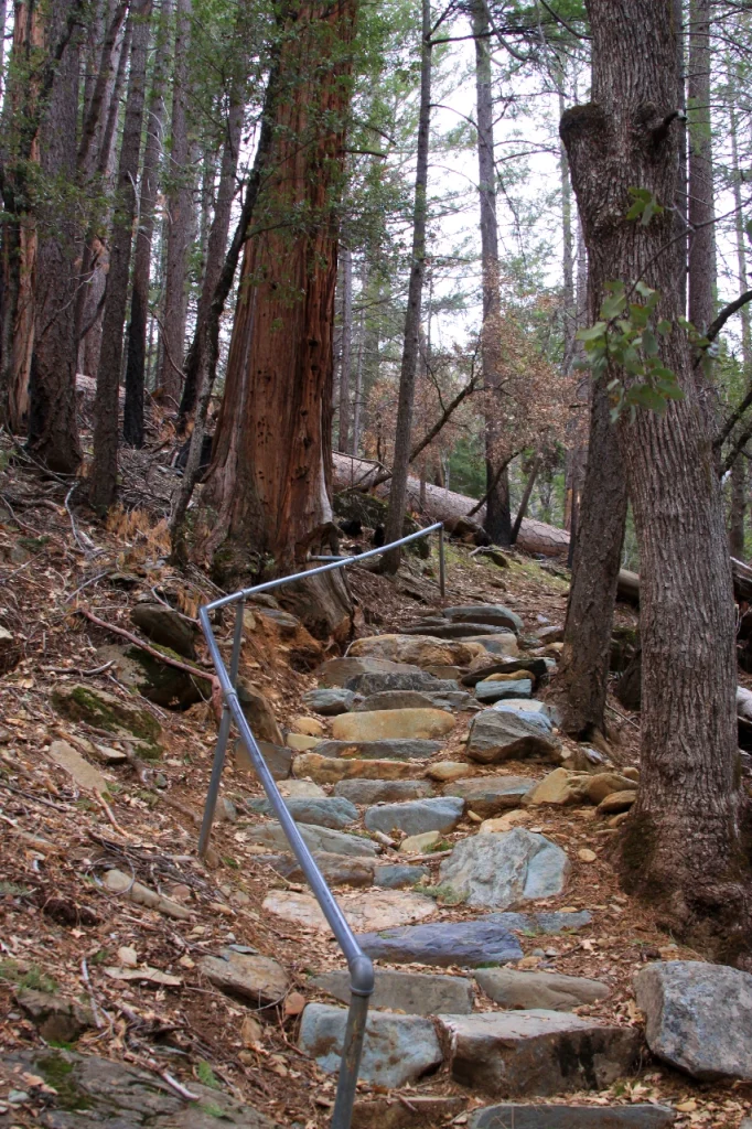
First glimpse of the water fall can be seen shortly after when the downhill trail comes to a park bench with a vista view of the fall. a nice phot spot, the bench is better used on the way back up. Although some will turn around here we encourage you to travel the extra 25 years down the rock stair case to a rock and sand beach area just past the tree line. The shore of the Indian creek below the fall is filled with large rock and sandy beach, perfect for an afternoon picnic on your travels.
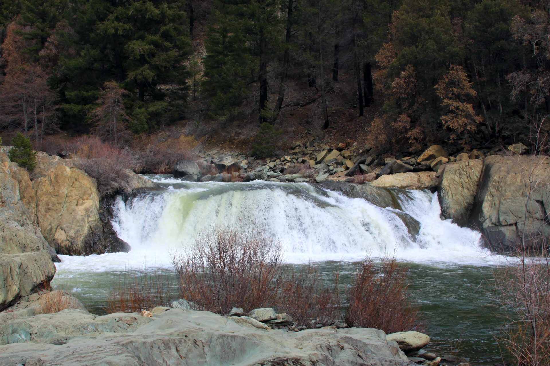
Although there always inherit dangers in climbing on rock faces near a rushing river ethe granite rocks provide ample opportunity to explore different angles of the raging little giant as it plunges forward in what looks like maybe a 20 foot fall.
I have never scene a kayaker attempt this fall but I always think, that it looks very much like a place that a confident kayaker might just go for it as he traversed the river. After the fall the river widens into a deep pool and I envision that gold miners once used dredges hear to dig a deeper hole around the granite in search for gold. The waters of Indian creek will flow into the Feather river just a mile or two down the road in an area well known as federal gold mining district.
On this visit as I did mourn the lush forest landscape a bit at the top of the trail I could almost completely forget about the fire from the shores of the river. As if this little oasis was saved just for its next visitors amongst all the destruction that the dixie fire brought.
On your next visit down Highway 89 from Chester Ca. or up from Quincy or Lake Oroville on Highway 70, take a few minutes on your journey and walk down the slope to see Indian falls. It is well worth the visit.


Leave a Reply