Living in the Carson Valley, it is often easy to overlook the natural play ground that exist out my back door while looking high into the Sierra. But I would be missing many great trail memories if it was not fo rthe excelent trail options that exist for us her in the Valley.
Visitors and locals a like are welcomed to the foot hills of the Sierra and Pine nut mountain on some of the finest multi use trail in the Sierra through the Carson Valley Trail Systems. The Carson Valley trail system now supports 68 miles of Multi Use trails in the Carson Valley that range from the Tahoe rim trial down to the Valley floor and across the East valley slopes near the pine nuts.
We at Sierra Rec Magazine call these trails our base camp adventures. If you are visiting and like to hike, don’t miss the opportunity to hit the dirt on one of these great trails
A Guide to Carson Valley Trails
The Genoa Trail System
The Genoa Trail System – The Genoa Trail System is 16 miles of trails in the Genoa area open to hikers, equestrians, mountain bikes and dogs. Trail names include the Genoa Loop, Eagle Ridge Loop, Sierra Canyon Trail and Discovery Trail. The Discovery Trail is the same trail as the upper section of both loops. The lower section of both loops follows public roads in and near the town of Genoa. For an even longer loop, users can traverse the entire Discovery Trail and loop down through Genoa for a 10-mile round-trip hike.
Discovery Trail:
The Discovery Trail is 5.4 miles long with a north terminus at Eagle Ridge Trailhead. The south terminus is currently just a spot on the Genoa Loop, 2 miles above the Genoa Canyon access point at the uppermost switchback. At this location, the trail may continue further south at a future time connecting to Pine Basin. Continuing down the Genoa Loop to Genoa Canyon will add an additional 2 miles. Returning to the Eagle Ridge Trailhead can occur by following roads through Genoa, along Jacks Valley Road and back up Eagle Ridge Road for a 10 mile loop hike.
Sierra Canyon Trail:
The Sierra Canyon Trail connects to the Tahoe Rim Trail west of Genoa Peak and is close to 10 miles long one-way with nearly 4,000 feet of elevation gain. The lower end begins from the Sierra Canyon access point at the junction of Centennial Drive and Snowshoe Lane. Parking is designated on the east side of Centennial Drive across from Snowshoe Lane. A second option is to begin from the Eagle Ridge Trailhead which is about the same distance to the Tahoe Rim Trail, but 250 feet less elevation to climb. Keep in mind that views of Lake Tahoe are about another mile north or south on the Tahoe Rim Trail. If going to Genoa Peak, it’s another mile of hiking and 700 feet elevation gain, so yeah, it’s a long ways.
Anyone planning a round trip hike to the Tahoe Rim Trail should be prepared for a long day, nearly 20 miles round-trip and substantial elevation changes. A much less strenuous alternative is to carpool and begin your trip from either the Kingsbury North Trailhead or South Spooner Summit Trailhead on the Tahoe Rim Trail. A one-way trip to either the Eagle Ridge Trailhead or Sierra Canyon Trailhead is approximately 15 miles from the Kingsbury North Trailhead or 16 miles from the South Spooner Trailhead.

Genoa Loop:
The Genoa Loop is 8.2 miles long. The lower 1.4 miles of this loop goes through the town of Genoa, following the roads between the Sierra Canyon and Genoa Canyon access points. Those wanting to shuttle vehicles between the two access points would have a 6.8 mile hike. Parking is available just about anywhere on the Genoa streets such as near Genoa Park and Mormon Station State Historic Park. The least strenuous direction to do the loop by bike or foot is likely counterclockwise starting in Sierra Canyon (or alternatively from the Eagle Ridge Trailhead).
Eagle Ridge Loop:
This loop is 6.2 miles long, however the lower 2.2 miles of this follows the graveled Centennial Drive down to Jacks Valley Road, then north on Jacks Valley Road and back up Eagle Ridge Road to the Eagle Ridge Trailhead. This loop has the least amount of snow during winter months. If you just want to travel the 4-mile trail portion between the trailheads, you can shuttle vehicles.
For those wanting a very short 1.5-mile loop with nice views, one can park at the Eagle Ridge Trailhead and walk a combination of old road and constructed trail segments.
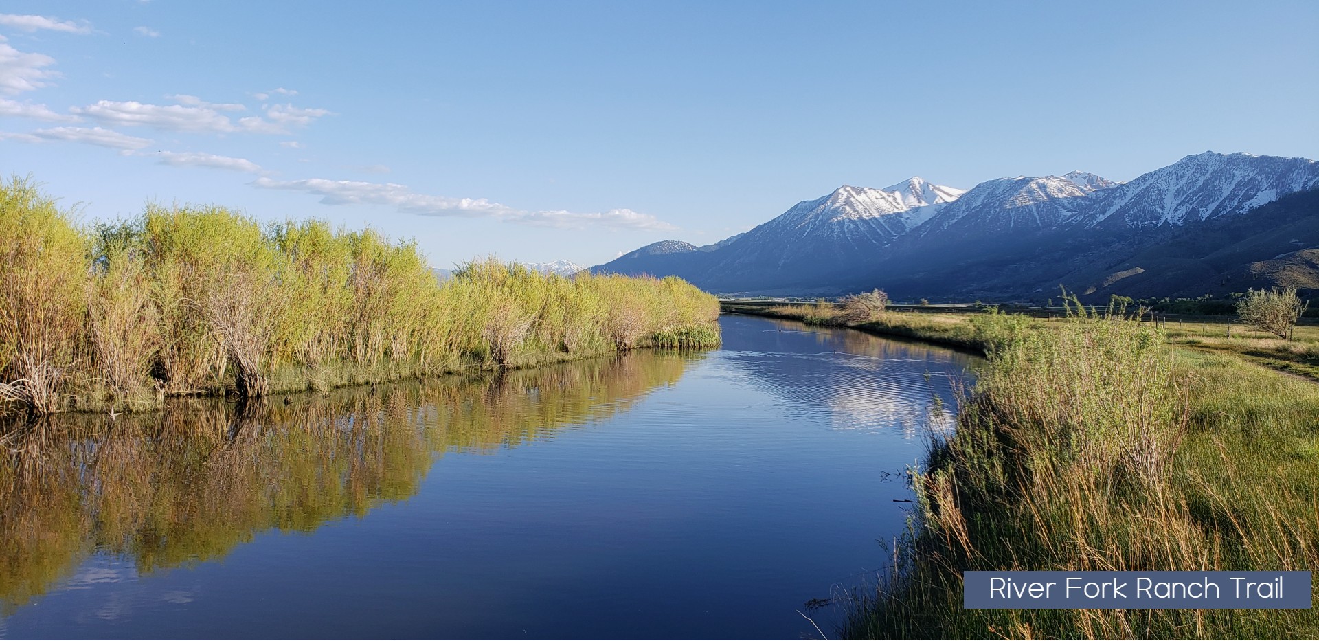
River Fork Ranch Trails:
Two flat trails are located at The Nature Conservancy’s River Fork Ranch located about one mile east of Genoa on Genoa Lane. No dogs are allowed here. The East Brockliss Loop is a 0.7 mile, nearly flat, natural surface trail with two short 24” wide boardwalks over water part of spring.
The West Fork Trail is a 2-mile long, flat and wide trail also used as a ranch road that connects Genoa Lane and Muller Lane. Both trails are considered easy hikes with excellent panorama views of the Carson Range.
Genoa Vista Trail:
This is an approximate 1.3-mile fairly level paved trail between the town of Genoa and David Walley’s Hot Spring Resort.
Fay-Luther / Jobs Peak Ranch Trail System
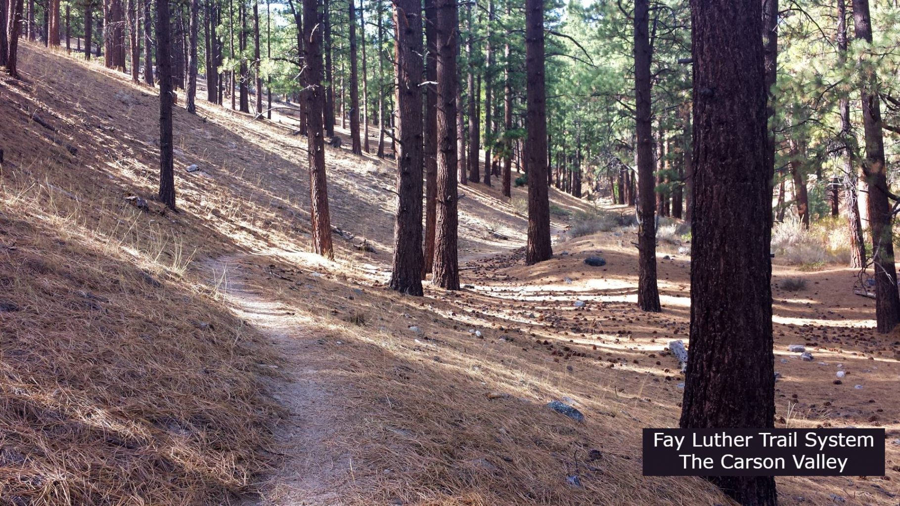
This trail system connects the Fay-Luther and Jobs Peak Ranch Trailheads which are 3.5 miles apart. There is a total of about 9 miles of loop and connector trails to choose from. The Interpretive Loop provides interpretive signs about the area. There is no trail access to Jobs Peak.
- Fay-Luther / Jobs Peak Ranch trail – 3.5 miles
- Valley View Loop- 1.7 miles
- Lonesome Trail – .6 miles
- Sandy Trail. 5 miles
- Interpretive Loop 1.3 miles
- Jeffery Pine trail . 3 miles
- Grand View Loop 1.1 miles
- Luther Creek Spur .2 miles
There are two General starting location for the fay Luther trail System. Starting at Sandy Trail head located on forest Service Land, has a general parking area large enough for Horse trails and plenty of Parking. After a short .5 mile hike along a very sandy and wide section of trail you will have access to all the loops and off shoots in the system.
The alternative starting location is Locates 2 miles up the road Jobs Peak Ranch Trailhead which allows you to hike the 3.5 mile section through private property segment and connects with trail system about mid point of the Sandy Trail.
The Clear Creek Trail system
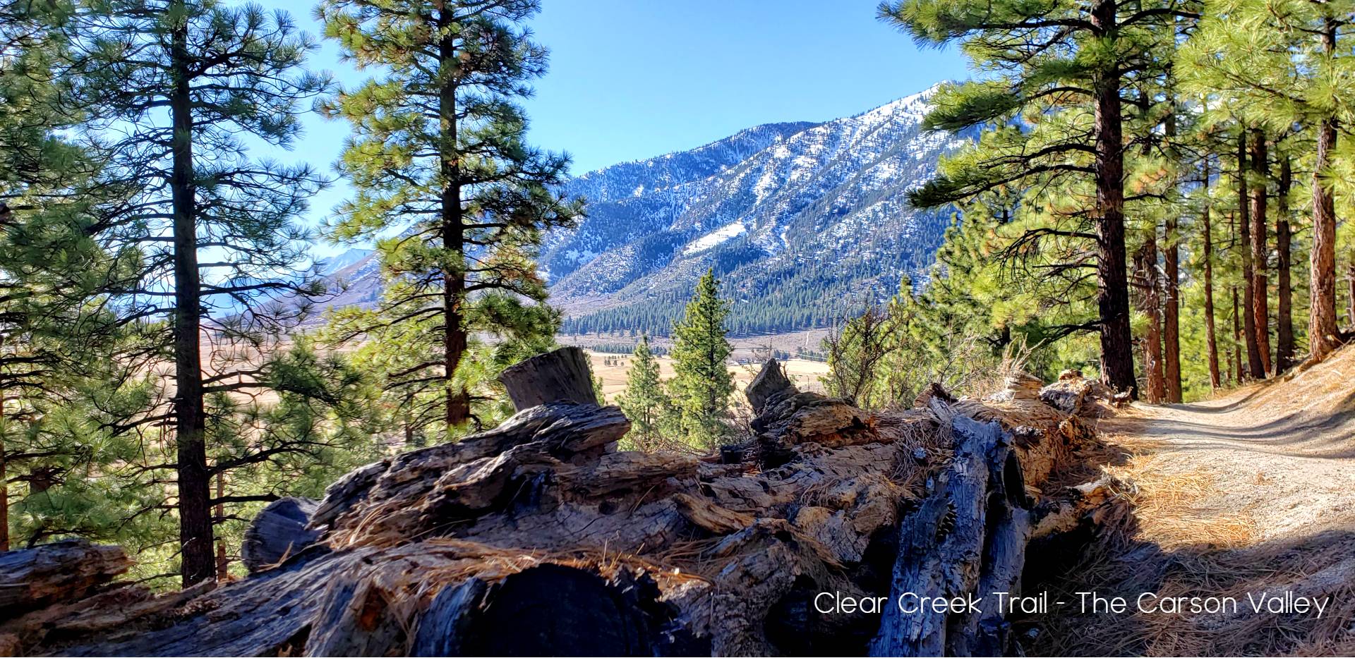
The Clear Creek Trail –The Clear Creek Trail is 15 miles long starting at either Jacks Valley Trailhead next to Jacks Valley Elementary School or Spooner South Trailhead. This trail is a partnership that traverses through U.S. Forest Service land, private land, Douglas County trail easements and a Nature Conservancy Conservation Easement.
The new additions of the Jacks Valley Loop and the James lee Park loops has added an additional 8-9 miles of trails options to the Clear creek trail network in 2023.
This trail is a great experience for hiking, biking, horseback and dogs.

The newest section of this trail system traverse from Spooner Summit down into the Carson Valley. similar to the Sierra Canyon trail which comes into Genoa, it is a natural connector to the Tahoe Rim trail. There have been discussions on how to connect this trail as well across High way 50 into Kings Canyon trail system in Carson City in the future.
Bently Heritage Trail
The Bentley Trail – Explore nearly 5 miles of hiking trail adjacent to the Carson River in the Carson Valley. The Nature Conservancy has partnered with the Carson Valley Trails Association, local Eagle Scouts, and the property owner to construct the hiking trail system.
Here, the Carson River winds its way in braided channels, supporting willows and wetlands that sustain many animals and migratory birds. The trail provides visitors with access to these natural areas and to amazing panoramic views.
Trail consists of three loops each adding distance to your hike, south loop, middle loop and north loop. This is a Hikers only trail. No Dogs, Horses Bikes etc. allowed on this trail.
- South Loop Approx. 2.3 miles
- Middle Loop Approx. 4.3 miles
- North Loop Approx. 4.7 miles
The Pinyon Trail

The Pinyon Trail – The Pinyon Trail is a 5-mile round-trip hike located about 7 miles east of Gardnerville. This trail is open to hikers, equestrians, mountain bikers and dogs. This trail project was funded and built by the Carson Valley Trails Association in partnership with the Bureau of Land Management and Douglas County. The Pinyon Trail features a 1.1 mile spur that connects with the Pinyon trail lop which climbs up along the rim of the mountain then scurries across the top and back over the ridge in a loop with fantastic views of both the Sierra to the West and the Pine Nuts to the East.
Other Local favorites not in the Carson Valley trail system officially.
Hot Springs Mountain trails
If you love the world of use trails and simple BLM regulations then Hotsprings Mountain might be what you are looking for. A Sage filled environment that is dotted with roads and day use trails built by regular use b the locals. Great for Hiking, biking, horseback, Dogs, UTV and motor bikes
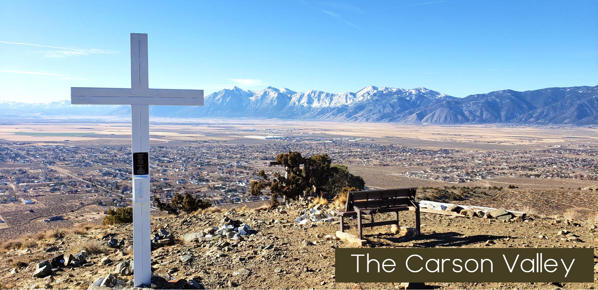
The Cross – a grueling short trek straight up a sandy path that is part road and part trail this hike features one of the best vista views in the Carson Valley, but it will give you a burn in the legs. – Located at the end of Stephanie drive on BLM access road, locals park at the road side pull off and hike up sandy road until is starts to climb up the side of the mountain to the cross. Great location for Sunrise Hikes.

Lower Hotsprings Mountain – Another day use area in the West side of the Mountain. So dotted through out this area are human use areas, recently we discovered a group of hikers are building a new trail that starts near the end of Vicky road and climbs up onto the foot hills of Hot springs mountain and traverses the better part of the West side of the ridge.
Pick a Gorge – Truth be told if you like to explore and adventure there are several dirt roads around Hot Springs mountain that end at the base and human use trails have been developed by hikers and motorcycles that travers up old washout canyons into the peaks. Pick a dirt road and follow it to the base. there probably is a trail waiting to be explored up the gorge.

Leave a Reply