Looking to book a trip on the JMT? Planning is crucial for all access to the JMT for backpacking. Permits are required and are tough to get based on the demand. Yosemite in the recent years has even instituted an Exit quota over Donahue pass and have cut back on individual passes for people entering the trial from alternative route inside the park.

Understand the Popular Trailheads
- Yosemite Trailheads (Happy Isles, Lyell Canyon) – One of the great things about the John Muir Trail is that you can start in Yosemite National Park, and get your permit for the whole trip. Here are some tips for getting the permit at Yosemite. First of all, set a reminder for yourself 24 weeks in advance, if possible. You may reserve a permit for $5.00 per person. The reservation is what costs you, the permit is free. If you are on a schedule, we suggest having the reservation. The reservation is not the permit. You have to show up in person to get the permit. The Yosemite Conservancy is the agency that makes reservations for trailheads in Yosemite National Park. http://www.yosemiteconservancy.org/wilderness-permits-details
- Mammoth Lakes Trailheads (Devil’s Postpile, Reds Meadow) – The agency regulating these trailheads is Inyo National Forest. A hike from Yosemite to Mammoth is a great week’s hike, whether from Yosemite Valley or Lyell Canyon, of course, one being about 60 miles, the other being 34 miles. The advantage is that adequate transportation is available by bus between Mammoth and Yosemite, so you don’t need two cars for the one way hike. There are several other trailheads that will meet up with the JMT, including Rush Creek, Shadow lake, Devil’s Postpile, Reds Meadow Resort, Mammoth Pass Trail, and Duck Lake Trail. The most direct are the Devil’s Postpile and Reds Meadow, since you can take the bus from Mammoth Ski Resort down to the trailhead. There is a Forest Service Information Station as you are driving into Mammoth, where you can pick up your permit.
- Edison Lake(Vermillion Valley Resort)and Muir Ranch Trailheads– The agency regulating these trailheads is Sierra National Forest http://www.fs.fed.us/r5/sierra/passes/getwildpermit.shtml The road to Vermillion Valley Resort has the reputation of being REALLY rough, and long. From the “resort” you can take a ferry to the end of Lake Edison, and the trail through Quail Meadows meets up with the JMT/PCT in about a mile, depending on the water level of the lake. This same road forks to head to Florence Lake, where you can hike 10 miles to Muir Trail Ranch to catch the JMT/PCT, or cut the distance in half by taking the ferry across the lake.
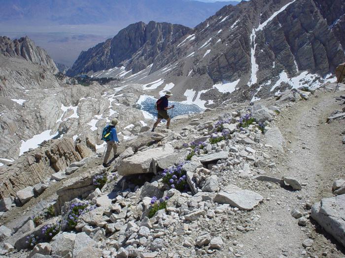
- Bishop Pass Trailheads – The agency for these trailheads is Inyo National Forest. The North lake/South Lake loop hike is one that is highly recommended by the rangers in INYO and it is in some spectacular country. The trail drops you right at the Ranger Station in beautiful Le Conte Canyon. If you continue north on this loop you will turn off the JMT at Piute Creek and head to North Lake.
- Onion Valley Trailhead (Kearsarge Pass)- The permit agency is Inyo National Forest. Leaving from Independence on the eastern Sierra, the Onion Valley Trailhead is a popular alternative to Whitney Portal as a means to get to the summit of Whitney. Others just like to camp at the trailhead to acclimate, as it is at 9200.’ This is a good place to have a resupply, as it is only 8 miles to reach the JMT from Onion Valley.
- Whitney Portal – There are some brave souls who will start here, and head north. There are limited permits available, and even though it is in the Inyo National Forest, it is a separate process. Details can be found at http://www.fs.fed.us/r5/inyo/recreation/wild/whitneyavail.shtml
Top Ten Most Popular Trails/ Destinations in JMT Country
- Mount Whitney – Mount Whitney Trail is a 20.9 mile heavily trafficked out and back trail located near Lone Pine, California that features a lake and is only recommended for very experienced adventurers. The trail is primarily used for hiking, camping, and backpacking and is best used from April until October.
- Big Pine Lakes– Big Pine Lakes Trail is a 15.2 mile heavily trafficked out and back trail located near Big Pine, California that features a lake and is rated as difficult. The trail offers a number of activity options and is best used from May until October. Dogs are also able to use this trail.
- Duck Pass and Pika Lake trail -Duck Pass and Pika Lake Trail is a 9.5 mile heavily trafficked out and back trail located near Mammoth Lakes, California that features a lake and is rated as difficult. The trail offers a number of activity options and is best used from July until October. Dogs and horses are also able to use this trail.
- Kearsarge Trail to Kearsarge Lakes – Kearsarge Pass Trail to Kearsarge Lakes is a 12 mile heavily trafficked out and back trail located near Independence, California that features a lake and is rated as difficult. The trail offers a number of activity options and is best used from April until October. Dogs are also able to use this trail.
- Rock Creek to Long Lake – Rock Creek to Long Lake Trail is a 4.5 mile heavily trafficked out and back trail located near Bishop, California that features a lake and is good for all skill levels. The trail offers a number of activity options and is best used from March until October. Dogs are also able to use this trail.
- Sherwin Lakes Trail – Sherwin Lakes Trail is a 4.4 mile heavily trafficked out and back trail located near Mammoth Lakes, California that features a lake and is rated as moderate. The trail is primarily used for hiking, camping, nature trips, and bird watching and is best used from April until September. Dogs are also able to use this trail.
- Bishop Pass trail – Bishop Pass Trail is a 10 mile heavily trafficked out and back trail located near Bishop, California that features a lake and is rated as difficult. The trail offers a number of activity options and is best used from May until October. Dogs and horses are also able to use this trail.
- Onion Valley to Flower Lake – Onion Valley Campground to Flower Lake is a 4.3 mile heavily trafficked out and back trail located near Independence, California that features a waterfall and is rated as moderate. The trail is primarily used for hiking, camping, and fishing and is best used from May until September.
- Lake Sabrina to Blue Lake – Lake Sabrina to Blue Lake Trail is a 6.2 mile heavily trafficked out and back trail located near Bishop, California that features a river and is rated as moderate. The trail offers a number of activity options and is best used from June until October. Dogs are also able to use this trail but must be kept on leash.
- Palisades Glacier Trail -Valentine Lake Trail via Sherwin Lakes Trail is a 11 mile heavily trafficked out and back trail located near Mammoth Lakes, California that features a lake and is rated as moderate. The trail offers a number of activity options and is best used from June until November. Dogs are also able to use this trail.
What’s your Reaction?
+1
+1
+1
+1
+1
+1
+1

Looking for info on lake mary clockwise 40 mile loop passing thru devils post pile mammoth area. Any suggestions or experiences?.
Gary,
No personal experience with this loop. Can i ask if you are planning to hike over Ducks pass then turn back north? Happy to look up some details with information i might have in data base or connect you with one of our readers.
Charlie.