
Deep in the Southern Sierra, the rusty granite and sand valleys of the Kern Valley give way to lush forests and Silver granite domes high in the Sierra along the Great Western Divide highway in Sequoia National Forest. It is here that we found our way into a day of discovery and adventure on a recent travel route through the South and West sides of the Sierra Nevada.
Trail Of 100 Giants In Sequoia National Forest
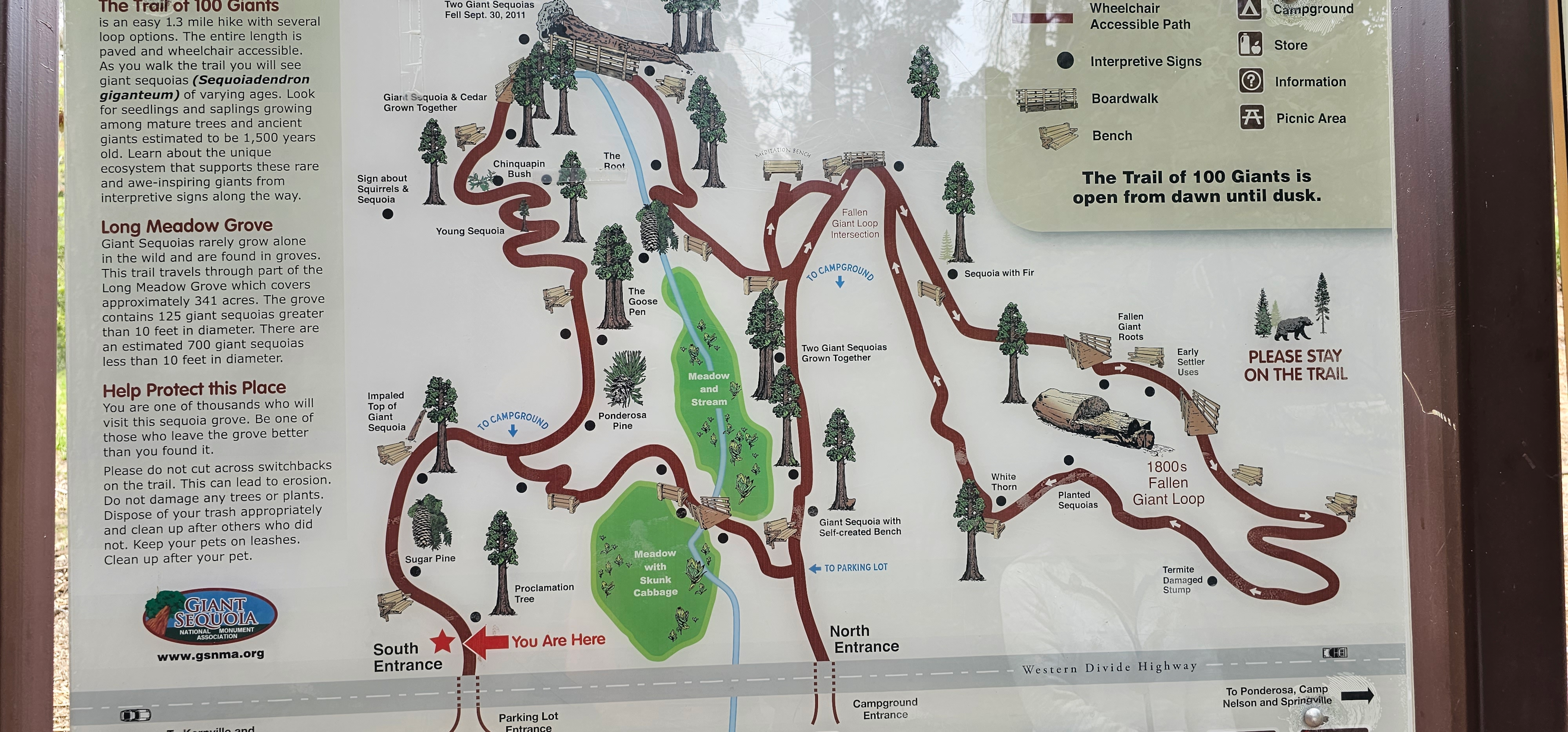
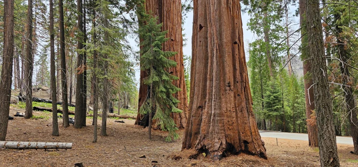
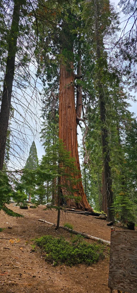
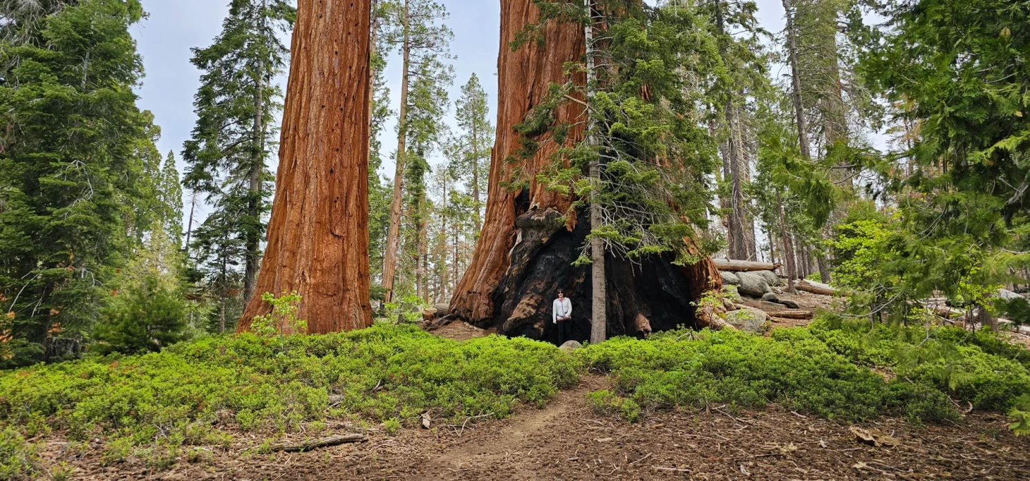
The Trail of 100 Giants was recognized as a National Monument on On April 15, 2000; President Bill J. Clinton proclaimed the establishment of the Giant Sequoia National Monument, making the proclamation announcement beneath one of the Proclamation tree at the Trail of 100 Giants. The grove contains approximately 125 giant sequoias greater than 10 feet in diameter and more than 700 giant sequoias less than 10 feet in diameter. The largest tree in the grove has a diameter of 20 feet and is 220 feet in height. The grove defined by the outermost giant sequoia trees covers 341 acres. It is estimated that the ages of larger giant sequoia trees in the grove are up to 1,500 years old.
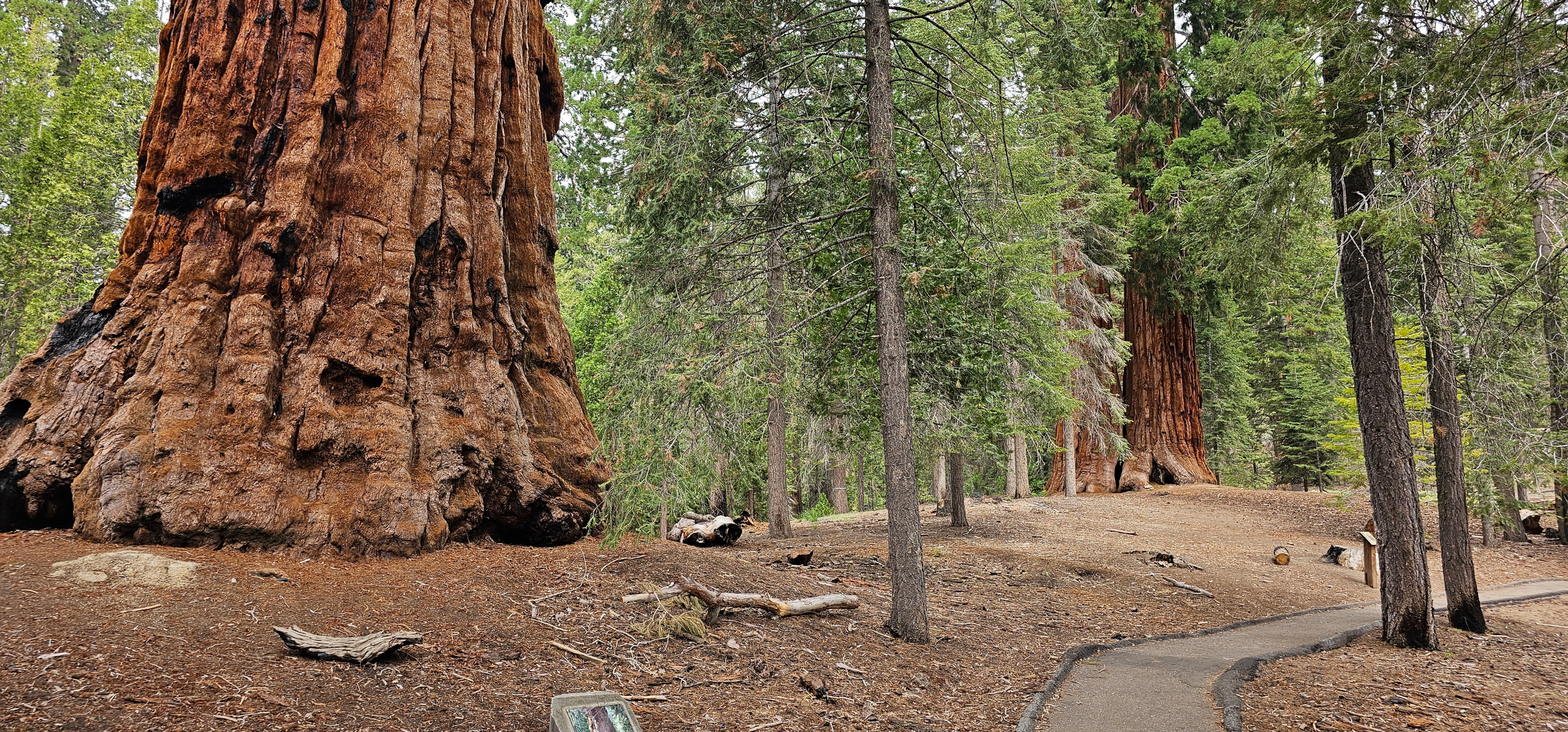
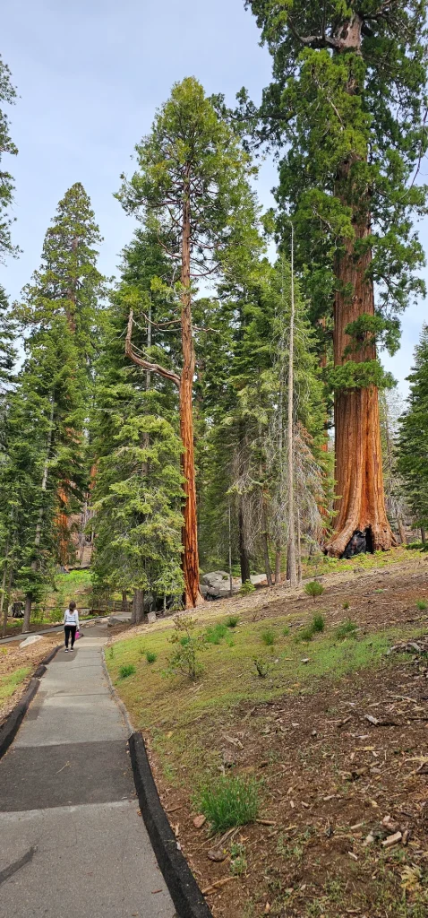
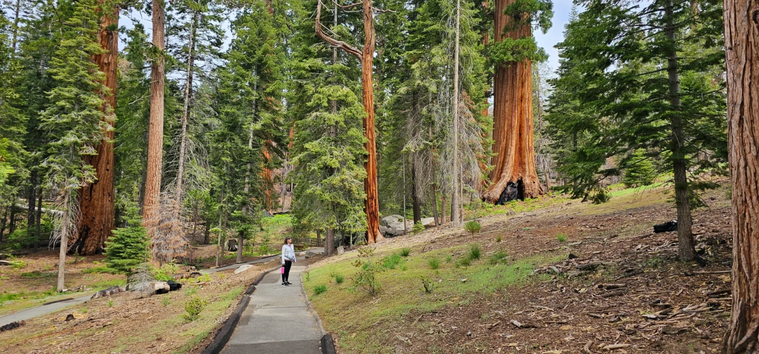
As a first-time visitor, I was pleased to find a paved pathway that gave me access to many of the biggest trees in the area. And an easy stroll in all directions we did find one trail closure near the back of the designated region where it looks like winter caused some damage.
A 1.3-mile paved trail has several loop options with interpretive signs for some of the highlights. Located on the Western Divide Highway (M 90), facilities include a paved parking area, restrooms, picnic area and Redwood Meadow Campground nearby. A $10.00 per vehicle fee is charged to help maintain and improve these facilities.
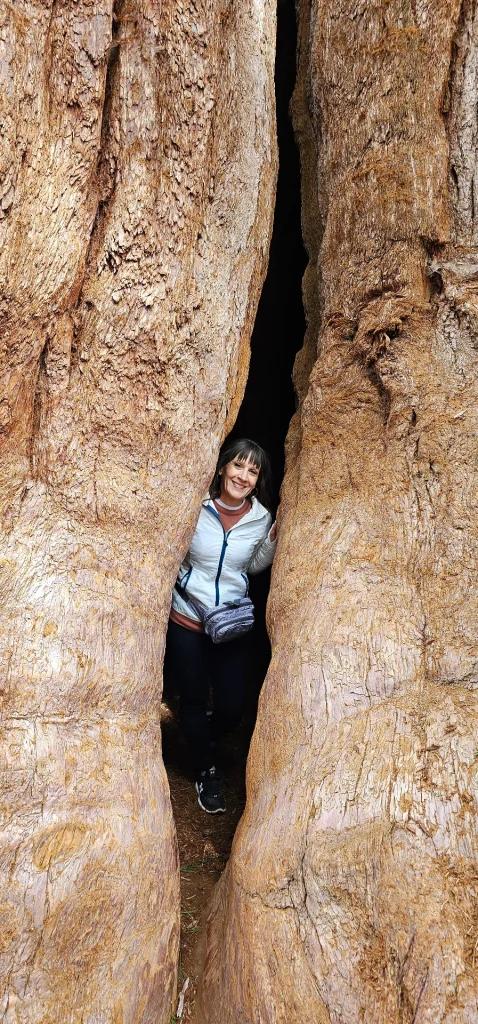
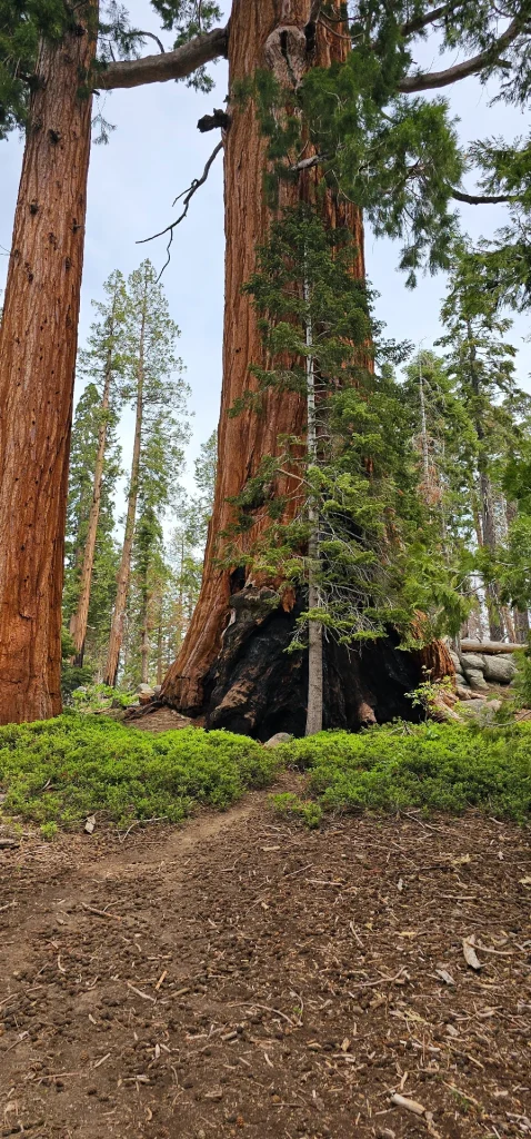
The first tree on the Trail is the Proclamation Tree. This is where President Bill Clinton made the proclamation on the monument in 2000. Just a little further up the trail to the left, you will find the goose pin tree. A popular tree for people to climb into features a small slot in the tree to leads to a cavern inside the tree. Continuing on the path you will discover the age difference of Sequoias and how to identify the various stages of life, the significance of the sugar pine tree in relation to Sequoias an the unique nature of groves and their relationships with the meadows and elevation that they grow in in the Sierra.
There are several noteworthy sequoias in this grove, including:
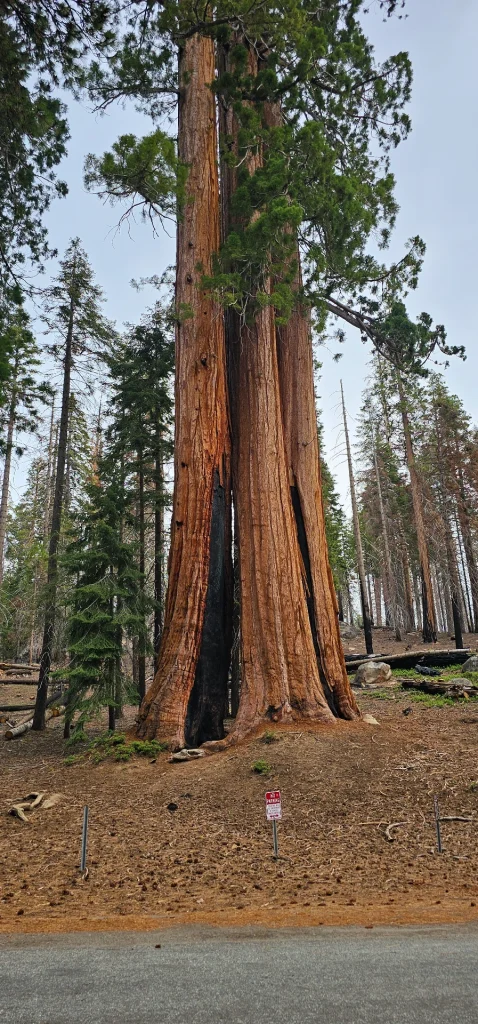
- Cedoia: a giant sequoia and a cedar tree growing together as one.
- Fallen Giant: a fallen giant sequoia that is slowly being reclaimed by the surrounding forest.
- Proclamation Tree: the tree under which then president Bill Clinton proclaimed the establishment of the Giant Sequoia National Monument on April 15, 2000.
- The Sentinels: a close circle of five giant sequoias growing together. This group is hard to see in 2023 as it is part of the closed section of trail.
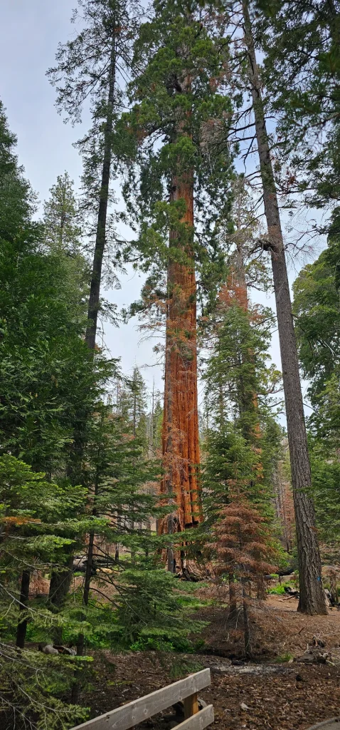
- Red Chief: one of the largest giant sequoias in the world with a volume of 28,723 cubic feet (813.3 m3). In 1986, Red Chief was measured at 220.6 feet tall and 20 feet in diameter at breast height. Red Chief is located in a logged area in the upper portion of the grove. There is no trail leading to the tree.
Long Meadow
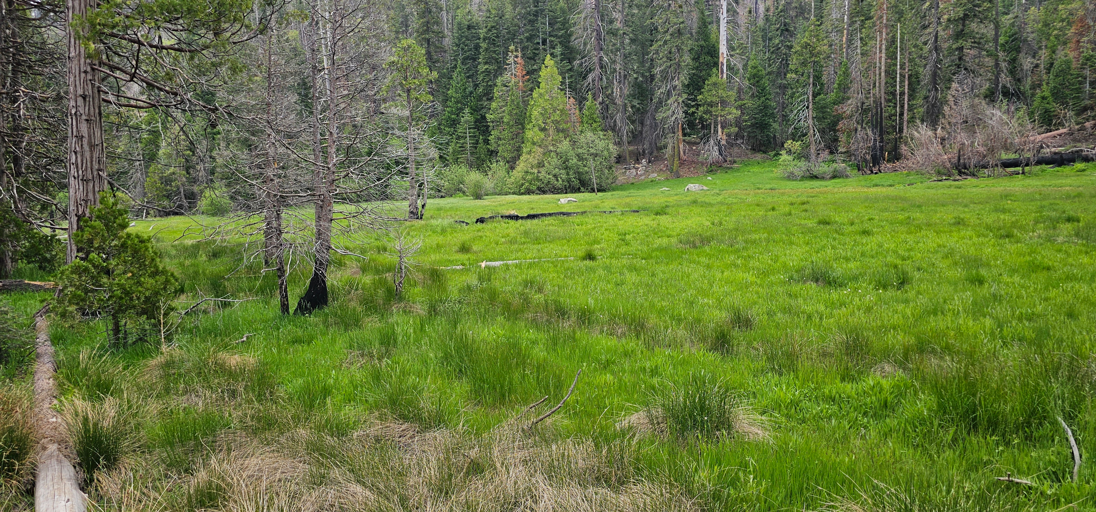
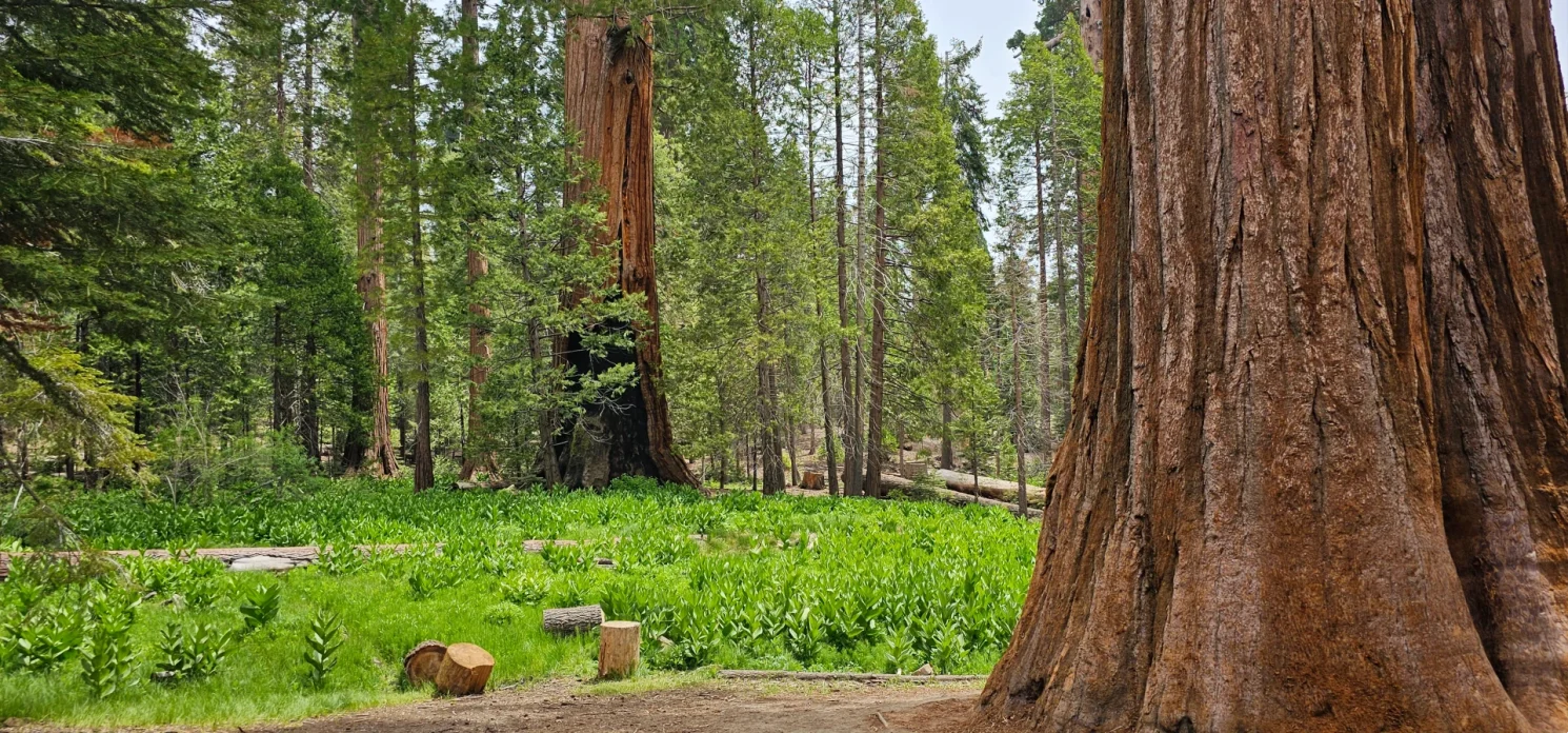
Long Meadow is featured near the Parking area across the road for the trail and intermingles with the grove on the bottom Northside of the grove path. Long Meadow Creek seasonally runs from here down the slopes into the Kern River basin. It is this meadow that highlights the other name for this scenic monument area, the Long Meadow Grove. There is a campground and day-use picnic area next to the meadow and parking area. There are pit toilets available but no trash service, so visitors are asked to carry out all trash on their visit.
Camping at Long Meadow Grove
Camping is available at the Trail of 100 Giants at two sites. Redwood Meadow Campground and the Long view Meadow group campground. The Group site for 36 people. Suitable for 16′ long RV’s; elevation 6,500 feet; toilet; No water; open May to October; supplies at Ponderosa Lodge and R-Ranch. By reservation only. Group site is $158 per night, and can hold a maximum of 36 people. Long Meadow Group Campground, 6,000 ft. elevation The facility contains six family units that can accommodate up to 36 people at one time. The site contains two single vault toilets. The parking, camping and roads are natural surfaces.
Redwood Campground, elevation 6,400 feet, is located east of Porterville, CA along county road M107 in the Giant Sequoia National Monument in the Western Divide Ranger District. It sits adjacent to the Long Meadow giant sequoia grove that contains the Trail of 100 Giants interpretive trail. There are 6 single family sites and, 6 yurts. The facility contains 2 double wooden vault toilets. The road and camping pads are paved. Yurt: $100/night Campsites: $32 night
Reservations are available six months in advance. Reservations for this campground can be made by visiting Recreation.gov. Reservations must be made three days ahead of arrival for the campsites and four days ahead of arrival for the yurt. Reservations can be made up to 6 months in advance.
Trail Of 100 Giants Highlights
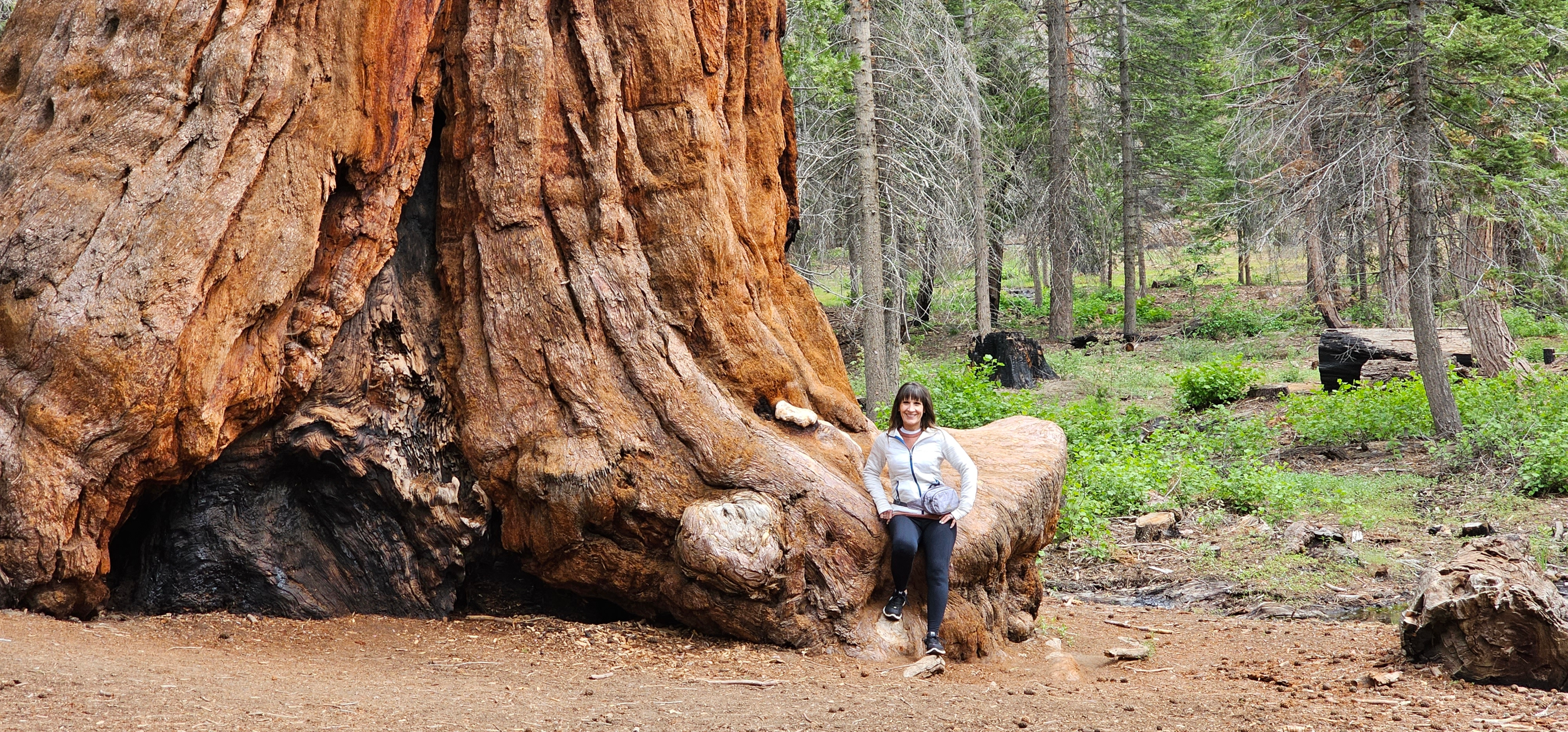
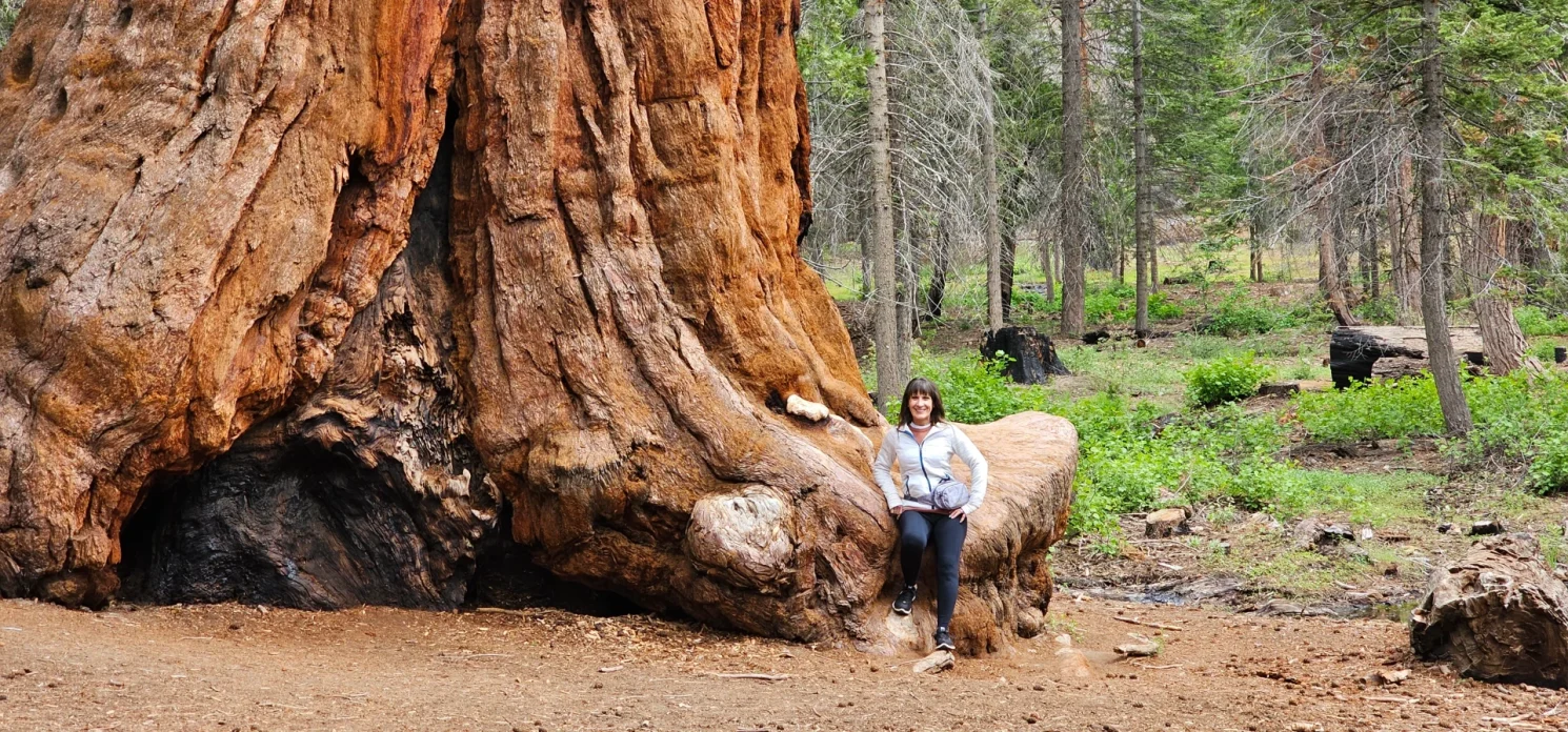
Personally, there are several highlight trees in this Grove. The Proclamation tree stood out immediately and a little further down towards the North there is a tree that has a natural bench growing on its base.
The Fallen Giant tree is huge, and seeing the tree start to get reestablished into the landscape is a cool visual.
Just below that tree is a segment of trail that passes by several large Giants, with wildflowers blooming and the woodpeckers and birds making music on our visit, I found myself sitting here on a bench for several minutes just taking in the Beauty of the region. This is a very family-friendly venue and has plenty of trees to experience and others to sit back and admire.
I did find a group of trees to the South of the grove trailhead up the road a couple of hundred yards, next to a cattle guard, a beautiful old tree with a split and hollowed-out base. It is worth a walk up to this point even though there is no shoulder to walk on, so be careful of traffic.

I also understand that there are several trees further back in the grove that are not accessible by trail; on another day I might have spent more time exploring, but on this day trip, the loop is all we had time to enjoy.
Fallen Sequoia Trees
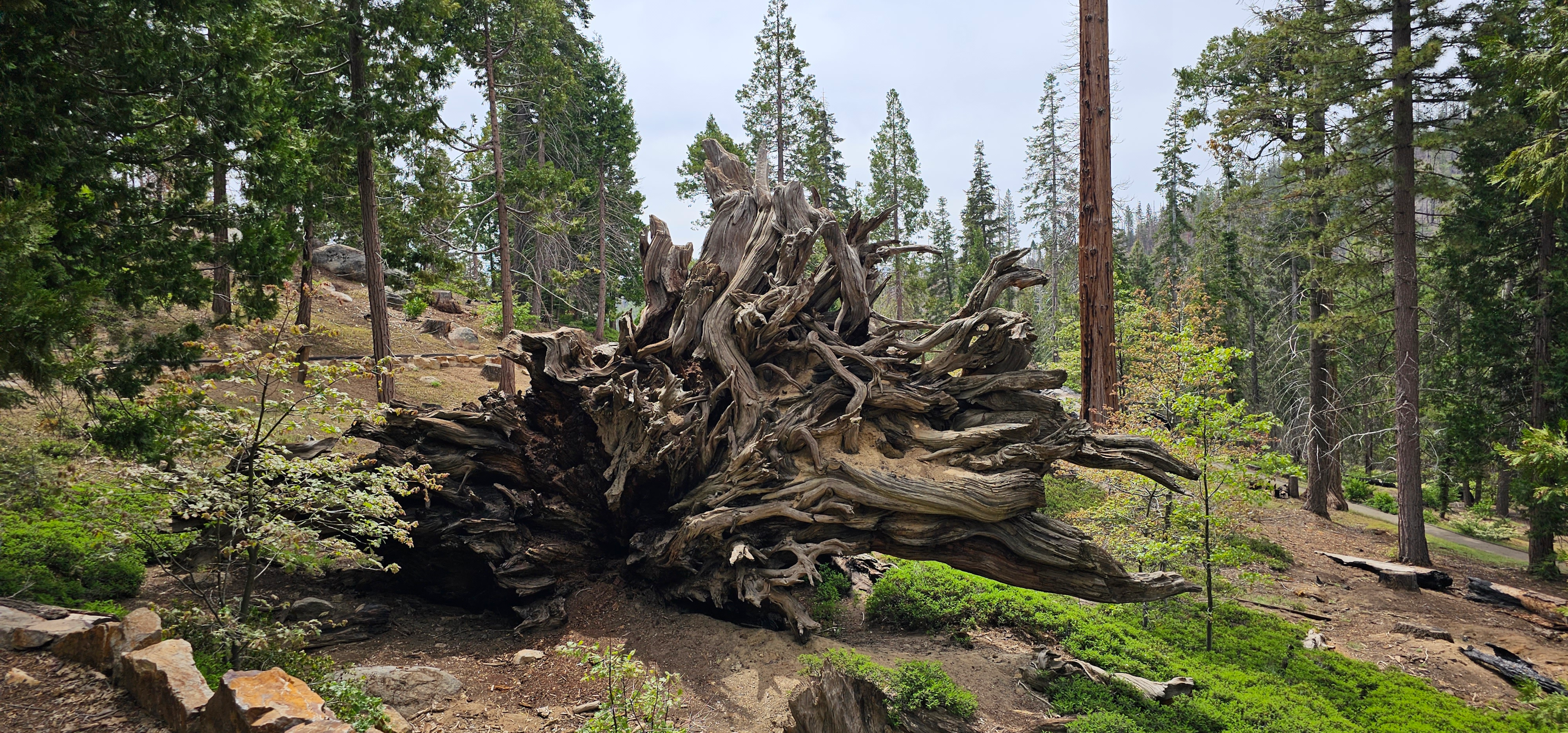
The monument has several Fallen Sequoia to see. The Giant Fallen tree is the most admired because of its size and access on the trail, but up by the Sentinel tree group, another large sequoia has fallen over the trail. Wind and fire events in the past ten years have fallen several of the Giant Sequoia trees in this grove.


The Great Western Divide Highway – Where is it? Where does it go?
The Great Western Divide Highway is located in the Southern Sierra 33 miles North of Kernville, near the small town of Johnsondale on the East side or California Hot Springs on the West side.
The Western Divide Highway (M107) travels the dramatic ridgeline that divides the Kern River watershed from the Tule River watershed. This 15-mile scenic route begins at Quaking Aspen Campground and ends at the junction with M50. From this road, access numerous giant sequoia groves, fire lookouts, fishing streams, and trails. The road is closed to passenger vehicles during the winter, due to snow, but many still enjoy the area for snow play, cross-country skiing, snowshoeing, and snowmobiling.
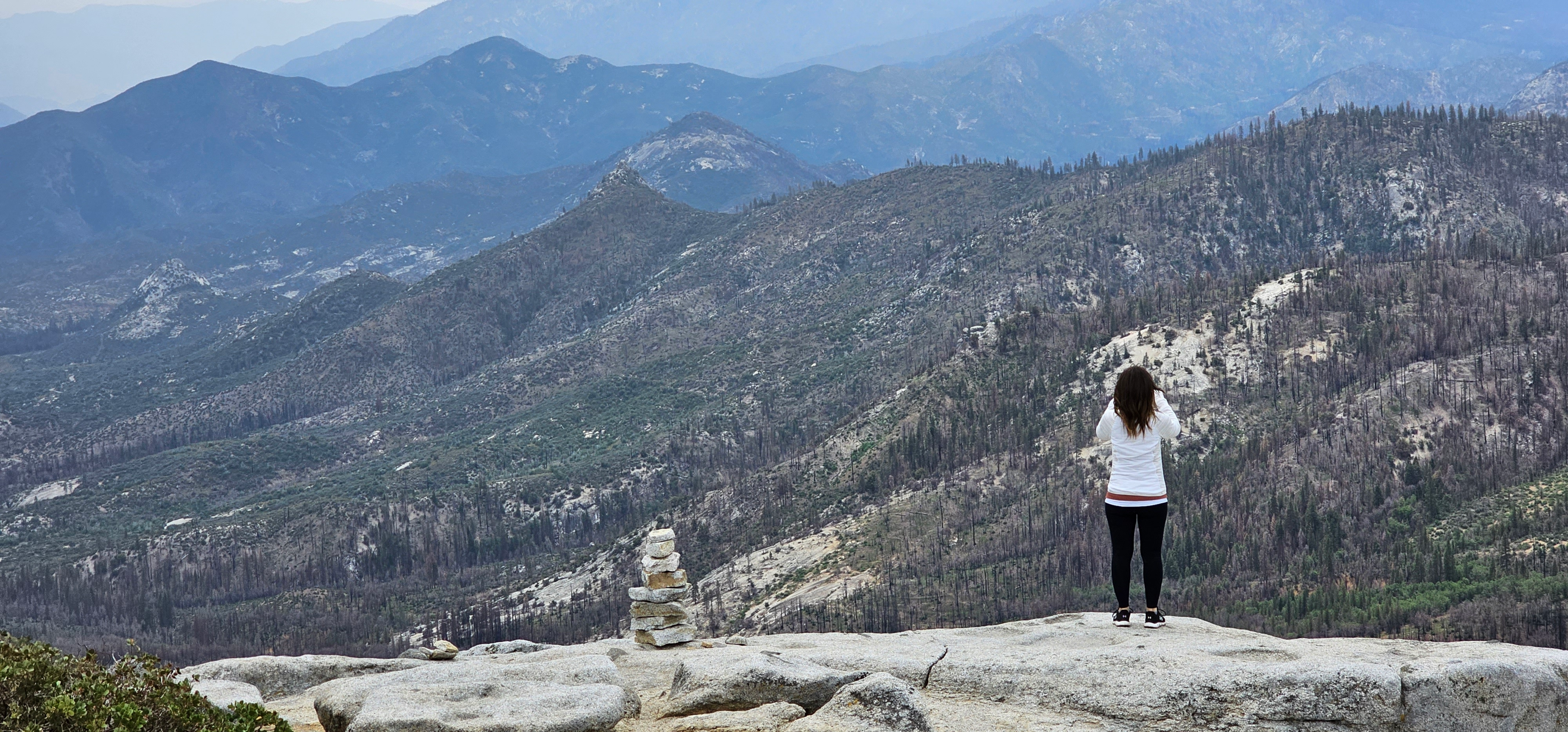
Other Feature Recreational hot spots on the Western Divide Highway include; Dome Rock, Nobe Young Falls, Needles Point Lookout. The views from Dome Rock are a cant miss excursion after enjoying the trail of 100 Giants. The dirt road in is not marked with signage so a little google maps or map study will do you well, but visually from the South it is pretty easy to identify and find the short dirt road back to the parking area. no services are available here and the Dome has no safety feature sin place so use caution and go prepared.
Sequoia National Forest
Sequoia National Forest is located in the southern Sierra Nevada mountains of California. The U.S. National Forest is named for the majestic Giant Sequoia trees which populate 38 distinct groves within the boundaries of the forest. Forest headquarters are located in Porterville, California. There are local ranger district offices in Dunlap, Kernville, Lake Isabella, and Springville.
There are six wilderness areas within Sequoia NF that are part of the National Wilderness Preservation System. Some of these extend into neighboring National Forests, as indicated. Two of them also extend into land that is managed by the Bureau of Land Management.
- Domeland Wilderness (partly BLM)
- Golden Trout Wilderness (mostly in Inyo NF)
- Jennie Lakes Wilderness
- Kiavah Wilderness (mostly BLM)
- Monarch Wilderness (partly in Sierra NF)
- South Sierra Wilderness (mostly in Inyo NF)
How to Get to the Trail of 100 Giants:
Travel to the Trail of 100 Giants recreational area can bring you from three different directions. Seasonal road closures are possible on all three.
From Kernville and Lake Isabella (South Route) – Travel 33 Miles out of Kernville up the Kern Canyon (M-50 route) through Johnsondale, this route is a two-lane road that follows the river until the Johnsondale bridge and then climbs quickly on a steep and corner driven drive up to the Western divide highway. This route is often closed in the Winter. The Scenic Value of this drive is spectacular. Plan a stop at the Johnsondale Bridge and enjoy the forest life that appears in the Johnsondale area during your visit.
From the Westside, you Travel on the M%6 out of Ducor, California, until shortly after California Hotsprings, where the road turns into the M-50, which again will have you climbing a steep route up the Sierra to the top and drop you down into the Western Divide highway and the Trail of 10o giants.
The Northern Route has travelers coming in on the I90 out of Portersville, California, before turning into the M-90 Western Divide Highway near the top at Quaker Aspen Campground and Forest Service Route 21S50. on this route, you would pass Dome Rock first before getting to the trail of 100 giants.
