
Mokelumne Wilderness – 2023- The Caples Lake Recreation area near Kirkwood Resort off Highway 88 is one of my go-to recreational areas living here in the Carson Valley. Emigrant Lake is an 8-mile outback trial hike exploring the Mokelumne Wilderness’s early boundaries directly south of Caples Lake. If you have never done this beautiful hike in the central Sierra, we highly recommend it as a bucket list hike if you like beautiful mountain lakes and a forest-covered trail.
I often choose this trail and lake for a weekend hike when looking for forest cover on a hot day or seeking early summer wildflower hikes, including a waterfall or lake.
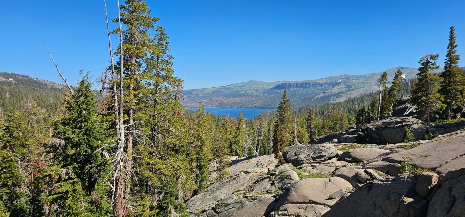
The trailhead at Caples Lake dam gives hikers, backpackers and daily fishermen easy access to the Wilderness and the backside of Caples Lake. Hikers will hike approx 2 miles along the backside of Caples Lake with very little elevation change, and then the final two miles are climbing up the canyon with a water crossing, waterfall viewing area and a variety of forest features from meadows, old-growth forest and granite outcroppings.

In July 2023, the question was about trail access and the quantity of snow on the trail. Our group arrived at 8:00 am to find parking at the primary parking area. This area would undoubtedly be filled by 9 am typically. A short climb up to lake level quickly has hikers entering Mokelumne wilderness. The trail in 2023 has a full display of small water crossings over the trail, which made the first 2 miles a little wet and buggy. We started up the canyon once we reached the Southeast side of Caples Lake. We quickly ran into several areas where the trail is water and mud for about half a mile, and then the trail hits snow in 2023.
The final 1.5 miles of the trail as of this past Saturday, July 15, 2023, there was 4-6 feet of snow on top of the trail consistently up to Emigrant Lake. Also challenging this year is the multiple seasonal creeks running in the Mokelumne wilderness can cause a navigation nightmare while trying to find the trail over snow drifts. Our group added an extra mile to our hike today by following a creek we believed to be the main flow from Emigrant Lake. After correcting our direction, we quickly crossed the snowpack back to the Waterfall area below Emigrant Lake.
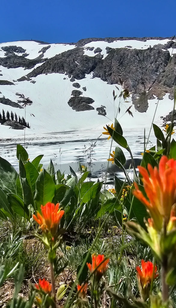
Approaching Emigrant Lake, we noticed in several areas that it sounded like we were maybe walking over running water, so being careful to stay higher to prevent any cave-in on snow bridges we could not see, we made it to the lake. We found the lake to be about 80% still covered in snow, with a well-defined avalanche debris field still on the snow on the south side of the lake. Five different waterfalls can be seen on the cliffs above the lake, and the shoreline on the north eastside had cold clear water for us to enjoy and attempt a July polar plunge.
The wildflowers on the East side of the lake are in full bloom, with Lupine, Indian paintbrush, Monkeyflower and Yarrow littering the hillside above the thawing water.
After a few plunges and a lunch, we were back on the snowpack, finding our route back. We passed several groups on the way up and were happy that we had the morning hike to ourselves. Stopping at Caples for a nice swim after the hike is another great plus of this hike, especially on a hot summer day.


Backpacking Emigrant Lake.
Emigrant Lake is a popular summer backpacking destination for backcountry fishing or individuals looking for a quick, quiet getaway near Kirkwood in the Mokelumne Wilderness. Fourth of July Lake or Winnemucca Lake on Carson Pass is more popular. Emigrant Lake is considered a self-sustaining brook trout fishery in California after fish plants stopped a few years back, after studies showed the lake had become a self-sustaining Brook trout population.
Backpackers must stay 300 feet away from the lake, so locations for camping are either upslope or down river for the lake. We found one small group backpacking and fishing the early season thaw on this visit.
Traveling over snow
If you are headed to emigrant lake this summer, you will cross snow for another 30-plus days. GPS tracking on apps like All Trails or Spot is recommended for first-time visitors unaware of which draw the lake is located in. We used a paper map and google maps to locate the correct direction once we were off the trail and dn ran into two ladies climbing up on our exit using All Trails and finding themselves pretty close to the actual trail. The cool part of the trail is that we had cell service for about 855 of the trail and could use our apps. We didn’t use any extra traction, but a pair of Trax for your boots would not hurt over some snow drifts with slippery slopes. We fell multiple times, coming down especially.
As for creek crossings, we found a log on the way up to the cross, but on the way down, we took our shoes off and forged the creek in knee-deep cold water. Neither crossings were on the trail, so navigation back to the trail area was needed.
2023 route alternative
In hindsight, even though we enjoyed our trail adventure Saturday, I might consider taking the old Carson Emigrant trail at the 1.5-mile marker. This trail does not go directly to the lake but looks to keep you out of snow trouble much longer as it climbs above the canyon, and with navigation, you could travel via the hillside to the emigrant lake with much less snow coverage until much closer. The problem is that you also do not have tree coverage on this route, and water would become essential on a hot summer day.
