Taking a trip up California’s Highway 395 strips away the frantic energy of coastal highways. The corridor serves up wide-open sagebrush basins that give way to high-alpine lakes, dense lodgepole pine groves, and the jagged wall of the Eastern Sierra. Turnoffs lead to quiet mountain communities, ghost towns, and backcountry trailheads, making it easy to turn a short drive into an extended exploration.
While spontaneous side trips bring this region to life, traveling unprepared presents real risks. Services are miles apart, weather in the mountains is unpredictable across elevation changes, and getting to the best viewpoints often involves pulling off onto unpaved dirt. Packing the right gear means you won’t let the little things derail your adventure.
Quick-Start Packing Checklist
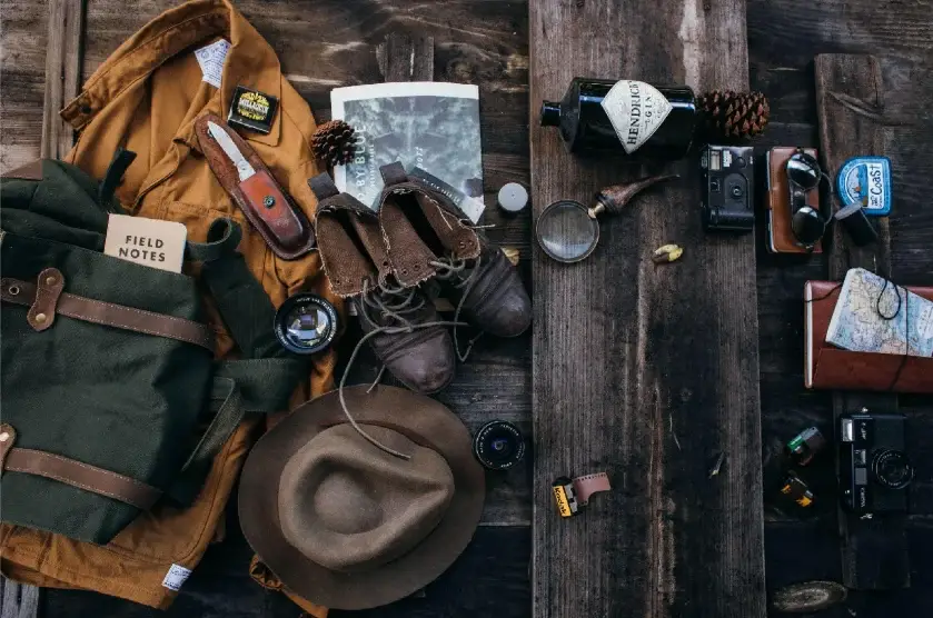
Before turning off the main highway or setting out on remote side roads, make sure your vehicle and daypacks hold these core essentials:
- Layered Clothing: Sweat-wicking base layers, an insulating fleece midlayer, windproof/waterproof outerwear, and sturdy trail shoes.
- Sun Protection: Wide-brimmed hat, SPF lip balm, high-strength sunscreen, and UV-blocking sunglasses.
- Navigation Tools: Downloaded offline maps, a physical paper map, and a magnetic compass.
- Vehicle Safety Kit: Fully inflated spare tire, reliable jack, jumper cables, tow strap, extra engine fluids, and snow chains (during cooler months).
- Emergency Supplies: Minimum 1 gallon of water per person daily, non-perishable snacks, first-aid supplies, a headlamp, and a thermal blanket.
- Tech & Power: Mobile phone, dedicated camera, charging cords, and a high-capacity portable power bank.
- Personal Items: Photo ID, daily medications, trash bags for Leave No Trace, and required wilderness or park permits.
Adjust these basics based on season and location—a quick scenic pullout requires much less gear than a full day navigating dirt tracks or high-altitude passes.
Essential Gear for the Eastern Sierra Environment
Packing for 395 requires thinking in thermal layers. You might start your morning in mild, dry desert conditions and find yourself in freezing wind by the time you reach an alpine lake trailhead at noon.
Smart Layering and Sun Gear
Comfort on the Eastern Front comes down to managing temperature and high-elevation exposure:
- Base Layer: Pick breathable, synthetic, or merino fabrics that move moisture away from your skin.
- Insulation: Keep a lightweight down jacket or fleece within arm’s reach in the vehicle.
- Outer Shell: Carry a packable rain jacket to block sudden mountain gusts and seasonal downpours.
Footwear is all about aggressive tread. You need solid support if you step on loose gravel beside the road, on sandy trails, or on granite scree.
Sun protection is equally important. The high elevation means thinner air and more intense UV radiation, and the open valley floors reflect the harsh glare for long stretches of driving. Secure-fitting sunglasses with high UV protection prevent eye fatigue during long hours behind the wheel or on the trail.
Navigation and Vehicle Safety
Cell tower coverage drops quickly outside town limits and vanishes entirely once you head into National Forest or BLM lands. Store offline digital maps on your phone before leaving town, throw a road atlas under your seat, and always communicate your planned route to someone outside your group.
Treat your car as a mobile emergency shelter. Beyond standard spare tire tools, keep extra drinking water, high-calorie food reserves, and a warm fleece blanket in the trunk. Avoid blind reliance on vehicle navigation systems when evaluating dirt roads—many forest routes feature deep sand or sharp rocks that trap standard passenger vehicles.
Outdoor Photography and Hands-Free Tech
From sunrise alpenglow lighting up Mount Whitney to crystal-clear reflections on mountain tarns, the region demands a camera setup. Whether relying on a smartphone or a full DSLR rig, bring extra storage cards, extra batteries, and a rugged power bank since vehicle charging spots fill up fast.
Travelers looking to document their trip without constantly fumbling for a phone can take advantage of wearable technology. For example, wearing AI glasses with voice-activated controls provides a convenient way to capture photos, field calls, or access device settings hands-free while keeping your hands open for trekking poles or driving.
Remember that smart devices complement—rather than replace—traditional outdoor gear. Test battery longevity ahead of time, abide by local privacy expectations near crowded overlooks, and always bring your car to a complete stop in a safe pullout before interacting with device controls.
Strategic Route Planning
Highway 395 stretches across hundreds of miles, so choosing a key sub-region yields a much better trip than trying to cover the entire corridor in one go.
Key Base Camps Along the Route
- Lone Pine: Ideal for visiting the Alabama Hills, viewing Mount Whitney, and exploring film history sites.
- Mammoth Lakes: Offers high-elevation access to alpine trailheads, mountain biking, and mountain lakes.
- Lee Vining: Serves as the gateway to Mono Lake’s tufa formations and the eastern entrance to Yosemite (Tioga Pass).
- Bridgeport: Provides access to natural hot springs and the preserved gold-rush ghost town at Bodie State Historic Park.
Give yourself generous travel buffers. A quick stop for a photo can easily stretch into an hour-long hike, and mountain roads naturally slow driving speeds. Monitor Caltrans updates for road closures and seasonal pass delays before embarking.
Unmissable Detours and Highlights
The defining feature of 395 is the ease of taking short detours off the main pavement.
Alabama Hills (Lone Pine)
Rounded granite arches and golden boulder fields sit right below the sharp peaks of the Sierra crest. Wear shoes with firm rock traction, bring plenty of water, and stay on established dirt tracks to avoid damaging fragile desert crusts.
Mammoth Lakes Basin
Dense pine forests and clear glacial waters make this an outdoor hub for hikers and anglers alike. Keep in mind that high-altitude snowpack can linger across upper trails into summer, so check with local ranger stations for current trail conditions.
Mono Lake Tufa Reserve (Lee Vining)
This ancient inland sea features unusual limestone spires called tufa towers, created where freshwater springs mingle with alkaline lake water. Walk only on designated boardwalks and paths to safeguard sensitive habitats and lakebed structures.
Adapting to Changing Mountain Weather
Weather along the Eastern Sierra ties directly to elevation changes. Temperatures down in Bishop or Lone Pine rarely reflect conditions at trailheads sitting 4,000 feet higher up the slopes. Look up hyper-local forecasts for your exact destination rather than broad regional summaries.
Check highway alerts every morning, top off your fuel tank regularly, and never assume isolated outposts will have open stores or working gas pumps. When hiking, start early to beat afternoon wind or lightning risks, carry ample water, and turn around if cloud cover darkens suddenly.
Embrace the Eastern Sierra Flow
The best moments along Highway 395 often happen unexpectedly—watching evening light turn a granite face red, pulling over at a quiet creek side road, or eating a meal at a local roadside diner.
A smooth road trip rests on clear preparation. Equipping yourself with warm layers, reliable maps, plenty of water, and smart hands-free gear allows you to explore the Sierra Nevada’s eastern front comfortably while protecting the landscape for future visitors.