The Views are Spectacular after Short Climbs at Davis Creek Regional Park near Reno
Washoe Valley, NV – Davis Creek Regional Park in the Washoe Valley south of Reno is a place that needs to get more love from us as a local destination for exploring and getting out into the mountains. Located just South of Reno on the North end of Washoe Valley, Davis Creek has a great camping area, as well as day, use region with trails, ponds and plenty of space to spread along the edge of Slide Mountain.
With the winter storms that we have been blessed with this winter, I decided to check out the snow conditions at this elevation Saturday. I was surprised at how quickly a routine day turned into a beautiful and somewhat surprising afternoon adventure with stunning scenic value.
Arriving at Davis Creek, I was not surprised to see a dozen cars already at the park, as it is traditionally an excellent sledding area for families. However, I was surprised to see so many put on their cross-country or backcountry skies in the parking area.
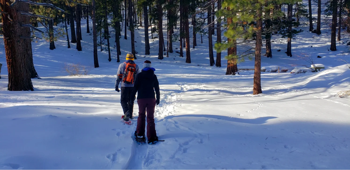
We made our way down to the parking area near the Pond. You can follow the Ophir creek trail from hear or do the park loop called the discovery trail. We decided that we wanted to climb and go off trail a bit today, so we headed up past the group tent campgrounds and followed what looked like an old jeep trail that climbed the mountain from the base of the camping area. After a short climb, the mountain opened up a bit in this little creek valley between two ridges which was a nice place to snowshoe.
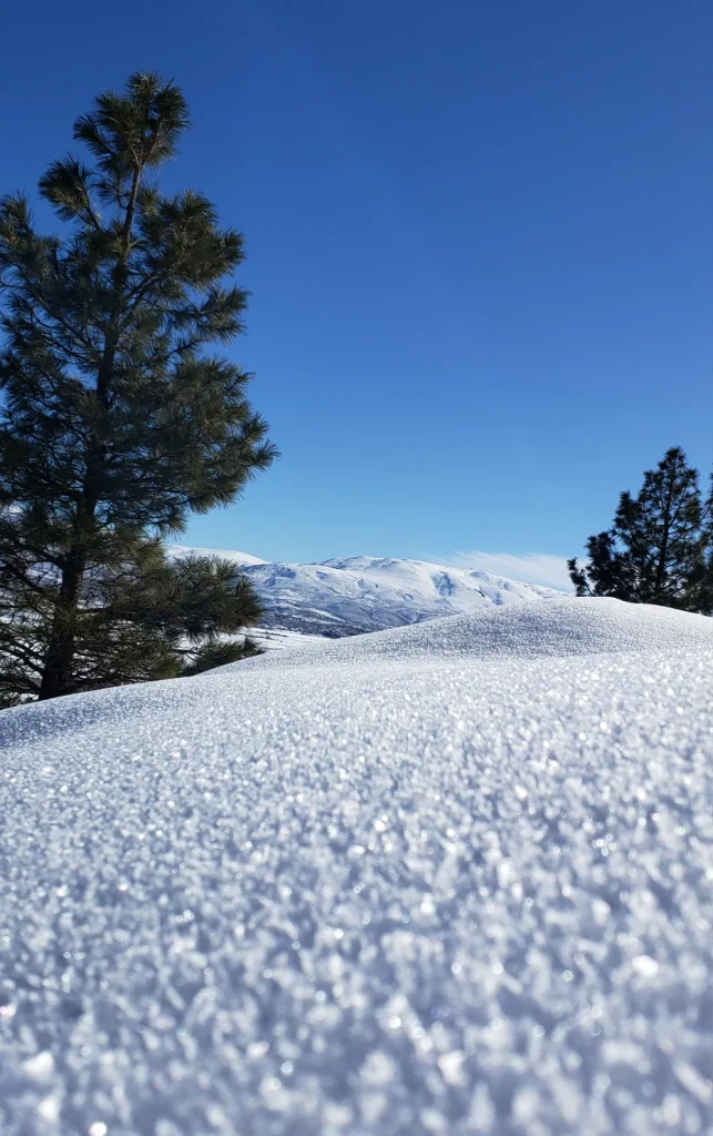
Manzanita brush and granite boulders were breaking through the snowpack and the snow was light and fluffy. Almost like shaved ice texture. The warm sun and blue sky above today completed what I consider a perfect color palette for the day.
Reaching the back of this small canyon, we found an area that looked like a potential spring creek and crossed over on the south ridge, following coyote tracks around the edge of the mountain. Heading south on the side of the mountain proved to be an excellent move as we soon came out of the forest with stunning views of Washoe Valley.
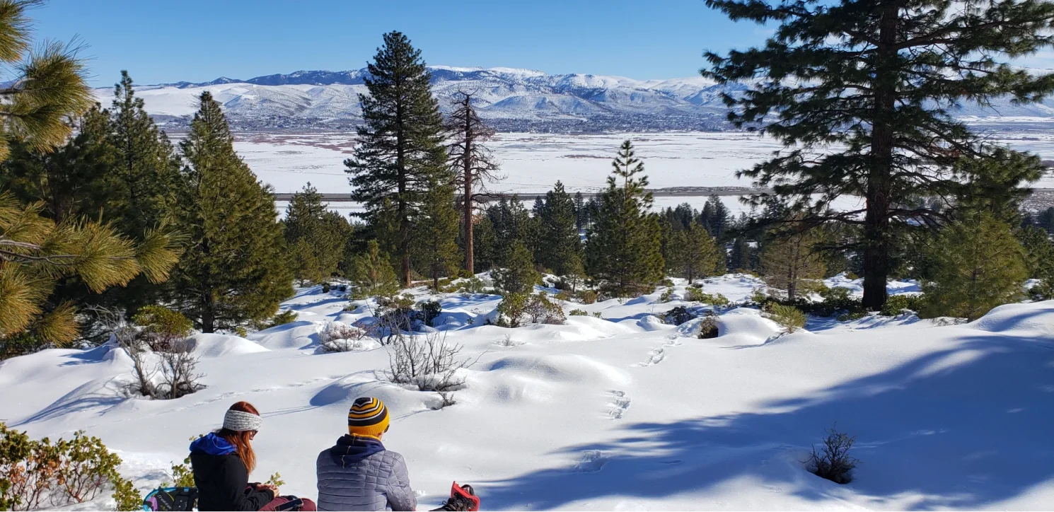
We decided to take a leisurely approach to the day, stopped for a quick snack enjoying the view, and then meandered southward along the edge, continually enjoying the fact that the coyotes seemed to know the most accessible routes. The mountain’s slope always looked manageable but we were not eager to climb today and enjoyed the in-and-out movement of the mountainside as it dipped in and out. Soon we came to a short little peak/knoll top with a classic Washoe Lake view that was worth the visit. This little area was where we discovered that regulars come to a different route up to this point as we ran into tracks coming up from the valley floor to this vista point.
Today we only had a couple of hours to be out, so this would be the final point of outward discovery. We decided to follow the other tracks back down the mountain and make a loop back to the car. Unfortunately, it turned out to be a bit tricky following tracks back down the slope in the slick snow and we came to an area where Glissading (Sliding on our Bottoms) was the only safe way down the slope.
Glissading down the slope, we found ourselves quickly next to the canal that ran through the park and could follow it back into Davis creek for a little more snowshoeing on the discovery trail down to the frozen pond.
We will return to explore the other areas of the park, In the summer time the Ophir Trail is a trail we need to check out as it heads back to two lakes before circling up to Tahoe meadows. Looks like a pretty challenging route however with over 3000′ of elevation change.
Other Trail option in the park:
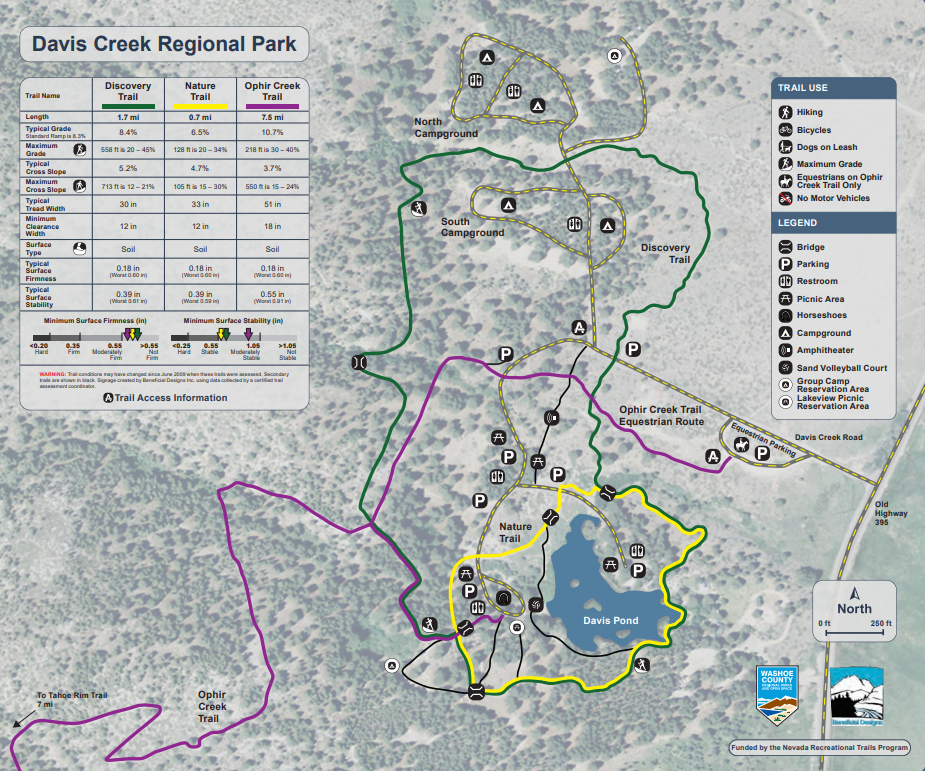
- .7 mile Nature Trail around the pond – click here for the interpretive trail guide
- 1.7 mile Discovery Trail that circles the park
- 7.5 mile Ophir Creek Trail, which winds up the mountain to Price Lake and the Tahoe Meadows – click here for the Ophir Creek Trail map