
Lyell Canyon wasn’t supposed to be one of those hikes for me.
Back in 2019, I was working through a list of the best day hikes off Tioga Pass and realized I had skipped over one of the most talked-about stretches of trail in Yosemite’s high country—the Lyell Canyon section of the John Muir Trail heading toward Donohue Pass.
That didn’t sit right.
So on July 4th, just a few days after Tioga Road opened that year, I headed out from Tuolumne Meadows to see what it actually felt like.
What I found wasn’t what I expected.
There’s no big reveal here. No moment where you arrive and think, this is it. Instead, Lyell Canyon unfolds slowly—almost quietly—as you follow the Lyell Fork of the Tuolumne River through one of the most open glacial valleys in the Sierra.
The first mile alone could be a full day for some people. River crossings, meadow edges, wildlife, places to sit and stay longer than planned. I remember thinking more than once that I could hang a hammock, call it a day, and not feel like I missed anything.
But Lyell Canyon has a way of pulling you forward.
Every bend in the river suggests there’s just a little more to see.
And more often than not, that instinct is right.
Where Lyell Canyon Begins
Lyell Canyon starts just east of Tuolumne Meadows, with access near the wilderness permit station and Tuolumne Meadows Lodge.
Within the first mile, you cross both the Dana Fork and the Lyell Fork of the Tuolumne River—an early reminder that water is going to define this hike.
It’s also where the trail system starts to branch:
- Rafferty Creek heading south toward Vogelsang
- Elizabeth Lake splitting off toward Unicorn Peak
- And the main trail continuing east along the John Muir Trail
👉 If you’re still getting your bearings in this part of Yosemite, start with our Tuolumne Meadows guide, which ties all of these routes together.

Trail Overview (And Why It’s Different)
- Distance: Completely flexible (2 to 14+ miles round trip)
- Elevation Gain: Minimal for the first several miles
- Difficulty: Easy to Moderate
- Best Time to Visit: July through October
What makes Lyell Canyon different is that you don’t commit to the hike—you ease into it.
There’s no moment where you say, “I’m doing the full thing.”
You just keep going.
Walking Into the Canyon
The trail starts wide and forgiving.
For a while, it almost feels too easy. Flat trail, open views, the river nearby but not demanding your attention yet. You move between forest and meadow without much effort, crossing small rises and dropping back toward the water.
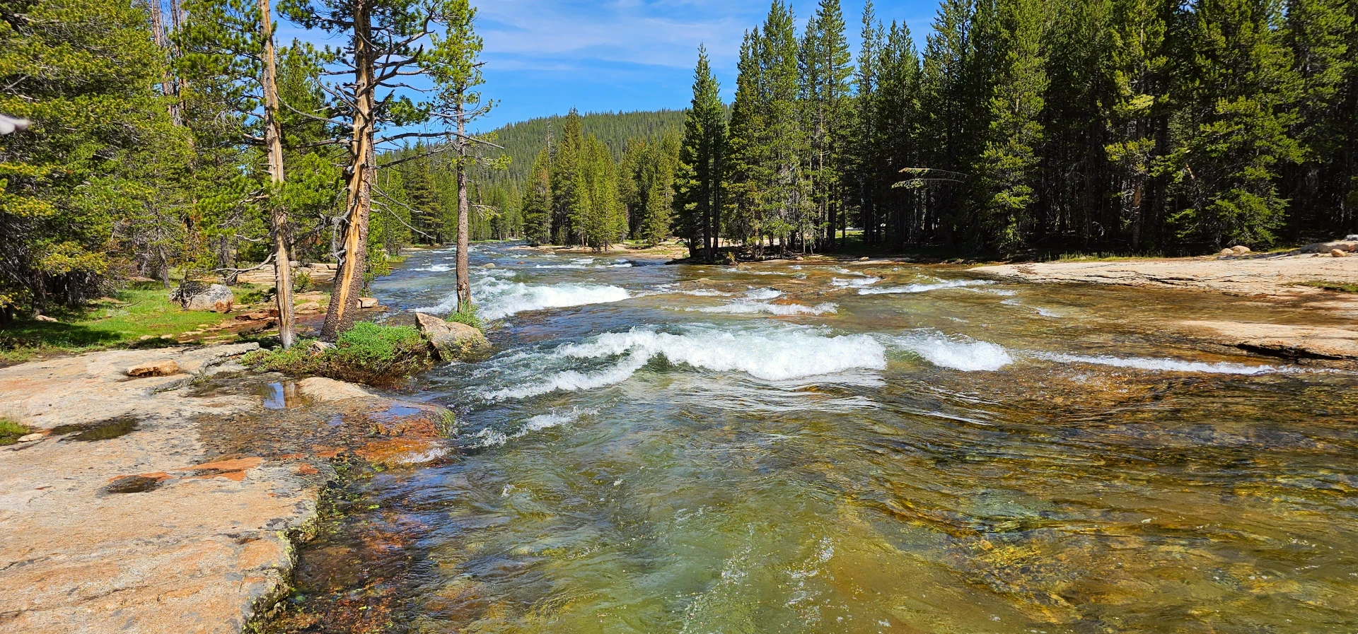
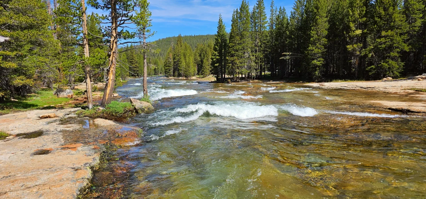
About a mile in, you reach a spot I’ve always thought of as “Two Bridges”—a stretch where the Lyell Fork drops into small cascades and the meadow opens up to the east. It’s the kind of place that makes you stop without thinking about it.
I seriously considered hanging the hammock there and calling it a day.
The river was running strong that year, still carrying snowmelt, and everything about that stretch felt complete.
But the trail had other ideas.
Following the Lyell Fork
The further you go, the more the river becomes part of your day.
Not in a dramatic way—like the Tuolumne downstream toward Glen Aulin—but in a steady, quiet rhythm. Pools, bends, reflections, small channels cutting through grass and granite.
I found myself leaving the trail more than once, dropping down to the water just to see what was around the next bend. Some of the best spots weren’t visible from the trail at all—small swimming holes, shaded stretches, quiet corners where the river slows down.
It’s the kind of place where time stretches out without you realizing it.
Wildlife in Lyell Canyon
Lyell Canyon might be one of the best places in Yosemite to quietly watch wildlife—if you give it the space to happen.
On that first trip, I woke up from a short hammock nap to find a buck grazing about 100 feet downriver from me. No rush, no concern—just moving through its day like I wasn’t even there.
I’ve had marmots chirp me out from granite slopes along the trail, clearly letting me know I was passing through their space. And more than once, I’ve watched a coyote cross the trail ahead of me, then stop and look back—not startled, just aware—before continuing to hunt mice in the meadow.
Deer along this stretch don’t always move off right away. You’ll find them laying near the river, watching as you pass by.
Out here, it feels different.
The wildlife isn’t reacting to you.
They’re living here.
And if you’re quiet enough, you just become part of the background.

The Further You Go
Somewhere around 5–6 miles in, near the Ireland Creek junction, the canyon begins to feel bigger.
Backpackers start appearing—many setting up camp near the boundary areas or pushing farther toward Donohue Pass. It’s a natural transition point where a day hike can turn into something more.
I kept going past Potter Peak, following the river as it worked its way deeper into the canyon, eventually stopping near a small unnamed lake just off the trail.
At about 9 miles, reality set back in.
The return trip matters out here.
And that’s part of the experience too—knowing when to turn around.
Backpacking Lyell Canyon, Donohue Pass, and Beyond
For many hikers, Lyell Canyon is a relaxed day hike.
For backpackers, it’s something else entirely.
This trail is the primary route out of Yosemite toward Donohue Pass—a key crossing on both the John Muir Trail and the Pacific Crest Trail. And because of that, it’s one of the more competitive wilderness permits in the park.
If you’re planning to go beyond a day hike here, permits matter. A lot.
Permits and Why This Route Is Competitive
Lyell Canyon is one of the most sought-after trailheads in Yosemite for a reason.
It offers:
- Gradual terrain to start
- Direct access to Donohue Pass
- A natural progression into the Ansel Adams Wilderness
Because of that, permits for this route—especially those continuing over Donohue Pass—can be difficult to secure during peak season.
If this is on your list, it’s worth planning well in advance and understanding your entry point options.
Where You Can Camp (And Where You Shouldn’t)
One of the most common questions is:
Can you camp in Lyell Canyon?
The answer is yes—but not everywhere.
Camping is not allowed in the main meadow areas near Tuolumne Meadows, and more importantly, it shouldn’t be.
This landscape is fragile.
The meadow system is easily impacted, especially during early season when water levels are high and sections of trail can be flooded or muddy.
👉 The general rule:
- Stay on trail—even when it’s wet
- Avoid walking around flooded sections (this widens damage)
- Camp only in appropriate backcountry zones
Most backpackers must push several miles into the canyon before setting up camp, often near the Ireland Creek junction area where established use sites exist.
This helps protect the meadow while also giving you a better overall experience.
Ireland Lake and the Route to Vogelsang
One of the most important junctions in Lyell Canyon is the trail split near Ireland Creek.
This is where things start to open up for backpackers.
Heading north, the trail climbs out of Lyell Canyon toward Ireland Lake—a quieter alpine basin that feels a world away from the main canyon floor.
From there, experienced hikers and backpackers can connect into the Vogelsang region, linking:
- Ireland Lake
- Evelyn Lake
- Vogelsang High Sierra Camp
It’s one of those routes that starts to tie the entire Tuolumne high country together.
Not a single destination—but a network of them.
Toward Donohue Pass
Continuing east through Lyell Canyon leads you toward Donohue Pass, one of the defining transitions out of Yosemite’s high country.
The terrain gradually shifts:
- Meadow gives way to more alpine exposure
- The river narrows and climbs
- The trail becomes more defined and purposeful
This is where Lyell Canyon stops being a casual hike and becomes a true backcountry route.
Lyell Glacier and Off-Trail Exploration
Beyond the maintained trail system, some hikers continue farther south toward the Lyell Glacier area.
This is not a standard day hike and typically involves:
- Off-trail travel
- Route finding
- Experience in alpine terrain
While I haven’t personally made that push, it’s a known extension for those looking to explore deeper into the Lyell Fork headwaters and the high alpine terrain surrounding Mount Lyell.
Like much of Yosemite, the further you go, the more self-reliant you need to be.
Lyell Canyon is one of the few places in Yosemite where:
- Day hikers
- Backpackers
- Thru-hikers (JMT / PCT)
All share the same corridor—just at different paces and with different goals.
You can spend a full day wandering the first few miles and feel completely satisfied.
Or you can follow the same trail for days, crossing passes and linking basins as you move deeper into the Sierra.
That dual identity is what makes Lyell Canyon so unique.
Fishing, Rest, and Letting the Day Happen
Lyell Canyon is one of those places where you don’t need to push mileage to feel like you had a full day.
Fishing along the Lyell Fork can be productive in the deeper pools. The river moves slow enough to read, and there are plenty of access points if you’re willing to step off trail.
But more than anything, this is a place to stop.
To sit along the river. To lay back on warm granite. To take a break that turns into an hour without noticing.
I made multiple stops that day that could have easily ended the hike.
And honestly, none of them would have been a bad place to turn around.
How Lyell Canyon Fits Into Tuolumne Meadows
Lyell Canyon offers something completely different from other hikes in Tuolumne Meadows.
- The Cathedral Lakes hike guide leads you into alpine basins and granite peaks
- The Glen Aulin hike guide follows the river as it builds into cascades
- The Grand Canyon of the Tuolumne backpacking route takes that river even farther into canyon terrain
Lyell Canyon sits somewhere in between.
It’s the place where everything slows down.
Final Thoughts
Lyell Canyon doesn’t try to impress you.
It doesn’t force big views or dramatic features.
Instead, it gives you something Yosemite doesn’t always offer:
Room to walk.
Room to sit.
Room to notice things you might otherwise miss.
And if you let it, it’ll keep pulling you forward—just a little farther than you planned to go.
