A Challenging Desolation Wilderness Adventure
Why do I do this to myself? I’m tired and cold. Who gets up at 5 am on a Sunday to drag themselves up a mountain, especially when that mountain was being blanketed in snow as I prepared for this journey?
The Bayview Trailhead has led me to Maggie’s Peak several times before, but today is different.
We’re not going to the destination my eyes are familiar with. We’re heading towards a peak I have never seen. I am going even though I’m aware that I won’t make it through the challenging scramble to reach Dick’s Peak. All available information labels it as a Class 2 and 3.
What does that even mean? My research suggested I might manage Class 2, which involves the occasional use of hands, but class 3 comes with exposure that I’m not ready to tackle. Some sources suggest that sticking to the right can make Class 2 the most challenging part of the
scramble.

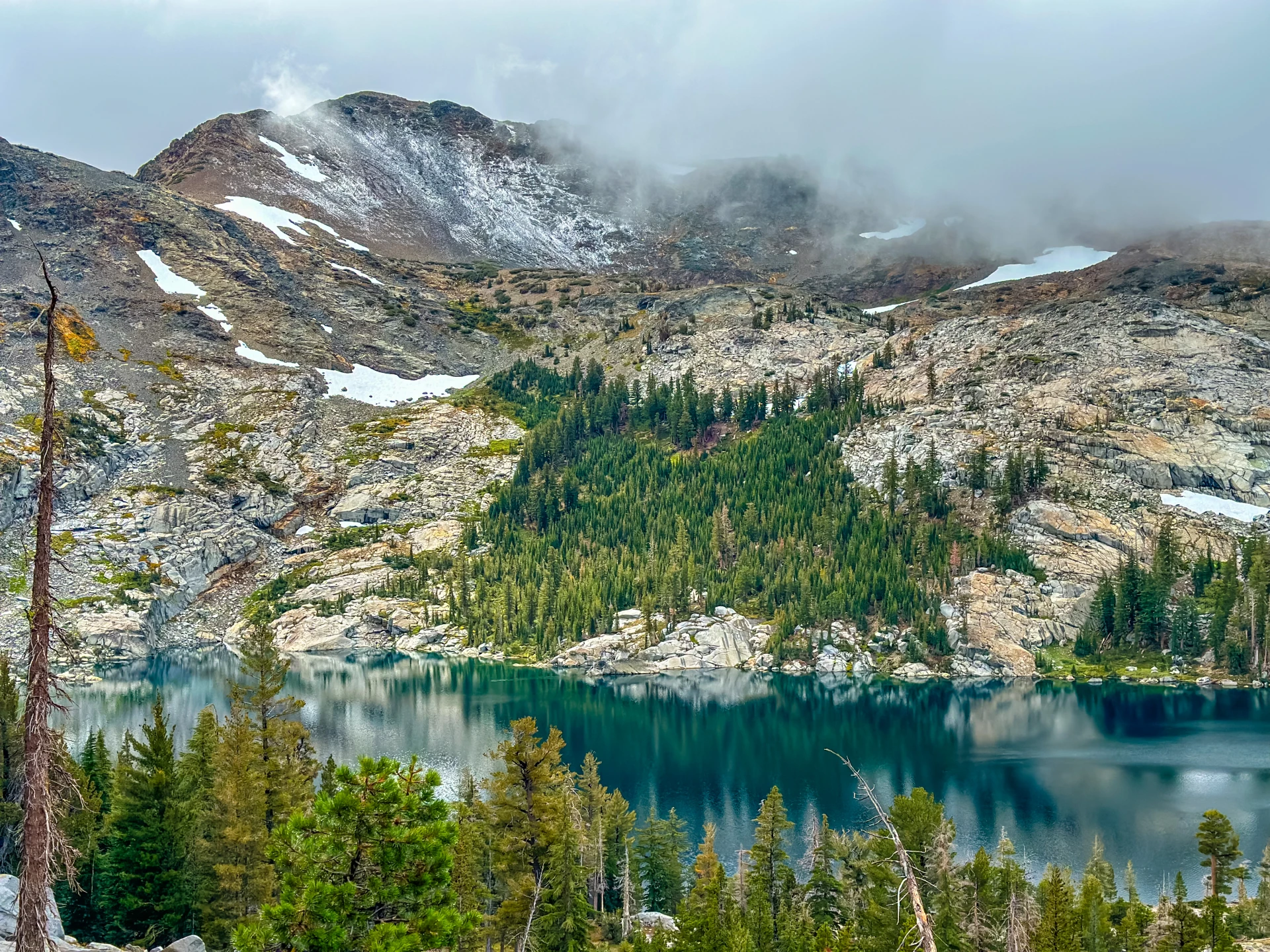
The first mile presents a steep incline with breathtaking views of Emerald Bay. Berry bushes have been ravaged by the residents of Desolation Wilderness. My camera captures a lonely fog patch’s attempt to consume Granite Lake.
The following mile brings switchbacks and an overhead view of Granite Lake. By the time we leave this view behind, the fog has dissipated. We pass the trail leading to Maggie’s Peak, and the miles that follow introduce me to unfamiliar terrain. I catch a glimpse of Azure Lake.
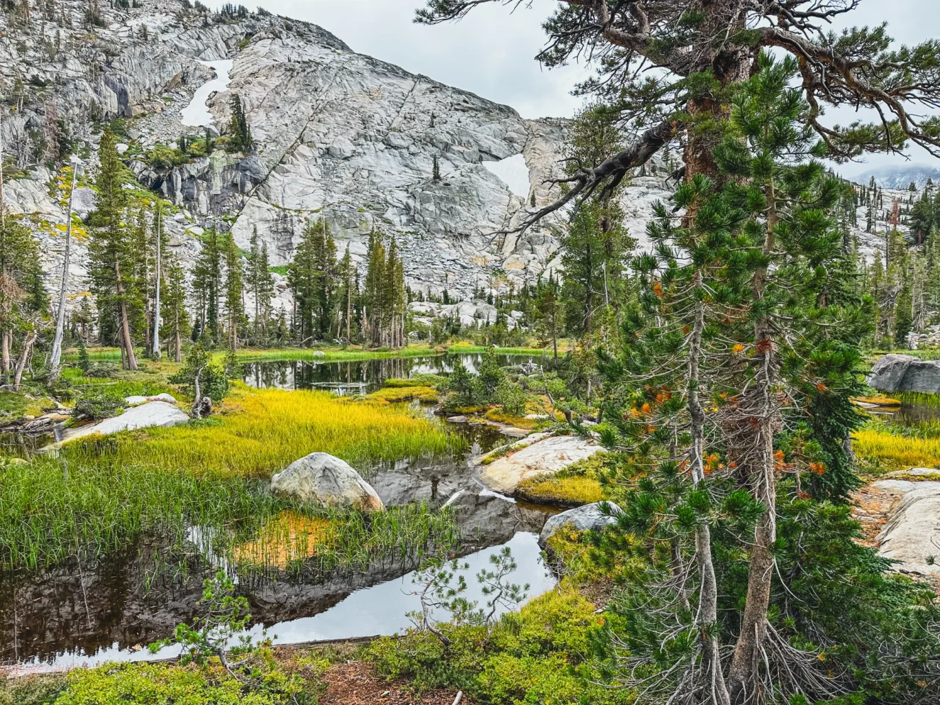
Further along, we pass an unnamed lake with a granite backdrop, surrounded by thoughtfully placed White Pines and islands of grass and rock. If only I could build a tiny cabin and live out my days here.
As the trail ahead unfolds, I’m greeted by the innocent beauty of White Mountain Heather and Shrubby Cinquefoil. We traverse granite that offers little sign of a trail. GPS don’t fail me now. After nearly five miles, a recognizable Desolation trail marker informs us that we’re now passing the trail to Dick’s Lake and Fontanillis Lake, a place I have always wanted to explore.
As we ascend towards the snow line, switchbacks greet us. It becomes abundantly clear I will need more stamina to reach the peak. I’m grateful for my friend’s company. We banter back and forth. Fresh snow is now all around us. While approaching a switchback, my cadence slows, then halts. My friend has already rounded the bend and stands above me. “Do you hear that?” I ask. She looks around inquisitively and replies, “No. I don’t hear anything.” “Me either,” I whisper back. The snow envelops us in its spectacular silence, the most beautiful silence I have ever experienced.

Continuing, Dick’s Lake unfolds below us, and I’m puzzled by the peaks that loom over it. Which one am I supposed to forgo reaching today? I soak in the view beneath me and remind myself that when I return to see Fontanillis, Dick’s Lake will be a part of that hike.
At mile 6, we have reached approximately 9200 feet above sea level, with a gain of 2,200 feet. I must really be a glutton for punishment. My negative thoughts dissipate as trees adorned in fresh snow, resembling scenes from a children’s book, come into view. They’re tall and lanky, dwarfing my friend as she approaches. Hiking into the clouds gives the children’s imagery a chilly, almost magical feel. Not long after, another trail marker appears, informing us that we’ve reached Dick’s Pass at 9400 feet. From there, we’re delivered to what can only be described as a terrace. To our right, we see the trail to Dick’s Peak. My GPS misled me; it is easily another 2 miles to the peak. My friend and I discussed a break in the clouds over the peak. Here’s our opportunity to bag it. I tell her to go ahead. I will just slow her down, and she could miss her chance. She refuses, insisting we stick together.

We let go of the hope of reaching the summit and instead enjoy a glimpse of Lake Aloha in the distance. Susie Lake reminds me of the hike my husband and I took a few weeks earlier. Aptly named Half Moon Lake, a body of water I had not yet seen sits closest to us.
After snacks and pictures, we head back. Stopping at the unnamed lake to enjoy a PB&J, I choose the location of my cabin. As our trek resumes, Mt. Tallac is on my right, and the clouds frame the peak and then dance around and reframe it again. Nature never ceases to amaze me.
I see a widow maker whose trunk looks like a candy cane. It begins to drizzle. My friend finds an abandoned egg belonging to a Gall Wasp shortly after passing Granite Lake. Along the trail, someone left a Dahlia near the Emerald Bay overlook. I find White-Veined Wintergreen further
down. As we approach the trailhead, mushrooms litter the forest floor.
I’m completely spent after covering 13.11 miles with a gain of 3,287 feet. My body was in motion for 6 hours and 24 minutes. I’m sore, tired, hungry and cold. On the way home, I asked my friend when we were going hiking next. We pass the miles discussing the details of our next adventure.
