
53 days into California’s 2nd Largest Fire in History, Fire Fighters Continue to Fight Fresh Fire growth.
Lake Davis Ca, – September 4, 2021 – At 885,954 acres it is hard to believe that the Dixie fire which started on July 14, 2021 still can find fuel to burn. As the second largest fire in California history the Dixie fire to still causing evacuations, closures and as it approaches HWY 395 questions on when it will stop?
Dixie Fire East Zone: Wind-driven flames pushed out of the southeast end of the fire near the intersection of Forest Roads 01 and 177 yesterday afternoon to the south end of Horton Ridge. As a result, crews worked overnight to protect structures in Dixie Valley and build line to halt the spread. Crews will continue more of this work in Dixie Valley today. Fire burning on the escarpment continues to threaten to advance towards Highway 395, west of Oliver Lane. On top of the escarpment, the fire continues to burn to the east towards the Sugar Fire burn scar. Crews and engines will continue to work closely with firefighters from the West Zone to develop line on both sides of the escarpment blaze and prepare and defend structures in Milford. Resources will continue to hold and improve dozer and handline from Clover Valley to the east side of Lake Davis, and from the west side of Lake Davis to Grizzly Ridge then further north to Taylorsville, to protect the Highway 70 corridor. Structure protection continues within Clover Valley, Genesee, Taylorsville, Greenhorn, and Cromberg.
Dixie Fire West Zone: Overnight, the fire activity was limited to lower intensity ground fire in the understory. Heavy material continued to smolder and consume itself, in part because of the limited humidity recovery in the mid and higher elevations. Today, the inversion will begin to set in keeping more smoke in the fire area. Interior islands will continue to burn out and create short range spotting if near the control lines. The portions of the fire which burned over 30 days ago will continue to smolder for a period.
Temperatures will continue to rise through the weekend. The relative humidity will remain low and winds will return to a general southwest flow. The smoke will be in the fire area lingering and may limit air operations throughout the day.
Residents are encouraged to stay vigilant and to monitor evacuation information and road closures, including social media and local law enforcement websites for the most current information. Residents will see smoke coming from trees and stumps for days following their return. Proceed with caution because burned out areas may have unseen hazards. Residents are encouraged to call 911 if they are concerned about any active flames near their homes or businesses. Damage assessment remains ongoing. Change in threatened structures due to new Evacuation Warnings in Lassen, Plumas and Shasta County.
Fire
The Dixie Fire is 885,954 acres, an increase of 17,173 acres
since yesterday, with 55% Containment. Warming
temperatures through the weekend and and low relative
humidity will lead to continued fire activity across the entire
fire incident. The Dixie Fire is being managed in two
cooperative zones – West and East. Additional fire information:
Inciweb – Dixie Fire
Smoke
Winds across the fire area today will change back to coming
from the West and Southwest. However, they will be lighter
and may not be able to lift and move smoke out of the forecast
area as efficiently as we experienced early this week. In
addition, more stable atmospheric conditions and a stronger
inversion will keep smoke lingering throughout the day,
possibly even after the inversion lifts in the afternoon. Morning
southeast winds over the West Zone of the fire will bring
smoke into Old Station and Burney but will change to
southwest in afternoon clearing smoke. Afternoon west –
southwest winds across the East Zone of the fire will move
smoke out of Quincy and Portola and possibly back into the
Highway 395 corridor. With the return of more westerly winds,
the Sacramento Valley will see less smoke today from the
Dixie Fire.
BAER Recreation Specialists Assess Forest Service Trails in Dixie Burned Area
The Dixie fire has been burning for so long that the places of origin are already showing signs of life and evaluation.
In additional to threats to human life and safety, the Forest Service Burned Area Emergency Response (BAER) program assesses potential threats to Forest Service (USFS) property and infrastructure such as biking, hiking and motorized OHV trails.
BAER recreation specialists are assessing the effects of the fire to trails within the Dixie burned area. They identify potential threats to public users of the trails because of the effects of the fire and related suppression activities during rainstorm events.
After assessing the trails within the Dixie burned area, BAER Recreation Specialists may recommend BAER stabilization trail treatments to lessen the impacts to USFS trails that will improve drainage. They may also recommend post-storm inspections and response to address any threats during and after rain events.
Recently Lassen National Forest BAER specialists Gabriel Hobson, Glen Logan and John Davis, and Chuck James from the Stanislaus National Forest completed their field assessment in Phase 1 of the Dixie burned area.
The following four photos are of the Lake Almanor Recreation Trail #51019 which is located near Canyon Dam that offers non-motorized bikers and hikers the chance to see a variety of wildlife.
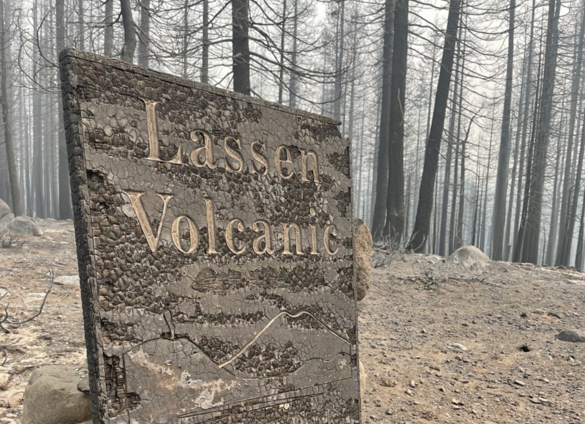
Lake Almanor Recreational Trailhead Sign:
Numerous potential hazard trees along trail:
Burned Trail Information signs:
Numerous potential hazard trees along trail:
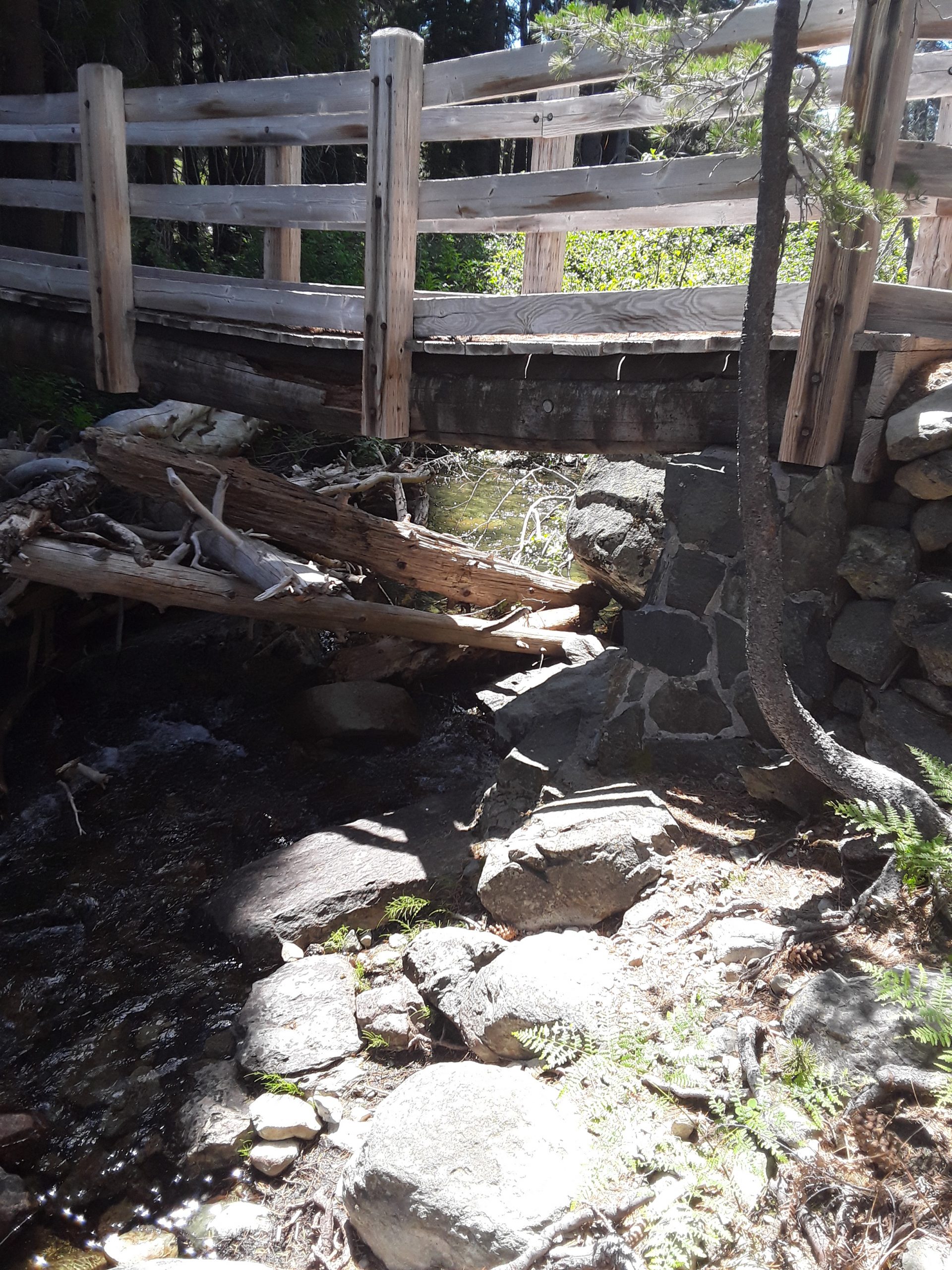
The next two photos of from the Yellow Creek Trail (6E27). The trail is a non-motorized trail. The photos show debris and soil dry ravel and the total loss of trail tread:

The last three photos are of the Rock Creek Trail (6M40) which is a motorized trail. The photos show soil dry ravel that partially covers the trail tread:
Forest Service BAER Specialists Assess Vegetation in Dixie Burned Area
Dixie Post-Fire BAER Burned Area Emergency Response
When a wildfire burns, burned tree snags are often the most noticeable feature remaining on the landscape. Less apparent are effects to the plant species in the understory, many of which are forbs and shrubs that are adapted to promptly return to the post-fire landscape. In addition to assessing potential threats to life and safety, property, and cultural resources during rain events following burned areas, the Forest Service Burned Area Emergency Response (BAER) program also assesses potential threats to natural resources, which includes an assessment of native plant communities.
Lassen National Forest botanist (Kirsten Bovee) and Plumas National Forest ecologist (Michelle Coppoletta) have been evaluating the risk of invasive plant introduction and spread in native plant communities within the Dixie Fire. They are finding that mere weeks after the fire swept through the Highway 70 corridor, many native and invasive species are already resprouting. These include native willow along the North Fork of the Feather River (Photo 1 background), but also invasive Himalayan blackberry (Photo1 foreground).
Areas that have experienced multiple recent fires, such as the hillslope within both the Rich and Dixie Fire perimeters, are particularly susceptible to weed establishment and spread, due to full sun conditions and bare mineral soil exposed as litter and duff were consumed by fire (Photo 2).
The spread of invasive plants compromises native plant communities and all that they support—from fish, to mammals, to the life support of the fungal network underground, to trees, shrubs, and herbs.
The following three photos show some native plants that are already making a reappearance on the burned landscape:
- Black oak (Quercus kelloggii, Photo 3) is sending up new stems from a root crown that continues to draw water and nutrients from the plant surviving in the below-ground root network.
- Caribou coffeeberry (Frangular purshiana ssp. ultramafica, Photo 4) is a rare shrub that grows only on serpentine soils in the northern Sierra Nevada.
- Beargrass (Xerophyllum tenax, Photo 5) lilies have protected their actively growing leaf tissue within rosettes of densely packed old leaves and have already added inches of new growth to the base of its leaves that burned during the fire. They will carpet the landscape with billowy clusters of white flowers in the years to come.
Dixie Post-Fire BAER team botany assessments will prioritize high value and vulnerable native plant communities and result in proposed land treatments, such as an Early Detection Rapid Response (EDRR) strategy, to prevent the fire-related introduction and spread of invasive species.
Photo 1:
Photo 2:
Photo 3:
Photo 4:
Photo 5:


