Black Point Fissures Provides A Unique Sierra Hiking Experience at Mono Lake
I have driven by Mono Lake a hundred times, even on occasions stopping at the visitors center and walking the boardwalk on the south west shores, but until recently I had never heard of a set of Slot Canyons (Fissures) that begged to be explored.
A friend recommended I go explore this area after taking his son last fall. I am always up for new exploration and have always been drawn to slot canyons. So Saturday I picked up my hiking buddy and his teen-ager sons and headed south to Mono Lake for a day of discovery.
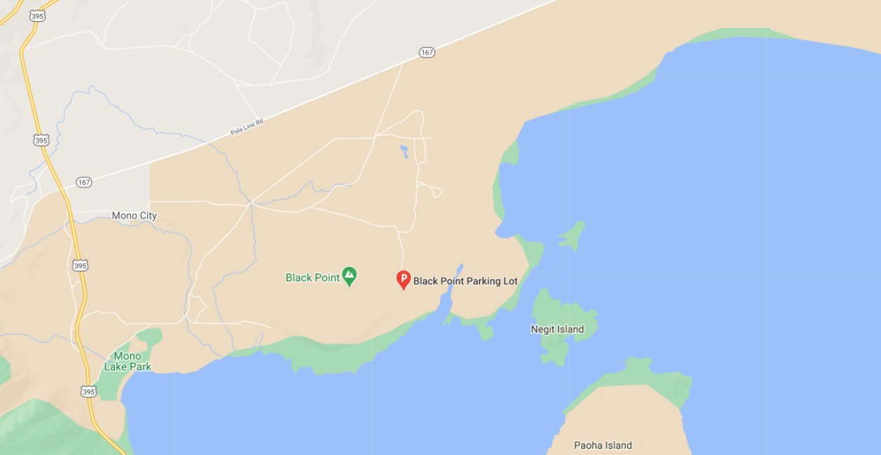
The Black Point recreational area is located on the North Shore near the Negit Island. From HWY 395 this mountain does not look like anything special or of interest, but trust me it hides some cool finds. We suggest using Google maps as access requires multiple dirt road turns in this desert landscape to get to the parking area.
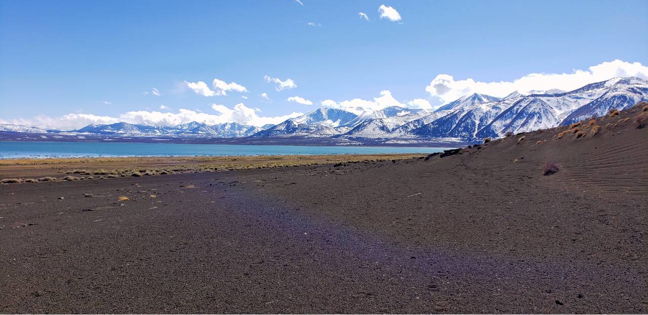
From the Parking area you are welcomed with your first sight of the Black sand dunes features that will be a key feature in your climb to the top. The trail is not easy to find or follow. the best i can tell you is head west and slowly start climbing the 450 feet of hill side in which ever route you are comfortable with. The trail is just not consistently there. We ended up walking down the sandy flat area 1/4 mile before following a ridge line up through the sand making a rock cropping of black volcanic looking rock our target destination. After completing the hike, i might suggest that is just as easy and possibly better navigation if you instead head straight up to Black Point and look west to locate the Slot canyons / Fissures.
Needless, if you follow our route and the other couple who was hiking there at the same time, you will end up on this plateau of sorts with no real direction of where the slot canyons are at. They really are hidden until you are right on top of them. We followed the western edge of this plateau north bound from the lake, after 1/4 to 1/2 mile we just ran into our first fissure.
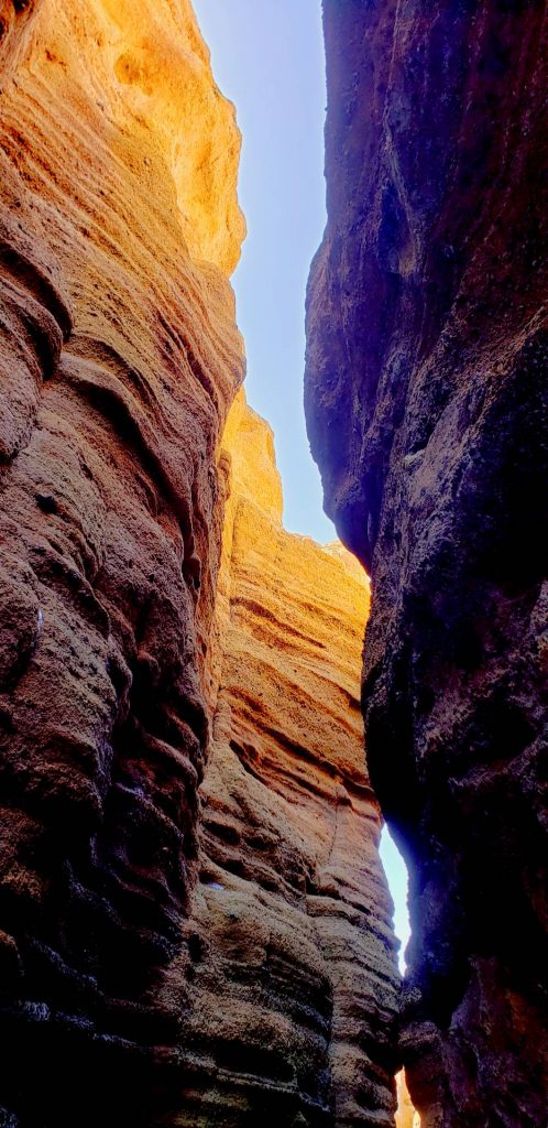
Getting into the slots was a bit tricky at this time of year with snow and ice still present but there were several areas where safer passage was doable.
The slots / fissures in this region range from 20 feet to 50 feet into the earth with passage ways ranging from a foot to 10 feet in width. The surface is carved with wind and water making for fascinating ripples in the walls and small cavities that capture the light and darkness through out the hike. the Largest fissure has multiple sections where elevation and width change dramatically and the opening above changing directions giving you a great sky line to photograph or look up to. It eventually opens out to the side of a plateau overlooking the Wilson and Mill Creek valley below.
A visit to the top of Black Point gives you a great 360 panoramic view of the basin and has a geological marker at the point for reference.


On the way out we did discover a second route in or out that uses East Mono Lake Drive turning into FS2N20 for the route to parking. this route was much easier on the car.