
PCT Adventures for Tahoe Guests
Are you planning a visit to Lake Tahoe this summer? Seeking a Pacific Crest Trail Adventure in the Tahoe area that won’t break the bank or require you to quit your job and get really extreme? The PCT trail has obviously gained some popularity since the movie “Wild” showed in 2014. And While most people can’t explore the entire PCT Trail, great adventure on the trail can be found in 1-4 day hiking experiences right her in the Sierra.
Lake Tahoe is blessed with so many hiking experiences and the PCT is a often over looked silent piece that runs along the entire east side of the Lake Tahoe Basin and is easily allows visitors to explore just to the south of the Lake into Alpine County.
These Three PCT Adventures are written by local explorers and adventure companies in the region. They help you get a glimpse of what it will take to accomplish, some of the sights you will get to experience and the elevations you will need to plan for in your journey. Along the Way you will get to camp by some of the Sierra’s prettiest mountain lakes, walk through lush Alpine meadows and scale along solid granite rock sections.
These areas of the PCT are a mix of coverage and open views. Often described as some of the driest areas in the Sierra PCT Hike, take plenty of water for your adventure.
Here are three Great Adventures to consider this summer in Tahoe and on the PCT:
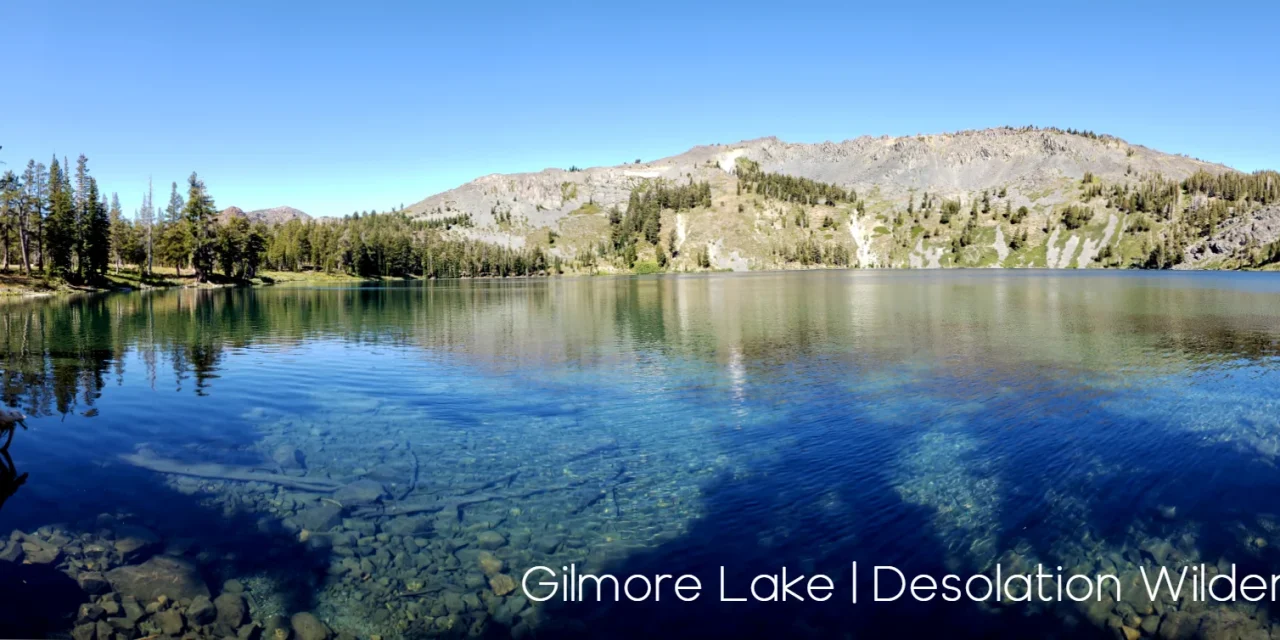
1. Desolation Wilderness / TRT – Echo Lake to Barks Pass
Trailhead: Echo Lake This is a joint section of the PCT that is joined with the Tahoe Rim Trail.
Distance 32.7 miles
Elevations: 7,525 9,400 , 7,650
Hike description Provided by The Tahoe Rim Trail Association

Between Echo Lake and Barker Pass, the trail leads deep into the granite heart of the Desolation Wilderness, where cool blue lakes lie cradled in ice-polished basins. The joint Tahoe Rim Trail/ Pacific Crest National Scenic Trail heads north from Echo Lakes across a rugged wilderness of glacial moraines and smooth granite ridges. Tumbling streams and serene lakes nourish pine groves and flower-filled meadows. The clear water and meandering shoreline of beautiful Lake Aloha offer delightful swimming and camping spots. The central portion of this segment is noted for its long steep approaches up and over Dicks Pass and for its equally breath-taking views. North of the pass, the Velma Lakes mark the trail’s entrance into a much drier and less open landscape, where thick conifer stands are interrupted by small meadows crowded with wildflowers. The gently rolling trail leads down out of Desolation Wilderness and eventually to shallow Richardson Lake. Several dirt roads cross the trail as it slowly rises to the Barker Pass trailhead. Small creeks and meadows punctuate the generally forested northern portion of the segment.
2. Hwy 50 (Echo Summit) to Carson Pass
Trailhead: Echo Lake Sno Park HWY 50
Distance 11.5 Miles
Elevation: 2875′ of ascent and 1700′ of descent 9000′ high point.
Hike Description provided by Tahoe Adventures

The parking lot at Echo Summit and climbs steadily for the first 2.5 miles. In this area you are hiking through Red Fir Forest with a sprinkling of Lodgepole Pine, Incense Cedar, Western White Pine, and even some Ponderosa and Jeffrey Pine. After a couple of miles, the trail flattens for a bit the begins to climb again until it reaches nearly 9000′ before descending to Showers Lake. Along the way, you will wander past high Sierra meadows and through classic, open Red Fir Forest. A couple of trails intersect with the PCT along this section, but are well marked. Be sure to stay on the PCT / TRT!
From Showers Lake, the trail descends steeply for a mile or so before entering the Upper Truckee River drainage. This leads to the incredible Meiss Meadows area, a huge alpine meadow along the banks of the river. After a couple miles of flat hiking along the meadow, a final climb out of the meadow area leads to the final descent to Carson Pass. In all, over 11 miles of hiking and (from Echo to Carson) 2875′ of ascent and 1700′ of descent.
This is a classic Tahoe hike and is a must do for any serious Sierra hiker!
3. Ebbetts Pass to Carson Pass
Trailhead: Ebbetts Pass
Distance: 24 miles – 3 Days
Elevation: 8,800′ – 7,800′ – 9,000′ – 8,600′

Hike description Provided By Ebbetts Pass Adventures

The Pacific Crest Trail from Ebbetts Pass to Carson Pass is easier than the section going south to Sonora Pass. There are numerous ups and downs on the way to Carson, but the biggest climb is only 1,200 feet.
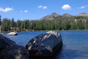
Park at the trailhead parking lot and take the little side trail up to meet the PCT and turn right, soon crossing Highway 4. Continue north past Upper Kinney Lake (shown left) and along the rugged shoulders of Reynolds and Raymond peaks. You could camp as early as Pennsylvania Creek, but if you’re feeling strong push all the way through to Wet Meadows Reservoir, 11 miles. The next day cross the Blue Lakes area where you’ll see people and cars and keep on going up to Lost Lakes for your second night, a 7 mile day with a big climb. The last leg of the trip meanders down to Forestdale Creek and then up to Carson Pass, 6 miles.
Items you will need on these Hikes:
- Backpack
- Tent /Shelter
- Sleeping bag
- Mosquito Spray
- Suntan Lotion
- Hiking Boots
- Water (Good Rule of Thumb is 2 liter for every Hour Hiking)
- Food ( remember you will burn many calories on these hike. Plan to take High energy foods that will help you gain strength and energy quickly)
- Food storage Containers (optional but this is bear country and you should prepare properly)
- Change of clothes
- Extra Socks
- Hat
- Hiking Poles (Luxury Item- but helpful on uneven terrain)
- Wilderness Permits ( You will be camping in wilderness Areas. Please check wilderness restrictions and guidelines before you go)
The PCT is a celebrated part of life for many in the Sierra. Along the trail you will find locals hiking for the day along with an occasional Thru Hiker that has made their way up from the Mexico border. The PCT Trail Association also has many great resources available for planning your hike. Here is a great story from a Sacramento visitor that might inspire your next adventure http://www.pcta.org/wild/stories/out-here-on-my-own/
Sierra REC Magazine is dedicated to sharing the events, news and adventure opportunities that exist in The Sierra Mountains. From Lassen Volcanic National Park to the North down through the Central Sierra and the Lake Tahoe Basin through the rugged eastern slopes of the Mono county and Yosemite National park to the southern tips near Sequoia National Park and the PCT trail. We invite you to share stories, trips and photos from your adventures in the Sierra. Please join us on Facebook, TwitterGoogle + and You-Tube or email us your events and photos at sierrarecinfo@gmail.com #goexplore


