

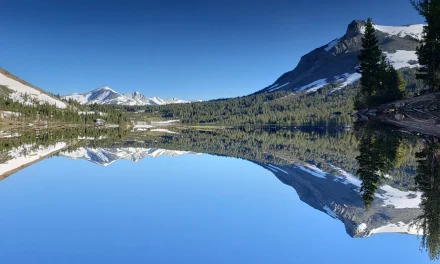
Sierra Nevada – December30, 2022 – Winter in the Sierra. We live and die by the storms that bring the snow and wind. As we sit here one day form New Years Eve 2022, the Sierra awaits its next weather maker storm. This storm has potential to cause blizzard type conditions across the sierra through saturday night before a break on Sunday and then a week of potential snow fall across the Sierra. This is very exciting news, unless you are planning your mountain celebration parties for the New Year.
Some sierra Mountain resorts like Kirkwood have already announced cancelation of firework shows.
“New Years Eve: With the forecasted blizzard on Saturday night, fireworks and torchlight parade are cancelled. We will have live music at Cornice Grill from 7-1030pm. Join us for a cheers to the New Years!”
Kirkwood Ski Resort
We spoke with Mammoth mountain this morning and as of this morning they are still moving forward with New Years Celebrations, saying that they have not yet made a call for any cancelations, but they will announce any changes later via their website and social media pages.
Palisades at Lake Tahoe has also canceled all outdoor activities of their New Years Celebrations, encouraging guests to enjoy indoor activites for the storm, while putting safety first with all traveling.
The National Weather Service has issues a Severe Winter warning for the Sierra Nevada through Jan.1, 2023
Expected rain and Snow in this storm with Snow levels starting at 9000 feet today and dropping tonight to 7000 feet. Saturday the Snow levels are expected to droop to Lake Level and bring 3-5″ of snow possible at lake level Saturday night.
They are expecting this storm to carry with it high winds making driving extremely challenging. Combined with a high likely hood of Ice forming on the roads as rain turns to snow, driving is not recommended over Sierra Passes.
The National Weather service this morning also issued a n urgent Avalanche Warning for the Sierra Back country.
The Sierra Avalanche Center in Truckee has issued a BACKCOUNTRY
AVALANCHE WARNING for the following areas:
NWS Reno NV - NVZ002 (Greater Lake Tahoe)...CAZ072 (Greater Lake
Tahoe (CA))

* WHAT...The avalanche danger is HIGH in the mountains.

* WHERE...Central Sierra Nevada Mountains between Yuba Pass (Hwy
  49)  on the north and Ebbetts Pass (Hwy 4) on the south,
  including the greater Lake Tahoe area.

* WHEN...In effect from Fri 07:00 PST to Sun 07:00 PST.

* IMPACTS...A winter storm with gale-force winds, high elevation
  rain, rain on snow, followed by high-intensity snowfall with
  feet of new snow accumulation will result in widespread
  avalanche activity in the mountains. Large avalanches could
  occur in a variety of areas.

* PRECAUTIONARY / PREPAREDNESS ACTIONS...Very dangerous avalanche
  conditions. Travel in, near, or below avalanche terrain is not
  recommended and should be avoided. Any steep slopes could be
  dangerous.

Consult https://www.sierraavalanchecenter.org/ or
www.avalanche.org for more detailed information.
Massive Atmospheric River To hit California Sierra Next Week
This storm that is arriving in the sierra today is the start of a very promising winter storm system that is going to potentially bring snow to the Sierra for 5-6 days straight. We have been discussing and reviewing the Atmospheric river of moisture that is headed inland for a week now on weather networks. the latest model looks like it is potential for moisture in the mountains for the next 10-12 days with arain and snow mix based on elevations
The West Coast will get one day to breathe on Sunday before a series of Pacific storms brings more rain and mountain snow Monday into Thursday. Additional heavy rain is likely to trigger more flooding and potential landslides while the high Sierra continues to pile up heavy snow.
One model we reviewed showed the potential for Lake Tahoe to see Rian/Snow mix for the next 14 days straight. As always these models change quite a bit as the storms produce, but it is looking like we might see significant amounts of moisture to start the New Year. Of course this also comes with added Flood watch warnings in California and Nevada as the river and streams fill quickly. Here in the Carson valley we saw the Carson River rise nearly 3 feet over night from the recent rain and snow storms.
Detailed Forecast
Today
Rain. The rain could be heavy at times. Snow level 9200 feet. High near 43. Windy, with a southwest wind 20 to 30 mph, with gusts as high as 45 mph. Chance of precipitation is 100%. New precipitation amounts between 1 and 2 inches possible.
Tonight
Rain. The rain could be heavy at times. Snow level 9100 feet lowering to 8500 feet after midnight . Low around 38. Windy, with a southwest wind 30 to 35 mph, with gusts as high as 55 mph. Chance of precipitation is 90%. New precipitation amounts between 1 and 2 inches possible.
Saturday
Rain before 1pm, then rain and snow. The rain could be heavy at times. Snow level 7600 feet lowering to 7000 feet in the afternoon . High near 42. Windy, with a southwest wind 25 to 30 mph, with gusts as high as 45 mph. Chance of precipitation is 100%. New snow accumulation of less than one inch possible.
Saturday Night
Rain and snow, becoming all snow after 7pm. Low around 26. Southwest wind around 5 mph becoming northwest after midnight. Chance of precipitation is 80%. New snow accumulation of 1 to 3 inches possible.
New Year’s Day
Mostly sunny, with a high near 32. Northeast wind around 5 mph.
Sunday Night
Increasing clouds, with a low around 22. Calm wind becoming south around 5 mph after midnight.
Monday
Snow likely after 10am. Mostly cloudy, with a high near 33. Chance of precipitation is 60%. New snow accumulation of 1 to 3 inches possible.
Monday Night
Snow likely, mainly before 10pm. Mostly cloudy, with a low around 26.

Tuesday
A chance of snow after 10am. Partly sunny, with a high near 33.
Tuesday Night
Snow likely, mainly after 10pm. The snow could be heavy at times. Mostly cloudy, with a low around 29.
Wednesday
Snow. The snow could be heavy at times. Cloudy, with a high near 36.
Wednesday Night
Snow. The snow could be heavy at times. Cloudy, with a low around 31.
Thursday
Snow likely. The snow could be heavy at times. Mostly cloudy, with a high near 35.

