
Another Weekend Adventure Into the Carson Iceberg Wilderness – Snodgrass Trailhead
Sierra Rec Magazine- Trail Review – Carson iceberg Wilderness – June 2020 – It is not often in my trail reviews that I start at the top of the mountain and hike down into the valleys of the wilderness. Yet on the last day of May 2020 that is exactly the adventure path i and couple friends would follow, exploring a new (to us) section of the Carson Iceberg Wilderness. Earlier this week I was reviewing videos from waterfallswest.com and came across a couple waterfalls I dint know existed in the Carson Iceberg Wilderness. This set me on a course to get the maps out and start looking for additional trailheads that I have yet to explode in one of my favorite wilderness areas.
The Snodgrass trailhead was a trail i had spotted once before while exploring near Walker Ca. and the Coral Valley region. We decided to check this trail out as a Sunday day hike experience (basically it would give us a chance to explore than enjoy a stop at Walker Burger for dinner).
Snodgrass Trail – Carson Iceberg Wilderness
Location: Just North of Walker Ca. Take the Mill Canyon Road The Take Right Spur onto Golden Gate Rd, to the top. Instead of heading into Corral Valley or the Corrals stay to the right til end of the road where Trailhead starts. This area is where the old Antelope Pack station was located.Note: This road is well graded but very steep climb to the top, will test your brakes coming down, does include two small stream crossings
Route: Out and Back (Optional Longer Loops available)

Starting at roughly 8100′ on a wide open high alpine tundra region the Snodgrass trail will head West/ NW down a forested canyon that follows the Snodgrass Creek through aspen groves, deep dark forests, wildflowers and some bolder sections for approximately 2.3 miles and 1300′ elevation loss before the first trail junction. This trail at times early was hard to find as it was a bit over grown but soon opens up into a pretty wide and well developed Horse trail with occasional animal trails that are wide enough to make you think it might be a trail but they are not as developed as the base trail.


Snodgrass creek is a small but pleasant creek which flows to the south of the trail the whole length and at one location even has covered the trail at this time of the year forcing us to hop over a couple boulders to stay on trail with out getting our shoes wet. There was an abundance of bear and deer sign along the trail and on our way back we even scared a bear (presumably, we didn’t see him but we could hear the weight of the animal crashing through the trees as we came upon the section) out of the creek bed. If i was hanging Hammocks today there were several locations that would have made great hammock locations for the day.

At the 2-.3 mile marker a forest trail marker will give you a choice of heading north along the Silver King Creek trail which will dead end 1.8 miles out at Silver King Valley Meadow area and where Silver King enters into the East Fork of the Carson river. Or head south towards Poison Flat and Soda Cone area before looping back up to Corral Valley trailhead which is located only .5 miles from Snodgrass Trailhead to make the loop which is .approx 7 additional miles.
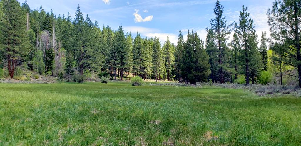
For our crew we choose the Northern route up to the Silver King Valley and made our trip an out an back totaling just over 8 miles. This route is not as well used as the other route and had spots where the trail was faint at best, but we just kept Silver King Creek to our left and traveled through the watershed to the meadow areas. There are several Aspen lined meadows along this route and most river locations we found early were heavily covered in River Bush making access to the river a little more challenging. The scenic value of this trial is fantastic with the forest color variations, this would make for a great fall color hike as well.
The return hike is completely uphill and can feel a little grueling in the afternoon heat, but over all this hike was really a pleasant surprise. We really enjoyed the tree cover on the trail and access to water all day long to soak our hats and refill water bottles. The meadow sections along the Silver King Creek had multiple Backpacking sites that had previously been used. And as far as crowds, on this final day of May 2020, we saw Zero people in an all day Wilderness hike. You really cant beat that when looking for solitude and a wilderness lifestyle.
Gallery of Trip images
snodgrass trail carson iceberg 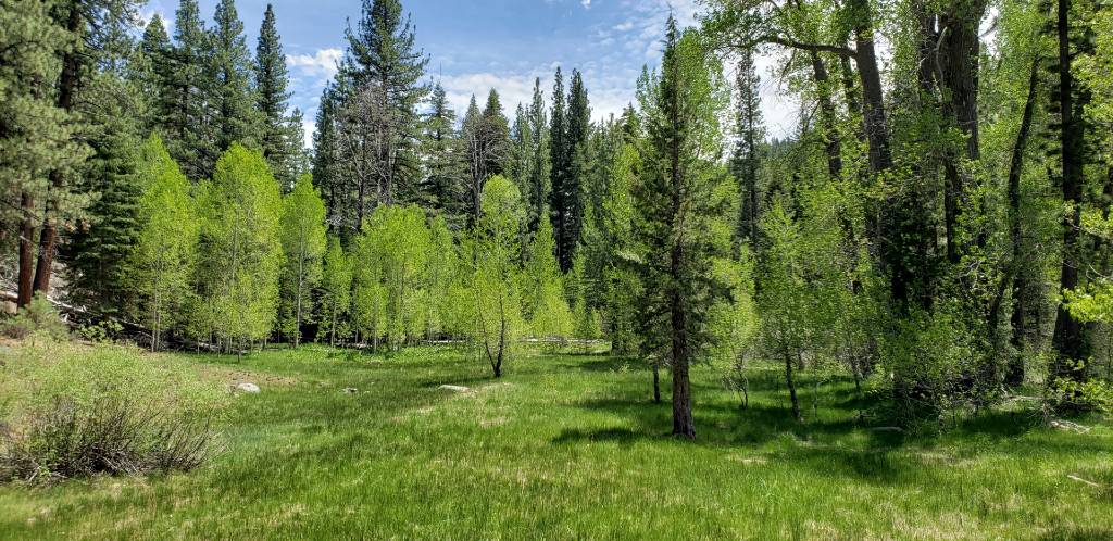
Silver King Creek Meadow 
Wildflowers on trail 
Silver King Creek 


Thanks so much for this post, it helped us plan a backpacking trip to this beautiful area one week before the Slink Fire hit it. You pictures are fabulous and we feel grateful that we were able to hike the Snodgrass trail and see the Silver King Creek and areas beyond.
B Oakley, Thank you, my friend I were discussing this weekend how lucky we feel to have seen it before it burned. Happy you enjoyed your trip. thanks for reading.