DISCOVER THE HIDDEN ADVENTURES OF CARSON ICEBERG WILDERNESS
Explore Like a Marine!
Once the former mountain warfare training grounds of the U.S. Marine Corps, the Carson-Iceberg Wilderness as well as the Carson River draw their names from Kit Carson, one of America’s early western frontiersman. Following his initiative and boldness the first group of emigrants from the East crossed the Sierra in 1841 just north of Sonora Pass.
This unique and special wilderness area is a favorite of Sierra Rec Magazine, because of its quite untouched nature. Filled with deep canyons and river canyons that carve the landscape, the Carson Iceberg Wilderness is an easy escape for the Carson City / Lake Tahoe region of the Sierra.
Inhabited most recently by the Miwok Indians but for over 10,000 years by other native groups, the Carson-Iceberg, has supported human life for thousands of years.
Designated wilderness in 1984 and managed today by both the Toiyabe and Stanislaus National Forests, the Carson-Iceberg includes both eastern and western slopes of the Sierra in its 161,181 acres. Though it lacks modern-day glaciers, the effect of glaciation is clear on its’ distinctive rock formation near Clark Fork Road, the wilderness’s southern boundary. The area is also characterized by a geologic anomaly a series of volcanic peaks and ridges known as the Dardanelles.
Glacial carved river valleys are prevalent in the Carson Iceberg wilderness but lakes are limited. Compared to the Desolation Wilderness to the North, Carson Iceberg Wilderness is far less visited by tourist traffic and backpackers, hikers and horseman can find a quiet day in the wilderness in almost every corner.

Access to the Carson Iceberg Wilderness generally takes a little navigation on several back road connections that will end at the wilderness boarded. Locations such as Wolf Creek or the Highland route have limited amenity Campgrounds suitable for horses at the wilderness boundaries. Bull run Lake, Sword Lake and Heiser lake are the most common lake backpacking destinations. The headwaters of the East Fork of the Carson River, the Clark Fork of the Stanislaus, and the Mokelumne River can also be explored in the Carson Iceberg Wilderness.
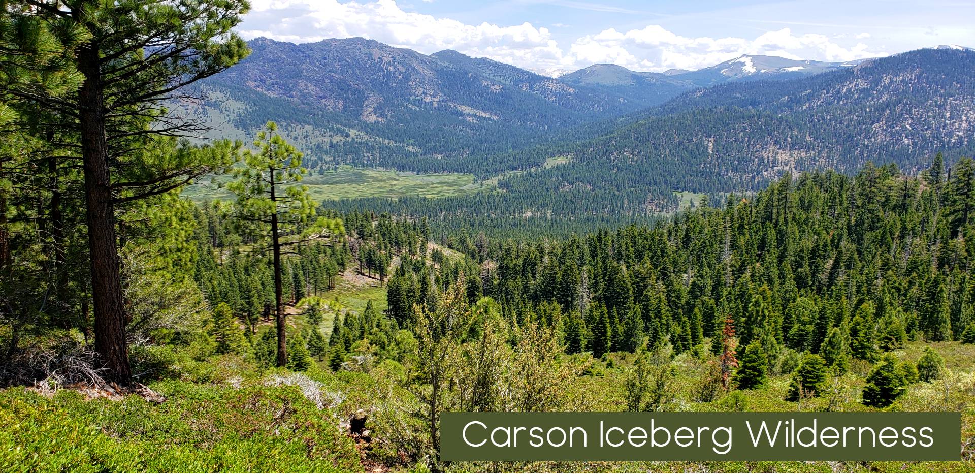
Featured Carson Iceberg Wilderness Adventures
Editors Choice – Carson Iceberg Wilderness Adventure
Congress designated the Carson-Iceberg Wilderness in 1984. Most of the area still includes cattle grazing allotments, and you will likely encounter cows or their signs from July to September. The Pacific Crest National Scenic Trail runs for over 26 miles within the Carson-Iceberg. About 200 total miles of foot and horse trails give access to this outstanding wilderness, where human use is moderate, especially on the eastern side.
Carson-Iceberg Wilderness: Trail Mileages
Stanislaus National Forest
Day Hiking
Recreation areas with activity Day Hiking:
- Elephant Rock Lake Trailhead
- Rock Lake Trail
- Gardner Meadow Trailhead
- Asa Lake/ Lower Gardner Meadow Trail
- Upper Gardner Meadow Trail
- Highland Creek Trailhead (at Highland Lakes)
- Highland Creek Trail (Highland Creek Trailhead)
- Mosquito Lakes Trailhead
- Emigrant/ MCCT Trail (Mosquito Lakes Trailhead)
- Heiser Lake Trail
- Mosquito Lakes to Pacific Valley/ MCCT Trail
- Mosquito Lks to PacificV/MCCT (Mosq Lks Trailhead)
- Mosquito Lks to PacificV/MCCT (PacificV Trailhead)
- Pacific Valley Trailhead
- Bull Run Creek Trail
- Silver Valley Trailhead-Carson Iceberg Wilderness
- Stanislaus Meadow Trailhead
- Bull Run Lake Trail
- Emigrant/ MCCT Trail (Stanislaus Meadow Trailhead)
- Summit Lake/ Mud Lake Trailhead
- Tryon Meadow Trailhead
- Milk Ranch Meadow Trail
- Wheats Meadow Trailhead (Spicer Dam Side)(CIW)
Backpacking
Recreation areas with activity Backpacking:
- Elephant Rock Lake Trailhead
- Rock Lake Trail
- Gardner Meadow Trailhead
- Asa Lake/ Lower Gardner Meadow Trail
- Upper Gardner Meadow Trail
- Highland Creek Trailhead (at Highland Lakes)
- Highland Creek Trail (Highland Creek Trailhead)
- Mosquito Lakes Trailhead
- Emigrant/ MCCT Trail (Mosquito Lakes Trailhead)
- Heiser Lake Trail
- Mosquito Lakes to Pacific Valley/ MCCT Trail
- Mosquito Lks to PacificV/MCCT (Mosq Lks Trailhead)
- Mosquito Lks to PacificV/MCCT (PacificV Trailhead)
- Pacific Valley Trailhead
- Bull Run Creek Trail
- Silver Valley Trailhead-Carson Iceberg Wilderness
- Stanislaus Meadow Trailhead
- Bull Run Lake Trail
- Emigrant/ MCCT Trail (Stanislaus Meadow Trailhead)
- Summit Lake/ Mud Lake Trailhead
- Tryon Meadow Trailhead
- Milk Ranch Meadow Trail
- Wheats Meadow Trailhead (Spicer Dam Side)(CIW)
Horse Riding
Recreation areas with activity Horse Riding:
- Gardner Meadow Trailhead
- Asa Lake/ Lower Gardner Meadow Trail
- Upper Gardner Meadow Trail
- Highland Creek Trailhead (at Highland Lakes)
- Highland Creek Trail (Highland Creek Trailhead)
- Mosquito Lakes Trailhead
- Emigrant/ MCCT Trail (Mosquito Lakes Trailhead)
- Mosquito Lakes to Pacific Valley/ MCCT Trail
- Mosquito Lks to PacificV/MCCT (Mosq Lks Trailhead)
- Mosquito Lks to PacificV/MCCT (PacificV Trailhead)
- Pacific Valley Trailhead
- Bull Run Creek Trail
- Stanislaus Meadow Trailhead
- Bull Run Lake Trail
- Emigrant/ MCCT Trail (Stanislaus Meadow Trailhead)
- Milk Ranch Meadow Trail
- Wheats Meadow Trailhead (Spicer Dam Side)(CIW)
Featured Trails and Elevations of the Carson Iceberg Wilderness
- Trailhead: Arnot Creek—Elevation 6240’, native surface, limited parking, fair overnight camping opportunities, no facilities.
From Summit Ranger District (Pinecrest) take Hwy 108 east 20 miles to Clark Fork Road. Turn left on Clark Fork Road and continue 6.5 miles. Trailhead is just across from the Clark Fork Campground on left.
From Mi-Wok Ranger District (Mi Wuk Village) take Hwy 108 east 32 miles to Clark Fork Road. Turn left and continue 6.5 miles. Trailhead is just across from the Clark Fork Campground on left. - Trailhead: Clark Fork
Elevation 6400’, native surface, limited parking, fair overnight camping opportunities, no facilities.
From Summit Ranger District (Pinecrest) take Hwy 108 east 20 miles to Clark Fork Road. Turn left on Clark Fork Road and continue 10 miles to the end of the road. Trail departs from right-hand side of road along Clark Fork Creek.
From Mi-Wok Ranger District (Mi Wuk Village) take Hwy 108 east 32 miles to Clark Fork Road. Turn left on Clark Fork Road and continue 10 miles to the end of the road. Trail departs from right-hand side of road along Clark Fork Creek. - Trailhead: Corral Valley
Elevation: 8,300’ - Trailhead: Heiser Lake
Elevation: 7,950’ - Trailhead: Pacific Valley
Elevation: 7,600’ - Trailhead: Seven Pines
Elevation 6400’, native surface, limited parking, fair overnight camping opportunities, no facilities.
From Summit Ranger District (Pinecrest) take Hwy 108 east 26.5 miles, a mile past the Eureka Valley Campground. Trailhead is on left. Watch for trailhead sign. Parking just off highway.
From Mi-Wok Ranger District (Mi Wuk Village) take Hwy 108 east 39 miles, a mile past the Eureka Valley Campground. Trailhead is on left. Watch for trailhead sign. Parking just off highway. - Trailhead: Sonora Pass/
Pacific Crest Trail (North)
Elevation 9600’, improved surface, limited parking, fair overnight camping opportunities, accessible restrooms. Pacific Crest Trail crosses Hwy 108 at parking area.
From Summit Ranger District (Pinecrest) take Hwy 108 east 38½ miles. Parking area located on left.
From Mi-Wok Ranger District (Mi Wuk Village) take Hwy 108 east 51½ miles. Parking area located on left.
From Bridgeport Ranger District (Bridgeport) take Hwy 395 north 17 miles to Hwy 108. Go west on Hwy 108 for 14 miles. Parking located on right. - Trailhead: Spicer Mdw Reservoir
Elevation: 6,400’ - Trailhead: Wheat’s Meadow
Elevation 6400’, native surface, limited parking, fair overnight camping opportunities, no facilities.
From Summit Ranger District (Pinecrest) take Hwy 108 east 20 miles to Clark Fork Road. Turn left on Clark Fork Road, continue 1 mile until crossing second bridge and turn left toward Fence Creek Campground. Continue 4 miles and look closely for trailhead sign on left (among trees), about 1½ mile before County Line trailhead.’
From Mi-Wok Ranger District (Mi Wuk Village) take Hwy 108 east 32 miles to Clark Fork Road. Turn left on Clark Fork Road, continue 1 mile until crossing second bridge and turn left toward Fence Creek Campground. Continue 4 miles and look closely for trailhead sign on left (among trees), about 1½ mile before County Line trailhead.’ - Trailhead: Disaster Creek
Elevation 6400’, native surface, limited parking, fair overnight camping opportunities, no facilities.
From Summit Ranger District (Pinecrest) take Hwy 108 east 20 miles to Clark Fork Road. Turn left on Clark Fork Road and continue 10 miles to the end of the road. Trail departs from left-hand side of road along Disaster Creek.
From Mi-Wok Ranger District (Mi Wuk Village) take Hwy 108 east 32 miles to Clark Fork Road. Turn left on Clark Fork Road and continue 10 miles to the end of the road. Trail departs from left-hand side of road along Disaster Creek. - Trailhead: Ebbett’s Pass
Elevation: 8,800’ - Trailhead: Elephant Rock
Elevation: 7,100’ - Trailhead: St Mary’s Pass
Elevation 9600’, native surface, limited parking, fair overnight camping opportunities, no facilities. Pacific Crest Trail crosses Hwy 108 at parking area.
From Summit Ranger District (Pinecrest) take Hwy 108 east 37½ miles. Parking area is located on left.
From Mi-Wok Ranger District (Mi Wuk Village) take Hwy 108 east 50½ miles. Parking area is located on left.
From Bridgeport Ranger District (Bridgeport) take Hwy 395 north 17 miles to Hwy 108. Go west on Hwy 108 for 14 miles. Parking located on right. - Trailhead: County Line
Elevation 7200’, native surface, limited parking, fair overnight camping opportunities, no facilities.
From Summit Ranger District (Pinecrest) take Hwy 108 east 20 miles to Clark Fork Road. Turn left on Clark Fork Road, continue 1 mile until crossing second bridge and turn left toward Fence Creek Campground. Continue 5.5 miles to the end of the road.
From Mi-Wok Ranger District (Mi Wuk Village) take Hwy 108 east 32 miles to Clark Fork Road. Turn left on Clark Fork Road, continue 1 mile until crossing second bridge and turn left toward Fence Creek Campground.
| Trailhead | Elevation | Destination | Miles |
|---|---|---|---|
| Arnot Creek | 6,350′ | Arnot Creek/Woods Gulch Jct. | 2.0 |
| Arnot Creek | 6,350′ | Woods Gulch | 4.0 |
| Arnot Creek | 6,350′ | Jenkins Canyon | 6.0 |
| Arnot Creek | 6,350′ | Disaster Creek Trail | 6.5 |
| Arnot Creek | 6,350′ | Highland Creek | 8.0 |
| Arnot Creek | 6,350′ | Upper Gardner Meadow | 8.0 |
| Arnot Creek | 6,350′ | Hiram Meadow | 10.0 |
| Arnot Creek | 6,350′ | Sword Lake | 12.0 |
| Arnot Creek | 6,350′ | Highland Lake | 12.5 |
| Arnot Creek | 6,350′ | Lost Lake | 12.5 |
| Arnot Creek | 6,350′ | County Line TH | 14.0 |
| Arnot Creek | 6,350′ | Lake Alpine | 18.0 |
| Trailhead | Elevation | Destination | Miles |
|---|---|---|---|
| Corral Valley | 8,300′ | Coyote Valley TH | 1.0 |
| Corral Valley | 8,300′ | Poison Flat | 4.2 |
| Corral Valley | 8,300′ | Coyote Valley | 4.3 |
| Corral Valley | 8,300′ | Connel’s Cow Camp | 5.8 |
| Corral Valley | 8,300′ | Soda Spring | 6.2 |
| Corral Valley | 8,300′ | Poison Lake | 6.7 |
| Corral Valley | 8,300′ | Carson River | 8.2 |
| Corral Valley | 8,300′ | Falls Meadow | 8.2 |
| Corral Valley | 8,300′ | Silver Creek Meadow | 9.3 |
| Corral Valley | 8,300′ | Murray Canyon | 10.2 |
| Corral Valley | 8,300′ | PCT Trail | 11.2 |
| Corral Valley | 8,300′ | Ebbett’s Pass | 22.7 |
| Corral Valley | 8,300′ | Sonora Pass | 25.2 |
| Trailhead | Elevation | Destination | Miles |
|---|---|---|---|
| Seven Pines | 6,200′ | Clark Fork/St Mary’s | 7.0 |
| Seven Pines | 6,200′ | Boulder Creek | 9.0 |
| Seven Pines | 6,200′ | Clark Fork Meadow | 9.5 |
| Seven Pines | 6,200′ | Boulder Lake | 10.8 |
| Seven Pines | 6,200′ | Clark Fork TH | 11.5 |
| Seven Pines | 6,200′ | St Mary’s TH | 12.0 |
| Trailhead | Elevation | Destination | Miles |
|---|---|---|---|
| Wheat’s Meadow | 6,500′ | Dardanelle Creek | 1.5 |
| Wheat’s Meadow | 6,500′ | Wheat’s Cow Camp | 3.0 |
| Wheat’s Meadow | 6,500′ | Burgson Lake | 3.1 |
| Wheat’s Meadow | 6,500′ | Sword Lake | 4.5 |
| Wheat’s Meadow | 6,500′ | Lost Lake | 5.0 |
| Wheat’s Meadow | 6,500′ | Bummer’s Flat TH | 6.0 |
| Wheat’s Meadow | 6,500′ | County Line TH | 6.5 |
| Wheat’s Meadow | 6,500′ | Spicer Mdw Reservoir | 6.5 |
| Wheat’s Meadow | 6,500′ | Highland Creek | 8.5 |
| Trailhead | Elevation | Destination | Miles |
|---|---|---|---|
| Disaster Creek | 6,400′ | Adams Camp | 2.5 |
| Disaster Creek | 6,400′ | Adams Camp PCT | 3.5 |
| Disaster Creek | 6,400′ | Golden Canyon | 3.5 |
| Disaster Creek | 6,400′ | Upper Gardner Mdw | 6.5 |
| Disaster Creek | 6,400′ | Carson Falls | 7.5 |
| Disaster Creek | 6,400′ | Murry Canyon | 8.5 |
| Disaster Creek | 6,400′ | Falls Meadow | 9.0 |
| Trailhead | Elevation | Destination | Miles |
|---|---|---|---|
| Elephant Rock | 7,100′ | Rock Lake | 2.0 |
| Elephant Rock | 7,100′ | Silver Valley TH | 3.0 |
| Elephant Rock | 7,100′ | Duck Lake | 4.0 |
| Elephant Rock | 7,100′ | Summit Lake TH | 5.0 |
| Elephant Rock | 7,100′ | Rock Lk Trl to Duck L | 5.5 |
| Elephant Rock | 7,100′ | Highland Creek | 8.5 |
| Elephant Rock | 7,100′ | Bull Run Peak | 10.5 |
| Trailhead | Elevation | Destination | Miles |
|---|---|---|---|
| County Line | 7,200′ | Sword Lake | 2.0 |
| County Line | 7,200′ | Lost Lake | 2.5 |
| County Line | 7,200′ | Highland Creek | 6.0 |
| County Line | 7,200′ | Wheats Mdw TH | 6.5 |
| County Line | 7,200′ | Hiram Meadow | 8.0 |
| County Line | 7,200′ | Highland Lake | 12.5 |
| Trailhead | Elevation | Destination | Miles |
|---|---|---|---|
| Clark Fork | 6,400′ | Boulder Creek | 2.5 |
| Clark Fork | 6,400′ | Boulder Lake | 4.2 |
| Clark Fork | 6,400′ | Seven Pines Trail | 4.5 |
| Clark Fork | 6,400′ | Clark Fork Meadow | 7.0 |
| Clark Fork | 6,400′ | St Mary’s Pass TH Jc | 9.5 |
| Clark Fork | 6,400′ | St Mary’s Pass | 10.0 |
| Trailhead | Elevation | Destination | Miles |
|---|---|---|---|
| Heiser Lake | 7,950′ | Heiser Lake | 1.5 |
| Heiser Lake | 7,950′ | Bull Run Lake | 3.6 |
| Heiser Lake | 7,950′ | Stanislaus Mdw TH | 5.0 |
| Trailhead | Elevation | Destination | Miles |
|---|---|---|---|
| Pacific Valley | 7,600′ | Bull Run Peak | 3.0 |
| Pacific Valley | 7,600′ | Highland Creek | 6.5 |
| Pacific Valley | 7,600′ | Hiram Meadow | 7.0 |
| Pacific Valley | 7,600′ | Tryon Meadow | 8.0 |
| Pacific Valley | 7,600′ | Jenkins Canyon | 8.5 |
| Pacific Valley | 7,600′ | Sword Lake | 10.5 |
| Pacific Valley | 7,600′ | Lost Lake | 11.0 |
| Pacific Valley | 7,600′ | County Line TH | 12.5 |
| Trailhead | Elevation | Destination | Miles |
|---|---|---|---|
| Sonora Pass/Pacific Crest Trail (North) | 9,600′ | Wolf Creek | 3.0 |
| Sonora Pass/Pacific Crest Trail (North) | 9,600′ | White Canyon | 9.0 |
| Sonora Pass/Pacific Crest Trail (North) | 9,600′ | Carson Falls | 10.5 |
| Sonora Pass/Pacific Crest Trail (North) | 9,600′ | Golden Canyon | 11.5 |
| Sonora Pass/Pacific Crest Trail (North) | 9,600′ | Asa Lake | 17.0 |
| Sonora Pass/Pacific Crest Trail (North) | 9,600′ | Noble Lake | 17.6 |
| Sonora Pass/Pacific Crest Trail (North) | 9,600′ | Noble Creek | 21.6 |
| Sonora Pass/Pacific Crest Trail (North) | 9,600′ | Ebbett’s Pass | 24.5 |
| Trailhead | Elevation | Destination | Miles |
|---|---|---|---|
| Spicer Mdw Reservoir | 6,400′ | Wheat’s Cow Camp | 3.5 |
| Spicer Mdw Reservoir | 6,400′ | Dardanelle Creek | 5.0 |
| Spicer Mdw Reservoir | 6,400′ | Bummer’s Flat | 6.5 |
| Spicer Mdw Reservoir | 6,400′ | Wheat’s Mdw TH | 6.5 |
| Spicer Mdw Reservoir | 6,400′ | Sword Lake | 8.5 |
| Spicer Mdw Reservoir | 6,400′ | Lost Lake | 8.5 |
| Spicer Mdw Reservoir | 6,400′ | County Line TH | 10.0 |
| Spicer Mdw Reservoir | 6,400′ | Highland Creek | 12.0 |
| Spicer Mdw Reservoir | 6,400′ | Hiram Meadow | 14.0 |
| Spicer Mdw Reservoir | 6,400′ | Highland Lake | 18.5 |
| Trailhead | Elevation | Destination | Miles |
|---|---|---|---|
| Ebbett’s Pass | 8,800′ | PCT/Noble Lake | 4.0 |
| Ebbett’s Pass | 8,800′ | Bull Lake Trail | 4.5 |
| Ebbett’s Pass | 8,800′ | Bull Lake | 8.0 |
| Ebbett’s Pass | 8,800′ | Asa Lake | 6.5 |
| Ebbett’s Pass | 8,800′ | Murray Canyon | 10.5 |
| Ebbett’s Pass | 8,800′ | Golden Lake | 12.0 |
| Ebbett’s Pass | 8,800′ | White Canyon | 15.5 |
| Ebbett’s Pass | 8,800′ | Adams Camp | 15.6 |
| Ebbett’s Pass | 8,800′ | Carson Falls | 16.1 |
| Ebbett’s Pass | 8,800′ | Wolf Creek Mdw | 16.5 |
| Ebbett’s Pass | 8,800′ | Disaster Creek TH | 18.1 |
| Ebbett’s Pass | 8,800′ | Wolf Creek | 21.5 |
| Ebbett’s Pass | 8,800′ | Sonora Pass TH | 24.5 |
| Trailhead | Elevation | Destination | Miles |
|---|---|---|---|
| St Mary’s Pass | 9,550′ | Clark Fork Meadow | 2.5 |
| St Mary’s Pass | 9,550′ | Stanislaus Peak | 3.0 |
| St Mary’s Pass | 9,550′ | Seven Pines Trail Jct. | 5.0 |
| St Mary’s Pass | 9,550′ | Boulder Creek | 7.0 |
| St Mary’s Pass | 9,550′ | Boulder Lake | 8.8 |
| St Mary’s Pass | 9,550′ | Clark Fork TH | 9.5 |
| St Mary’s Pass | 9,550′ | Seven Pines TH | 12.0 |
Wilderness Regulations Emigrant/Carson Iceberg/Mokelumne Areas
Stanislaus National Forest
The following regulations are necessary to assure that future generations will find the
Wilderness at least as wild and free as it is for your visit. Violation of any of these regulations could result in a substantial penalty. Official
orders authorizing enforcement are available for review in Forest and District offices. Wilderness visitors must possess a valid permit for overnight trips.
Do not camp, travel or gather in groups exceeding 15 persons. (Limit per group is 12 persons in the Mokelumne Wilderness. Voluntary reduction of group size when traveling in wilderness areas is always encouraged as a hedge against resource damage.
- Dispose of body waste and wash water more than 100 feet from water, trails and campsites. Use “cat holes” six to eight inches deep for human waste.
- Do not use any soap in lakes or streams. Even biodegradable soaps are a shock to fragile and pristine
aquatic ecosystems. “Wash” using a bucket well away from surface water. - Campsites must be at least 100 feet from lakes, streams, trails and any “No Camping” signs.
- Pack out all refuse.
- Do not cut standing trees or deface them in any way.
- Do not shortcut trail switchbacks.
- Mechanized and motorized vehicles and equipment (including chainsaws, bicycles, Drones and carts) are prohibited. Non-motorized wheelchairs may be utilized.
- Construction of items such as rock walls, structures, tables or improvements of any permanent kind is prohibited.
- Do not build new fire rings—use the existing ones, please (except those too close to water).
- Do not leave any property (including camping gear, food or other provisions) unattended for longer than 24 hours.
- Discharging of firearms is permitted only for the taking of game during appropriate hunting seasons.
- Out-of-control dogs are not permitted. Check county ordinances for pet control requirements.
- One night camping limits (per trip) are applicable at the following lakes: Grouse, Camp, Bear, Powell and Waterhouse
- Campfires are prohibited above 9,000 feet in elevation and within ½ mile of Emigrant Lake.
WILDERNESS PERMITS
The western half of the Carson-Iceberg is managed by the Stanislaus National Forest, while the eastern half is managed by the Humboldt-Toiyabe National Forest. There are no quotas on the Carson-Iceberg Wilderness, however Permits are required for all overnight trips. Use the links in the sidebar to access the appropriate National Forest for more info.
BEARS AND FOOD STORAGE
Bear canisters are recommended. Use the Bear Section on this site to learn more.
CAMPFIRES
Campfires are generally allowed within the Carson-Iceberg wilderness, with a few exceptions. In places where fires are allowed, always follow smart campfire guidelines.
Not Ready for a full blown Wilderness Overnight Experience? Check ut Local Camping Solutions near by and day hike into your favorite wilderness locations. Our Sierra Nevada Camping Guide is a great place to start
PETS
Pets must be kept under control and not allowed to harass wildlife or people.
Wildlife
The Carson-Iceberg Wilderness, located in the Sierra Nevada range of California, is home to a diverse array of wildlife. While the exact species you may encounter can vary depending on factors such as season and habitat, here are some of the wildlife commonly found in this wilderness area:
- Mammals:
- Black bears
- Mountain lions (also known as cougars or pumas)
- Mule deer
- Coyotes
- Gray foxes
- Bobcats
- Bighorn sheep
- Martens
- Marmots
- Chipmunks
- Squirrels (including Douglas squirrels and golden-mantled ground squirrels)
- Birds:
- Stellar’s jays
- Mountain chickadees
- White-headed woodpeckers
- Red-tailed hawks
- Golden eagles
- Peregrine falcons
- Clark’s nutcrackers
- Western bluebirds
- American dippers (also known as water ouzels)
- Various species of owls (such as great horned owls and northern pygmy owls)
- Reptiles and Amphibians:
- Western fence lizards
- Northern Pacific rattlesnakes
- California kingsnakes
- Various species of frogs and toads (such as Pacific treefrogs and Yosemite toads)
- Fish:
- Rainbow trout
- Brown trout
- Brook trout
- Cutthroat trout
- Golden trout (California state fish)
- Insects and Arachnids:
- Butterflies (including various species like swallowtails and admirals)
- Dragonflies and damselflies
- Beetles
- Spiders (including tarantulas)
Remember to always respect wildlife and their habitats while visiting the Carson-Iceberg Wilderness, and follow guidelines for responsible outdoor recreation to minimize your impact on the environment.
Carson-Iceberg Wilderness Trip Stories
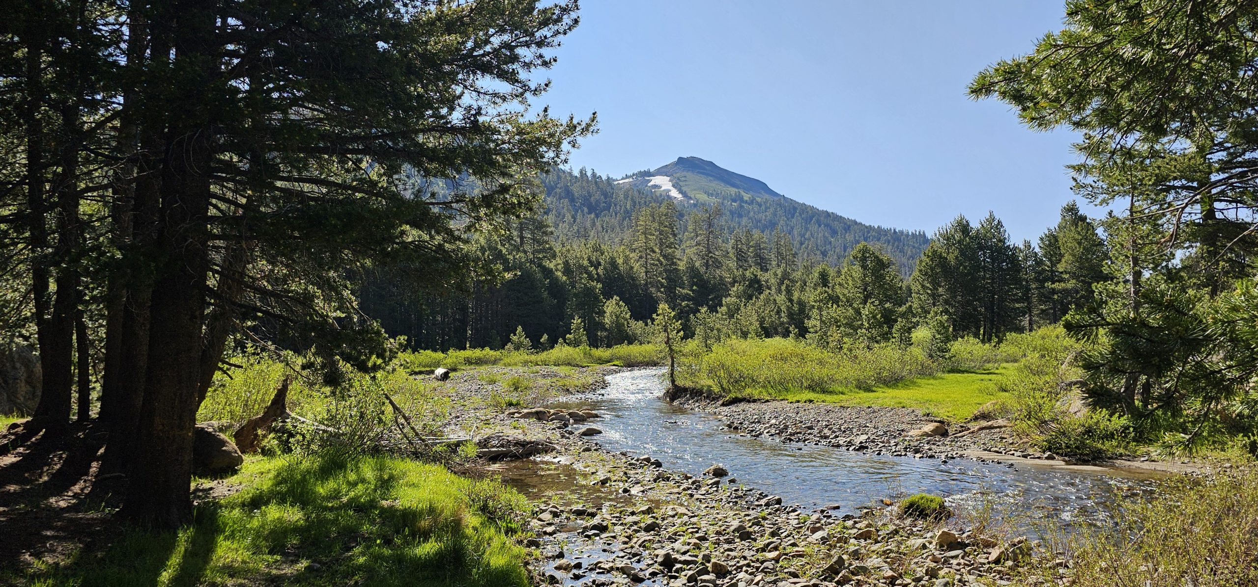
Highland Lakes Dispersed Camping & Gardner Meadow Loop Hike
June 25, 2025
Words & Photos by Charlie Pankey | Sierra Rec Magazine Sponsored by Mountain House, EXPED, and Nestout Summer is finally here, and with it comes our favorite way to explore
Read more
Ebbetts Pass: Your Gateway to Sierra Adventure
August 5, 2024
Ebbetts Pass is more than just a scenic drive; it’s a portal to some of the Sierra Nevada’s most pristine wilderness and day trip adventures. With its towering peaks, crystal-clear
Read more
10 Incredible Trail Experiences We’d Like to Do Again
July 18, 2024
Some trails leave us yearning for more, wishing we had taken just a few more steps or spent a little more time soaking in the views. Our list of incredible
Read more
The Trail Mix: 10 Hikes That Won’t Kick Your Butt (Too Hard)
May 24, 2024
Sierra Smackdown: A Beginner’s Guide to Crushing (and Not Crashing) in the Wild Okay, so you’ve seen the postcards – Yosemite’s granite cliffs scraping the sky, turquoise lakes reflecting double
Read more
Great Family Hikes Off Sierra Scenic Byways
July 17, 2023
Crossing the Sierra during the summer season is a right of passage for many that love to adventure into the Sierra for travel and recreation. Typically the three largest scenic
Read more
The Road to Bagley Valley
May 30, 2023
Man stands and views Carson Iceberg Wilderness. Photo Credit Brandon Pankey
Read moreExplore More Wilderness Areas
- Wilderness Adventure — All Sierra Wilderness Areas
- Explore Desolation Wilderness
- Explore Ansel Adams Wilderness
- Emigrant Wilderness
- Explore John Muir Wilderness
- Explore Granite Chief Wilderness
- Explore Golden Trout Wilderness
- Explore Mokelumne Wilderness
- Explore Bucks Lake Wilderness
- Explore the Caribou Wilderness of Northern California
- Exploring Hoover Wilderness
- Exploring the Dinkey Lake Wilderness
- Jennie Lakes Wilderness