Yosemite National Park – Public Notice – April 25-2023 – Yosemite National park today announced via its social channels that the Park in preparation of massive snow melt flood potential this week that Yosemite Valley will Close Friday until at least Wednesday May 3.
Most of Yosemite Valley will close starting Friday, April 28, at 10 pm, due to a forecast of flooding. This closure will last until Wednesday, May 3—possibly longer. Additional flooding and closures may occur later in May or June. Reservations for lodging and campgrounds in eastern Yosemite Valley will automatically be canceled and refunded. Wilderness permits can be rescheduled to alternate trailheads as space allows.
During this closure, Wawona, Mariposa Grove (via hike only), Crane Flat area, Hetch Hetchy, and western Yosemite Valley will be open. In Yosemite Valley, the closure will be at El Capitan crossover (the road that crosses the Merced River just east of El Capitan). There will be no visitor access (including pedestrian access) east of that road. Parking in western Yosemite Valley and throughout the park will be extremely limited. Do not park off road. No services will be available in western Yosemite Valley.
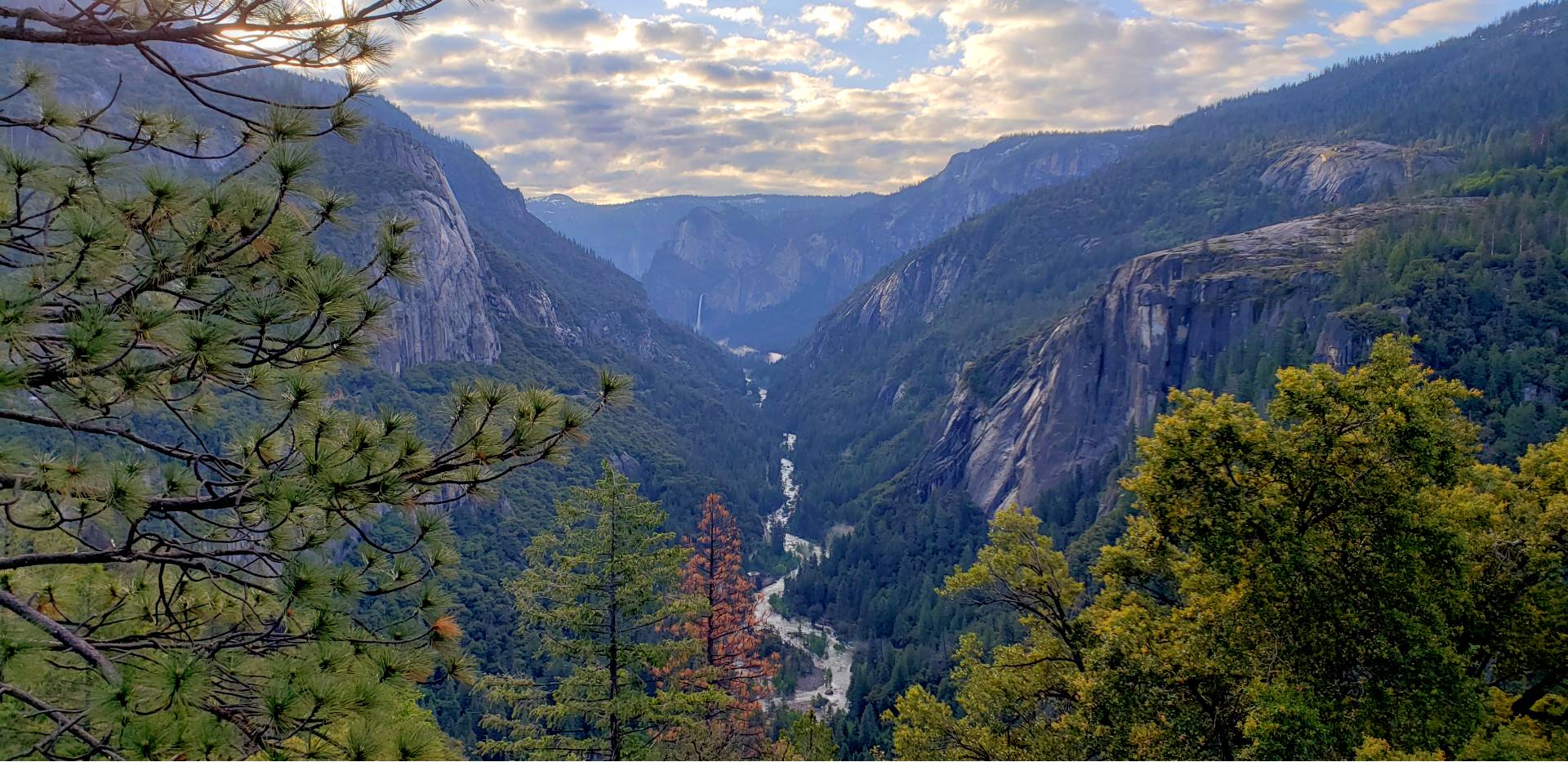
As of the April 1 snow survey, Yosemite’s snowpack (based on water content) is over 240% of average, which is a record. Above 8,000 feet, snow is the deepest ever recorded. The heavy snow will affect your visit to Yosemite, especially from late April into July. Additionally, some construction projects will cause traffic delays.
Will Yosemite Valley flood?
While visiting Yosemite Valley with high water is an amazing experience, Yosemite Valley closes once the Merced River at Pohono Bridge is forecast to exceed 10 feet. At flood stage (10 feet), roads and other critical infrastructure begin flooding, making it unsafe for visitors to be in Yosemite Valley. It is very likely that the Merced River will reach flood stage off and on from late April through early July.
If Yosemite Valley closes, anyone with reservations in Yosemite Valley during the closure for lodging (Curry Village, Housekeeping Camp, Yosemite Valley Lodge, and The Ahwahnee) or camping (Upper Pines, North Pines, Lower Pines, and Camp 4) will receive a full refund.
Update (April 25): Most of Yosemite Valley will close starting Friday, April 28, at 10 pm, due to a forecast of flooding. This closure will be in place until Wednesday, May 3, but could last longer. Reservations for lodging and campgrounds in eastern Yosemite Valley will automatically be canceled and refunded. Wilderness permits can be rescheduled to alternate trailheads as space allows.
When will Tioga, Glacier Point, and Mariposa Grove Roads open?
All three of these roads will open late, which will cause other areas of the park (especially Yosemite Valley) to be very busy.
Tioga Road
Tioga Road opening work begins on or around April 15 each year. Snowpack in the Tuolumne River basin was 244% of average on April 1, 2023. The latest opening in modern history was July 1, which was in 2019 (at 176% of average snowpack) and 1998 (156% of average snowpack). In 1983, the previous record snow year, the road opened on June 29 (224% of average snowpack). You can view a list of opening dates since 1980 and this year’s plowing progress (updated weekly). Keep in mind that it takes several weeks of additional work before the road can open once road crews have plowed a lane up to Tioga Pass.
Glacier Point Road
Glacier Point Road plowing also begins around April 15. While it takes less time to plow Glacier Point Road, additional road work must occur this year before the road can open. Once open, expect 30-minute delays as the road project concludes. The earliest possible opening for Glacier Point Road is July; it is very likely the road will open later than that.
Mariposa Grove Road
Mariposa Grove Road was damaged this winter. As a result, the road is closed to both shuttle buses and private vehicles. The earliest possible opening for Mariposa Grove Road (and shuttle service) is end of May; it is very likely the road will open later than that. It is possible to hike to the Mariposa Grove (two miles each way with 500 feet of elevation change).
Creek Crossings
Most popular trails do not have unbridged creek crossings, but some do. Unbridged rivers and creeks will be running high well into summer, making them challenging or impossible to cross. Stream heights can fluctuate, so a stream that was passable the day before may not be passable today, or even what was passable in the morning may not be passable in the evening. High flow at any particular location may not be in the afternoon, but could be in the morning or in the middle of the night. Rocks and logs may not be stable and are more slippery than you expect. Steep snowbanks on either side of streams may make crossings even more difficult. Finally, before you cross, look downstream and consider the worst-case scenario if you fall in: where will the water take you: into whitewater or over a waterfall?
Wapama Falls
The Wapama Falls footbridge may close off and on into July due to high water. It will be possible to hike up to near the bridge, but hikers and backpackers will not be able to cross the bridge when it is closed.
Merced River Recreation
The Merced River in Yosemite Valley is likely to remain high into mid-July. This means that the river will be unsafe for swimming, rafting, and boating. Picnic areas along the river may close or have limited space.
