A Favorite Westside Entry Point into Desolation Wilderness
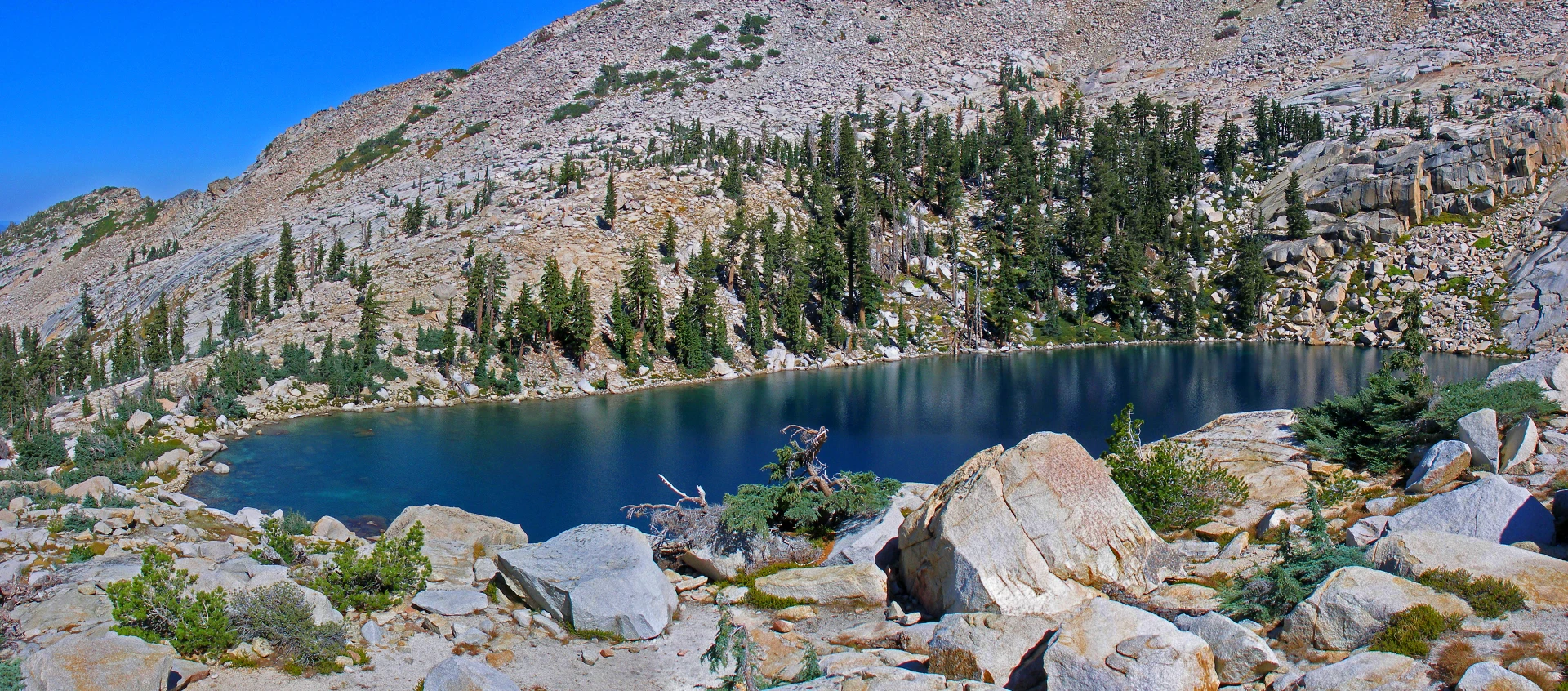
Desolation Wilderness – Trail reports – July 2022 – This one trailhead opens up a world of wilderness resources you can experience that will enliven your spirit, soothe your soul, and recharge your life force. The wilderness resources you’ll see along the Twin Lakes trail include granite in its many forms: huge boulders, glacial erratics, sheer vertical faces of granite, and great open expanses of glacially polished smooth granite.
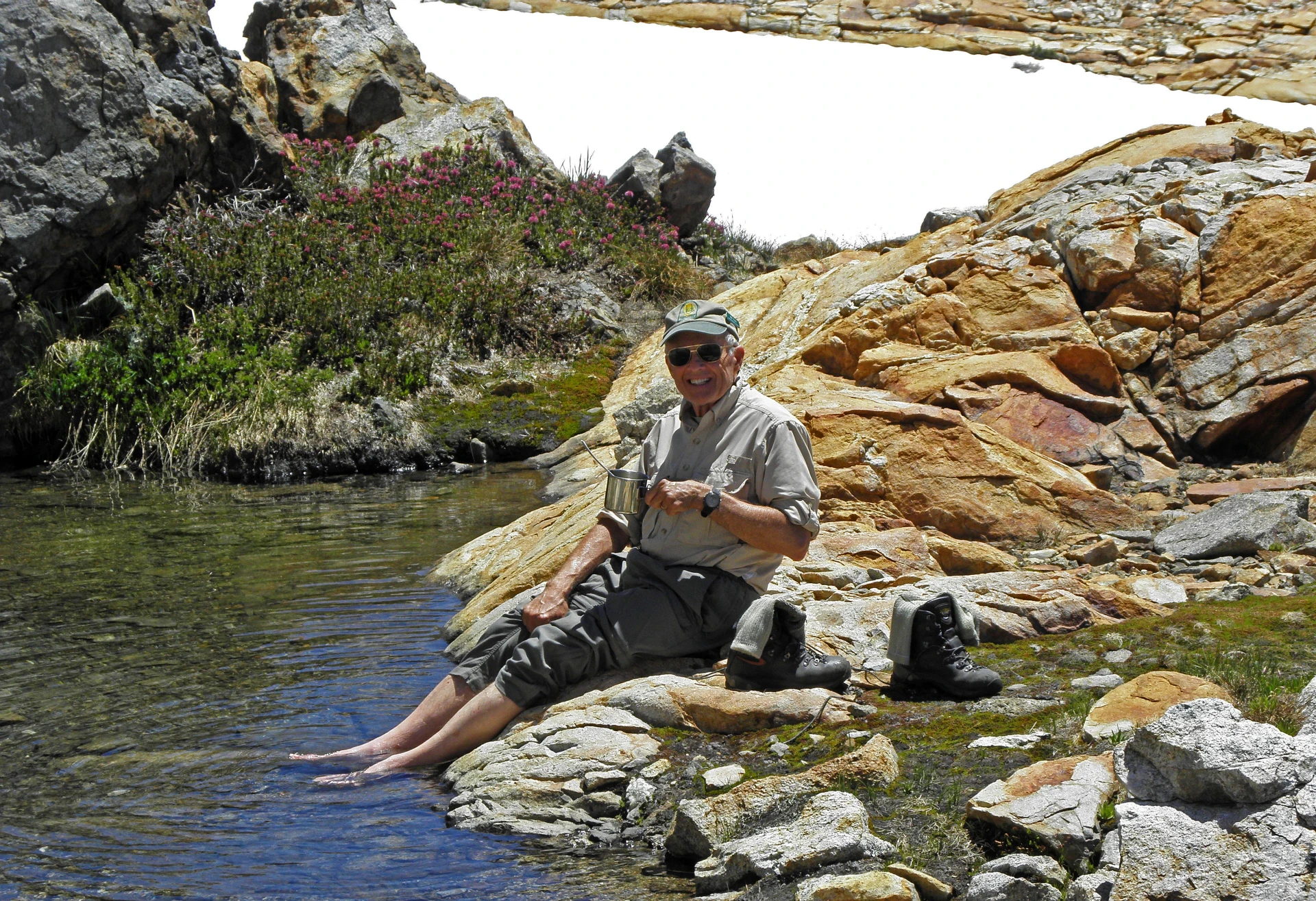
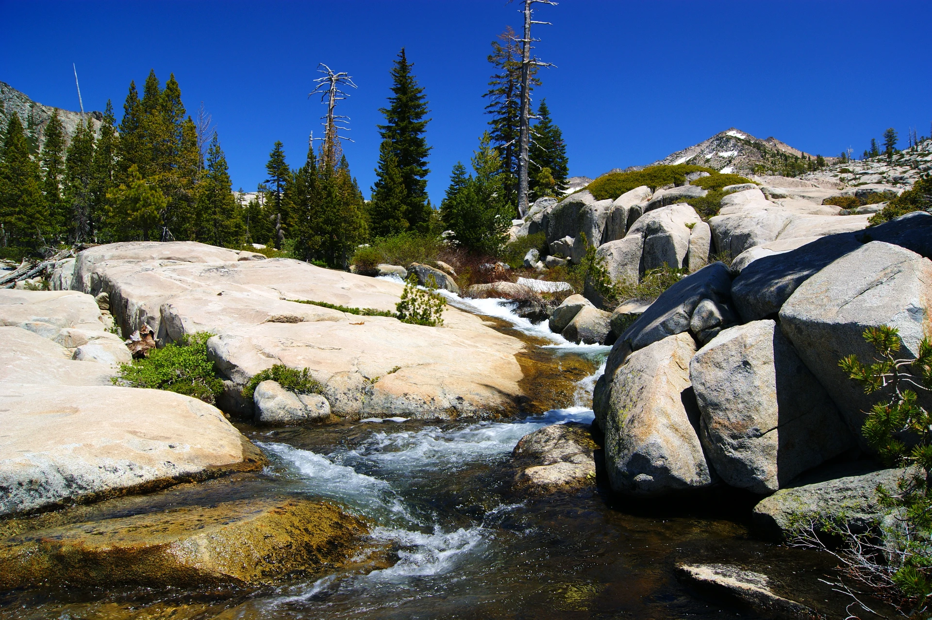
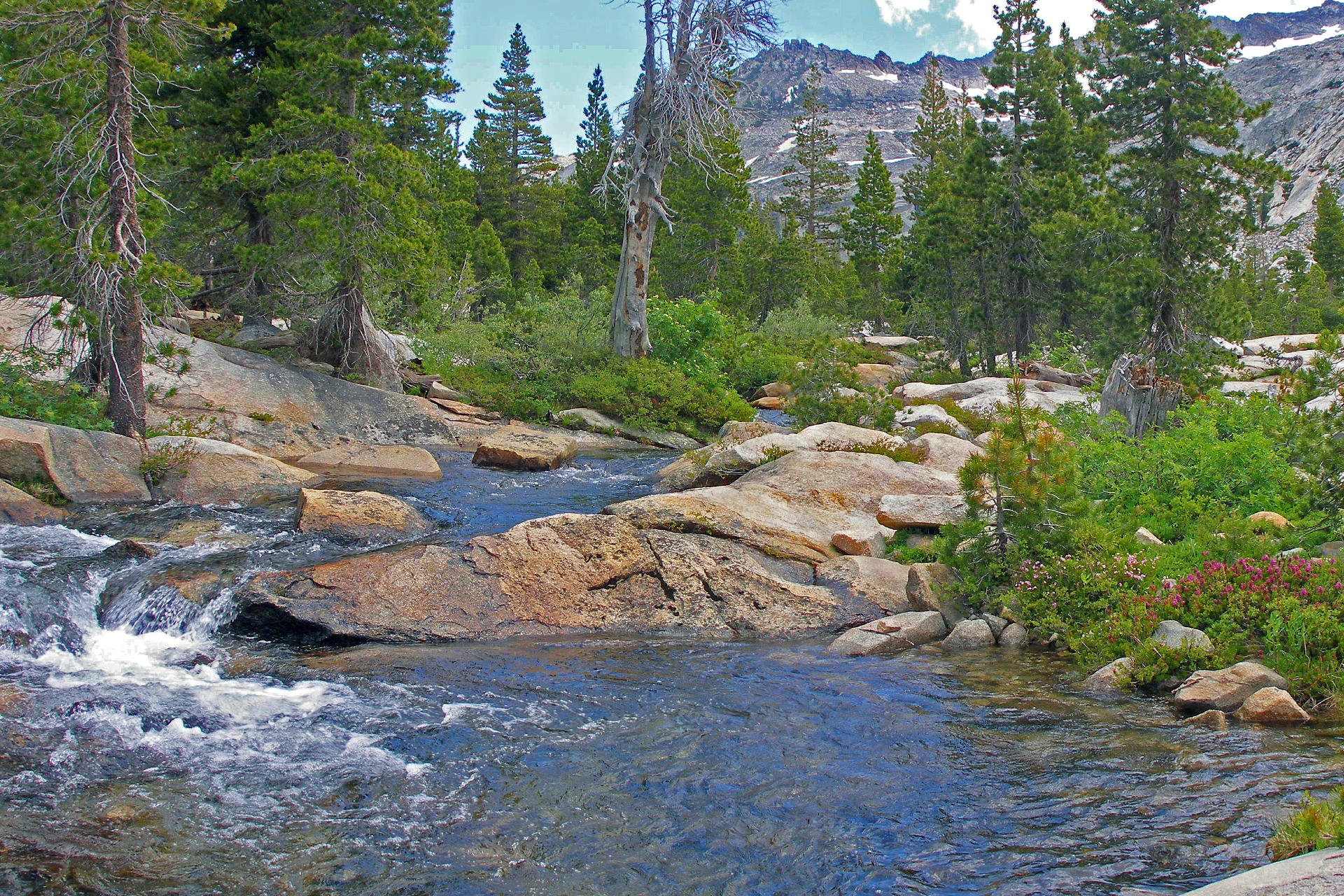
You’ll also encounter an abundance of wildflower species, pockets of old-growth forest, raging streams (early in the season) cascading from quiet pool to pool as the water flows down and out of the wilderness to Wright’s Lake. For the fisherperson, brook and rainbow trout are present in the lakes and some streams. Other protected resources include the sublime qualities associated with the unique and scenic beauty of the broad landscape, the land ‘as it used to be unaltered by man, the pristine qualities found in out-of-the-way sanctuaries of splendor, tranquility, and solitude away from the din. What you glean from your interaction with these natural wilderness resources individually and collectively will become your memories, both mental and digital.
Twin Lakes Trailhead located at Wright’s Lake
Your hike starts from the Twin Lakes Trailhead located at Wright’s Lake. The elevation here is 6960 feet. The trail will lead you to two separate areas of spectacular scenic beauty: Smith and Island Lakes. You will cover about 3 miles to Smith Lake, about 3 miles to Twin Lakes and 3.5 miles to Island Lake. These are one-way mileages. Your total elevation gain from the Twin Lakes Trailhead to Island Lake (at 8120 feet) will be 1160 feet and 1720 feet if you choose to go to Smith Lake (at 8680 feet). Guide books label the trail difficulty as moderate, with some areas strenuous. Once you reach the high country, sections of the trail become easy.
As you depart the Trailhead parking lot, you will hike along a flat are through a semi-marshy-forested area for about a third of a mile before arriving at a point where the trail begins to climb upward. You then hike across open granite for a while and then the trail climbs through the forest until you reach the Desolation Wilderness boundary sign that announces your entrance into an extraordinary place. Ten more minutes along the route, and you arrive at a junction where the trail forks.
Grouse Lake & Smith Lake
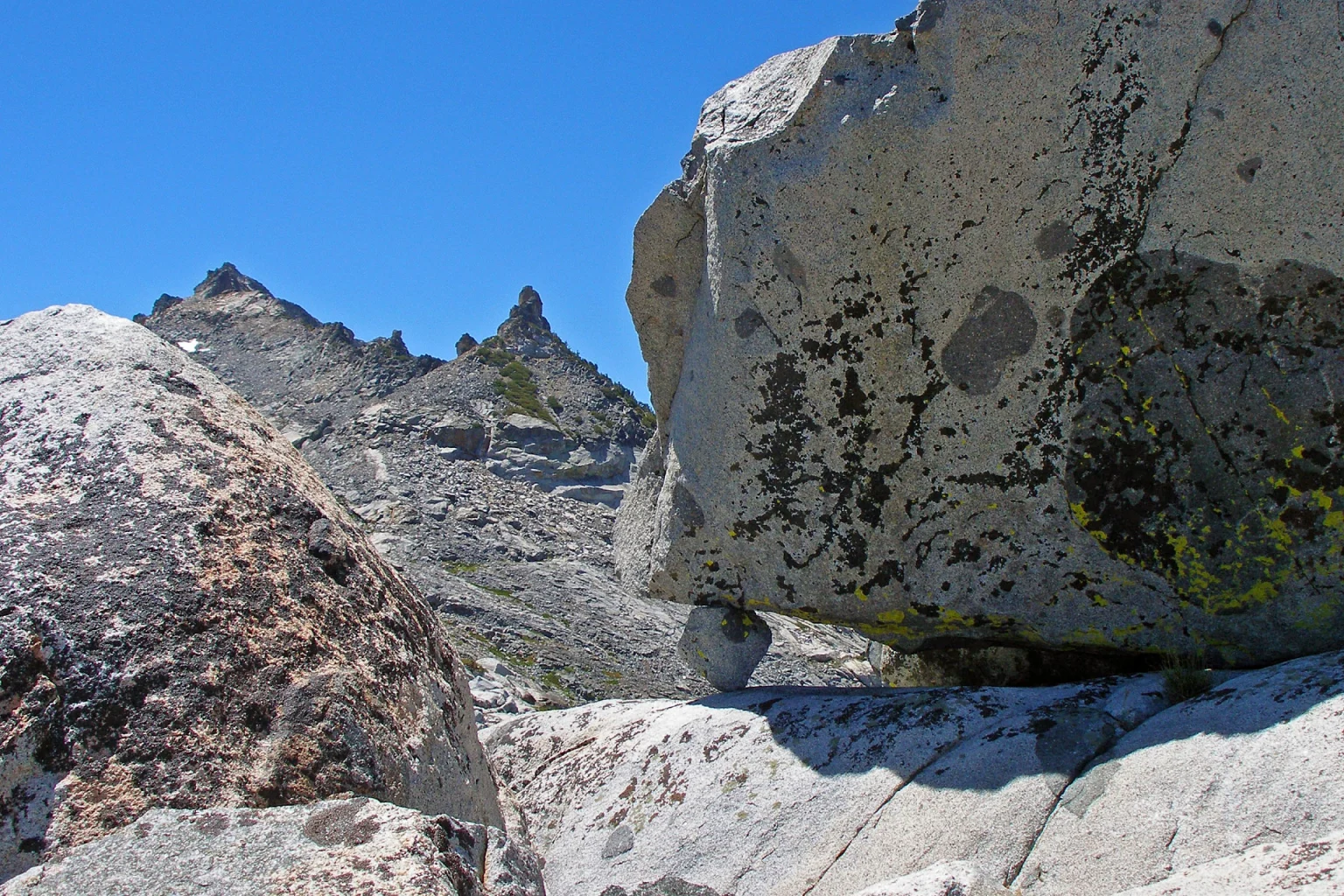
If you want to go to Grouse Lake (elevation 8120 feet), then on up to take the right fork for Smith Lake (the highest lake in Desolation Wilderness at 8680 feet). Following a well-used trail, at times challenging and steep, you will arrive at Grouse Lake, a beautiful alpine lake surrounded mainly by a coniferous forest. Continuing, you will eventually arrive at Smith Lake after a steep climb up and across open granite. From here, the long views to the west are awesome. On a clear day in the valley, you can see the Sacramento skyline.

Twin Lakes & Island Lake
Back at the fork, take the trail to the left if you plan to go to Twin Lakes and Island Lake. In about 100 yards, you will need to cross a stream that carries the snow melt runoff from the Grouse Lake watershed. Once across the stream, you will be on a vast expanse of open granite where it is difficult to follow the trail. Look for little stacks of three rocks (sometimes more) called cairns or ducks that will lead the way until you once again come upon a well-used portion of the trail where footprints reveal the way to go. The Forest Service advises: Don’t follow the ducks. A GPS can be beneficial here,
By now, as you continue along the trail through some switchbacks and across more open granite, you will see on the far eastern horizon (the Pacific Crest) a near vertical set of jagged granite rocks known locally as the Crystal Crags or the Five Fingers, and Snaggletooth by author Kim Stanley Robinson that prominently stands out against the sky. Ahead, you will see a low wide waterfall (depending on the time of the season) that drops about 8 to 10 feet. Beyond, the trail climbs sharply up open granite. After a rather steep climb, you will notice a deep cleft in the rock terrain about 30 yards off the trail and you may hear the waterfall in the crevice on your left. You will see an impressive waterfall in that crevice by hiking this short distance off the trail. Continuing from that point, you will easily hike the rest of the way to Lower Twin Lake on a trail easy to follow.
However, if you want to add a little more joy to your hiking experience, leave the trail at the waterfall and hike along the creek up to the lake. You will be rewarded with scenic beauty unseen if you had continued on the trail. As Lower Twin Lake comes into view (elevation 7960 feet), the reflected blue will catch your eye (unless it is a cloudy day) and give you pause to take in the whole expansive view offered by this awesome basin.
Boomerang Lake
To continue past Lower Twin Lake, make your way across what is left of the old dam if it is safe to do so, as in the spring, it could be underwater. If so, make your way to the west downstream until you can safely cross). The trail will take you to Boomerang Lake, which is spectacular in its own right. You’ll see what I mean when you get there. At the north end of the lake are terraces in a huge dike of white granite that beg exploration. The hiking trail continues after you cross the outflow channel at the southeast corner of Boomerang Lake.
Glacier Birthing Area
When you reach the end of the old hiking trail at Island Lake (elevation 8120 feet), look around and take note that you are in a giant bowl, a glacial Cirque. This area was but one of the great glacier birthing areas in Desolation Wilderness. The glaciers that formed here spilled out over the lip of the cirque (along the western shore of Lower Twin Lake), grinding and polishing the granite as they headed west. During different epochs in the past several million years, glaciers that took shape here flowed as far west as Crystal Basin, some seventeen miles away.
The last glacier in the area in which you are standing melted (or retreated) about 10,000 years or 100 centuries ago. Since that time, the view has changed little except through erosion and the establishment of flora. So today, here you stand in a polished granite wonderland with talus-covered slopes very much as it was all those thousands of years ago when the cirque was first exposed to sunlight.
This is an idyllic location for pondering the meaning of wilderness in all that it was, and all that it is today, and why we need to protect and
preserve its ancient essence for all generations. Ask yourself what wilderness means to you and why we must strive to keep it safe and pure. We all are its caretakers because it is our land—our wilderness area. When you get back to civilization, tell people about your experience and invite them to come and have a wilderness experience of their own and Share in our stewardship.
On the way back down the trail to the trailhead, be very careful to avoid the exposed roots and rocks on the trail that seem to be more
prominent on your way down than they were on the way up. Also, the hike back to the parking lot is not just a repeat of ground you’ve already covered, because on the return hike you’ll have the opportunity to see anew the scenery you passed by but didn’t see because these scenes were behind you on the way up to the high country.


Any hike from the Twin Lakes Trailhead will be a hike you will always remember. I predict your memories will serve as encouragement to return again—and again. There is so much to explore in this vast area.
Happy Trails.
