
NOBEL LAKE TRAIL IS ACCESSED OFF HWY 4 IN ALPINE COUNTY ENTERING INTO THE CARSON ICEBERG WILDERNESS.
“Life is a journey and not a destination”
–Dr. Lynn H. Hough
10 – 10.5 miles round trip-
Rated Moderate Hike
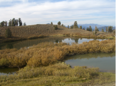
Sierra Rec Trail Review – By Tom Trelenberg – Looking for a hike with diverse landscape including forest, high Sierra volcanic terrain, bristlecone pines, creek crossings and vista views. You might enjoy the journey of this classic Carson Iceberg Wilderness hike. Below is a snap shot of my first visit to Nobel Lake and the exploration / journey I had to endure to find my way in to the wilderness.


A (not so) funny thing happened to me on the way to Nobel Lake… According to the USDA Mokelumne Wilderness map from 2015, the trailhead for Noble Canyon begins at the hairpin turn just south of of Silver Creek Campground on Hwy 4 heading up to Ebbetts Pass. Following this information and parking in the open area inside the hairpin (there is little room elsewhere), one finds a trail but no markers of any kind. The next 20 to 30 minutes from this starting point presents a relentlessly steep trail that finally flattens in an open meadow area. The trail becomes a bit indistinct here. Heading westerly along the north side of the meadow, one finds the trail again…along with a trail marker indicating that the trailhead is down a path different from the one thus far traveled.
On my return trip I followed this alternate route–a short (~10 minutes) and relatively flat path that passes the true trailhead markers adjacent to a dedicated parking area. All this is located at the hairpin turn above the previous hairpin by approximately a half of a mile. In short, the 2015 USDA map is incorrect (the current trailhead is obviously older than 2 years) and the true trailhead is a much better place to start. About the only advantage afforded my original path would be if one were to be staying at Silver Creek Campground and wished to get to the Noble Canyon trail without a drive up Hwy 4. The distance using the true trailhead should cut off a quarter mile (or more), a difficult climb, and a tricky, steep descent on loose dirt and decomposed granite. I highly recommend starting at the marked trailhead.
Continuing up Noble Canyon, the path remains fairly flat and, in 15 to 20 minutes beyond the trail marker, one comes to the major crossing of Noble Creek (the rest are easy). There is no clearly preferred place to forde across–one can find evidence of past crossings for perhaps an eighth of a mile.

However, one of the best crossings might be close to where the trail first emerges from the forest and crossing becomes possible. Once across one finds a labyrinth of interconnecting trails and determining the “true trail” is quite difficult. Heading easterly, a much smaller stream crossing is presented, with a continuation of the labyrinth on the other side. Having wandered myself for a bit, my best advice is to, after the initial crossing, stay on the northern-most of the available paths (I found no obvious trails heading north back down the canyon from this area) while also continuing to head east. Once east is no longer an option (and doing so would start to get considerably steeper), head south. This should be the Noble Canyon trail one more. Once through this area the interconnected nest of trails is no more and the path remains well defined.
On my outing, this area had been recently maintained, with years of pine-needle mat having been shoveled out. Given all the effort obviously put in to accomplish this, I think I would rather have seen that effort put into signage to keep hikers on the main trail–nevertheless, I remain grateful to those who do the largely thankless task of trail maintenance; at this point one is quite a distance from the trailhead.
What follows is a long, slow climb with scenery that doesn’t change overly much for 1.5 – 2 miles with few directional changes. There are a few clearings with occasional aspen groves (I got to see a bit of Fall colors) and four stream crossings–nice to pour some water over your head to keep cool.
After the fourth crossing, the terrain gets a bit more open, rugged, and winding as part of a more aggressive climb. The lack of trees allow you to see Noble Canyon open up before you and the Pacific Crest Trail (PCT) is visible, carved into the mountain on the other side. This view was, to me, one of the most memorable views I had on this hike, so take some time to enjoy it-unfortunately, given the lighting when I was passing this area, my pictures did not turn out or I would show you (on the other hand, the deep shadows and bright patches that my camera couldn’t resolve might have been what made the view so memorable). Continuing the winding climb soon brings the junction with the PCT.
Left/easterly leads to Noble Lake (right/westerly to Ebbetts Pass/Hwy 4). Fifteen minutes down this path leads to the most difficult, yet the most starkly beautiful, part of the hike. Multiple switchbacks climb a barren gravel escarpment. Dotted with the occasional bristlecone pine, forging out an existence where little else can, the trail provided me a beautiful view of an ice-encrusted waterfall fed from Noble Lake.

At the top of this climb the trail flattens out and shortly one arrives at Noble Lake. After 5-ish miles and having just completed a difficult climb, I found the lake to be a bit anticlimactic. It is small, roundish, and devoid of any interesting features around it. While it was mid-October and I was not looking for a swim, the lake did not have the look of being inviting even in summer. Another couple of minutes further down the trail one crests a small plateau just behind the lake. While not spectacular, this location offers a better view of the surrounding area, and in my opinion, is a more satisfying end-point destination than the lake itself. An old wooden sign in this area says this area is 9000+ feet–I couldn’t make out all of the digits. This made a good location to have a snack and rest a bit before starting the trek back.
Once I made it back to the car, given the rocky start (is there a pun there?) from the wrong trailhead and the lake being somewhat unremarkable, I had pretty much decided to give this write-up a pass–why say bad things about a trail? However, a couple of events changed my mind:
- A visit to some friends in central California the next weekend and hiking in an area that was considered so popular one needed reservations to park: The area was primarily fire roads through dry-grass covered hills and a small waterfall that was crowded with people (I saw not one other soul during my entire Nobel adventure).
- A hike in the mountains in the Carson Valley that had a long stretch of steep, brutal switchbacks passing through an area that had very little to recommend it. Fortunately, we were doing a point-to-point hike and traversing this section heading downward, which wasn’t so bad–but I felt so sorry for those who did this fairly dull section as a brutal climb. I must say, however, that the rest of the hike was quite nice.
I enjoyed the first hike–but it was the friends, and not only the scenery, that colored my view on this trip. The second was a great journey (both scenery and company), with just one section that was less than awe-inspiring. These trips caused me to reconsider why I was giving my Noble Canyon trip such a bad wrap. I got a whole new perspective. The Sierras have so many beautiful destinations, and I have gotten so spoiled at how beautiful these destinations are that I failed to recount the beauty and awe-inspiring sights of my Nobel Canyon journey–reminding me of the quote heading this review. Also, I’m sure my emotions were a bit colored by my map listing the wrong trailhead. My day had taken me on a pleasant trip through thick woods, I had nice stream crossings, I got to experience the stark beauty of that final climb–and from this perspective I had quite a good trip. Noble lake via Noble Canyon would be quite beautiful to those who don’t get to see similar areas on a regular basis. My point is that, if your plan for the day is a hike of striking beauty, head out for the 20 lakes basin off Hwy 120 just outside of Yosemite’s east gate–one of the most strikingly beautiful areas I’ve seen. However, if you are looking for a pleasant day through an nice area that you may not have seen before, Noble Lake via Noble Canyon might be just right.

One of the things I try to evaluate on my hikes is its suitability for my sons, 10 and 13. While they have done some long (9 mile), grueling hikes (steep), I think this is one is just a bit too long and without sufficient distraction either along the journey or at the destination. I think they really would have liked the climb up the barren rocks right before arriving at Noble lake. However, the long stretch (a pleasant, easy walk) between that climb and the first stream, barring a couple of brief stream crossings, is without a lot of variation.
I want to try the PCT from Hwy4/Ebbetts route–it looks to be shorter and to have some interesting sections given the brief view I got from the Noble Canyon trail and would, perhaps, be better for their skill and interest level.
Funny, one of the things my boys would really have enjoyed was clamoring over some of the rock outcroppings I passed between the false trailhead and the junction with the true trail–that which had me so bent out of shape would have been one of their highlights…

2 thoughts on “NOBEL LAKE HIKE VIA NOBEL CANYON”