

Why HWY 4 Outside of Markleville Is Becoming One of My Favorite Snowshoe Locations
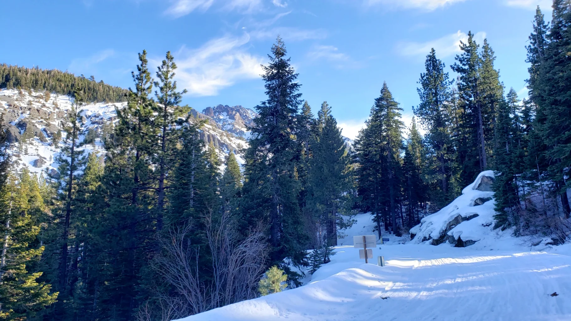
Markleville, Ca – Snowshoeing near Markleville, Ca, has traditionally been about Grover’s Hot Springs State Park. But the 2001 Tamarack fire significantly changed my access and thought process in this region. Last year knowing that my traditional snowshoe locations near Grover Hot Springs were closed because of tree fall dangers, I decided to travel 10 miles past Markleville to the Silver creek region and try snowshoeing. To my delight, Caltrans had started closing HWY 4 at the Historic Silver City Jail site, developing a makeshift snowmobile park along the long straight section of road at the base of Ebbetts pass.
I took multiple trips last year and ventured out again this early winter for a snowshoe adventure. It is becoming my favorite regional snowshoe location rather quickly for several reasons.
Creek Access
Silver Creek is beautiful in the snow and ice season. A constant water flow in the creek and a large amount of snow that tends to collect in this region lead to pillow formations along the creek with an occasional snow bridge across the stream. Crossing back and forth over silver creek opens up this canyon for great snowshoe exploration. Lodgepole Pine, Silver Pine, Jeffrey Pine, Red Fir, and Sierra Juniper dominate the landscape. Making this forest creek walking region stunning. Further down the canyon towards Ebbits Pass three creeks merge before leading into Noble Canyon.
Wildlife
Silver Creek is a source of life for the wildlife in this region. On a warm winter day when the sun is shining on the river, you can often spot various birds and other small creatures along the backs of the creek. I have yet to find bear or cat tracks, but they do live in this region, so it is possible. During my travels, we have seen a White-headed woodpecker, a heron, and several hawks on the creek.
Both migratory and resident bird populations take flight along the highway corridor. Woodpeckers, ravens, flycatchers, nuthatches, owls, warblers, finches, sapsuckers, swallows, juncos, jays, wrens, vireos, blackbirds, towhees, robins, grosbeaks, sparrows, swifts, hummingbirds, and chickadees are found in this region, generally with several species of each group.
During the spring and early summer, avid birders can observe the many species of warblers that pass through the area. Water-loving birds such as sandpipers, Pacific loons, mergansers, various ducks, grebes, American dippers, egrets, gulls, Canada geese, and great blue herons may be observed in or around reservoirs, lakes, streams, and ponds.
Additionally, several game birds make this area home: blue grouse, ruffed grouse, mountain quail, band-tailed pigeon, and mourning dove.
A rare but not unheard of sighting would include species such as the osprey, golden eagle, spotted owl, great gray owl, goshawk, white-headed woodpecker, pileated woodpecker, bald eagle, and peregrine falcon.


History
The historic remains of the silver city mining industry in this area are a bonus of discovery in the summer. However, in the winter, when snow covers the ground, I still find remnants of old roads, mining scars, and the old jail fun to discover. Many of the creek beds that flow from the mountainsides down into silver creek lead to mining areas along the ridges. But mainly, I stick to the Silver creek basin in my excursions.

Three Creeks Merge
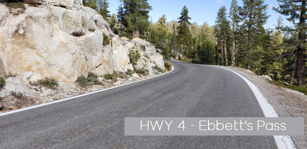
My favorite area to explore is at the base of Ebbits Pass on the Silver creek side of the road. This section is where Pennsylvania Creek and Noble creek merge and lead into Noble canyon. It creates a few more creek-crossing areas to maneuver, but the forest area has more of that wilderness/ untouched feel that makes that peaceful, quiet feeling I love about snowshoeing.
Traveling from the Parking area, you can walk the road up about 1/2 mile til just past where Pennsylvania creek crosses HWY 4. then head left into the forest and let your exploration begin.
For those who like waterfalls, continue up the slope on the highway to where Silver creek Plunges under the road for a great look at what I call the Silver Creek Plunge.
Alternative Canyon Routes
Alternatives canyon routes you can explore. Just before the Snowmobile parking area, on the right side of the road, is an old mining road that climbs up out of the valley and into Adolphus canyon. Great roadside vista views can be achieved pretty easily.
Following the canyon up Pennsylvania creek is also an option for a short excursion with plenty to explore.


Go prepared
The one thing you need to know out here is that there are no services and no cell service. So plan appropriately. Let someone know where and what area you plan to explore.
Also, with creek crossings, there is a danger of falling through ice and getting wet. And although silver creek is not a deep creek in most areas, the water of any kind at these temperatures can be a severe issue if you fall in.
If the stream is frozen, take stock of the situation, looking for solid paths across. Stream crossings often require scouting up and downstream, seeking the best option. Do you see places where others have successfully crossed? Follow their footsteps. Logs, rocks, or other natural bridges are preferable to ice, wherever possible. Once you have selected your route, use your poles or throw rocks to check the ice. When you feel you have found a safe route, continuously probe the ice ahead with your pole.
Enjoy exploring in the snow.


