The Western Divide Highway cuts through some of the most spectacular and least-crowded terrain in all of California. While tourists pack into Yosemite Valley and jostle for parking at Kings Canyon, this 50-mile stretch of pavement winds through ancient sequoia groves, climbs to over 7,000 feet, and delivers views that rival anything in the Sierra Nevada. I’ve driven this route in every season, on two wheels and four, and I keep coming back because it rewards the kind of traveler who does their homework.

This isn’t a road that forgives poor planning. Cell service disappears for long stretches. Gas stations are spaced far apart. Weather can shift from sunny to snowy in hours, even in late spring. But for those willing to prepare properly, the Western Divide Highway offers an experience that feels increasingly rare: genuine wilderness accessible by paved road, without the crowds that have overwhelmed other Sierra destinations.
What follows are the practical travel tips for the Western Divide Highway that I wish someone had given me before my first trip. Whether you’re planning a leisurely scenic drive, a photography expedition, or a motorcycle tour through the Southern Sierra Nevada, these insights will help you get the most out of this remarkable route while avoiding the mistakes that catch unprepared visitors off guard.
Planning Your Sequoia National Monument Scenic Driving Guide
The Western Divide Highway runs through Sequoia National Monument, which confuses some visitors who expect it to be part of Sequoia National Park. They’re different entities managed by different agencies, and this distinction matters for planning. The monument, managed by the U.S. Forest Service, has fewer restrictions and generally lighter crowds than the national park to the north.
Your scenic driving experience hinges on timing and preparation. The route connects California State Route 190 near Springville to the southern reaches of the Giant Sequoia National Monument, passing through the Tule River Indian Reservation and climbing through several distinct ecological zones. Expect the drive to take three to four hours if you’re stopping at major viewpoints, longer if you’re photographing or hiking.
Best Time of Year to Drive Highway 190 and the Western Divide
Late May through mid-October provides the most reliable access, though each season offers distinct advantages. June brings wildflowers to the lower elevations and lingering snow patches that make the sequoias look particularly dramatic. July and August deliver warm temperatures and the longest days, perfect for maximizing your time on the road.
September is my personal favorite. The crowds thin considerably after Labor Day, the air clears of summer haze, and the light takes on that golden quality that photographers chase. October can be spectacular when fall color hits the black oaks, but you’re gambling with early storms that might close higher sections.
Winter access is limited and unpredictable. Chains may be required from November through April, and sections of the road close entirely during heavy snow years. If you’re determined to see snow-dusted sequoias, check road conditions obsessively in the days before your trip.
Navigating California State Route 190 Road Conditions
The road surface varies considerably along this route. Highway 190 from Porterville to Springville is standard two-lane highway, well-maintained and straightforward. Things get more interesting past Springville, where the road begins climbing and the curves tighten.
Check CalTrans road conditions before departing, especially outside summer months. The agency updates closure information regularly, and a quick phone call to the Springville Ranger Station can provide real-time conditions that websites miss. After heavy rain, watch for rockfall debris in the first few miles of the climb. I’ve encountered basketball-sized rocks in the roadway after spring storms.
The pavement quality on the Western Divide Highway (M107) itself is generally good, though frost heaves create rough patches at higher elevations. These tend to get patched by early summer but can catch you off guard if you’re driving fast. Pull-offs exist at most viewpoints, but some are small and fill quickly on summer weekends.
Must-See Stops Along the Western Divide Highway
The temptation on any scenic drive is to push through to the “big” attractions. Resist it here. Some of the best moments on this route come from unplanned stops at unmarked pullouts where the view opens up unexpectedly.
That said, certain stops deserve priority on any itinerary. The sequoia groves are the obvious draw, but the high-elevation meadows and granite viewpoints offer experiences you won’t find in the more famous parks to the north.
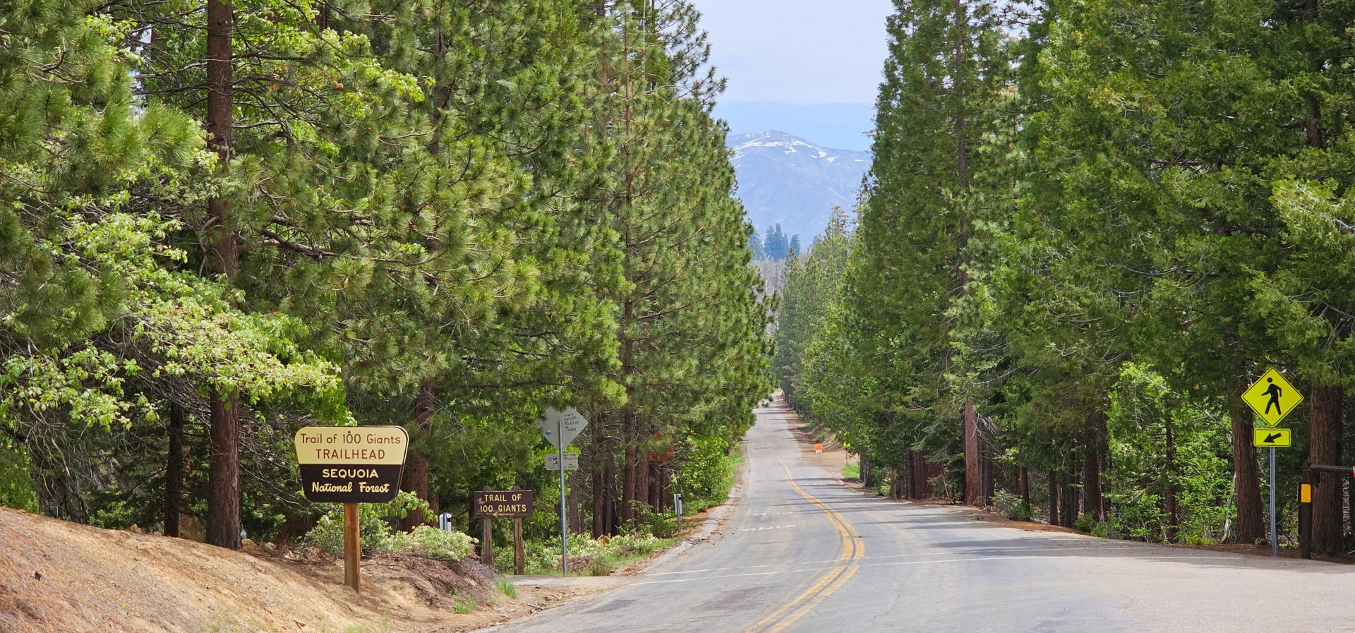
Trail of 100 Giants Parking and Accessibility
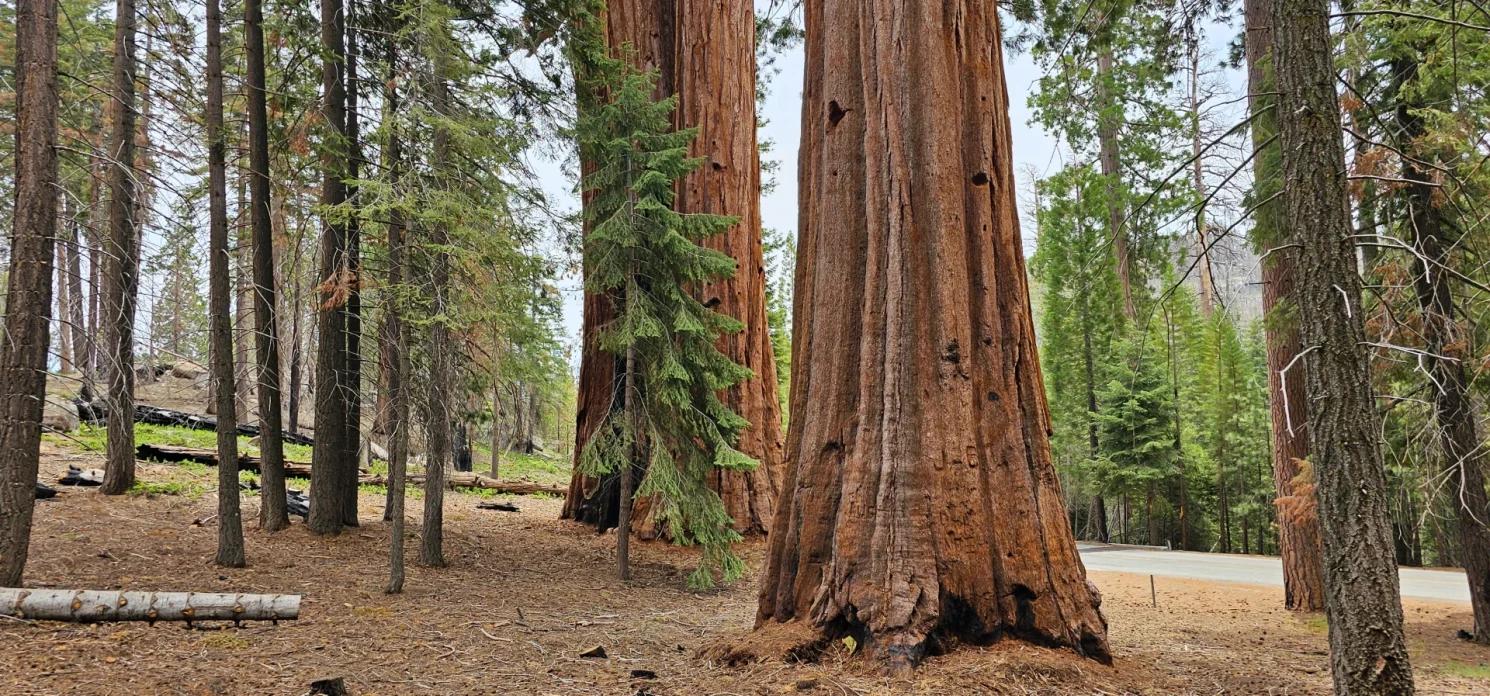
This grove is the most accessible collection of giant sequoias along the route and deserves at least an hour of your time. The paved trail loops for about a mile through mature trees, including several specimens over 20 feet in diameter. Unlike the more famous groves in the national park, you can often have sections of this trail to yourself, even on summer weekends.
Parking fills by mid-morning on peak summer days. Arrive before 9 AM or after 4 PM for the best experience. The lot accommodates about 40 vehicles, with additional overflow parking along the road when rangers direct traffic. RVs and trailers can park but should arrive early since the designated spaces are limited.
The trail is wheelchair accessible and suitable for strollers, making this one of the few places where visitors with mobility limitations can experience old-growth sequoias up close. Interpretive signs explain the ecology and fire history of the grove. Restrooms are available at the trailhead.
Overlooks and High-Elevation Vista Points
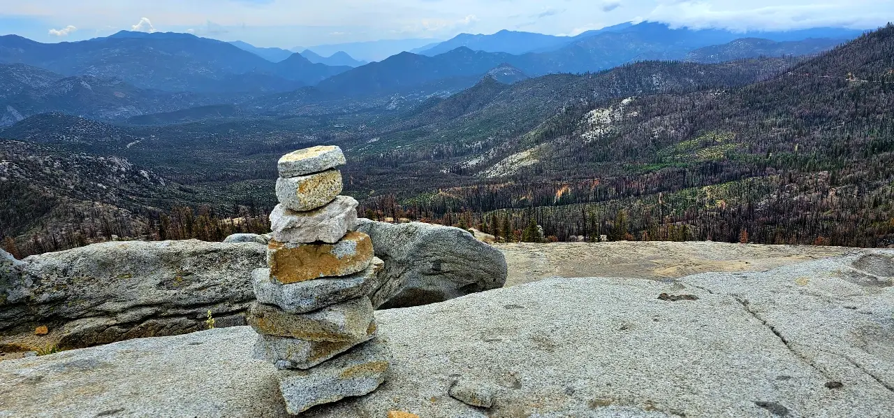
Dome Rock offers the most dramatic viewpoint along the route. A short but steep trail leads to a granite dome with 360-degree views of the Kern River drainage and the distant peaks of the Great Western Divide. On clear days, you can see over 50 miles in every direction.
The unnamed pullout at mile marker 47 catches most people by surprise. There’s no sign, just a widened shoulder where the view opens to the west. On summer evenings, this spot delivers some of the best sunset watching in the Southern Sierra.
Johnny McNalleys Retreat, Just outside of Kernville on the way up the pass makes a good stop over location if you are looking to escape town.
The Ultimate Southern Sierra Nevada Motorcycle Tours
Motorcyclists have discovered this route, and for good reason. The combination of sweeping curves, minimal traffic, and spectacular scenery makes the Western Divide Highway one of the best rides in California. But the same features that make it appealing also demand respect.
The riding season runs shorter than the driving season. Snow and ice linger on shaded curves into late May, and cold temperatures arrive by late September. Most experienced riders target June through August for the most predictable conditions.
Technical Curves and Elevation Changes
The road gains roughly 5,000 feet of elevation from Springville to the highest points, and those feet come in concentrated sections of switchbacks separated by straighter stretches through meadows and groves. This rhythm rewards riders who can shift gears mentally between technical focus and relaxed cruising.
The tightest curves cluster in the first 15 miles above Springville and again near the Quaking Aspen area. These sections include decreasing-radius turns that catch aggressive riders off guard. The pavement camber varies, sometimes banking helpfully into turns, sometimes falling away toward the outside edge.
Gravel accumulates at the apex of certain curves, particularly after rain or in early season. Sand washes across the road at specific drainage points that locals know by heart. Your first trip should be about learning the road, not setting speed records.
Safety Tips for High-Altitude Riding
Altitude affects both rider and machine. Above 6,000 feet, carbureted motorcycles lose power noticeably. Fuel-injected bikes compensate automatically but still produce less power than at sea level. Plan your passing maneuvers accordingly.
Dehydration sneaks up on riders at elevation. The dry mountain air pulls moisture from your body faster than you realize, and the cooling effect of wind masks the symptoms until you’re already impaired. Carry water and drink regularly, even when you don’t feel thirsty.
Afternoon thunderstorms build quickly in summer months. These storms typically develop between 2 PM and 5 PM, bringing lightning, heavy rain, and occasionally hail. Plan your highest-elevation riding for morning hours, and have a plan for shelter if weather develops.
Sierra Rec Magazine has covered several motorcycle routes through this region, and the consistent advice from experienced riders is the same: this road rewards patience and punishes overconfidence.
Essential Preparation for Remote Mountain Travel
The Western Divide Highway passes through genuine backcountry. This isn’t a suburban scenic drive with services every few miles. Understanding what you’re getting into prevents the kind of situations that turn adventure into emergency.
Fuel, Supplies, and Connectivity Gaps
Fill your tank in Porterville or Springville before beginning the climb. The next reliable fuel is roughly 80 miles away, depending on your route. That’s within range for most vehicles, but running low on a remote mountain road adds stress nobody needs.
Cell service disappears shortly after leaving Springville and doesn’t return reliably until you descend the other side. Verizon customers report occasional signal at the highest elevations, but don’t count on it. Download offline maps before your trip, and tell someone your itinerary and expected return time.
Pack more water and food than you think you’ll need. A breakdown or road closure could strand you for hours. Basic supplies should include a gallon of water per person, non-perishable snacks, a flashlight, and warm layers regardless of the forecast. Temperatures drop rapidly after sunset at elevation.
Wildlife Awareness and Environmental Ethics
Black bears are active throughout this region, particularly in early morning and evening hours. They’re generally not aggressive toward humans but will investigate vehicles that smell like food. Don’t leave coolers or groceries visible in your car, even briefly.
Deer present the more immediate hazard for drivers. They’re most active at dawn and dusk, and they cross the road without warning. Slow down during these hours, especially in meadow areas where deer congregate to graze.
The sequoia groves are fragile ecosystems that have survived for millennia. Stay on established trails to avoid compacting the shallow root systems. The bark that looks so rugged is actually quite soft and easily damaged by climbing or carving. These trees were here before recorded history, and our job is to leave them for future generations.
Connecting Routes and Extended Loop Itineraries
The Western Divide Highway works beautifully as a standalone day trip, but it really shines as part of a larger exploration of the Southern Sierra. Several connecting routes allow you to create loops that take in multiple ecosystems and attractions.
The most popular extension continues north through the Giant Sequoia National Monument to connect with Generals Highway and the famous groves of Sequoia National Park. This adds significant time but creates a comprehensive sequoia experience that covers the full range of accessible groves.
Heading east, forest roads connect to the Kern River corridor, opening access to whitewater, hot springs, and the dramatic canyon scenery that Sierra Rec Magazine has featured extensively. These roads vary from paved to rough dirt, so check current conditions and your vehicle’s capabilities before committing.
For those seeking solitude, the road south toward Johnsondale offers even fewer crowds and access to the Golden Trout Wilderness. This area sees a fraction of the visitors that the more famous destinations attract, and the fishing in the upper Kern tributaries remains excellent.
Whatever route you choose, the Western Divide Highway rewards those who approach it with preparation and patience. The sequoias have stood here for thousands of years. They’re not going anywhere, and neither should you rush through their domain.
Our free digital magazine brings you in-depth guides and essential travel tips for every corner of the Sierra Nevada. Explore more adventures and never miss an opportunity to discover this magnificent region.

5