
Every year I find myself coming back to Desolation Wilderness, studying the map and picking out a few hikes I haven’t done—or ones I want to experience again. With 2026 shaping up as a low snow year, access is going to come earlier, which opens the door to those classic granite basins and clear alpine lakes sooner than usual. It’s one of the easiest places in the Sierra to plan a rewarding day hike, whether you’re heading out for a quick out-and-back or a full day exploring multiple lakes.
I’ve spent countless mornings on these trails, watching the sunrise paint the granite pink and gold, and I can tell you that finding the best day hikes in Desolation Wilderness near Lake Tahoe requires more than a quick Google search. Some trails deliver jaw-dropping payoffs for minimal effort, while others demand everything you’ve got before revealing their secrets. The difference between a transcendent day in the backcountry and a frustrating slog often comes down to knowing which trail matches your fitness level, how early to start, and what to expect when you get there.
What makes this wilderness special isn’t just the scenery, though that alone would justify the trip. It’s the accessibility. Within an hour of South Lake Tahoe, you can stand on a 9,700-foot summit or swim in a glacially carved lake surrounded by nothing but granite and sky. These seven trails represent the best of what Desolation has to offer for day hikers ready to earn their views.
Planning Your Adventure: Permits and Best Time to Visit
Before you lace up your boots, you need to understand the logistics that can make or break your trip. Desolation Wilderness operates under a permit system designed to protect its fragile alpine ecosystems while still allowing public access.
Desolation Wilderness Permit Requirements for Day Use
Day hikers need free, self-issued permits available at trailheads throughout the wilderness boundary. You’ll find permit stations with clipboards and forms at every major access point. Fill one out completely, tear off your copy, and keep it with you on the trail. Rangers do check, and they’re not particularly sympathetic to the “I didn’t know” excuse.
The system is straightforward, but don’t skip it. These permits help the Forest Service track usage patterns and make informed decisions about trail maintenance and resource allocation. During peak summer weekends, some trailheads see hundreds of hikers, and accurate data helps preserve the wilderness character that draws us here in the first place.
The Best Time of Year to Hike Desolation Wilderness
Snow typically clears from lower elevations by mid-June, though higher routes like Mount Tallac may hold snowfields into July. The sweet spot runs from late June through September, with July and August offering the warmest temperatures and most reliable conditions. However on years like 2026 winter we might have full access and clear trails as early as May. The trails early in summer are wet with run off and often include snow fields that cover sections of trail, especially on the popular Lake Aloha route above Tamarack lake.
September brings something special: smaller crowds, golden light, and the first hints of fall color in the willows along creek bottoms. The tradeoff is shorter days and cooler temperatures, so plan accordingly. I’ve hiked Tallac in late September and had the summit entirely to myself, a rare gift during a season when most trails see steady traffic.
Conquering the Iconic Mount Tallac Trail
No list of day hikes in Desolation Wilderness near Lake Tahoe would be complete without Mount Tallac. This is the peak you see dominating the skyline from South Lake Tahoe, the one with the distinctive cross-shaped snowfield that gives the mountain its name.

Mount Tallac Hiking Trail Difficulty and Elevation Gain
The numbers tell part of the story: 9.4 miles round trip, 3,300 feet of elevation gain, summit elevation of 9,735 feet. What the numbers don’t capture is the relentless nature of the climb. This trail doesn’t mess around with gentle switchbacks or gradual warm-ups. You gain elevation steadily from the parking lot and don’t stop until you’re standing on top.
The first section climbs through mixed conifer forest before breaking out at Floating Island Lake around mile two. Cathedral Lake appears shortly after, a stunning alpine tarn that tempts many hikers to call it a day. But it is the next section that climbs and crosses an open talus field that will challenge most climbers. Resist if you can scramble off trail. stay the course and follow the steady path to the top of the ridge for a great view of Desolation and Lake Tahoe. the hike to the top is straight forward from here. . The final push above tree line delivers increasingly dramatic views with each step, culminating in a 360-degree panorama that stretches from the Carson Range to the Crystal Range.
Start early, ideally by 7 AM on summer weekends. Afternoon thunderstorms are common above treeline, and you don’t want to be on that exposed summit when lightning starts popping. Bring more water than you think you need and pack layers for the summit, where temperatures can drop twenty degrees from the trailhead.
Exploring Scenic Alpine Lakes in South Lake Tahoe
The lakes are why most people come to Desolation. Glaciers carved dozens of basins into the granite bedrock, and those basins filled with snowmelt to create some of the clearest, coldest, most beautiful bodies of water you’ll find anywhere in the Sierra.
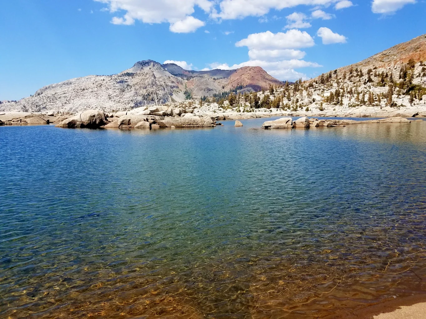
Aloha Lake: The Heart of the High Sierra
Aloha Lake sits at 8,116 feet, a sprawling reservoir surrounded by granite domes and scattered islands. The hike in from Echo Lakes covers about six miles one way, but you can cut two miles off by taking the water taxi across the lower and upper Echo Lakes.
The trail passes through classic Desolation terrain: lodgepole pine forests, granite slabs polished smooth by ancient ice, and smaller lakes that offer preview glimpses of what’s ahead. Aloha itself feels almost oceanic in scale compared to the pocket lakes you pass along the way. Pack a lunch, find a granite perch, and spend an hour watching the light shift across the water.
Eagle Lake and Velma Lakes Loop
For hikers wanting multiple scenic alpine lakes in South Lake Tahoe without committing to an all-day death march, the Eagle Lake and Velma Lakes loop delivers exceptional value. The trailhead at Eagle Falls sits right on Highway 89, making access straightforward.
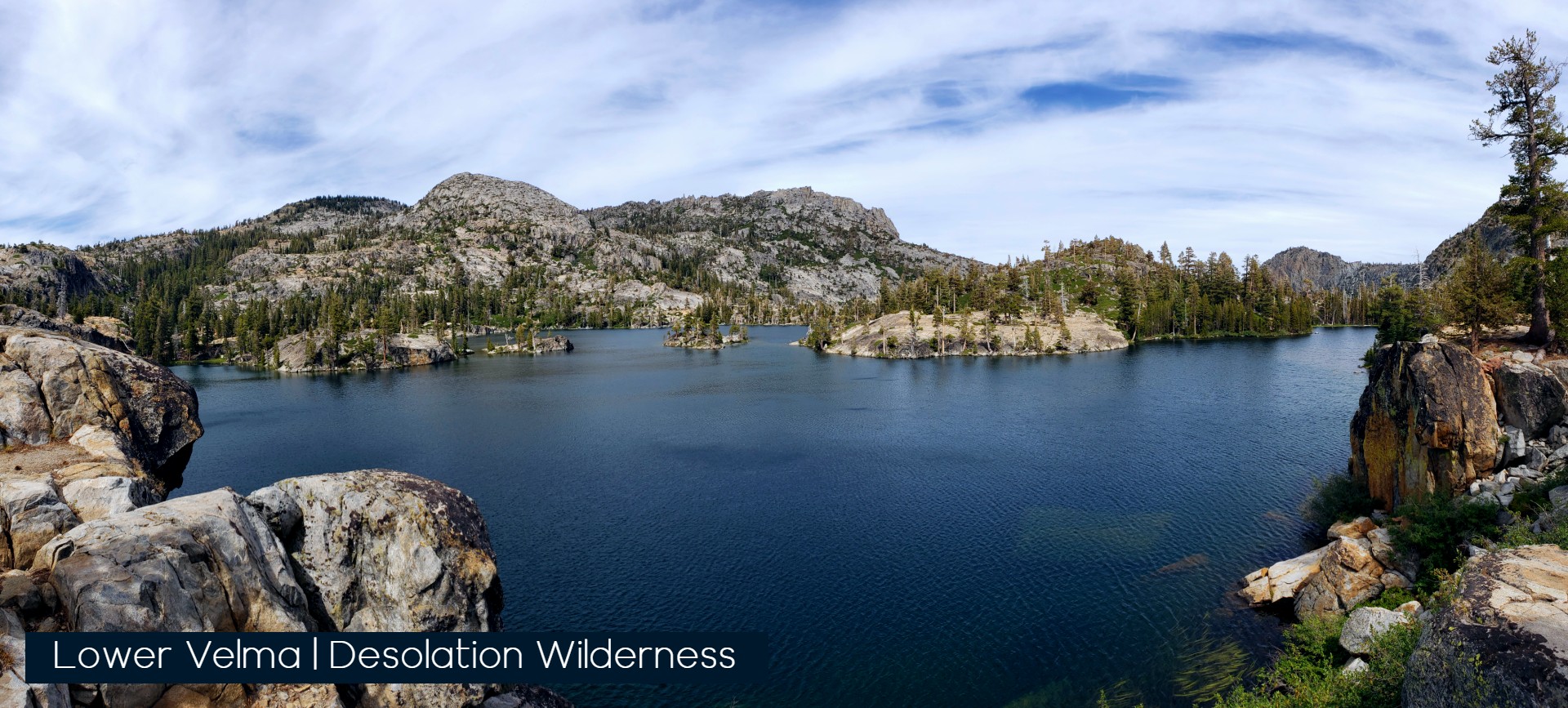
Eagle Lake comes quickly, just under a mile from the trailhead, making it popular with families and casual hikers. Push beyond up the challenging ridge line above to reach the Velma Lakes basin, where Upper, Middle, and Lower Velma offer progressively more solitude. The full loop covers roughly ten miles and visits some of the most photogenic terrain in the wilderness. We Prefer to actually skip Eagle lake and instead hike the loop from Bayview Trailhead, which has a more direct climb past Granite Lake and past Maggie’s peak, another great peak view that is easier than Tallac.
Dog Friendly Trails in the Tahoe Backcountry
Four-legged hiking partners are welcome in Desolation Wilderness, though they must remain on leash at all times. Several trails offer particularly good options for dogs, with reliable water sources and manageable terrain. Tip: the Trail conditions on some Desolation trails will tear your pets paws up, take time to make plans to protect their feet.

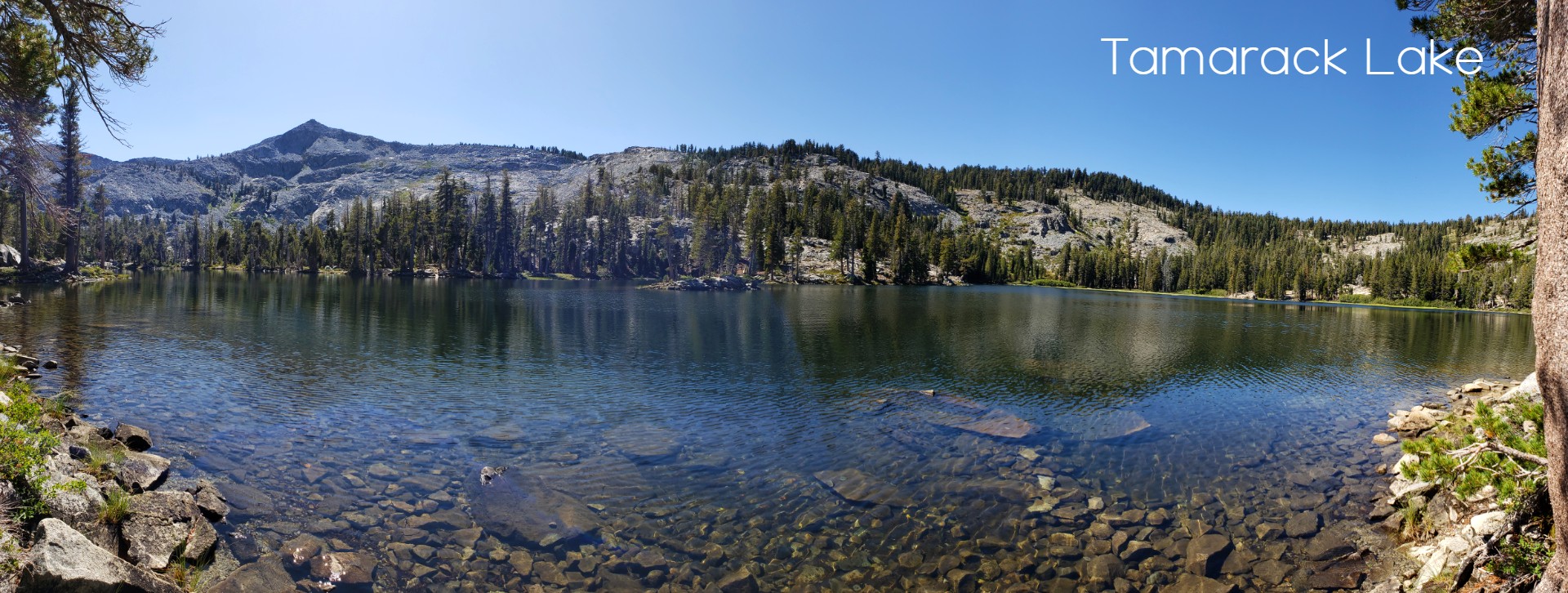
Echo Lakes to Lake Tamarack
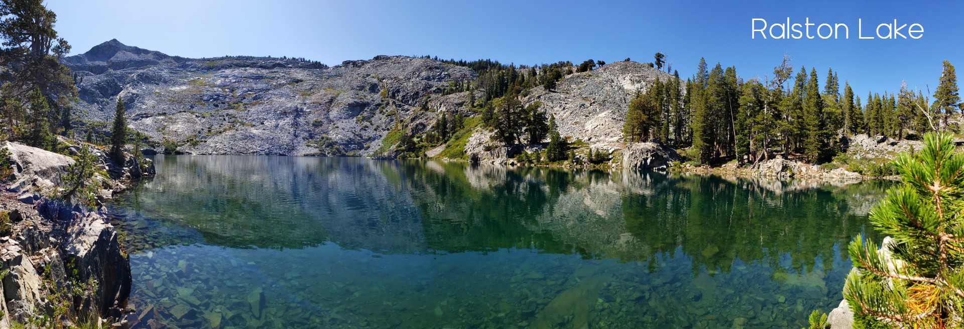
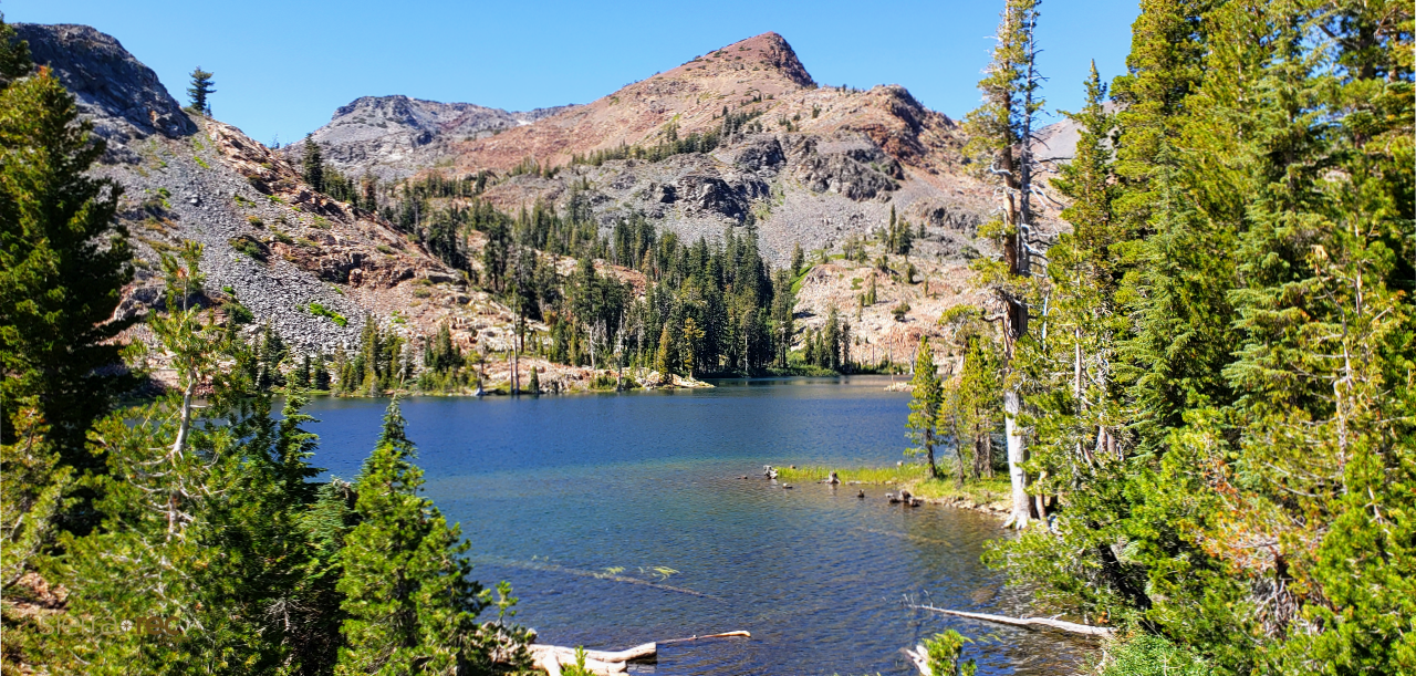
This route follows the Pacific Crest Trail from the Echo Lakes trailhead toward Lake Tamarack, covering about eight miles round trip with moderate elevation gain. The trail stays relatively shaded through much of its length, which matters when hiking with dogs in summer heat. Looking for the hidden gem and often missed lakes in the area, Ralston Lake behind Tamarack is stunning and quiet, and up above Tamarack is twin lakes, two small lakes hidden on the ridge.
Water access is excellent, with multiple creek crossings and lakeshores where dogs can cool off. The terrain is generally smooth granite and packed dirt, easy on paws compared to rockier routes. Lake Tamarack itself sits in a quiet basin that sees less traffic than the more famous lakes along the main corridor.
Glen Alpine Trail to Susie Lake
Starting from the historic Glen Alpine Springs resort site, this trail climbs through gorgeous meadows before reaching Susie Lake at about 3.5 miles. The grade is steady but never brutal, making it manageable for fit dogs of most sizes.
The Glen Alpine area has a fascinating history, with stone ruins of the original resort still visible near the trailhead. Susie Lake occupies a classic glacial cirque, with steep granite walls rising above the deep blue water. This trail sees moderate traffic, so you’ll have company but won’t feel crowded. If you are comfortable off trail take a look at Half Moon Lake near by.
Granite Peaks and Hidden Gems
Beyond the famous destinations, Desolation holds quieter corners that reward hikers willing to venture off the beaten path and to its highest points.
Ralston Peak: Panoramic Views of the Basin
Ralston Peak offers summit views rivaling Mount Tallac with significantly fewer people. The trail gains 2,500 feet over four miles, climbing through forest before emerging onto open granite slopes near the top. The 9,235-foot summit provides commanding views of Desolation’s lake-studded interior, the Tahoe basin, and the distant peaks of the Crystal Range.
This hike suits experienced hikers comfortable with steep terrain and some route-finding near the summit. The final approach involves scrambling over granite blocks, nothing technical but requiring hands in places. Start from the trailhead on Highway 50 near Echo Summit.
The Solitude of Lyons Lake
Tucked into a basin below Pyramid Peak, Lyons Lake sees a fraction of the traffic that flows to more accessible destinations. The hike covers about five miles each way from the Lyons Creek trailhead, with around 1,800 feet of elevation gain.
What you get for your effort is a genuine wilderness experience. On weekdays, you might have the entire lake to yourself. The granite shoreline offers countless spots to spread out a picnic, and the swimming, while cold, is sublime on a hot afternoon. This is the kind of place that reminds you why wilderness designation matters.
Bonus Tip: The Thousand Island Lakes (Wright Lake Approach)
If you’re willing to head to the quieter west side of Desolation Wilderness, the route out of Wright Lake toward what’s often called the “Thousand Island Lakes” zone offers a completely different experience than the more traveled east-side trailheads. This isn’t a single destination—it’s a scattered basin of small, unnamed lakes, granite shelves, and tucked-away water pockets that feel more like exploration than a defined hike. The trail itself starts straightforward, but quickly opens into off-trail navigation where route-finding, map awareness, and a willingness to wander become part of the experience. It’s the kind of place where you’re not just hiking to a lake—you’re discovering your own version of one.
It also happens to echo a story we published a few years back, “A Perfect Untouched Gem in Desolation Wilderness” by Bill Finch, where the idea of a “perfect lake” isn’t about a name or a destination—it’s about that moment when everything just comes together: granite, water, solitude, and silence. This Wright Lake basin feels like that kind of place. You may not know exactly which lake you’re heading to, and that’s the point. Wander a little, trust your instincts, and you just might stumble into your own version of “My Lake”—the one that keeps you coming back long after the hike is over.
Essential Gear and Safety for High Altitude Trekking
Desolation’s high elevation and exposed terrain demand respect. Afternoon thunderstorms can develop with startling speed in summer, bringing lightning, hail, and sudden temperature drops. Watch the sky and be prepared to descend if clouds start building.
Sun protection is non-negotiable at these elevations. The thinner atmosphere filters less UV radiation, and granite reflects light from every angle. Bring sunscreen, sunglasses, and a hat. Carry more water than you think you need, at least three liters for longer hikes, and consider a filter or purification tablets if you plan to refill from lakes or streams.
A basic first aid kit, emergency bivy or space blanket, headlamp, and extra food should live permanently in your pack. Cell service is unreliable to nonexistent throughout the wilderness, so self-reliance isn’t optional. Tell someone your plans before you go, including your intended route and expected return time.
The Sierra Rec Magazine team regularly covers gear recommendations and safety protocols for high Sierra adventures. If you loved this glimpse into Desolation Wilderness, our free digital magazine delivers in-depth guides, stunning photography, and essential travel tips for exploring the entire Sierra Nevada. Subscribe here and never miss an adventure.
These trails represent just a sample of what Desolation Wilderness offers. Each visit reveals something new: a hidden tarn, a marmot sunning on a boulder, the way afternoon light transforms familiar granite into something otherworldly. The wilderness rewards those who return, who learn its rhythms and seasons, who understand that the best day hikes in Desolation Wilderness near Lake Tahoe aren’t just about checking off destinations but about building a relationship with one of California’s most spectacular landscapes.


