Top Day Hikes for first time Visitors to Death Valley National Park
With a recent visit to Death Valley with a group that had never been before, it was critical that we mapped out the must see sights and choose our day hikes wisely in order to both see Death Valley at its best and to see as much as we could with three days in the park. this list comprises some of our favorite Day hike locations and couple that are just highly recommended that we may not have trekked to date.
Golden Canyon, Gower Gulch, and Badlands Loop
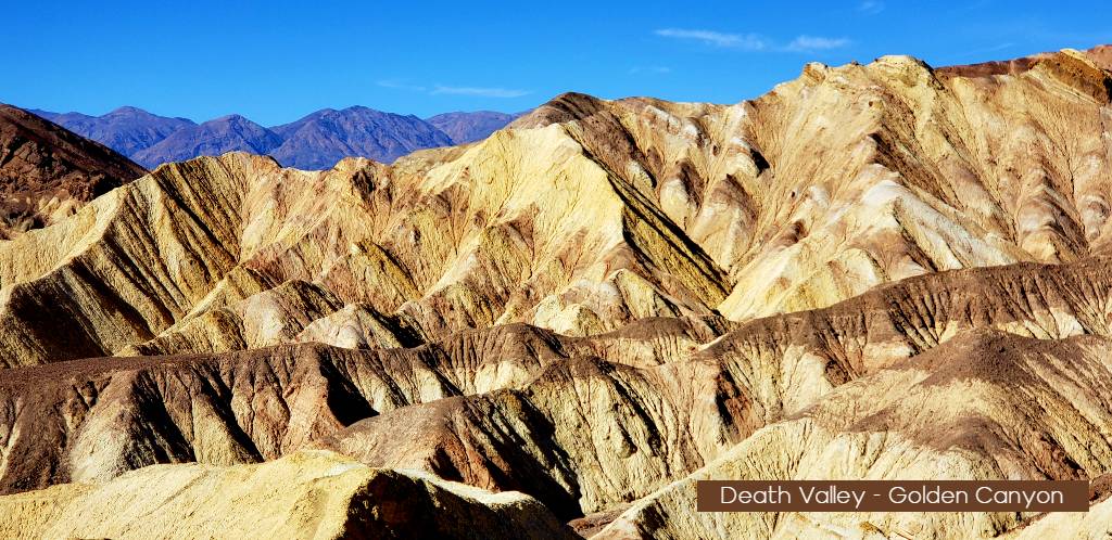
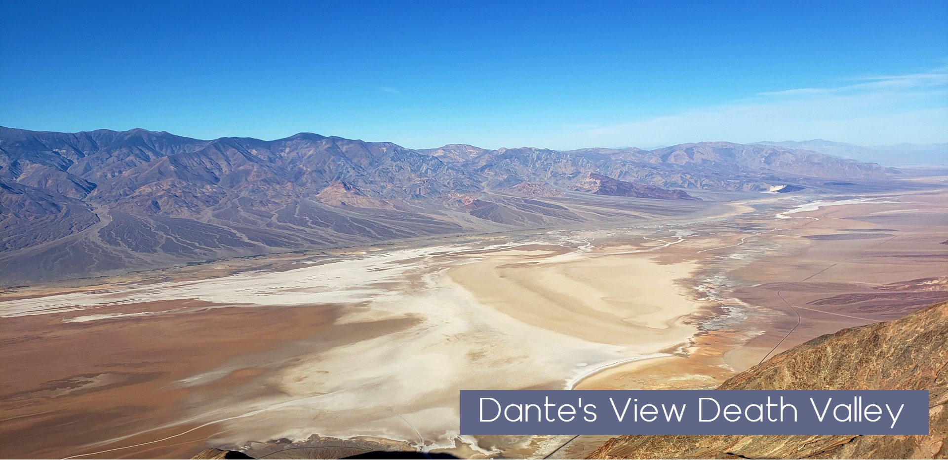
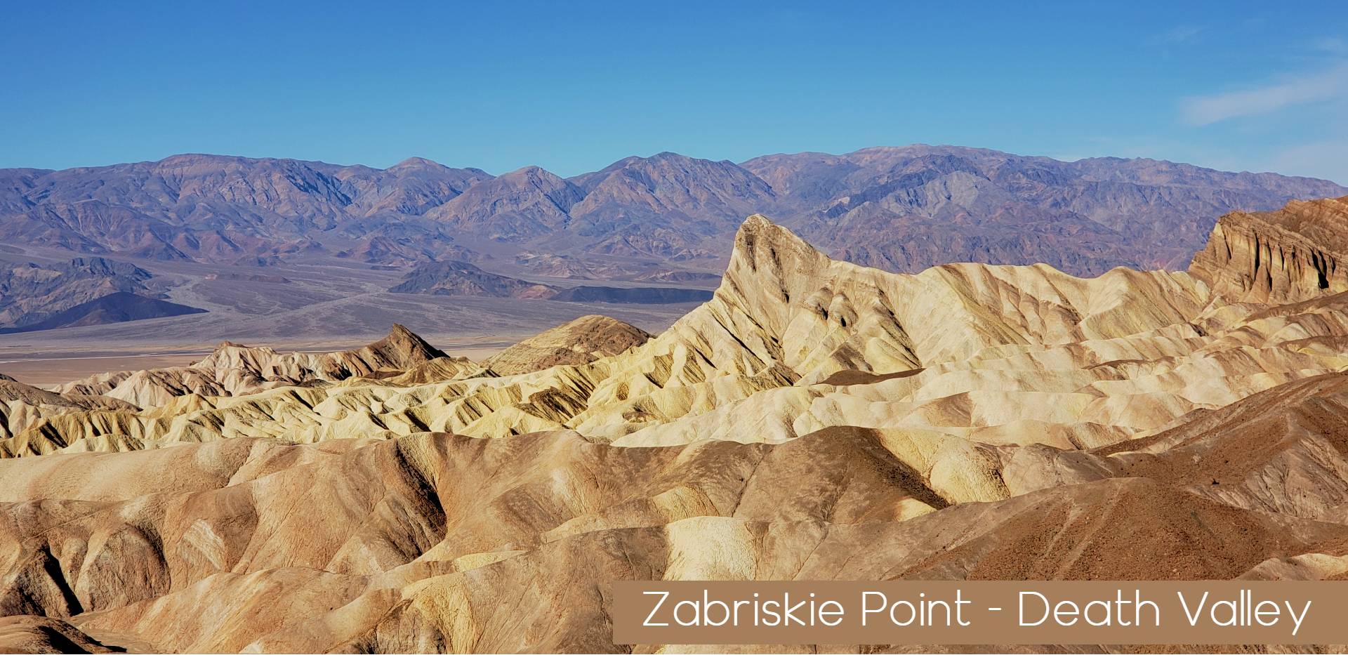
By far the most popular hike for first time visitors, Golden Canyon is also part of the Star Wars movie history in the park. 3 to 8 miles and 1.5 to 4.5 hours round trip depending on route. Golden Canyon is easy for the first 1.5 miles of the hike with tons of great canyon options and visuals to enjoy. The rest of the hike is moderate as it climbs up to Red Cathedral, Manly Beacon and into the Badlands of Zabriskie Point 1.5 to 4.5 hours round trip depending on route. the complete loop will take you over in to Gower Gulch with a rough river wash out section with tons of rock and formational changes on this section.
Mesquite Flat Sand Dunes

The summit of the high dune is 1 mile (1.6km) each way. No formal trail. Of the seven sets of dunes in Death Valley, these are the most famous and accessible. Located in Stovepipe Wells Village 30 minutes (24mi/39km) west of Furnace Creek. Mesquite Flats Dunes are a favorite for families and groups looking to enjoy the sand dunes in various forms of recreation. You will often find groups at the dunes with snowboards and sleds riding on the sand or groups trying to create sand avalanches that make the sand Hummm! A Perfect outing for the morning or evening the dunes are a great way to experience Death Valley.
Ubehebe Crater Loop

The Ubehebe Crate hike is commonly done in a counter-clockwise direction where hikers begin with the uphill section first. Within 0.5 mi (0.8km) Little Hebe Crater comes into view and is a common destination for those looking for a shorter trip. Exposed edges! Not good for those with a fear of heights. 1.5 mile Outer Loop.
Darwin Falls
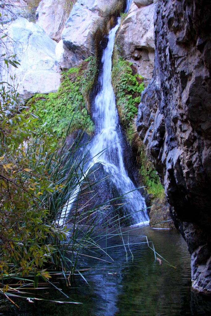
The biggest surprise hike on the list. Darwin falls is found on an unmarked dirt road just west of west of Panamint Springs on CA-190. Follow froad back approx 2 miles, Well graded and easily traveled by crossovers and sedans to the parking area. The trail head is marked and will wind through a canyon for approx 1 mile before suddenly coming into an oasis of vegetation that ti feed by darwin falls at the back the canyon. The unmarked route is fairly flat but rocky as it transitions from a desert wash into a high walled canyon. Inside the canyon thick vegetation, stream crossings, and large slick rocks require that hikers use caution as they work their way deeper into the oasis. Please protect this fragile resource. No swimming!
Desolation Canyon
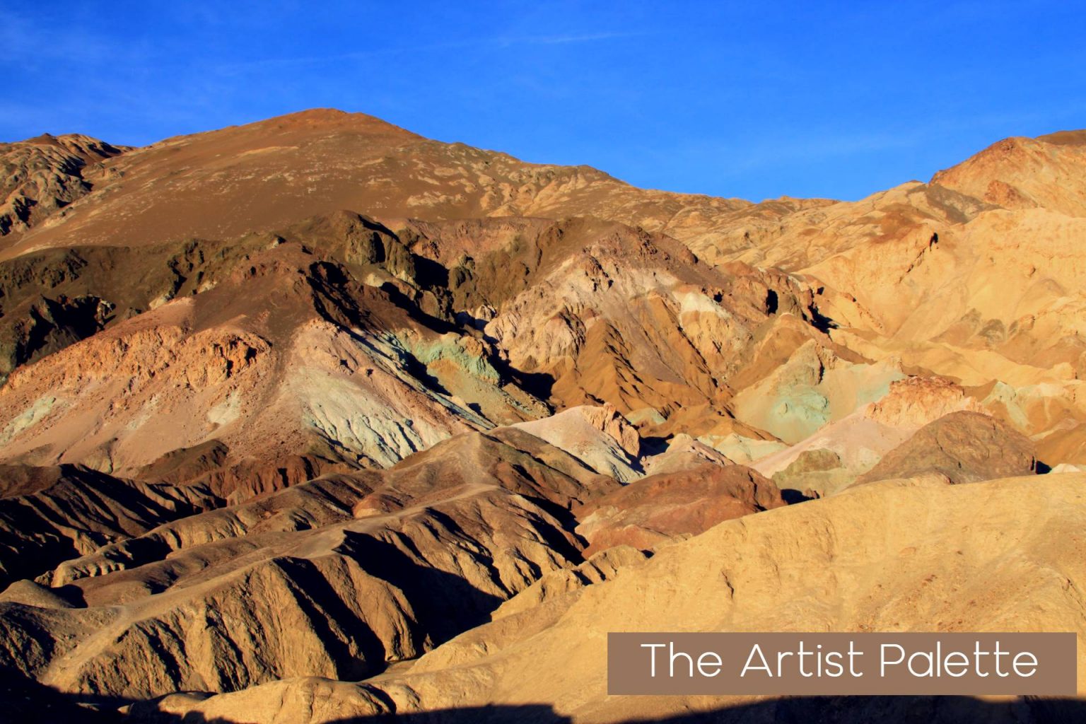
3.6 mile (5.8km) out and back, round trip – 2.5 hours round trip this moderate hike may require some canyon climbing. Entering the canyon, the colorful walls quickly grow high above as the wineglass shaped canyon begins to take shape and constrict around you.
Venturing gradually uphill through the corridor of the main canyon, many interesting but short side canyons offer opportunities for exploration. The maze of canyons provides hours of possibilities for adventure, but may also become confusing. The hike shares many features of its neighbor Artist’s Drive. Colorful walls and unique geological formations define the horizon.
Corkscrew Peak
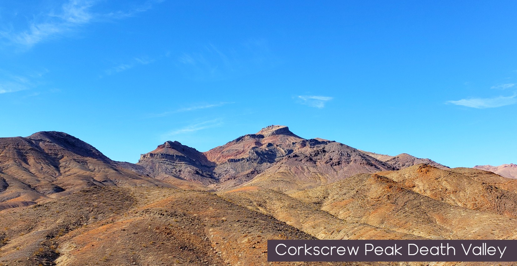
Lesser Known peak hike definitely takes a little skill in navigation. Trail location is Off daylight Pass Road from Beatty into the park. a road sign points to the peaks location and parking is found just south. The trail follows the easter slope of a washout for the first mile and provides visual of botht e peak and a great little red canyon below to the East. Trail then crosses the washout and disappears before reappearing in the North on a set of foothills as it head around the back side of the peak.
At about 1.9 miles from the road, in a narrow wash, you’ll come to a place where the use trail leaves the wash to the left (northwest) and starts up a ridge toward the peak. This turn-off is well-marked with rocks and cairns. From this point, follow the use trail as it climbs to the summit. The last half of the climb up the ridge is the steepest part, but it is never more than Class 1. Keep an eye out for the bighorn sheep that live in this area.After this last bit of climbing, you’ll reach the summit ridge, pass “Hole-in-the-Rock”, and soon be on the summit with its expansive views in all directions.
But unlike the Telescope Peak hike next on this list you will seldom see a crowd on this hike. Corkscrew Peak is a 7 mile out and back trail and has over 300 ft of elevation gain. Features grand views overlooking Mesquite Flat, the Grapevine Mountains, the contorted strata of the Funeral Range, and central Death Valley.
Short Distance Easy Walks Not to Be Missed
Salt creek


Leave a Reply