Looking for a hike that turns from easy to moderate to hard the further you go? Horsetail falls trail off of HWY 50 at Twin bridges is a popular day hike location into Desolation Wilderness that give the bravest of hikers and backpackers access to some of the wildest sections in Desolation wilderness if you are willing to give the effort.
Horsetail falls is so big and beautiful from HWY 50, visitors to the region don’t even need to leave their car to experience on of the great wonders on the Sierra. The waterfall is less than a 2 mile hike from the parking lot giving thousands of weekly visitors a great way to experience wilderness and a front row seat to one of California’s largest waterfalls. This multi stage fall falls some 500 ft in a beautiful set of cascades and drops visible from the highway.
Please Note that in 2022 the Horsetail Falls trail is closed do to the damage caused by the Caldor Fire in Lake Tahoe. The entire forest around this trial to the water fall was damaged in the fire and danger exists from tree falls, flooding and debris flows. Closed by Forest Order No. 03-22-06
Trail Options
Horsetail Falls is on a trail call Pyramid Creek Loop that leaves the parking lot and quickly scurries visitors over to the creek for a first visit of a small cascade and water feature less than 100 ft. off the highway. From there the trail leads visitors through an easy walk through the forest along the creek. The trail is pretty easy to follow, however over the years visitors have developed human use trails through out this section making navigating a little less straight forward.
At the end of the forest section you will have your first option route on the trail to Horse Tail falls and you meet a large granite field with nothing but moderate climbs in all directions across the granite.

Option One:
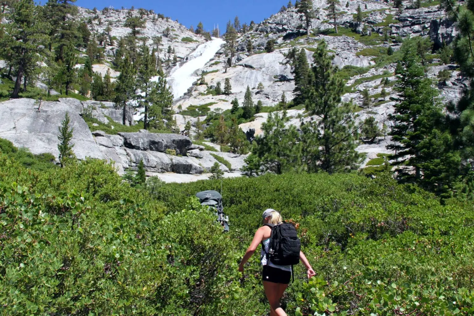
Follow the creek. Head East up the granite keeping the creek and the tree line close you will start to see signs of human use that lead to a beautiful veil cascade that crashes against the granite face at the bottom giving visitors a wonderful phot op and picnic location with the rushing water, plus a first vista view of Horsetail falls from the trail.
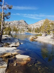
From here you follow the creek up over the dome and kind o make your own path across the granite until you reach the Desolation wilderness Signs and a large viewing area for Pyramid Creek and another great phot spot with a small water feature.
Option 2:
For those with less time who just want to get up close to Horsetail Falls, you can skip the water feature and loop action of the creek and head straight up the dome at the edge of the forest. Once on top you will find trail life of the Pyramid Loop trail that will take you directly to the Wilderness edge. This Moderate climb up the granite dome will give you a preview of the work yet to come for the Waterfall, but should not scare hikers away as most of the hike from here is relatively easy until right before the fall.
Entering Desolation Wilderness

At this point you will be entering Desolation Wilderness, day use permits are free for Desolation wilderness and though a permit is not required, if there are permits at the sign you should fill one out and carry it with you. this really helps us measure the proper resources for the wilderness. Backpackers of course you do need a permit to stay over night so you are reserving a permit for section 44 in desolation wilderness leading to Avalanche lake or Ropi lake typically.

At this point of the trail things get a little wonky because people have created way to many human use trails through this section. There is a main route but you basically want to just keep the creek to your right and although the trail takes you to the left at times it always comes back towards the creek eventually. You will cross a couple streams with logs across to keep feet dry. And if you ever feel you are headed up the mountain to far just look for easy route back towards creek and your should find a route paralleling the creek.
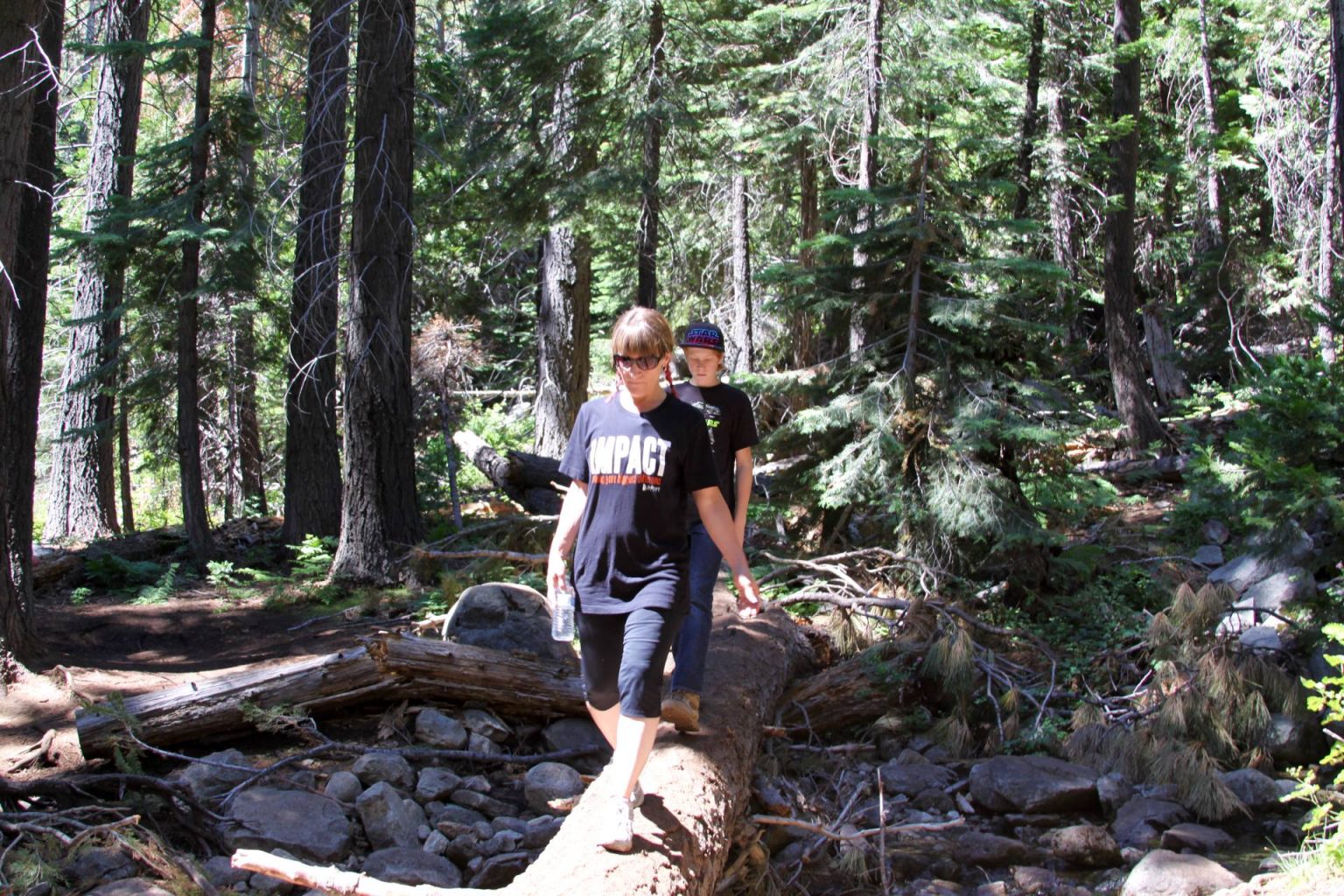
The first section is an easy hike, but not easy to navigate for some hikers. if in a group stay together and generally speaking there are others in the area so you have an idea where the crowds are going.
Tips:
There are two locations where you will seem to come to a large rock and the trail is unclear. The first is typically where people who cant find there way to the trail make their mistake. The trail at this first big rock will make you feel like you should go high side because there is water to the low side. That is the wrong way to go. Stay to creek side and either get your feet wet or back track 20 -30 yards and look for route to the creek, once you are through the scrubs you will find many human use trails around this section. (Seasonally there may be no way to keep feet dry here)
The second rock you will meet will feel like a dead end to some, but close inspection you will find a trail that loops to the left of the rock to the backside and up through the brush to the trail. Or you will see a small rock climb to the right of the large boulder that will lead you also to the trail.
Once you make it around this boulder you have short 400 yards through a rather brushy and rocky well marked trail up to the base of the waterfall. At the base you will find many spots to get up close to the waterfall including climbing a bit more or going down stream a bit. This area can be slippery so caution is best practice and there are typically lots of people congregated here for the day.
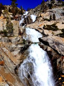
Interestingly enough, even through the water fall is spectacular her at the base you are only seeing about 1/3 of the total water fall from her as it twists and turns in the mountain side. It often reminds me of Wapama Falls at Hetch Hetchy in Yosemite.

For the Brave and Adventurous
The next part of Horsetail falls is a pure class two scramble up the side of the waterfall deeper into Desolation Wilderness. This section is not for the faint of heart or those who are not fit for such a climb. Please note: Even if you are brave enough to go ahead and do make it to the top, the trouble is in coming back down. Go prepared, and take your time.
If you do decided to climb further, you will find Minnie segment s of human use trails that seem to weave from Tree to tree some 100 yards West of the falls. And once to the top you will find Avalanche Lake waiting for you as it pours out over the falls. a great place for afternoon picnic, backcountry fishing or just a great place to feel like you are hundreds of miles away from the world. Please remember the Leave No trace principles. As a volunteer Wilderness Ranger i often adopt this area and you would be shocked at the amount of trash we carry out that has been left here in this beautiful place.

Pyramid Creek Adventures
For those who are seeking more from their adventure Pyramid creek leads to a series of backcountry wilderness lakes from here. the most popular being Ropi Lake approx. another mile past Avalanche. You will find no trails from here out however and must navigate the granite and water along the way. our tip just stay within sight of the water and you will be lead right to your destination.